Casebler, Dennis G; Friends of the Mojave Road; Martin, Bob (Maps); Jensen, Ted (Illustrator)Biblio.com
1987ref. 24391Norco CA: Tales of the Mojave Road 1987. Hardcover. Near Fine. 320 pp with maps illustrations index illustrated endpapers. Previous owner's name Elden Hughes Director of the California Desert Protection League on front pastedown else fine. "The 600-mile loop has been laid out carefully and a guide developed like the guide for the Mojave Road. Then a resources of inestimable value will be created for people who enjoy the backcountry -- people who are looking for something to do in the backcountry besides 'testing their machines'" p. 15. Extensively illustrated with maps b/w illustrations from photographs and drawings. This volume contains miles 0.0 through 171.6 of the East Mojave Heritage Trail west of the Colorado River extensively illustrated with maps b/w illustrations from photographs and drawings. Tales of the Mojave Road hardcover
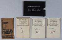
1935ref. 219096Semarang.: Hoofdkantoor. Circa1935. 3 folding colour lithographed maps on linen in a cloth covered slipcase lettered in white on the upper cover. Scale 1:500000. Each map has been numbered 1 to 3 by a prior owner on the reverse of the map with their signature. Sheets measure 55.5 x 83.4cm; 56 x 90cm and 56 x 82.3cm. The first map is a little stained on the reverse but the stains are not visible on the map itself. Very good copies in like slipcase. TOGETHER WITH Afstands Tabellen 1928 a separate 62pp booklet accompanies the folder of maps spine repaired with washi tissue. . Hoofdkantoor. hardcover
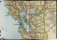
1928ref. 2443San Francisco and Los Angeles: The Heald-Menerey Company 1928. Very good. Large color map measuring 44 x 64 inches cut into eight sections and folded into book form. Original black limp textured cloth yapp edges titled in pale yellow on front cover. Moderate edge wear titles on front cover almost completely worn away. Internally clean. A rare portable version of the large and impressive Heald-Menerey's Geographical Commercial and Recreational Map of California produced in the late-1920s. According to the sheet of instructions bound before the map: "The first of its kind ever devised for desk home or automobile use. It consists of the California Survey 44 x 64 inches in size cut into eight strips and folded to make a book of 64 pages. Page No. 1 is the extreme northwest corner of our Survey and page No. 64 is the extreme southwest corner." The instructions proceed to inform the user on how to locate points on the map given its form as a book. The verso of the instructions page is a county index keyed to the pages of the map. The cover title begins "California Survey" but the remainder is rubbed beyond readability. The map was produced by the Schmidt Lithograph Company of San Francisco. The legend of the map contains symbols representing roads trails railroads streams springs swamps aqueducts lighthouses county and state boundary lines national forests mountain peaks township and range lines base and meridian lines and more. There are also two inset maps - one showing San Francisco and vicinity and the other Los Angeles and its immediate surroundings. OCLC records just a handful of copies of this book-form map published between 1928 and 1933. The Heald-Menerey Company unknown
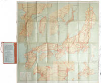
1927ref. 215711Tokyo.: Japanese Government Railways. Circa1927. Large folding colour map 78.5 x 80 cm of Japan and Korea 6 inset maps one of which shows Taiwan scale 1:1640000 for Hondo Shikoku and Kyushu 1:2340000 for Chosen; tipped into the original orange cloth covered case with orange ties text in 31 panels on the verso one a little age-toned a few very small fold splits without loss a very good copy. Attractive tourist map for the English-speaking traveller issued by the Japanese Government Railways with extensive notes for tours and points of interest on the verso short descriptions of cities and sites to visit principal theatres with suggestions for cafes restaurants and department stores. . Japanese Government Railways. hardcover
ref. 1581742495.Gpaperback. Good. Access codes and supplements are not guaranteed with used items. May be an ex-library book. paperback
ref. 0259600024.Gpaperback. Good. Access codes and supplements are not guaranteed with used items. May be an ex-library book. paperback
ref. 0282579060.Gpaperback. Good. Access codes and supplements are not guaranteed with used items. May be an ex-library book. paperback
ref. 0282429476.Gpaperback. Good. Access codes and supplements are not guaranteed with used items. May be an ex-library book. paperback
ref. 1566958636.Gmap. Good. Access codes and supplements are not guaranteed with used items. May be an ex-library book. unknown
1914ref. 005933Paris: Dépôt des Cartes et Plans de la Marine 1914. Cloth Backed. Very good. This extensive uncolored sea chart provides comprehensive coverage of the entire Eastern Mediterranean Sea in multiple panels which have been assembled and backed with cloth to form a large composite map. Published by the official French hydrographic office in Paris the "Dépôt des Cartes et Plans de la Marine" which became the Service Hydrographique de la Marine around this time the chart is a practical navigational aid rather than a decorative one. It features a dense network of hydrographic data including numerous soundings indications of sea bed composition and detailed representations of coastlines and harbors. The chart's functional uncolored style is typical of official government maritime surveys designed for practical use by mariners with details corrected and augmented over time to reflect the most current surveys. Sheet dimensions: 76 cm x 107 cm approx. assembled from multiple sheets. Condition: Very Good. Sound paper uncolored as issued minimal signs of wear along seams where sheets are joined. Please see photos for full appraisal of condition. Dépôt des Cartes et Plans de la Marine unknown
1914ref. 005930Paris: Dépôt des Cartes et Plans de la Marine 1914. Loose Sheet. Very good. This extensive uncolored sea chart provides comprehensive coverage of the entire Western Mediterranean Sea in multiple panels which have been assembled and backed with cloth to form a large composite map. Published by the official French hydrographic office in Paris the "Dépôt des Cartes et Plans de la Marine" which became the Service Hydrographique de la Marine around this time the chart is a practical navigational aid rather than a decorative one. It features a dense network of hydrographic data including numerous soundings indications of sea bed composition and detailed representations of coastlines and harbors. The chart's functional uncolored style is typical of official government maritime surveys designed for practical use by mariners with details corrected and augmented over time to reflect the most current surveys. Sheet dimensions: 76 cm x 107 cm approx. assembled from multiple sheets. Condition: Very Good. Sound paper uncolored as issued minimal signs of wear along seams where sheets are joined. Please see photos for full appraisal of condition. Dépôt des Cartes et Plans de la Marine unknown
ref. 0528855816.Gspiral_bound. Good. Access codes and supplements are not guaranteed with used items. May be an ex-library book. unknown
1881ref. ABE-EBAY-197700219739London: Kegan Paul 1881. Hardcover. Good. A Polar Reconnaissance. Being the Voyage of the ""Isbjörn"" to Novaya Zemlya in 1879. By Albert H. Markham. With Maps and Illustrations. London: C. Kegan Paul 1881. 10 engravings 6 of them full-page plates 2 folding maps. Top and bottom of spine significantly chipped other extremities rubbed spine sun-faded a little scuffing and staining. Pages yellowed with an occasional bit of foxing smudge minor blemish; there are a couple of light pencil marks; a blank page at the end has a few pencil notes. Binding cracked and weak one signature is detached a couple of others are loosening. Owner bookplate James Richardson. Kegan Paul hardcover
ref. 1566953049.Gmap. Good. Access codes and supplements are not guaranteed with used items. May be an ex-library book. unknown
ref. 1870423933.Ghardcover. Good. Access codes and supplements are not guaranteed with used items. May be an ex-library book. hardcover
1955ref. 173072Washington D.C.: Army Map Service U.S. Army. 1955. Large colour map. 1:250000 scale. Transverse mercator projection. 23°00'N 91°30'E-22°00'N 93°00'E. Series U502 Sheet NF 46-6 Edition 1-AMS. Map measures 57.3 x 75.8cm. Slight wear creasing even light browning small closed tears on edges upper-right corner little foxed. Shows signs of use but map is clean and complete. Corps of Engineers Army Map Service map of Chittagong and surrounds compiled in 1955. Based on the British Indian one-inch and half-inch map series from 1938-43 and 1936-43 respectively. . Army Map Service, U.S. Army. unknown
ref. F3-KKRA-KN67Hardcover. Very Good. Jacket is Good with moderate wear and tear book is Very Good with light wear clean yellowed pages firm binding. hardcover
ref. G8N-H27-VU6Hardcover. Good. Jacket in Fair condition worn torn faded and foxed with significant tape repairs verso. Book has moderate wear some edge foxing; pages yellowed with an occasional minor blemish; binding firm; gift inscription to half-title. hardcover
ref. RY-O4EE-72UHHardcover. Good. Jacket has average wear tear and fading. Book has some bumps pages yellowed with an occasional minor blemish binding firm. Good plus. hardcover
1999ref. 060925067Franklin Maps 1999. unknown_binding. Very Good. 0x0x0. Very good condition. Clean text without highlighting or underlining. Tight spine. Light wear to the exterior. Franklin Maps unknown
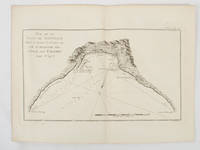
1774ref. 174257Paris.: Chez Saillant et Nyon rue Saint-Jean-de-Beauvais Chez Panckoucke Hotel de Thou rue des Poitevins. 1774. Engraved map on laid paper 18.5 x 31cm 25.6 x 34.4cm sheet size central fold slight marginal toning but a very good dark impression. Map of Bonthain Bay situated southeast of Macassar on the island of Celebes finely re-engraved for the French edition of Captain James Cook's First Voyage 1768-1771 "Relation des voyages.pour faire des decouvertes dans l'hemisphere meridional et successivement executes par le commodore Byron le capitaine Carteret le capitaine Wallis & le capitaine Cook.". . Chez Saillant et Nyon, rue Saint-Jean-de-Beauvais, [Chez] Panckoucke, Hotel de Thou, rue des Poitevins. unknown
ref. 0881307904.Gpaperback. Good. Access codes and supplements are not guaranteed with used items. May be an ex-library book. paperback
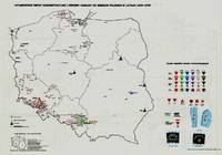
1979ref. 41929Warszawa Warsaw: Pan´stw. Wydawn. Naukowe 1979. 1st Edition. Original black printed portfolio 8vo. Portfolio of seven large folding maps on on 4 sheets of heavy paper 3 are double sided 1 is singled sided. Primarily black and white with some color. Text in Polish. Title translates to “Nazi camps in Poland 1939 - 1945. An Encyclopaedic Reference Book: Maps." Collection of 7 maps each 84 cm x 60 cm 33 x 24 inches produced by Jan Laskowski at the Main Commission for the Investigation of Nazi Crimes in Poland. The maps comprise Volume II of the work; Volume I is a heavily illustrated 676-page book of the same title which we offer separately. The Seven maps all present are: - Map 1 Single Sided: Hitlerowskie obozy na ziemiach polskich w latach 1939 - 1945. “Nazi camps in Poland in the years 1939 - 1945”. Showing: concentration and extermination camps sub-camps of concentration camps extermination centers POW camps more important sub-camps working divisions commandos and temporary POW camps penal labor camps major labor camps prisons transit camps & ghettos. - Map 2A: Getta na ziemiach polskich w okresie okupacji hitlerowskiej w latach 1939 - 1945 “Ghettos in Poland during the Nazi occupation in 1939 - 1945”. - Map 2B: Hitlerowskie obozy przejsciowe na ziemiach polskich w latach 1939 - 1945 “Nazi transit camps in Poland in 1939-1945”. - Map 3A: Hitlerowskie wiezienia i areszty na ziemiach polskich w latach 1939 - 1945 “Nazi prisons and arrests in Poland in 1939 - 1945”. - Map 3B: Hitlerowskie obozy pracy na ziemiach polskich w latach 1939 - 1945 “Nazi labor camps in Poland in the years 1939 - 1945”. - Map 4A: Hitlerowskie obozy jenieckie na ziemiach polskich w latach 1939 - 1945 “Nazi POW camps in Poland in 1939 - 1945”. - Map 4B: Hitlerowskie obozy koncentracyjne i osrodki zaglady na ziemiach polskich w latach 1939 - 1945 “Nazi concentration camps and extermination centers in Poland in 1939 - 1945”. Maps 2A & 2B have been described as a “Terrifying pair of maps showing the locations of German POW and internment camps in Poland during World War II highlighting the widespread locations of these establishments. In some parts of the map the information becomes so dense that three inset maps are shown. This map was designed by Jan Laskowski and printed in 1979 as part of a work on the Nazi extermination machine produced by PWN Warsaw a state-owned research-focused publishing house in Poland. The map on the front is particularly interesting for its depiction of symbols used to classify internees in German camps. The uppermost of these depictions shows the combinations that can be made for different types of prisoners of different levels of importance. The armbands that would have been worn by these prisoners is shown as well as the prison uniforms. Other details are also shown. The map lists hundreds of sites run by Nazi operators throughout the country. These include concentration camps death camps transitional camps and ghettos. The map is divided according to Poland's voivodeships with a key in the lower left. Names of cities too long to spell are also provided in the lower left. This map was produced during a point in Poland's history during which it was actively revisiting the period during the Second World War. Leading social scientists devoted their time to trying to gather all the living as well as the recorded history of the events of the Holocaust and related atrocities before this information vanished. Leading these efforts particularly during the 1960s and 1970s was the Glówna Komisja Scigania Zbrodni przeciwko Narodowi Polskiemu known as the Chief Commission for the Prosecution of Crimes against the Polish Nation. They were active in publishing maps both for domestic educational purposes and for international remembrance and diplomatic efforts regarding the Holocaust. Jan Laskowski was a leading cartographer who produced a number of maps in this field. These maps were produced as part of a series of maps that purported to combine to form an atlas of all of Hitler's crimes in Poland. Many of the large wall maps produced during this period could only show a fraction of the crimes or only the atrocities committed in one region. Thus a series of maps was needed to show all the points necessary which this present work contributes to. Polish Reinterpretations of the Holocaust: Studying the effects of German occupation in Poland is a delicate subject. While it is certain that Poland suffered at least as badly as any other European nation during the Second World War reinterpretations of the Holocaust in the country have also been used to satisfy nationalistic tendencies. It has become evident to Western observers in the last several years that there is a strong nationalist movement in Poland that seeks to place blame for the Holocaust solely on the shoulders of non-Polish actors a movement originally fostered under Soviet rule. This movement has gone so far as to limit freedom of speech criminalizing with a three-year sentence the suggestion that Poland or its citizens in any form participated in the murders committed by Nazis. As such the term ‘Polish concentration camps’ has been deemed unacceptable with the government-approved term being ‘concentration camps on Polish territory.’ All lines of evidence show that this map 2A & 2B was produced using the most accurate and impartial historical sources. The language on the map is simple naming only ‘Hitler's Atrocities’ and there is no evidence of a clear anti-German bias. However it is impossible to separate this map one of the most important productions of the remembrance movement during this period from the social situation in which it was produced. Maps like these can easily be converted into propaganda instruments and today's Polish leaders most of whom grew up during Soviet occupation will have formed their understanding of the Holocaust through maps like these. Soviet Censorship: While the content of the map appears to have been produced free from bias the map still had to go through Soviet censorship. Mentioning prisoner of war camps in which primarily Soviet troops were interned would have been a prerequisite condition upon which the publication of the map rested. Further the lack of mention of any Soviet killings or camps requires no explanation….The map unlike many later maps makes no differentiation between the populations who suffered at the various camps. This represents the Soviet agenda that all nations suffered fought and won equally which sought to limit divisions in this post-identity state” Ruderman 2022. SUBJECTS: World War 1939-1945 -- Prisoners and prisons German. -- Concentration camps -- Poland. Guerre mondiale 1939-1945 -- Prisonniers et prisons des Allemands. -- Camps d'internement -- Pologne. Obozy koncentracyjne -- Polska -- 1900-1945. OCLC: 830885973. Light shelf wear to portfolio as expected. All maps in pristine condition with normal folds as issued. Very Good Condition. Complete and dramatic BR5 holo2-147-19-'cc. Warszawa (Warsaw): Pan´stw. Wydawn. Naukowe unknown
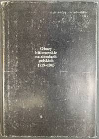
1979ref. 41930Warszawa Warsaw: Pan´stw. Wydawn. Naukowe 1979. Pamphlet. 1st Edition. Original Cloth in dustjacket 8vo 678 2 pages 36 unnumbered leaves of plates with 164 illustrations. 25 cm. In Polish. Title translates to “Nazi camps in Poland 1939 - 1945. An Encyclopaedic Reference Book.” ISBN: 8301000651. A massive encyclopedic record of Nazi camps prisons and ghettos in Poland based on extensive source material in Polish and foreign archives and research carried out by the General Commission for the Investigation of Nazi Crimes in Poland. The 5877 entries pages 87-601 are arranged in alphabetical order of location providing data on the period of existence character of and fundamental information about each site. Pages 11-86 comprise an introduction by Czeslaw Pilichowski "Hitlerowskie obozy i os´rodki przymusowego odosobnienia oraz ich rola w realizacji programu ludobo´jstwa i zaglady narodu polskiego" "Nazi Camps and Forced Detention Centers and Their Role in Implementing the Program of Genocide and Extermination of the Polish Nation". Includes a bibliography and indexes and summaries in Russian English French and German p. 657-676. The last 73 pages contain photographs. SUBJECTS: World War 1939-1945 -- Prisoners and prisons German. -- Concentration camps -- Poland. Guerre mondiale 1939-1945 -- Prisonniers et prisons des Allemands. -- Camps d'internement -- Pologne. Obozy koncentracyjne -- Polska -- 1900-1945. OCLC: 5709074. Top corners bumped some tears to dust jacket otherwise Very Good Condition in Very Good Dustjacket. Important Work. BK5 holo2-147-20. Warszawa (Warsaw): Pan´stw. Wydawn. Naukowe unknown