Cartes, KateBiblio.com

ref. 1802239049.Gpaperback. Good. Access codes and supplements are not guaranteed with used items. May be an ex-library book. paperback
ref. 1845879619.Gmap. Good. Access codes and supplements are not guaranteed with used items. May be an ex-library book. unknown
1952ref. 9160DuBois PA: Samuel A. King 1952. Revised 1952. Folding map 25x19" printed in red and black. Sportsman's club label to upper margin with some offsetting to lower. Small split at fold intersections title and a few stains to blank verso otherwise a clean near fine example. Very popular map which was originally designed and published by Samuel A. King in 1951 and revised in 1952 and 54. According to OCLC there were also 1960s and 70s printings under slightly different titles. This map shows the Allegheny National Forest and surrounding counties with animal silhouettes tracks and a portrait of John O'Bail the Cornplanter last of the great Seneca chiefs. Made for motorists hunters and anglers it shows paved and clay roads trails pipe and power lines fire and lookout towers state parks game lands airports and towns with post offices. The early copies of this map are somewhat scarce and there are many modern reprints available. OCLC cites 8 holdings for the '51-54 editions with just 1 being the '52. A lovely example. . Samuel A. King unknown
ref. 0881302554.Gpaperback. Good. Access codes and supplements are not guaranteed with used items. May be an ex-library book. paperback
ref. 1770091939.Gpaperback. Good. Access codes and supplements are not guaranteed with used items. May be an ex-library book. paperback
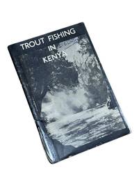
1950ref. 8975Nairobi Kenya: Printed in E. Africa by W. Boyd & Co 1950. First edition. 18x13cm 64pp. Illustrated ads photos fold out map attached at rear. Staple bound in illustrated wrappers. Old tape reinforcement to spine edges rubbed owner's name to front cover. Upper corners stained else clean internally and very good. Very scarce mid-century publication a guide for English and American sportsmen seeking angling opportunities in Kenya Colony. Brown and Rainbow Trout eggs were introduced into the rivers by colonists around 1905. The sport was a popular pastime for the colonists and tourist fishing in the region continues to thrive today. The three color map at rear shows the Kenya Highlands with principle trout rivers roads and railways. OCLC cites a single holding at the University of California. Printed in E. Africa by W. Boyd & Co unknown
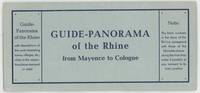
1960ref. 000015404Mainz: W. Suder 1960. Later edition. Wraps. Near Fine. 24.5 cm x 11.5 cm folded in the wrappers. Map bound in the leporello style. Blue paper wraps printed in dark blue. A colorful map with captions printed in black in 16 folds. A map similar to this one was first published earlier in the twentieth century by a different press. The captions are in English. Castles and other landmarks from Bonn Cologne Linz Krahnenburg Koblenz and from several other suburbs and towns on the Rhine river are pictured and discussed in the map's margins. Light wear to the wraps else a sharp example. W. Suder unknown
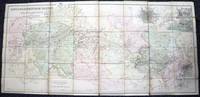
1835ref. 000014144London: Cha. F. Cheffins 1835. Map. Ex-Library. 29 3/8" x 61.5". Linen-backed map done on two sheets. Map printed in black pink yellow and green hand-colored. Housed in a 8" x 5.5" green case with gilt lettering and a gilt device on the front board the front of the case states "London & Birmingham Railway. Map of the Line. above the device Incorporated 6th May 1833". A portion of the map backed with green goat in order to have it enter and exit the case more smoothly. A large and beautiful representation of the London to Birmingham railway line with the stops outlined at the bottom edge of the map. With two engraved vignettes showing the depots in Birmingham and in London. An early example of this captivating map. A bookplate and one stamp on the verso of the map otherwise no markings. The bookplate states that the map was a gift donated by James J. Hill a wealthy bibliophile from St. Paul to the University of Wisconsin Library. The map has three small spots of loss to its folds. The case has wear and light discoloration. Cha. F. Cheffins unknown
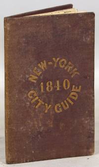
1840ref. 000014171New York: Tanner & Disturnell 1840. Later edition. Hardcover. Very Good. 64mo. 13 cm x 8 cm. 3 4-15 1 pp. Brown cloth with gold lettering on the front board. Yellow coated rear endpaper and rear pastedown. Illustrated with a frontispiece and with a folding map in the rear of the volume. The folding map in the rear of the volume is hand-colored. Its title is "New Map of the City of New-York with part of Brooklyn & Williamsburg". By J. Calvin Smith. Engraved on steel by Stiles Sherman & Smith. The folding map is dated 1840. Phillips 532. Guide books similar to this one were published as early as 1836. OCLC locates a few examples of this exact edition. With a list of wards streets and information on how to get around the city. A fascinating look at early nineteenth-century New York City. Light soiling to the cloth. Lacks the yellow free front endpaper and front pastedown. The folding map with one piece neatly detached but laid in the whole map is present. Tanner & Disturnell hardcover
1970ref. B-Shelf-08152022-cjb018Charles Scribner's Sons 1970-01-01. Hardcover. Very Good. 8x6x1. Ships quickly. 3 Vol set as shown. Pages in Cover in VG condition. DJs have fluttered edges and a few small tears consistent with normal use. Mild shelf/reading wear. Orphans Treasure Box sells books to raise money for orphans and vulnerable kids. Charles Scribner's Sons hardcover
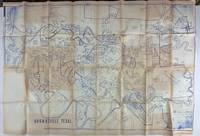
1980ref. 3562N.p. probably Brownsville Tx 1980. Very good. Blue-line map 42 x 62 inches. Uneven toning minor overall wear. A large-format plat map of the Texas border town of Brownsville likely created in the early 1980s. The date is based on the appearance of the Sunrise Mall which opened its doors in 1979 and the name of the airport which was changed in 1983; as such the present map was printed sometime between those two dates. The present map shows the original city parcel as well as many other notable modern developments including the Airport Industrial Park the Fourteenth Street Commercial Plaza and the Amigoland Theme Park the latter of which was never built. The Rio Grande can be seen winding its way through the bottom portion of the map. We locate no other copies of this map anywhere. It was likely produced for local developers and as such is quite rare. An ideal decorative Texas map. unknown
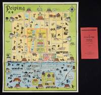
1934ref. 158433Peiping.: Peiyang Press. circa1934. Coloured folding plan of Peking with original envelope. 60 x 50cm. A few neat repairs at folds two panels evenly browned on reverse. A very good copy of a scarce pictorial plan with its envelope. This delightful and scarce pictorial map of Peking with landmarks and streets in romanised Chinese with occasional Chinese characters is surprisingly scarce. Although apparently issued in several editions in the 1920s and 30s it appears relatively infrequently on the market. The divisions of the Legation District are indicated by their flags - this edition shows the German Legation by use of the black white and red bands of the German flag. This flag which was no longer used after 1935 helps date this edition. Other landmarks and attractions shown included theatres foreign shopping area adjacent to the legations quarter Liu Li Chang Curio District the racecourse the many city gates etc. . Peiyang Press. unknown
ref. 1597753351.Gmap. Good. Access codes and supplements are not guaranteed with used items. May be an ex-library book. unknown
1889ref. 9062St. Paul Minn: W.C. Riley 1889. 8vo 140 15pp ads and blank journal at rear. Illustrations maps large folding map in pocket at rear as issued. Original leather over card covers stamped in gilt on front with red page edges. Gift inscription on ffep in pencil dated 1907 else clean internally. A beautiful fine copy. Beautiful copy of this illustrated tourist's guide to Yellowstone giving descriptions of the attractions and features of the park with maps a brief history and rules and regulations. Riley issued a just few of these according to OCLC between 1886 and 1890. Scarce and more so in this condition - the nicest we've seen. . W.C. Riley unknown
ref. 366634US: Houghton Mifflin 1952. Houghton Mifflin 1952 First Edition NAP Fine/Very Good DJ Author: De Voto Bernard; Raisz Erwin maps. Light blue cloth with grey text bloacks and brown lettering. USA map end papers. Pages lightly tanned with many smaller maps in text. xxii647 pages with index. Bright glossy clipped dust jacket with small mended tears protected in clear dust jacket cover. HEAVY ITEM 1.89 Pounds. Size: 8 5/8 x 6 x 1 1/2 inches. First Edition NAP. Hardcover. Fine/Very Good DJ. No Exp. Houghton Mifflin Hardcover
ref. 2308220004Doubleday Doran & Company. hardcover. Good. 0x0x0. states "first publication for general circulation 1935" yet title page states 1936 - Doubleday Doran hard cover - red cloth cover - no dust jacket - 1 1/2 inch cut at binding - some staining to cover and closed page edge - gift inscription inside front cover - owner's label inside front cover - a number of illustrations throughout - dingins trong contents clean - enjoy Doubleday, Doran & Company hardcover
2024ref. __1849077002Philip's 2024. Hardcover. New. 448 pages. 11.26x1.50x14.49 inches. Philip's hardcover
1919ref. 061262New York: Frederick A. Stokes Co. 1919. Book. Near Fine. Hardcover. 1st Edition. 12mo - over 6¾" - 7¾" tall. Blue cloth spine panel lettered in orange color front and back cover pastedown illus. Text block edges typically somewhat tanned with minor loss along top edge/corner of cover pastedown otherwise only slight wear. Color illus. dust jacket shows area of loss along top front edge minor loss to corners several closed tears and rubbed joints/folds now in mylar. xii371 pp. illus. Frederick A. Stokes Co. Hardcover
1984ref. 057032Eldon D. Weber 1984. Book. Near Fine. Hardcover. First Thus. 4to - over 9¾" - 12" tall. Brown leatherette lettered in gold foil. 3rd ptg. 1984 of facsimile reprint edition. Slightly soiled covers nearly as issued. Main text dates to 1895-96 Eby with 1931 supplement by Snyder every-name index and geographical index by Weber. Map in rear pocket as called for. Eldon D. Weber Hardcover
1979ref. mon0003831126Fine Arts Gallery of the Univers 1979-01-01. Paperback. Good. . Book shows minimal shelf & handling wear. First page is marked with previous owner's gift inscription otherwise pages are clean: text and pictures are intact and unmarred. Binding intact and firm. Good reading copy. Fine Arts Gallery of the Univers paperback
ref. 1802239030.Ghardcover. Good. Access codes and supplements are not guaranteed with used items. May be an ex-library book. hardcover
1960ref. 78704Atladena California: Altadena Federal Savings and Loan Association 1960. Printed on both sides on an 18 1/2" x 23 1/2" sheet of white paper that folds to 4" x 9 1/4" 24 panels. There is printing in red and a color rendering of the Altadena Federal Savings building on one side. Handwritten name on the front panel; else near fine. Scarce OCLC locates no holdings. Fully indexed street map of the unincorporated Los Angeles County California community that was devastated by the Eaton Fire in January 2025. Situated next to and within the foothills of the San Gabriel Mountains Altadena has long resisted annexation to Pasadena though that city has taken 46 "bites" of it over the years seeking tax revenues. That independent spirit is reflected in the mosaic of ethnic diversity that made Altadena one of the most integrated communities in Southern California. Altadena Federal Savings and Loan Association unknown
ref. 1865003123.Gmap. Good. Access codes and supplements are not guaranteed with used items. May be an ex-library book. unknown
ref. 1802238956.Ghardcover. Good. Access codes and supplements are not guaranteed with used items. May be an ex-library book. hardcover
ref. 0881304433.Ghardcover. Good. Access codes and supplements are not guaranteed with used items. May be an ex-library book. hardcover