Thomas Brothers MapsBiblio.com

ref. 1581742363.Gpaperback. Good. Access codes and supplements are not guaranteed with used items. May be an ex-library book. paperback
1819ref. 1405618Paris: Menard et Desenne 1819. Dernière édition. Hardcover. Octavo 684 pages. In Fair minus condition. Spine is tan with gold print on red banner. Boards half bound with green leather to spine and corners and green cloth to boards; corner leather not present spine leather is toned with some rubbing and wear to hinges board cloth has worn edges rubbing shelf wear. Text block has deckle edges; cracked front hinge foxing and toning throughout. Illustrated: “Enrichie de sept Cartes géographiques conformes aux nouvelles divisions et ornée des Pavillons des vingt principales Puissances maritimes”— title page; however illustrations may not be present. Text in French. NOTE: Shelved in Netdesk Column W. 1405618. FP New Rockville Stock. Menard et Desenne hardcover
1823ref. 42750London: T. Cadell and W. Davies 1823. First edition. Hardcover. g to vg. Large quarto 11 1/4 x 9". 2 xxviii xxiii 1 812pp; xix 13 715pp 1pp Errata 2pp Publisher's advertisement; 2 xv 12 20 822pp; 2 xx 14 735pp 1pp Errata; xii 14 763pp 1pp Errata; 2 iv 14 555 1pp. Modern half black morocco over dark grey cloth with gold lettering and ruling to spines. Raised bands. First volume with a striking tissue-guarded frontispiece portrait of the author engraved by Richard Golding after a painting by John Opie. Tissue-guarded engraved frontispiece in each volume. First edition of Edward Daniel Clarke's magnum opus "Travels in Various Countries of Europe Asia and Africa" the author's personal account of a fascinating journey throughout three continents. Following a tour of Scandinavia in 1799 Edward Daniel Clarke 1769-1822 travelled through Russia and the Crimea before proceeding to Constantinople Rhodes and afterwards Egypt and Palestine. Greece was the country next visited. While touring this country Clarke as a mineralogist and antiquary collected marbles coins and vases and purchased a large ancient statue at Eleusis. From Athens he proceeded by land to Constantinople and after a short stay in that city directed his course homewards through Rumelia Austria Germany and France. Each of the six volumes is lavishly illustrated throughout with numerous in-text vignettes and woodcuts as well as full-page copper plates many folded depicting views monuments natives in traditional costume ceremonies and processions antiquities etc. Includes several folded maps and charts. All the 185 copper plates and 157 vignettes and cuts are accounted for. Plates engraved by Joseph Skelton R. Pollard Laetitia and Elizabeth Byrne F. R. Hay J. Fittler and R. Cooper after illustrations by E. D. Clarke Angelica Clarke Guarenghi Martin Dreier W. Havell Camporesi J. B. Lusieri Morritt W. Harraden Grelot Fauvel G. Wilkins Henry Wrighte and Preaux. Most of the delightful vignettes were engraved by Elizabeth and Laetitia Byrne. The maps and plans were engraved by S. I. Neele and H. Mutlow. Some offsetting to text pages facing plates. Moderate to heavy foxing to plates throughout. Minor foxing to text pages. Sporadic clear water-staining along edges of plates in second volume Part 2 section 1. Ex-library copy with perforating library stamp to each title page and small reference stamp at inner gutter of the first text leaf of each volume not affecting lettering. Bindings in overall very good interior in good to very good condition. T. Cadell and W. Davies hardcover
1999ref. 053262Thomas Brothers Maps 1999 Book. Good. Soft cover. 8vo - over 7¾ - 9¾" tall. Cover has some light rubbing and a few small creases name and date on inner front cover. Thomas Brothers Maps paperback
1965ref. 230929DRandom House 1965. Hardcover. Excellent. 7x5x1. Photographs and Maps. Rare Collectible Pictorial Cover Book. This book is in Wonderful Excellent Unused condition with One Exception- it was bound upside down! So of course this has no effect on your ability to read this great book in great condition!- just flip it over! Book is in Very Good Plus to Excellent condition with a tight binding and clean crisp internal pages. Inside text is unread and unused! There is a stamp from "Colonial Press" on the first end page but No other writing or markings in the book. Outside pictorial covers are Very Nice! This is a great book but as stated you just need to flip it over to read! Very Hard to Find as a Non-Library Book in this condition! This book was NOT published with a Dust Jacket. Landmark Books Volumes 104-122 are only available in the picture cover format also these titles had virtually no trade sales with public and school libraries taking most of the books. Landmark Books and World Landmark Books are accurate in-depth stories for young people in the 9-15 year old range. These living histories were written by award-winning authors or by men and women who experienced the events first hand. Written during the 1950's and 1960's and illustrated either with two-color drawings or clear photographs the books are informative enjoyable and well worth reading and collecting. The Story of Thomas Alva Edison Landmark Book #110. Here is a colorful account of America's greatest inventor who was also one of American's most rugged individualists. Simply and clearly the author explains Edison's contributions to the electric light the telephone the phonograph the electric locomotive radio broadcasting motion pictures and many other aspects of our modern electrified world. Random House hardcover
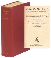
1932ref. 69128London: William Heinemann 1932. Hardcover. Very good. Hardcover. Sixth printing. xxix 577pp index; 14 maps. Name on front free endpaper scattered pencil underlining to text notes on half of rear endpaper some spotting to rear board else very good in publisher's red cloth. William Heinemann hardcover
1992ref. 050926Seattle WA: Seal Press 1992. Advance Uncorrected Galley Proofs . Paper Back. Very Good/No Jacket. 4to - over 9¾" - 12" tall. 103pp.; SC blk.plastic comb-binding w/clear plastic cover; slight rub w/cleantight pgs. "Poems by Barbara Kingsolver. Spanish translations by Rebeca Cartes. Seal Press unknown
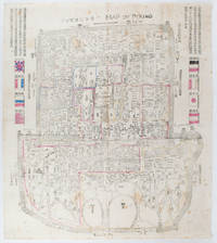
1900ref. 169765Circa1900. Large illustrated map of Beijing showing the city in the period following the invasion of the military forces of the Eight National Alliance old folds scale not given. Some scattered light foxing particularly at edges short closed tear at fold lower edge neat non acidic tape repair short section upper edge wear along folds and a couple of small unobtrusive holes with minor image loss. Blocks of text in traditional Chinese right and left upper sections stating each nation's occupied zone Japanese text title accompanies the English title along the upper section of the map. 63.7 x 56.9cm. Very good overall. A rare and significant large Japanese woodblock map of Peking Beijing issued just after the suppression of the Boxer Rebellion. Centred on the Forbidden City the map depicts Peking following the multinational suppression of the Boxer Rebellion or Yihetuan Movement of 1900. The map was issued to illustrate the areas of occupation associated with each of the powers in the Eight Nation Alliance. The map gives measurements of the city walls detailed names of streets and buildings and the boundaries of the inner and outer city including the forbidden city are shown with demarcation lines in pink yellow and blue. The hand coloured eight national flags of the occupation powers are featured at the right and left. This map is essentially a later edition of 京城内外首善全圖 a map of Beijing issued by the Qing for administrative purposes in the mid-19th century. The Japanese seized the wood blocks during the suppression of the Rebellion and subsequently pulled new impressions overprinting them additional details including flags and demarcations of areas of the city held by members of the Alliance. Versions are known in French German Japanese and as with the present example English. An attractive map of great historical interest. . unknown
ref. 187791195X.Gpaperback. Good. Access codes and supplements are not guaranteed with used items. May be an ex-library book. paperback
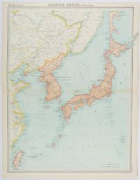
1922ref. 215880Edinburgh.: John Bartholomew & Son Ltd. 1922. Large double page map 54.2 x 43 cms map original fold some edge toning and to the fold but in very good condition. Large map prepared as plate 65 for “The Times Survey Atlas of the World” in 1922 and was prepared at the Edinburgh Geographical Institute under the direction of J G Bartholomew. The map shows Japan's territory inclusive of Korea southern Sakhalin and Taiwan. . John Bartholomew & Son Ltd. unknown
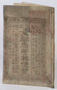
1873ref. 216097京都. Kyoto.: 村上勘兵衛. Murakami Kanbei. Meiji 5 1873. Black and white woodblock maps and city plan 22 x 15.3cm 17 double-folded leaves 4 hole string binding. Covers worn and soiled chop on upper cover. This guide to Kyoto and its surroundings includes two double-page and twelve single-page pictorial maps published around Meiji 5 1873. Each map highlights geographical features place names and major buildings such as Buddhist temples within Kyoto and its surrounding areas. The latter section covers three counties of the Tanba region offering a detailed look at the area beyond Kyoto itself. . 村上勘兵衛. [Murakami Kanbei]. unknown
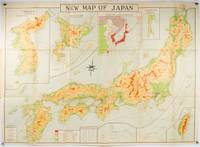
1935ref. 214827Tokyo.: Nihon-Kenkyusha. 1935. Large folding colour map of Japan 74.3 x 10⁵ cms; folding into printed card covers 27 x 19.5 cms: 9 insets: Chosen Korea; Hokkaido; Chisima Islands; General Map of Japan and Manchuokuo; Karafuto Saghalien; Okinawa Loochoo; Taiwan Formosa; Micronesia; Ogasawara; Hajijoshima; the covers a litle worn and marked and the sheet slightly toned but the map is in very bright clean condition. Scarce World War II era map of Japan including Korea published in English by Kenkyusha. Founded in 1907 it had a history of publishing for students of English and the English market. An attractively composed map in remarkbable condition; with the insets circled around the islands of Japan heights marked in graduations from green to red and showing provinces railways roads steamer routes Buddhist and Shinto Temples. . Nihon-Kenkyusha. unknown
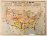
1938ref. 215547Los Angeles.: Los Angeles Examiner. Sunday 1 May1938. Printed colour pictorial map 33 x 48 cms; 41.8 x 54.5 cms sheet central fold sheet toned corners chipped with some loss to the bottom border and at the central fold in good condition; and on the verso "Movie-Go-Round" by Louella O. Parsons black and white photos and advertisements. Pictorial map printed for the weekend supplement of the Randolph Hearst owned newspaper the Los Angeles Examiner. The map-maker and artist Howard Burke had also worked for the San Francisco Examiner and was known for pictorial maps many with a persuasive or rhetorical edge and as here were designed to shore up American patriotism and defences against a wider world in the increasingly turbulent pre-war 1930s. The caption to this map outlines a multi-billion dollar 25 year proposal by Congressman J. Buell Snyder for a network of coast to coast transcontinental highways "in case of an attack by a foreign power at any point along the border". Buell Snyder earned the soubriquet "the father of superhighways" and during the War he was assigned to a Congressional Committee in charge of appropriations for the War Department. Scarce. . Los Angeles Examiner. unknown
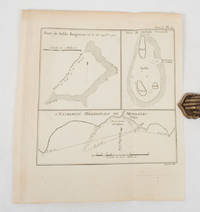
1774ref. 174260A Paris.: Chez Saillant et Nyon rue Saint-Jean-de-Beauvais Chez Panckoucke Hotel de Thou rue des Poitevins. 1774. Engraved map on laid paper 27.2 x 19.9cm 26.5 x 22.2cm sheet size edge fold slight marginal toning but in very good condition. Map of the treacherous coastal waters sandbars submerged rocks and reefs surrounding Mindanao and the Joseph Freewill Islands Mapia Atoll in the Philippines finely re-engraved for the French edition of Captain James Cook's First Voyage 1768-1771 "Relation des voyages.pour faire des decouvertes dans l'hemisphere meridional et successivement executes par le commodore Byron le capitaine Carteret le capitaine Wallis & le capitaine Cook.". . Chez Saillant et Nyon, rue Saint-Jean-de-Beauvais, [Chez] Panckoucke, Hotel de Thou, rue des Poitevins. unknown
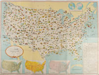
1955ref. 172003Washington D.C.: 国務省. Kokumishō. No date. circa1955. Large folding Japanese coloured map of the United States with 3 inset maps at foot of map showing main railways air and highway routes and hemispheres at the top right. Some browning mainly visible on reverse still a good copy. 66 x 81cm. An intricate and detailed pictorial map of the United States published in Japanese by the US State Department. The same type of map had been published since 1945 in English and subsequently in other languages. The Japanese language map is hard to find. The map is undated but was probably produced in the 1950's. The images include depictions of women board riders in two piece swimsuits of the sort popular in the 1950s but the inset text lists Alaska and Hawaii as external territories of the US indicating that the map was produced before they attained statehood in 1959. An inset panel provides information on the area and population of the US the population of major American cities mineral and other resources climate and topography. A note at the bottom right hand corner of the map states that copies of the map can be obtained free of charge from your nearest US Information Office. Every region of the country is decorated with an illustration of the natural resources industries or cultural or historical resources associated with that particular place. These include images of early colonial settlers the birthplaces of Mark Twain and Woodrow Wilson Booker T. Washington's house and Abraham Lincoln's grave; images of major dams oil fields coal mines cotton plantations etc. various animals and crops and images of ships cars and public buildings including the Statue of Liberty located rather oddly far out at sea. . 国務省. [Kokumishō]. unknown
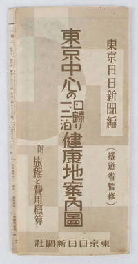
1419ref. 163423東京日日新聞社. Showa 14 19391939. Title on map :東京中心の健康地案内鳥瞰圖. Tōkyō chūshin no kenkōchi annai chōkanzu. Colour map of region around Tokyo with inset map in lower right corner. Few closed tears along central fold larger tear repaired small holes at folds a little light browning. Measures 19.5 cm x 9.5 cm when folded and 38.7 cm x 54 cm when open. Bird's eye view map of the region around Tokyo showing places where the residents of the city can go for healthy one two or three day trips. The map published by the Tokyo Nichi Nichi Newspaper in 1939 highlights hot springs golf courses beaches parks fishing areas mountains shrines and ski areas. The mark ハ indicates hiking courses. On the reverse side the distance to each resort area the way to get there and the costs are detailed. Users of the map area are warned that the areas circled in red around the mouth of Tokyo Bay is a military area where photos cannot be taken without permission. Even with the rising tides of war in 1939 city people were clearly still looking for ways to escape the noise and dust of the city for health-giving recreation. . 東京日日新聞社. unknown
1862ref. H4452Edinburgh and London: Gall & Inglis 1862. Hardcover. Very Good. Ca. 1862 folded backed in original linen housed in original cloth folder with green printed title label to cover the map measures 26.75 x 22 inches; 67.5 x 56 cm and is in excellent condition with vivid coloring. No date on map or binding but we found an advertisement for this map in another Cruchley production dated 1862 and it feels right. RARE with no copies in OCLC to our knowledge. Gall & Inglis hardcover
ref. 1566958601.Gmap. Good. Access codes and supplements are not guaranteed with used items. May be an ex-library book. unknown
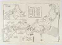
1955ref. 172396No publication details. Circa1955. Chinese black and white military map of Japan based on a map issued by 赤旗報 Shimbun Akahata on 24 June 1953. No scale given inset map of Hokkaido upper left corner legend lower section showing air and navy bases military exercise bases ammunition dump shooting ranges for the air force and navy headquarters of the coast guard etc. Text upper section provides details of the different types of US military bases and infrastructure. Text in traditional Chinese. 25.8 x 35.8cm. . No publication details. unknown
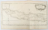
1750ref. 136782circa1750. Black and white copperplate engraving map of Java a little light even browning neat colour pencil highlighting of rivers and two settlements. Folded as issued. Good copy. 26 x 44cm. Issued in Prevost's Histoire Générale des Voyages ou nouvelle collection de toutes les relations de voyages par mer et par terre. . unknown
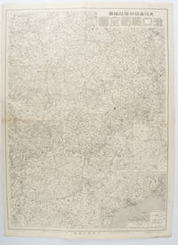
1572ref. 172829大阪. Osaka.: 大阪毎日新聞社. Osaka Mainichi Shinbunsha. 昭和 13 1938. Black and white map folded showing Hankow one of the three cities which merged to become Wuhan 54.5 x 49cm scale 1:2000000. Some light browning tiny closed tear upper margin neatly repaired with conservation standard tape. Good copy. This Hankow/Hankou War Situation Map is a supplement map of Osaka Mainichi Newspaper on 25 August 1938. The two inset maps show the region around Nanjing and Hong Kong. It gives detailed place names of Hankow area. . 大阪毎日新聞社. [Osaka Mainichi Shinbunsha]. unknown
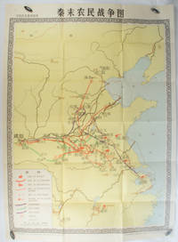
1981ref. 173280Beijing.: 地图出版社. Di tu chu ban she. 1st Edition 2nd Printing. 1981. Large Chinese coloured educational map folded scale 1:2000000. Legend lower left corner shows the routes of military advance led by peasant rebellion leaders' 陈胜Chen Sheng and 吴广Wu Guang in red and other military activities led by 项羽Xiang Yu and 刘邦Liu Bang in various colours. In original worn paper wrapper map in very good condition. Text in Chinese. Map measures 105.5 x 76.6cm. . 地图出版社. [Di tu chu ban she]. unknown
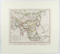
1855ref. 173439Gotha.: Perthes Justus. Circa1855. Engraved map 44.1 x 36.3 cm sheet size 35.8 x 29.7cm map size plate mark map with original hand colouring and hand coloured key noting Islamic "Mohammedanische" Buddhist "Buddhaistische" and European territories by country. Unusual map in an early issue. It was included as map 39 in Stieler's "Hand-Atlas uber alle Theile der Erde und uber das Weltgebaude by Frederic von Stulpnagel" revised by Hermann Berghaus in 1855. The issue is noted to the top right: Ausg. in 63BI. no XIV. Fine outline hand colouring denotes territories by religion and Chinese ports open to European trade and Japanese ports open to American trade. . Perthes, Justus. unknown
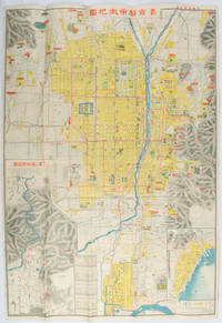
1922ref. 171899京都. Kyoto.: 山中書房. Yamanaka Shobō. 大正 11 1922. Attractive colour folding map of Kyoto with a quite detailed illustrated tourist guide printed in blue and white on the reverse some light browning holes at some folds good copy. 78.5 x 54cm This 1922 colour folding tourist map of Kyoto offers sightseeing information each panel showing a photographic monochrome image of the site discussed. The two inset maps on the Kyoto map show Otsu city on the shore of Lake Biwa and the Arashiyama area north of Kyoto. The main map highlights the major temples and famous sights in red geographic features such as rivers and hills are shown and an inset chart shows distances of sights from the nearby stations. The information on the reverse gives more detail on the famous sights a calendar of events seasonal highlights and details of the Imperial graves around Kyoto. . 山中書房. [Yamanaka Shobō]. unknown
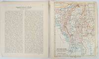
1903ref. 173709Gotha: Justus Perthes. 1903. Map printed in colour 24.7 x19.4cm and leaf of descriptive text in German 26.5 x 22.5cm slight toning and edges of the map worn with two small tears no loss. Geopolitical map of Burma with railways and railways under construction highlighted. The accompanying text is by the German Tibetologist linguist and orientalist Dr Emil Schlagintweit. . Justus Perthes unknown