MORDEN, ROBERTBiblio.com
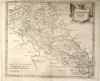
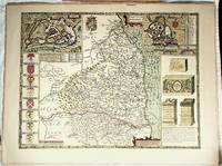
ref. 64139London.: Gibson. Early 18th Century. Engraved map on watermarked paper central fold 38 x 46.5 cm decorative title cartouche towns roads rivers and landforms shown; from Gibson's edition of Camden's Britannia upper edge trimmed by the original binder causing minor loss to the border at the inner edge but in very good condition. . [Gibson.] unknown
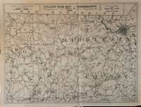
1891ref. List3031Lynn Massachusetts: Arthur W. Robinson 1891. Nine of a ten-map series mostly measuring 14 ½ x 19 inches. Folded with slight marginal folding and wrinkling; Near Fine. Nine of a set of ten maps of the entire state of Massachusetts produced in 1891 for the League of American Wheelmen. The League was founded in Rhode Island in 1880 as a membership organization for cyclists. Besides presiding over racing and producing cycling guidebooks it advocated for increased government spending on road improvements especially for rural roads; these maps indicate roads of superior and inferior quality. In the 1890s there was a boom in cycling’s popularity mainly because of several inventions that allowed a safer and more pleasant ride compared to that of a penny-farthing. This group is near complete; we find two complete editions on OCLC. Arthur W. Robinson unknown
ref. 001174FINE map. Reproduction from Speed's "THEATRE OF THE EMPIRE .". Softcover. FINE map. Overall 17.5"x23.5" image 15.25"x20". This is not a photographic reproduction. Attractive & colorful. . FLAWLESS image. Not even the faintest aging foxing etc. VERSO FLAWS: light but extensive surface damage from some sort of adhesive with some loss of lettering. Verso only effected not into recto. . paperback
ref. 2741601704.Gpaperback. Good. Access codes and supplements are not guaranteed with used items. May be an ex-library book. paperback
ref. 1932105514.Gmap. Good. Access codes and supplements are not guaranteed with used items. May be an ex-library book. unknown
2008ref. 3278London 2008. Slipcased. as New. Bartholomew John G maps. Used - VG: in very good condition with slipcase Hardcover ISBN 13 9780007801503 ISBN 10 0007801505 The Times Book Group. Illustrated hardback laminated board cover. 460mm x 320mm 18" x 13". 67pp 224pp plates. Colour maps. Heavy item - shipping supplement will apply for overseas. . unknown
ref. 1933911387.Gmap. Good. Access codes and supplements are not guaranteed with used items. May be an ex-library book. unknown
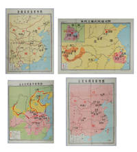
ref. 217061Shanghai.: 地图出版社 Cartographic Publishing House. Four coloured folding maps in the High School Chinese History Teaching Maps series. Map 1 辽北宋西夏形势图 Liao Bei Song Xi Xia Situation Map 106 x 75.6cm Map 2 金南宋西夏形势图 Jin Nan Song Xi Xia Situation Map 106 x 75.6cm Map 3 宋代主要农民起义图 Major Peasant Rebellions During the Song Dynasty Map 76.5 x 106cm Map 4 元末农民战争形势图 Peasant Battles in the Late Yuan Dynasty Situation Map 106 x 76.5. Text in simplified Chinese characters. Some very slight browning at folds on reverse not affecting image or text minor soiling at edges else all in very good bright condition. Descriptive listing in Chinese also included. Map 1 辽北宋西夏形势图 shows the Liao regime established by the Khitan in the north the western Xia established by the Danxiang in the northwest which co-existed with the Northern Song. Important military and economic activity locations also shown. Map 2 金南宋西夏形势图 shows the situation during the Southern Song Dynasty when three regimes co-existed; the Jin established by the Jurchens in the northeast the Western Xia established by the Dangxiang in the northwest and the Southern song. Important military activity locations also shown. Map 3 宋代主要农民起义图 shows locations of peasant uprisings in the Northern and Southern Song Dynasties Map 4 元末农民战争形势图 shows the situation of the three northern expeditions of the Red Turban Rebellion at the end of the Yuan Dynasty and the activities of the rebel armies. . 地图出版社 [Cartographic Publishing House]. unknown
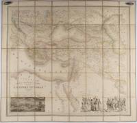
1853ref. 176118Paris.: Ministère d'Etampes et de Géographies. 1853. Engraved map with outline hand colour 67.2 x 75.1 cm sectioned and linen-backed two large vignettes: a view of Constantinople; and costumed Turks and European soldiers facing off across a stream the linen browned with some loss but not affecting the map with the fine nineteenth century label of Charles Delarue & Hivert on the verso. Fine map with beautiful vignettes by Adrien Toussaint Lallemand 1793 - c.1856 geographer and engraver at the Depôt de la Guerre. Lallemand was appointed at a precociously young age and later set up in business on his own the quality of his work assuring him of the continued business of the Depôt. Highly attractive map of the Ottoman Empire published at the outset time of the Crimean War 1853-1856. This item is held off-site. Please note there may be a few days delay while it is brought into our shop for viewing or mailing to you. Thank you for your understanding. . Ministère d'Etampes et de Géographies unknown
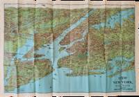
1928ref. List2973George J. Nostrand; Winkoop Hallenbeck Crawford Co 1928. Map measuring 20 x 29 inches; trifold measuring 8 ½ x 12 inches. Map folded with some small tears at folds slightly wrinkled pencil markings verso; very attractive. Overall excellent. Offered here is a large attractive bird’s-eye view map of New York City and the surrounding areas by George J. Nostrand a New York City-based lithographer and cartographer; and a small pamphlet advertising sightseeing tours by car or yacht with “lecturers accompanying each trip explaining all points of interest”. The map highlights the most car-friendly routes around the city and New Jersey as far west as Mountain View and is beautifully illustrated with buildings landmarks and ships in the harbor. It was likely produced between 1927 and 1929 given certain details for instance the George Washington Bridge is labeled only as “proposed”; we find two copies of the 1928 printing and four of the 1929 printing on OCLC. George J. Nostrand; Winkoop Hallenbeck Crawford Co unknown
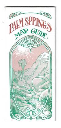
1976ref. 78705Orange and Palm Springs California: Ken and Ruth Du Maurier The Palm Springs Map Guide 1976. Tourist map to the desort resort city in Riverside County California. In addition to a large street map of Palm Springs there are smaller maps of the city bus route Cathedral City and the Coachella Valley respectively. Also provides a list with addresses of movie star and celebrity homes a brief history of the region a description of the picturesque canyon areas and descriptive lists of local shops restaurants hotels golf courses activities service stations etc. Features photographic illustrations and numerous advertisements. Printed in green and desert rose on a 30" x 25 1/2" sheet of white paper that folds to 3 3/4" x 8 1/2" 48 panels. A fresh and clean example. Scarce OCLC locates only one holding at the Library of Congress. Ken and Ruth Du Maurier, The Palm Springs Map Guide unknown
ref. 1843424215.Gpaperback. Good. Access codes and supplements are not guaranteed with used items. May be an ex-library book. paperback
ref. 609610 October 1891; Paris. On printed receipt. On one side of piece of discoloured paper roughly 13 x 22 cm. Delongueil's circular engraved device 3 cm diameter in top left-hand corner. Charges for striking a medal in bronze and silver of Olivier de Serres. 10 October 1891; Paris. On printed receipt. unknown
ref. 30286HBDJ 1968 EARLY Edition VG/VG- AS-IS Original publisher's blue paper-covered boards pictorial dustjacket large 8vo: xij 108pp. fold-in map in Middle and in back footnotes bibliographical notes. Verynear fine copy.Octavo. 5.5 x 8.5 in. lived to be hundreds of years old and were capable of telepathy astral travel and teleportation.ATLANTIS they became greedy petty and "morally bankrupt" and the gods "became angry because the people had lost their way and turned to immoral pursuits" Orser says. As punishment he says the gods sent "one terrible night of fire and earthquakes" that caused Atlantis to sink into the sea. LONDON, Illinois: Theosophical Publishing House, hardcover
1972ref. 30289HBDJ 1972 Revised VG-/VG AS-IS Blue cloth lettered in White Interior Nice tight light Wear SOME INK NOTES AND UNDERLINING but has FoX Stains 108 pgs DJ light wear & SCUFFING Extremities DJ 8vo - over 51â„4" - 83â„4" with 2 FOLD OUT Maps According to Churchward Lemurians developed homes with transparent roofs lived to be hundreds of years old and were capable of telepathy astral travel and teleportation. ATLANTIS they became greedy petty and "morally bankrupt" and the gods "became angry because the people had lost their way and turned to immoral pursuits" Orser says. As punishment he says the gods sent "one terrible night of fire and earthquakes" that caused Atlantis to sink into the sea. LONDON, Illinois: Theosophical Publishing House, hardcover
1952ref. 215851大陸輿地社. 1952. Charming pocket size atlas with double page coloured map showing China as a whole and the provinces with inset maps of special geographical features and a description of key information about each province vertical text. Text in traditional Chinese characters names on map read from right to left or vertically. Light wear little light browning but maps very clean and bright very good condition 14.5 x 9.8cm. . 大陸輿地社. unknown
ref. 1802238972.Ghardcover. Good. Access codes and supplements are not guaranteed with used items. May be an ex-library book. hardcover
ref. 1890463183.Gpaperback. Good. Access codes and supplements are not guaranteed with used items. May be an ex-library book. paperback
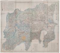
1418ref. 159850Shūseidō 衆星堂. Reprint. Tenpō 14 1843. Large folding handcoloured map of the thirteen provinces from which Mt. Fuji can be viewed. 159 x 178cm. Folds into paper covered card covers measuring 40 x 24cm. Title label upper cover. A little browning along folds occasional spotting and soiling. A little worming causing approximately 1cm of loss in places. Two chops in lower section. A very striking and attractive map. This very large handsome map is a detailed map of the thirteen provinces from which one can see Mt. Fuji. Provinces shown are the eight provinces of the Kantō region Sagami 相模 Musashi 武蔵 Kazusa 上総 Shimofusa 下総 Awa 安房 Kōzuke 上野 Shimotsuke 下野 and Hitachi 常陸 and five other provinces Izu 伊豆 Suruga 駿河 Tōtōmi 遠江 Kai 甲斐 and Shinano 信濃. The map offers a large amount of detailed information such as province and county borders rivers high ways post towns checkpoints villages and scenic spots. The cartographer Akiyama Einen or Nagatoshi 秋山永年 came from Edo and the editor Funakoshi Seizō 船越清蔵 studio name: Shugu 守愚 1805-62 a Confucian scholar from Nagato Province now the western half of present-day Yamaguchi Prefecture. A dedication by Funahashi Akira 舟橋徴 is dated 1843. . Shūseidō 衆星堂 unknown
ref. 1553413512.Gmap. Good. Access codes and supplements are not guaranteed with used items. May be an ex-library book. unknown
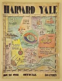
ref. 66643Yale University Athletic Association. Good. 160pp. Thin quarto 31 cm The front wrap is detached but present. The rear wrap is absent. Two small closed tears to the fore-edge of the front wrap. Scarce. Cover art by Utah artist John Held Jr. Utah Artist John Held Jr. 1889-1958 was a prominent illustrator of the 1920s and 1930s. He began by drawing sports and political drawings for The Salt Lake Tribune when he was just 16 years old. Held moved to New York City in 1910 where he went on to gain notoriety for his drawings in the popular magazines "Life" "The New Yorker" "Vanity Fair" "Judge" and "College Humor." His work epitomized the Jazz Age. He is most recognized for creating the short-haired "flapper." The cover of this publication features one of Held's maps. Held's maps illustrate the diversity of his art while at the same time serving to demonstrate Held's interpretation of various notable places and things. Kori Alexander writes in his article entitled Relevant Magic in the Art of John Held Jr. "While it was Held's caricatures of the young college chaps and flapper girls that earned him public notoriety it was his linoleum cuts and pen and ink maps that fortified his legitimacy as a social commentator." Virginia Commonwealth University website. Yale University Athletic Association unknown
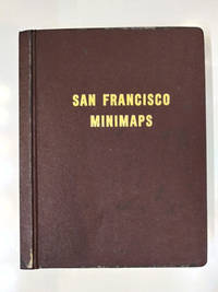
1969ref. 58769San Francisco: The Realty Index Co 1969. Hardcover. Very good. 631pp. Folio 36.5 cm Burgundy boards. With dividers and tabs. Moderate scuffing to the extremities; some discoloration to endpapers else internally clean. May require extra postage due to weight. An attractive and highly detailed volume of miniature Assessor's Blocks Maps reduced in size to make a legible yet at the same time compact and uncluttered book. With zoning information sectional maps major development areas and Assessor's Block Maps. The Realty Index Co hardcover
1998ref. OS-6693-TOB4-0.73House of Maps. Good. 1998. Unknown Binding. 8vo 8" - 9" tall; The book is in great overall condition showing only minor cosmetic wear.; - We're committed to your satisfaction. We offer free returns and respond promptly to all inquiries. Your item will be carefully wrapped in bubble wrap and securely boxed. All orders ship on the same or next business day. Buy with confidence. . House of Maps unknown
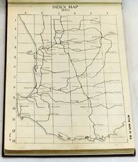
1923ref. 101984Perth: Hale's Motor Maps Ltd. 1923. Octavo cloth boards with block printed title laid on upper boards b&w plates b&w illus pp 244. Rebound with new endpapers in custom-made slipcase. First page creased otherwise contents clean. Very good condition. Road maps of Western Australia from Moora Kondut and Becubbin in the north to Albany in the south and stretching iinward through the wheatbelt. Scale: 4 miles to the inch. With many illustrated advertisements for WA companies decriptions of Perth and Western Australia with photographs lists of garages and hotels and information for travellers. Boards in slip-case. Hale's Motor Maps Ltd. hardcover
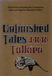
1980ref. 047136Boston: Houghton Mifflin Harcourt 1980. Book. Fine. Hardcover. First Edition/First Printing. A square solid tight clean unread copy. The 15.00 unlaminated jacket as issued has some lightish rubbing wear some edge wear some edge chipping two short closed tears. Light green cloth boards with silver/green inlay. First US Edition. A very nice overall copy in a worn jacket. Map by Christopher Tolkien tipped to rear endpaper as issued has neber been removrf from this copy. THIS COPY IS IN MY POSSESSION AND WILL NORMALLY SHIP NEXT DAY. Houghton Mifflin Harcourt Hardcover