NORTHUMBERLANDMareMagnum

12.245 resultados
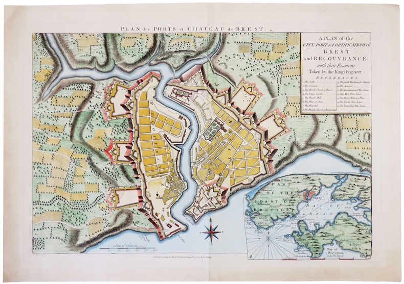
1806Engraved map on paper measuring 9.0 x 7.0 ins (approx. 23 x 18 cms), COLOURED BY HAND IN FRAME AND OUTLINE, small loss at bottom (blank) left-hand corner else a very good, bright, clean copy.
1 feuille repli?e. 55x75 cm.
2006ref. 012552Paris Ateliers Jean Nouvel - Hines - Gecina 2006 In-4 carré Cartonnage toilé illustré et étui éditeur Signé par l'illustrateur
1810ref. 46405159A Paris, Delion rue Greneta n°6 près celle Martin, s. d. (1810) ; grande planche gravée sur vergé fort, à toutes marges, pliée sous un cartonnage in-8 rose, avec étiquette de titre gravée sur le premier plat., 63 x 51 cm.Planche portant 25 vignettes (6,5 x 10,5 cm.) style cartes de jeux instructifs, avec les portraits des rois (3 par carte) depuis Pharamond, le fondateur de la monarchie, jusqu’à Napoléon et ses frères (Jérôme, Joachim, Eugène, Louis et Joseph). “Napoléon Ier Empereur des français, ce monarque surnommé le Grand, est admiré de toutes les Puissances pour son Courage, sa Clémence et se Générosité. Son Génie Pacificateur l’a conduit à la victoire et l’illustre alliance qu’il vient de faire avec Marie-Louise archiduchesse d’Autriche, donnant à la france l’espérance de voir Naitre des fils dignes d’un père vertueux met le comble au Bonheur e son Peuple...” Louis XVI est flanqué d’une sorte d’épitaphe : “Son cœur ne sut qu’aimer, pardonner et mourir. Il aurait su régner s’il avait su punir”.Etiquette de la maison Delion qui “fabrique un assortiment d’images, jeux instructifs et amusans à l’usage de la Jeunesse, et jeux de société” D’Allemagne. Les cartes à jouer I, p. 431.Les encadrements sont coloriés en jaune. Exemplaire à toutes marges. Fente marginale sans manque à une pliure.
ref. DADAX0415976480New unknown
ref. DADAX0415800536New unknown
ref. DADAX0803630522New unknown
1913Fine Turkish, Ottoman (1500-1928) Modern light brown cloth bdg. gilt lettering on the front board. [1], 99 p., 36 numbered maps printed in black and red ink, 5 numbered folded plates. A fine copy. First and only edition of this extremely rare atlas in user guide form including the instructions and descriptions of the routes of vessels by an advisor of the British naval officer and German prince related to the British royal family, Prince Louis Alexander of Battenberg (1854-1921), who was the first Marquess of Milford Haven, commanded the Atlantic Fleet from 1908 to 1910 and became first sea lord in 1912. This book was translated by Nusret, who was a lieutenant in the Ottoman Naval Forces in its period and prepared only for use of Turkish naval officers. The plates include the maneuver plate of an officer named "Martin", who is not able to be recognized. Every map and plate depending on the current position of the ship has its own descriptive text. Özege 12270.; Not in OCLC and Library Hub.
Zaragoza, 1952 [Separata de "Actas del Primer Congreso Internacional del Pirineo"]. 4to. mayor; 26 pp., con 14 reproducciones entre el texto y 8 láminas fotográficas aparte. Edición limitada de 500 ejemplares. Cubiertas originales.
2001No marks or inscriptions. Crease to lower corner of rear cover. A very clean very tight copy with bright unmarked boards and no bumping to corners. 82pp. A guide to the sumptuous Palace and gardens of Peterhof in St. Petersburg, Russia. Very scarce in the UK.
1960ref. AUB-6182Ed. Payot 1960. Bel exemplaire broché, fort in-8, 494 pages avec tables.
19301 feuille 80 x 67 cm.
2024ref. __1849077002Philip's 2024. Hardcover. New. 448 pages. 11.26x1.50x14.49 inches. Philip's hardcover
1959ref. 4624Guayaquil, Publicistas, 1959. Mehrfach gefaltete Farbkarte.
ref. 4647ohne Ort, Rand McNally (ohne Jahr). Mehrfach gefaltete Straßenkarte.
2004Contains a map. 24x17 cm. 102+72 pages. Softcover. In good condition.
1679ref. PHO-1772Paris, Dezallier, 1679, 2 volumes in-4 ,28ff.-686pp., 22ff-648pp , relié plein cuir époque, dos à nerfs orné avec pièce de titre et tomaison, tranches mouchetées rouge, réparations aux dos, pièces de titre et tomaison récentes au tome, illustré de 6 cartes dépliantes (7), ex-libris manuscrit en page de garde et au titre, traces de réparation aux cartes.
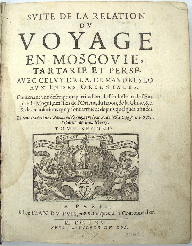
1666ref. PHO-2151Paris, Jean du Puis, 1666, 1 volume (2) in-4 (24x18cm), 23ff.-648pp., veau époque, dos à nerfs, manque important au dos, frottements, coiffes arasées, fentes, mouillure, manque les cartes.
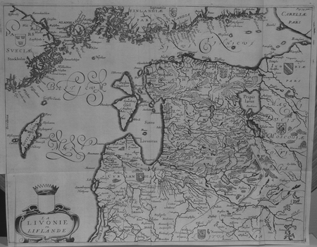
1659ref. LBW02521[1659]. 279 x 361 mm.
1679ref. 78821[Paris, A. Dezailler, 1679]. 28,5 x 36,5. Unter Passepartout.
1659ref. 78800O. O. (Paris), (Jean Dupuis), ( 1659). Kupferstich. Darstellung ca. 28 x 33 cm, Blattmaß 31 x 42 cm. Feinkartonpassepartout.
1795Foglio contenente delle sezioni di globo - in dodici segmenti - e altri elementi atti a costruire una sfera armillare. Il globo terrestre centrale è in 12 segmenti e avrebbe un diametro di circa 5,5 cm se costruito. La sfera armillare complessiva avrebbe un diametro di 28 cm. I vari anelli della sfera armillare comprendono l'equatore, il Tropico del Cancro, il Tropico del Capricorno, le zone e i cerchi polari e antartici. Tavola edita dalla Calcografia Camerale, Roma 1795 e tratta dal Nuovo Atlante Geografico Universale delineato sulle ultime osservazioni, edito a Roma dal 1792 fino al 1801, opera che la Calcografia Camerale commissionò al Cassini al fine di sostituire l’ormai obsoleto Mercurio Geografico della tipografia De Rossi. Bernardino Olivieri fu cartografo incisore presso la Calcografia Camerale di Roma sitauta nel Collegio di Propaganda Fide Incisione in rame, finemente colorata a mano, in ottime condizioni. Rara. This matching set of sheets contain the pieces to construct an armillary sphere. The central terrestrial globe is in 12 segments and would have a diameter of approximately 5.5 cm if constructed. The overall armillary sphere would have a diameter of 28 cm. The various rings of the armillary sphere include the equator, the Tropic of Cancer, the Tropic of Capricorn, the zones, and the Polar and Antarctic circles. Uncommon maps, published in the Nuovo Atlante Geografico Universale, that was commissioned to Cassini by the Calcografia Camerale, in order to replace the obsolete De Rossi's Mercurio Geografico. Bernardino Olivieri was a cartographer and engraver at the Calcografia Camerale di Roma located in the Collegio di Propaganda Fide. Copper engraving, finely hand colored, in very good condition. Rare.
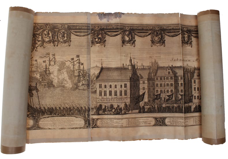
1696ref. 32611(Nürnberg, 1696). The large engraving of the procession through Stockholm being composed of 13 engraved plates joined together, measuring 30x450 cm. (Plates numb. 1-13). Some mostly marginal dampstains, some marginal tears, some brownspots mainly marginal. Upper margin of plate 3 partly gone. Margins strenghtened at verso with brown paper. Some variation to paperquality, but in general in good strong impressions.
1696(Nürnberg, 1696). The large engraving of the procession through Stockholm being composed of 13 engraved plates joined together, measuring 30x450 cm. (Plates numb. 1-13). Some mostly marginal dampstains, some marginal tears, some brownspots mainly marginal. Upper margin of plate 3 partly gone. Margins strenghtened at verso with brown paper. Some variation to paperquality, but in general in good strong impressions.