12.070 resultados
1821ref. 163241821 emboitage éditeur avec son étiquette. 16 sections montées sur toile et pliées, formant une carte de 570 x 480 mm., aquarellée, Edinburgh Macredie, Skelty & co. 54, Princes street 1821
1947Neat inscription on 2nd front end paper. No other marks or inscriptions. No creasing to covers, crease to spine. A very clean very tight copy with unmarked card covers loosened at lower part of spine and some bumping to corners. Dust jacket not clipped with dusty rear and well rubbed to edges and corners. Unpaginated. ca 100pp. Description and discussion on Switzerland in English followed by about 80 pages of black & white photographs.
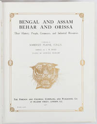
1917ref. 214418London and New York.: The Foreign and Colonial Compiling and Publishing Co. 1917. Numerous black and white photographic illustrations 768pp. 30 x 23.5cm. Full red morocco binding spine lettered and ruled in gilt in compartments 'Tiger head' emblematical device stamped in gilt on the upper board repeated in gilt on the title page corner ornaments blocked in gilt. All edges gilt marbled endpapers light rubbing to corners but a lavishly produced edition in exceptional condition. One of a series of publications published with the object of supplying the British public with a picture - complete as far as literary and pictorial effort could make it - of the several different parts of the Empire. in this instance Northern India. . The Foreign and Colonial Compiling and Publishing Co. unknown
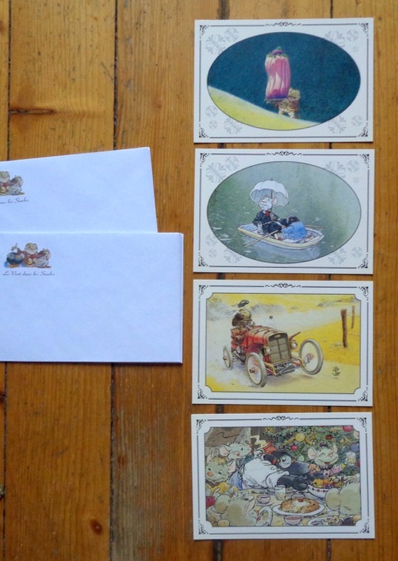
2001ref. 6242Guy Delcourt, 2001. 4 cartes au format 16,5 x 11,5 cm., accompagnées de leur enveloppe décorée.
1985ref. 99382Braunschweig, Archiv-Verlag, [ca. 1985]. Mehrf. gefalt. farb. Karte (Blattgröße ca. 53 x 84 cm; Bildgröße ca. 48,5 x 78,5 cm).
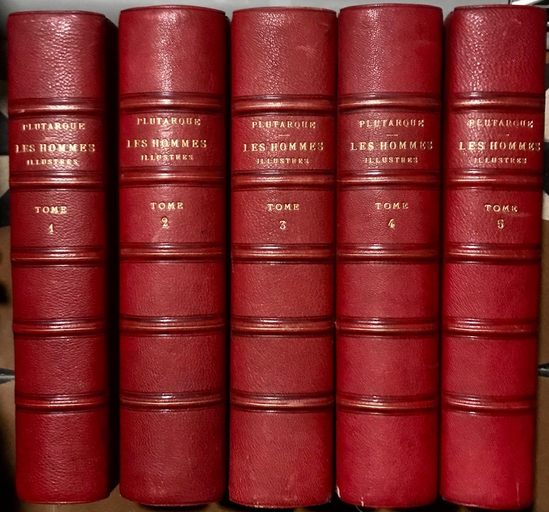
1828ref. 107481828 Paris , Aug. Dubois, 1828-1833; 5 volumes in-4°, demi - chagrin rouge de l'époque, dos à 5 nerfs plats cernés de filets à froid, filet maigre doré sur les nerfs, auteur, titre et tomaison dorés, tête dorée. Illustré de nombreux portraits tirés sur chine appliqué et de cartes et plans hors texte à double page en couleurs.Nous possédons les Tomes I, IX,X, XI et XII de cette édition, reliés en 5 volumes tomés de 1 à 5 et renfermant :Tome I, daté de 1830. Vie de Plutarque. Thésée. Romulus. LI - 324 pp. Portraits et 5 cartes hors texte. / Tome IX , daté de 1828. Alexandre, César. 432 pp. Portraits et 9 cartes sur 11 (manque la carte de l'Italie septentrionale au temps de César et le plan d'Alexandrie). / Tome X, daté de 1831. Nicias, Crassus, Sertorius, Eumène, Artaxerce. 428 - (3)pp. Portraits et 8 cartes sur 9 (manque carte de la Mauritanie). / Tome XI, daté de 1833. Agésilas, Pompée, Phocion. 397pp. Portraits et 8 cartes ou plans. / Tome XII, daté de 1828. Caton d'Utique, Démosthène, Cicéron. 396pp. Portraits et 9 cartes.
1948142 pages, illustrated, folded map loosely inserted, covers worn. eng
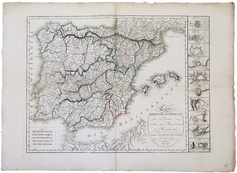
1823ref. LBW-5185Paris, Jean, An 1823. 486 x 649 mm.
1806ref. 26526paris chez Jean 1806 une carte entoilée (map cloth-lined map), dimensions de la carte dépliée (Dimensions of the unfolded map - size in Inches) : 90 X 67,5 CM , 1806, Gravée par Jean, Pierre, POIRSON, Jean Baptiste (1761-1831). Cartographe. À Paris, chez Jean Editeur
187343, (1) pages et (2) cartes depl broché, couverture imprimée de l'éditeur 1873, 1873, in-8, 43, (1) pages et (2) cartes depl, broché, couverture imprimée de l'éditeur, Rare tiré à part non coupé. A travers cette brochure, Poincaré traite des trois modes de représentation (isoombres, suivies et horaires) des phénomènes météorologiques, modes employés avec beaucoup de réticence à l'époque. Il explique notamment les légendes des deux cartes qu'il a réalisées pour représenter les pluies tombées sur la Meuse et le bassin de la Seine durant l'hiver 1868-1869. En 1871, Poincaré présente à la Commission de l'Association Scientifique de France une étude en 7 parties intitulée "études sur la distribution et la marche des pluies dans la région". Un résumé sera publié peu après dans le n° 211 de la revue hebdomadaire de l'institution. Antoine Poincaré, polytechnicien et ingénieur en chef à Bar-le-Duc fut l'oncle du mathématicien et physicien Henri Poincaré et le père de Raymond Poincaré, président de la France de 1913 à 1920. Malgré la présence minime de rousseurs et de taches sur les couvertures, bel exemplaire
1810ref. 90205Paris, Jean, 1810. Mehrfach gefaltete gestochene Karte mit Grenzkolorit. Maßstab: ca. 1:1.900.000. Blatt 65 x 85 cm, gefalzt zu 19 x 12 cm. Ppb dt. Zt mit Deckelschildchen.
1838ref. PHO-1194London, Richard Bentley, 1838. 2 volumes in-8 (21 x 13 cm), veau fauve glacé (reliure de l'époque), dos lisse orné, pièces de titre et de tomaison en maroquin grenat et olive, dentelles dorées et triple filet à froid encadrant les plats, roulette dorée intérieure et sur les coupes, tranches peignées, xii-403-[1];vi-441-[1] pages (complet). Coins usés, charnières frottées et fendues, coiffes accidentées ,manque au dos avec épidermure .
ref. SKU1748060Elsevier 2019-11-25. paperback. New. 7x0x9. New Book Ships with Tracking Elsevier paperback
ref. SKU0594671Elsevier 2019-11-25. paperback. Good. 7x0x9. Textbook May Have Highlights Notes and/or Underlining BOOK ONLY-NO ACCESS CODE NO CD Ships with Tracking Elsevier paperback
ref. SKU0642178Elsevier 2019-11-25. paperback. New. 7x0x9. New Textbook Ships with Tracking Elsevier paperback
2000ref. Q-044306265xChurchill Livingstone 2000-08-10. Paperback. New. In shrink wrap. Looks like an interesting title! Churchill Livingstone paperback
2007ref. Q-0443074291Churchill Livingstone 2007-11-21. Paperback. New. In shrink wrap. Looks like an interesting title! Churchill Livingstone paperback
ref. 360075Macmillan and Co. 1920. 3 VOL SET. Super octavo grey card boards label to brown cl spine lettered in gilt; frontis. illus. plates maps; xviii 378 2 advts viii 383 x 352 pp.; VG- moderate to heavy soiling & scuffing to boards moderate to heavy bruising to edges & extrems w moderate chipping; light to moderate soiling tanning & foxing to pg edges; moderate tanning foxing & soiling to eps prelims & terminals; moderate cracking to front vols. 1 2 & 3 & central vol. 2 gutters; wormholes rear boards vols 1 & 2 & sl to spine vols 1 2 & 3; wormholes to rear hinges 1 2 & 3 ; ffep unopened vol. 3; tape to boards. Macmillan and Co. 1920 hardcover
1872ref. 6193London, Hurst & Blackett, 1872. In-8 de XIV-[2]-347p. + 16p. de catalogue, pleine percaline verte d'éditeur ornée de fleurons à froid. Rousseurs sur la page de titre et le frontispice uniquement (à cause de la serpente).
1965ref. AUB-5302Zurich, Forum aplinum 1965. Bel exemplaire relié, rel. pleine toile et jaquette ornées d'éd., fort in-4, 432 pages + disque.
1759ref. 848041759. T. Kinnersley. London. 1759. In Two Volumes II and III and contains the whole set for the year 1759. Bound in 18th century quarter brown calf gilt very worn and rubbed and lacking portions of leather from heads and tails of spine. Joints tender but holding. Vol. II; ii 372 pages plus 4pages of index. Vignette to general title-page and engraved head-piece for each month. 6 engraved plates of unusual and more ordinary fauna including the dodo the rhinoceros sea hedge-hog the horned didapper flying fish and cassowary. 1 portrait plate of Magliabechi 14 full page engraved maps and plans. Vol. III; ii. 404 pages plus 4 page index. Engr. vignette to general title-page and engraved head-pieces or decorations to each month 4 engraved plates of fauna one portrait plate of Major General Wolfe 1 incredible engraved plate displaying the Torments Inflicted by the Dutch on the English in Amboyna plus the engraved frontis. to Pope's Essay on Man. Three engraved plates - 1 map and 2 plans. A wonderful insight into what interested people in the mid-18th century. Pages browned and occasionally foxed but otherwise a very useful set. hardcover
2011ref. SBBI-mon0000123365PopOut Maps 2011. map. Acceptable. Please see the condition note after this for details if this is missing please consider Acceptable to mean poor quality that could include major staining water damage writing missing dustjacket etc etc. Our books are dispatched from a Yorkshire former cotton mill. We list via barcode/ISBN so please note that the images are stock images and may not be the exact copy you receive furthermore the details about edition and year might not be accurate as many publishers reuse the same ISBN for multiple editions and as we simply scan a barcode or enter an ISBN we do not check the validity of the edition data when listing. If you're looking for an exact edition please don't order at least not without checking with us first although we don't always have time to check. We aim to dispatch prompty the service used will depend on order value and book size. We can ship to most countries see our shipping policies. Payment is via Abe only. PopOut Maps unknown
ref. 1845878698.Gmap. Good. Access codes and supplements are not guaranteed with used items. May be an ex-library book. unknown
2011ref. SBBIH-MLCPJ2FHNMNZPopOut Maps 2011. paperback. Good. Our good condition books are generally good for reading but not for gifting or collecting. They could have imperfections such as creasing fanning inscriptions margin notes yellowing staining on edge or cover or pages bumps scuffs etc etc sometimes multiple of these. It's a wide category that encompasses anything that isn't almost-new down to anything that is slightly better than poor. We would NOT recommend gifting Good books - these should be considered reading copies. Our books are dispatched from a Yorkshire former cotton mill. We list via barcode/ISBN so please note that the images are stock images and may not be the exact copy you receive furthermore the details about edition and year might not be accurate as many publishers reuse the same ISBN for multiple editions and as we simply scan a barcode or enter an ISBN we do not check the validity of the edition data when listing. If you're looking for an exact edition please don't order at least not without checking with us first although we don't always have time to check. We aim to dispatch prompty the service used will depend on order value and book size. We can ship to most countries see our shipping policies. Payment is via Abe only. PopOut Maps paperback