THIEROT E.; BELLMANN C:Livre Rare Book
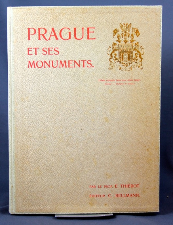
1900ref. 2244Prague, Impr. de Ch. Bellmann, 1900. 1 vol. in-4 de 43 pages, pleine percaline blanche d’éditeur, dos lisse muet, 1er plat orné aux armes. Bel état.
1575Suite completa delle carte raffiguranti i 4 continenti. Xilografie, 1575, finemente colorate a mano in epoca, impresse su carta vergata coeva, complete della linea marginale, in eccellente stato di conservazione. Le carte sono tratte dalla prima edizione de La Cosmographie universelle d'Andre Thevet, cosmographe du roy : illustree de diverses figures des choses plus remarquables veues par l'auteur, & incogneues de noz anciens & modernes, curata da Pierre l’Huilier, che precede di uno o due anni la ristampa di Guillaume Chaudiere. Nato a Angoulême intorno al 1516, Thevet divenne frate francescano e intorno al 1550 compì la sua prima spedizione, quando accompagnò il cardinale Jean de Lorraine in Italia e nel bacino del Mediterraneo. Poco dopo, Thevet pubblicò la Cosmographie de Levant, un compendio circa fatti, persone, luoghi, flora e fauna della zona visitata. L’esperienza di Thevet come un viaggiatore attirò l'attenzione di Nicolas Durand, Cavaliere di Villegagnon, che si apprestava a fondare una colonia in quello che è oggi il Brasile. Durant chiese a Thevet di accompagnarlo nella spedizione come suo confessore. Durante il viaggio, Thevet si ammalò e fu costretto a tornare in Francia dopo aver trascorso sole dieci settimane in Brasile. Tuttavia, combinando le sue osservazioni con le informazioni acquisite da altri viaggiatori, Thevet realizzò il suo Singularitez de la France Antarctique, pubblicato a Parigi nel 1557, che gli valse il riconoscimento reale e la nomina a cosmografo della corte dei Valois. Si dedicò poi alla sua opera più ambiziosa, La Cosmographie universelle, una sorta di descrizione di ogni parte del mondo conosciuto. Il suo collaboratore François de Belleforest, probabilmente a seguito di un litigio, lo abbandonò pubblicando una propria cosmografia nel 1572. Al di là delle accuse di furto del materiale mosse da Thevet, senza dubbio la pubblicazione di Belleforest, tolse successo all’opera di Thevet che, con oltre 2.000 pagine, apparve a 3 anni di distanza, nel 1575. Thevet continuò a scrivere di viaggi reali e immaginari fino alla morte, nel 1592, lasciando due opere manoscritte: la Gran Insulaire, un almanacco di isole di tutto il mondo, e le Histoire de deux voyages, un resoconto, probabilmente amplificato, dei suoi viaggi nel Nuovo Mondo. EuropeEsemplare nell’unico stato conosciuto. La carta deriva dalla rappresentazione murale del mondo di Gerard Mercator del 1569. La mappa è riccamente ornata con mostri marini e numerosi vascelli, e riporta anche le mitiche isole di Frislandia, Ibira e Enoem. La Groenlandia e l’Islanda sono in forma molto allungata, mentre la Scandinavia non si discosta, nella forma, dalla carta di Olaus Magnus.AsieEsemplare nel primo stato di due, avanti la firma dell’editore Chaudiere e la data 1581. La carta dell’Asia è basata sul modello di Mercator del 1569. La Nuova Guinea stranamente non compare nella mappa, mentre il Giappone assume una curiosa forma a tartaruga. La più importante novità cartografica della mappa è rappresentata dalla corretta rappresentazione delle stretto di Anania, oggi Bering.Table d’AfriqueEsemplare nel primo stato di due, avanti la firma dell’editore Chaudiere e la data 1581. Betz sottolinea come questa mappa dell’Africa costituisca un importante tassello nella storia della cartografia del continente, trattandosi della prima mappa di formato in-folio a descrivere l’area basandosi sul modello mercatoriano del 1569, fondendolo con le informazioni desunte dalle carte di Gastaldi e Ortelius. Il risultato è una mappa che fornisce un enorme numero di informazioni cartografiche, talvolta difficili da leggere.Quarte Partie du Monde Esemplare nel primo stato di tre, con il marchio tipografico sotto la descrizione nel cartiglio in basso a sinistra, edito nella prima edizione de La Comosgraphie Universelle del 1575. Burden ebidenzia che il secondo stato della carta non presenta questo marchio tipografico, mentre i... Set of the 4 continents. Woodcuts, 1575, finely hand colored at the time, printed on contemporary laid paper, complete the marginal line, in excellent condition. The maps are from the first edition of The Cosmographie universelle d'Andre Thevet, Cosmographe du roy: ILLUSTREE de diverses figures des choses plus remarquables veues par l'auteur, & incogneues de noz anciens & modernes, curated by Pierre the Huilier, which of one or two years before the reissue of Guillaume Chaudiere. Born around 1516 in Angoulême, Thevet became a Franciscan friar about 1550 and made his first expedition, when he accompanied the Cardinal Jean de Lorraine in Italy and in the Mediterranean basin. Soon after, he published the Cosmographie de Levant, a compendium of facts about people, places, flora and fauna of the area visited. The experience of Thevet as a traveler came to the attention of Nicolas Durand, Knight Villegagnon, who was preparing to establish a colony in what is today Brazil. Durant asked Thevet to accompany the expedition as his confessor. During the trip, Thevet became ill and was forced to return to France after having spent only ten weeks in Brazil. However, by combining his observations with information obtained from other travelers, Thevet realized his Singularitez Antarctique de la France, published in Paris in 1557, which earned him recognition and real cosmographer the appointment of the Valois court. He then devoted himself to his most ambitious work, The Cosmographie universelle, a kind of description of each of the known world. His collaborator François de Belleforest, probably as a result of a quarrel, left him by publishing its own cosmography in 1572. Thevet’s work, of over 2,000 pages, appeared 3 years later, in 1575. Thevet continued to write real and imaginary travel until his death in 1592, leaving two manuscripts: Great Insulaire, an almanac of islands around the world, and the Histoire de deux voyages, a quick, probably amplified, of his travels in the New World. EuropeExample in the only known state. The map comes from the wall map of the world by Gerard Mercator of 1569. The map is richly ornamented with numerous sea monsters and ships, and also reports the mythical islands of Frislandia, Ibira and Enoem. Greenland and Iceland are very elongated, while Scandinavia does not differ in form from the map of Olaus Magnus.AsieExample in the first state of two, before the address of Chaudiere and the date 1581. The map of Asia is based on the model by Mercator wall map of the world. 1569. The New Guinea strangely does not appear in the map, while Japan takes a curious form a turtle. The most important novelty of the cartographic map is represented by the correct representation of the Strait of Ananias, Bering today.Table d'AfriqueExample in the first state of two, before the address of Chaudiere and the date 1581. Betz points out this map of Africa is an important step in the history of cartography of the continent, this is the first map of folio format to describe the area based on the Mercator’s model of 1569, by fusing the information obtained from the maps by Gastaldi and Ortelius. The result is a map that provides a huge number of cartographic information, sometimes difficult to read.Fourth Partie du MondeExample in the first state of three, with the typographical mark under the description in the title, published in the first edition of The Comosgraphie Universelle of 1575. Burden notes that the second state of the map does not present this mark, while the third state is with the address of Chaudiere and the date 1581. From the cartographic point of view, the map is derived from the map of the world of Gerard Mercator of 1569, while the nomenclature and morphology of the northern part seem to be the assembly of several cartographic sources. New Guinea, and a large mass southern called "Cercle Antartique" are richly decorated with scenes of native life. Excellent examples of these rare maps, among... Betz, The Mapping of Africa, pp. 133/34, 17 I/II; Norwich 12; Burden, The Mapping of North America, pp.59/60, 46 I/III; Sweet, Mapping the continent of Asia, 6, I/II.
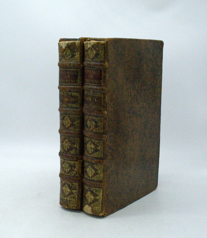
1696ref. PHO-1981Paris, Thomas Moette, 1696 ; 5 parties en 2 vol. in-folio (37x23,5cm), veau marbré, dos à nerfs richement orné de motifs dorés avec tomaison et pièce de titre grenat, quelques frottements, charnières fendillées, manque au dos, coins usés, coiffes absentes, 8 feuillets détachés, rousseurs, qlqs feuillets brunis. L’illustration comporte de nombreuses gravures et illustrations dans et hors texte, 6 cartes dont la carte de l’Indostan, de la Colchide, du Japon (qui regarde l’Amérique), carte de la route du voyage de Canton à Péking, carte de l’Éthiopie, carte de l'Éthiopie ["Entrée de quelques ports…"]. Il manque la Carte de Bassorah, les 2 planches de caractères Chaldéens, la carte de l’Australie, la carte des côtes d’Arabie et d’Asie, la carte des Costes de Sierlionne, la carte des Philippines et Chine, la carte de Chine
1663ref. PHO-2278A Paris, chez Jacques Langlois, 1663-1666 3 parties en 1 volumes in-folio (38x25cm). Veau tacheté époque, dos à nerfs ornés avec pièce de titre en maroquin et tomaison, tranches jaspées rouges. Réparations au dos et coins, mouillure, quelques rousseurs, réparation au titre, renforcement à la carte. Complet de ses relations de voyage selon Brunet & Camus
2005Very Good Turkish Original printed poster in a standard black frame. Folio. (50 x 35 cm). In Turkish. Izmir and Istanbul live of Therapy in their "Never Apologise Never Explain Tour 2005". An extremely rare and fine graphic-designed Turkish poster. Signed by all three members of the band: Andy Cairns, Michael McKeagan, and Neil Cooper. Only dedication by Michael as 'Love from'. Sponsors of those concerts are Yüxexes (a modern rock music periodical published in Turkey), Eksen 96.2 (Turkish radio channel), Tekel birasi (National Turkish brand of beer), and Host Productions. A fine, very collectible, and extremely rare poster with its signatures and inscriptions.
1994ref. 11891Irvine CA: Thomas Bros. Maps 1994. 1995 Edition. Spiral Bound 133 pages. Good. Soiling rubbing bumping and creasing to covers. Soiling to text block. Pages are clean and free of writing and/or highlighting. Soiling to inner covers mainly from rubbing of spiral bindings. Includes Northern California Fold-Out Map which is affixed to inner back cover. Thomas Bros. Maps unknown
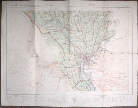
1934ref. 5731934 The Survey of Egypt (25/690), 1934 (33/885). Carte en couleurs de 53 x 69,5 cm montée sur toile par l'éditeur et pliée en 8.
1908This 1908 Scarborough Company folding map of Pennsylvania shows all counties, townships, cities, boroughs, villages, Post Offices, and railway stations. Rail lines, suburban electric lines, and a few highways are also shown. This large map is made of linen or cotton backed paper. The verso contains population for 1900 and a gazetteer keyed to a grid around the map edge. Includes an inset of Philadelphia, plus a mileage table. Scale: 1 inch = 6 miles. Size: 36 x 51 inches. In the original cloth folder. Map split at some folds. MAP CASE SE
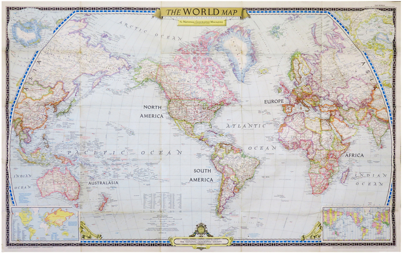
1951ref. LBW-6834Washington, D.C., The National Geographic Magazine, 1951. 0,65 x 1,02 m.
ref. DADAX09401182971981-09-01. 3. hardcover. New. 6.50x1.75x9.25. Buy with confidence. Excellent Customer Service & Return policy. hardcover
1691Amsterdam, Huguetan & Mortier, 1691. 56x85 cm. Large engraved map of Terra Sancta with original colours in outline. With two large engraved cartouches. Small repairs to lower part of centerfold.
1691ref. 43500Amsterdam, Huguetan & Mortier, 1691. 56x85 cm. Large engraved map of Terra Sancta with original colours in outline. With two large engraved cartouches. Small repairs to lower part of centerfold.
ref. DADAX1611210801New unknown
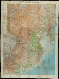
1953ref. 161304Edinburgh.: John Bartholomew & Son Ltd. 1953. Colour folding map laid down on linen. Scale 1:450000. 97 x 72 cm. Small holes and tears at some folds a little light browning. Cloth tape repair at fold adjoining upper card cover. Frederick Warne label upper cover a little creased and torn key includes glossary of Chinese geographical terms translated into English. Contour-coloured world map series. Published in the period immediately following the Korean War this map shows the 38th Parallel. . John Bartholomew & Son Ltd. hardcover
1804ref. 151171804. MOORE JOSHUA J. and THOMAS W. JONES. The Traveller's Directory: or a Pocket Companion Shewing the Course of the Main Road from Philadelphia to New York; and from Philadelphia to Washington: With Descriptions of the Places through which it Passes and the Intersections of the Cross Roads . By S. S. sic Moore and T. W. Jones. Philadelphia: Mathew Carey 1804. 8vo. 4 37 1 19 i.e. 17 p. 38 engraved strip maps on 22 plates. Modern full calf correctly done in perfect period style with original spine label slightly chipped at edges remounted and original endsheets relaid. Front free endsheet chipped at fore-edge name clipped from top blank margin of title page intermittant light browning of text and foxing of maps as is usual with this book. A very good copy of a book never found in fine condition. Second edition of the second American book of road maps following Christopher Colles' exceedingly rare Survey of the Roads of the United States 1789 and the first road map book to provide detailed maps of the road from Philadelphia north through New Jersey to New York and from Philadelphia south through Delaware Maryland and Virginia to Washington. Joshua John Moore and Thomas W. Jones were young surveyors in the employ of the Philadelphia publisher Mathew Carey. From several letters they wrote to Carey during the course of the survey Lea & Febiger papers PHi a clear picture emerges of the extremely difficult task they had undertaken. On June 29 1801 they wrote from New York: "We should have written to you before this had not fatigue of our daily Journies rendered repose indispensable after the finishing of our Notes and Traverses. After twelve days driving our way through an immense multitude of Questioners Observers laughters & Critics who generally thronged around us at every place to our great discomposure at first . we are at length arrived here. If astonishment would ensure success to a work we may entertain strong hopes indeed of ours; but it has nearly exhausted our health as every violent effort naturally must." Upon completion of the surveys the maps were drawn by the surveyors. They locate crossroads streams taverns churches and other public buildings and occasionally private houses. The text describes the various towns through which the roads pass. In this second edition published two years after the first edition of 1802 the descriptive text has been extensively corrected and expanded. The maps are identical to those in the earlier edition and are printed from the same plates. unknown books
1969Sixth annual edition. No inscriptions or marks to contents. No creasing to covers or to spine. A clean very tight copy with rubbed slightly marked laminated boards. 319pp. With discrete sections on 24 countries identified by a tab index, including United Arab Republic (Egypt) and Rhodesia.
1979No marks or inscriptions. No creasing to covers or to spine. A very clean very tight copy with bright unmarked boards and no bumping to corners. 84pp. Details of the culture of Indonesia with particular emphasis on Jakarta's Central Museum Pusat. Illustrated.
1954Neat writing to upper corner of front cover. No other marks or inscriptions. Crease to rear cover and to oversize extremeties of covers. A very clean very tight copy with slightly dusty covers and missing the map at the end. 141pp. With separate List of Hotels and Boarding Houses loosely tucked in. Undated but Council Rates given for year ending 1955.
1975No marks or inscriptions. No creasing to covers. A very clean tight copy with bright unmarked boards, very minor rubbing to edges and no bumping to corners. Fold-out pictorial map of Cheltenham in perfect condition. 104pp. Well illustrated in black & white. Undated but tucked-in is a personal letter of acceptance of nearby accommodation dated 1975.
1970Small mark at top edge of two pages. No other inscriptions or marks. Light creasing to covers. A very clean tight copy with bright front boards and dusty rear and no bumping to corners. 72pp. Details and photographs of around seventy inns and public houses in the old West Riding of Yorkshire plus a map. Not dated but around early 1970s.
1950No marks or inscriptions. Slight creasing to covers. A very clean very tight copy with lettering and a coloured coat of arms on matt black covers and no bumping to corners. Scarce. 48pp. Comprehensive concise review of the City of Manchester, its industry, sport, shops, suburbs, transport etc. Includes a table giving bus and rail fares between the city and other places, eg. bus to Sheffield was 6s 9d and the train cost 22s 4d to Windermere. Undated but latest aircraft movements given for first half of 1950.
1994No marks or inscriptions. Light creasing to covers, none to spine. A very clean very tight copy with bright unmarked boards and no bumping to corners. ca 100pp. The secrets of Britain's best-loved woodland illustrated including OS 1:25,000 maps.
1923No inscriptions or marks. No creasing to covers or to spine. A very clean crisp tight copy with bright unmarked covers and no bumping to corners. 20pp. The story of the Cavern's discovery is told along with its history and details of what visitors can see. Not dated but the Cavern was discovered in 1923 and special mention is made of it being 'Illuminated by Electric Light'.
1956No marks or inscriptions. No creasing to covers or to spine. A lovely clean very tight copy with bright unmarked boards, slight rubbing to top of spine and no bumping to corners. 132pp.
1948Slight foxing to top of page edges. No other marks or inscriptions. A very clean very tight copy with bright unmarked boards and minor bumping/rubbing to corners. Dust jacket not price clipped or marked with some loss to top of spine, tear to spine foot and nicks/creases to upper edge. 320pp. Includes 19 coloured plates by British artists