12.176 resultados
1943ref. 144341943. Archive of nine large original World War II maps used by a United States Army soldier in the European Theater of Operations during the Allied liberation of Western Europe. Lithographed military maps variously issued by U.S. Army and War Office agencies 1943-1944. Large formats ranging from approximately 19" x 24" to 42" x 34". These maps document the cartographic infrastructure of Allied ground and air operations in the climactic campaigns of 1944-1945. The German sheets-many designated for "Army/Air" or restricted War and Navy Department use-reflect the intensive aerial reconnaissance bombing coordination and mechanized advance into the industrial and administrative heartland of the Third Reich. Cities such as Berlin Magdeburg Kassel and Düsseldorf were central to armaments production rail networks and military command making accurate and rapidly updated mapping indispensable. The Paris map corresponds to the Allied advance culminating in the Liberation of Paris in August 1944 marking the symbolic reclamation of a major European capital from Nazi control. Several sheets note reliance on prewar German cartography 1938 editions supplemented by wartime intelligence underscoring how Allied forces repurposed and revised enemy geographic data for invasion and occupation planning. Crucially these maps also capture a political geography that was almost immediately transformed by postwar settlement and Soviet expansion into Central and Eastern Europe. Within two years of their issue Germany was divided into occupation zones and by 1949 into separate states aligned with Western and Soviet blocs. Cities such as Berlin Halle Saale Magdeburg and Wernigerode fell within the Soviet zone and subsequently the German Democratic Republic fundamentally altering administrative boundaries transportation networks and the ideological framing of space. Cartographic production in these regions shifted accordingly with new editions reflecting socialist state structures and restricted internal mapping policies characteristic of the emerging Eastern Bloc. Thus these 1943-1944 sheets preserve a transitional moment: Nazi Germany still territorially intact on paper yet already subjected to Allied military penetration and poised on the brink of partition. As artifacts carried by an American soldier they embody both the tactical prosecution of total war and the immediate redrawing of Europe into Cold War spheres of influence. The archive includes operational maps of Magdeburg Sheet M.53 1:250000 "First Edition" 1943 with manuscript annotation Kassel Sheet L52 "Emergency Road Map" First Edition color based on 1938 mapping with wartime intelligence updates Düsseldorf Sheet K52 similar issue with fading highlighting and manuscript marks Hanover Sheet L53 1943 Berlin Sheet N53 "Army/Air" 1943 Halle Saale Sheet M52 marked "War and Navy Department Agencies only. Not for sale or distribution" 1943 Wernigerode Sheet 4130 First Edition War Office 1944 Jülich G.S.G.S. No. 4507 War Office 1944 35" x 30" and a large U.S.-issued map of Paris 42" x 34" 1944. All were retained by the soldier following his service. Very good overall with expected wartime folds and handling; several sheets with manuscript annotations highlighting fading or moderate water exposure notably Wernigerode stiffened from dampness; no major losses observed. A substantial and research-rich archive of original Allied operational maps materially linking frontline navigation aerial bombardment liberation campaigns and the swift geopolitical reconfiguration of Germany and Europe under the expanding Soviet Eastern Bloc. unknown books
1943ref. 144341943. Archive of nine large original World War II maps used by a United States Army soldier in the European Theater of Operations during the Allied liberation of Western Europe. Lithographed military maps variously issued by U.S. Army and War Office agencies 1943-1944. Large formats ranging from approximately 19" x 24" to 42" x 34". These maps document the cartographic infrastructure of Allied ground and air operations in the climactic campaigns of 1944-1945. The German sheets-many designated for "Army/Air" or restricted War and Navy Department use-reflect the intensive aerial reconnaissance bombing coordination and mechanized advance into the industrial and administrative heartland of the Third Reich. Cities such as Berlin Magdeburg Kassel and Düsseldorf were central to armaments production rail networks and military command making accurate and rapidly updated mapping indispensable. The Paris map corresponds to the Allied advance culminating in the Liberation of Paris in August 1944 marking the symbolic reclamation of a major European capital from Nazi control. Several sheets note reliance on prewar German cartography 1938 editions supplemented by wartime intelligence underscoring how Allied forces repurposed and revised enemy geographic data for invasion and occupation planning. Crucially these maps also capture a political geography that was almost immediately transformed by postwar settlement and Soviet expansion into Central and Eastern Europe. Within two years of their issue Germany was divided into occupation zones and by 1949 into separate states aligned with Western and Soviet blocs. Cities such as Berlin Halle Saale Magdeburg and Wernigerode fell within the Soviet zone and subsequently the German Democratic Republic fundamentally altering administrative boundaries transportation networks and the ideological framing of space. Cartographic production in these regions shifted accordingly with new editions reflecting socialist state structures and restricted internal mapping policies characteristic of the emerging Eastern Bloc. Thus these 1943-1944 sheets preserve a transitional moment: Nazi Germany still territorially intact on paper yet already subjected to Allied military penetration and poised on the brink of partition. As artifacts carried by an American soldier they embody both the tactical prosecution of total war and the immediate redrawing of Europe into Cold War spheres of influence. The archive includes operational maps of Magdeburg Sheet M.53 1:250000 "First Edition" 1943 with manuscript annotation Kassel Sheet L52 "Emergency Road Map" First Edition color based on 1938 mapping with wartime intelligence updates Düsseldorf Sheet K52 similar issue with fading highlighting and manuscript marks Hanover Sheet L53 1943 Berlin Sheet N53 "Army/Air" 1943 Halle Saale Sheet M52 marked "War and Navy Department Agencies only. Not for sale or distribution" 1943 Wernigerode Sheet 4130 First Edition War Office 1944 Jülich G.S.G.S. No. 4507 War Office 1944 35" x 30" and a large U.S.-issued map of Paris 42" x 34" 1944. All were retained by the soldier following his service. Very good overall with expected wartime folds and handling; several sheets with manuscript annotations highlighting fading or moderate water exposure notably Wernigerode stiffened from dampness; no major losses observed. A substantial and research-rich archive of original Allied operational maps materially linking frontline navigation aerial bombardment liberation campaigns and the swift geopolitical reconfiguration of Germany and Europe under the expanding Soviet Eastern Bloc. unknown
1939ref. 144331939. Archive of six large original World War II-era maps used by a United States Army soldier in the European Theater of Operations during the Allied liberation of Europe. Lithographed maps various issuers 1938-1939 wartime use 1944-1945. Beyond their immediate tactical utility these maps occupy a pivotal geopolitical moment. The Czech sheets document territories liberated by American forces in May 1945 particularly around Plzeň which marked the effective western limit of U.S. advance before demarcation lines were fixed with Soviet forces. Within months these same regions fell firmly within the Soviet sphere of influence formalized through postwar agreements and culminating in the 1948 Communist coup in Czechoslovakia. Cartographically borders administrative divisions and place names shifted to reflect the new socialist state while subsequent Eastern Bloc map production emphasized different political geographies aligned with Moscow. Thus these pre-Communist and German-printed sheets capture a fleeting interstice: cities momentarily under American military administration before incorporation into the Soviet Eastern Bloc. The 1938 promotional map of Czechoslovakia preserves the nation's pre-Munich territorial identity prior to its partition under Nazi pressure while the 1939 Hamburg map reflects the industrial heartland of the Third Reich before Allied devastation and Germany's eventual division into East and West. In this sense the archive charts not only wartime movement but the rapid redrawing of Europe's political landscape-where American operational cartography was almost immediately superseded by Cold War boundary-making. Sizes range from 19" x 24" to 34" x 22". The archive comprises detailed city and regional maps of western Czechoslovakia-Město Teplá 19" x 24" Plzeň Sheet 4151 24" x 19" black and white with green overlay Horšovský Týn Sheet 4150 24" x 19" and Kralovice Sheet 4051-together with a large 1938 promotional map of Czechoslovakia 34" x 22" and a 1939 German-printed map of Hamburg 28" x 24". All are original period printings retained by the soldier following his service. Good overall with expected wartime folds creasing and moderate wrinkling from field use and storage; no significant losses observed. A rare and materially resonant survival of Allied operational maps that document both the liberation of Central Europe and the swift geopolitical transformation that consigned much of that terrain to the Soviet Eastern Bloc rendering these sheets artifacts of a brief and transitional military presence. unknown
2000136 pages, illustrated, includes articles on the Blue Nile, polar bears, early American humans, the Fiordland national park, Lake Wobegon (Garrison Keillor) and Shipton's Arch. eng
1963ref. 055361New York: Mcgraw-Hill 1963. 1st Edition 1st Printing. Hardcover. Fine/Near Fine. 192 Pp White Spine Blue Cloth Covers Gilt. First Edition Indicated. Fine In Near Fine Dust Jacket Priced $10.00. Vine-Bordered Bookplate Of California Wine Expert Robert Lawrence Balzer. Mcgraw-Hill hardcover
ref. G8N-H27-VU6Hardcover. Good. Jacket in Fair condition worn torn faded and foxed with significant tape repairs verso. Book has moderate wear some edge foxing; pages yellowed with an occasional minor blemish; binding firm; gift inscription to half-title. hardcover
1805ref. 52094Paris Vignon 1805 1 vol. en feuilles Grande carte entoilée en couleurs 96 x 130 cm. Quelques légères salissures sans gravité, sinon en bel état de conservation.
1805ref. 52094Paris Vignon 1805 1 vol. en feuilles Grande carte entoilée en couleurs 96 x 130 cm. Quelques légères salissures sans gravité, sinon en bel état de conservation.
1960Cartonn?e 126x92 cm. Repli?e.
1974ref. RO30364909Bibliothèque européenne/S.F.L.. 1974. In-8. Cartonné. Etat passable, Coins frottés, Dos fané, Papier jauni. 76 pages illustrées en noir et blanc. Quelques rousseurs.. . . A l'italienne. Classification Dewey : 741.68-Illustrations des cartes postales
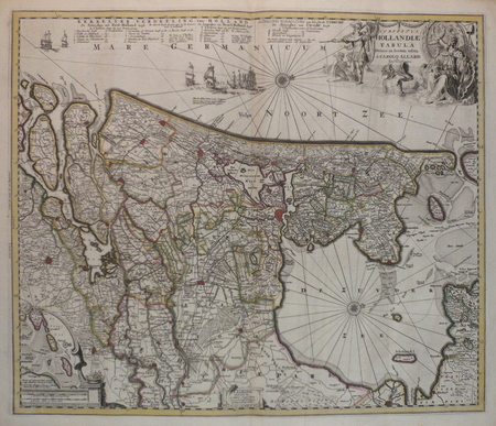
ref. LBW0416cAmsterdam circa 1700 472 x 560 mm.
1705ref. LBW-947Amsterdam, R. et I. Ottens, [circa 1705]. 482 x 574 mm.
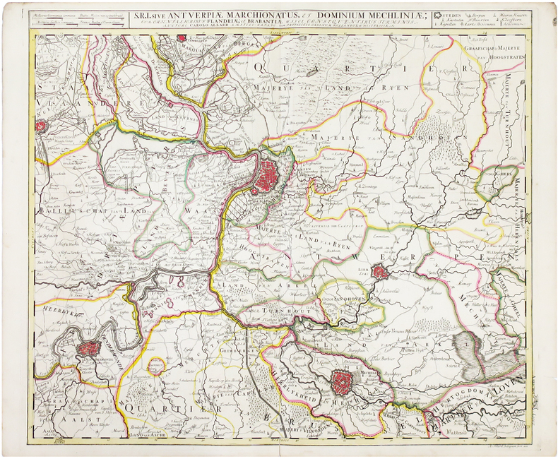
ref. LBW0417bAmsterdam, [circa 1700]. 500 x 582 mm.
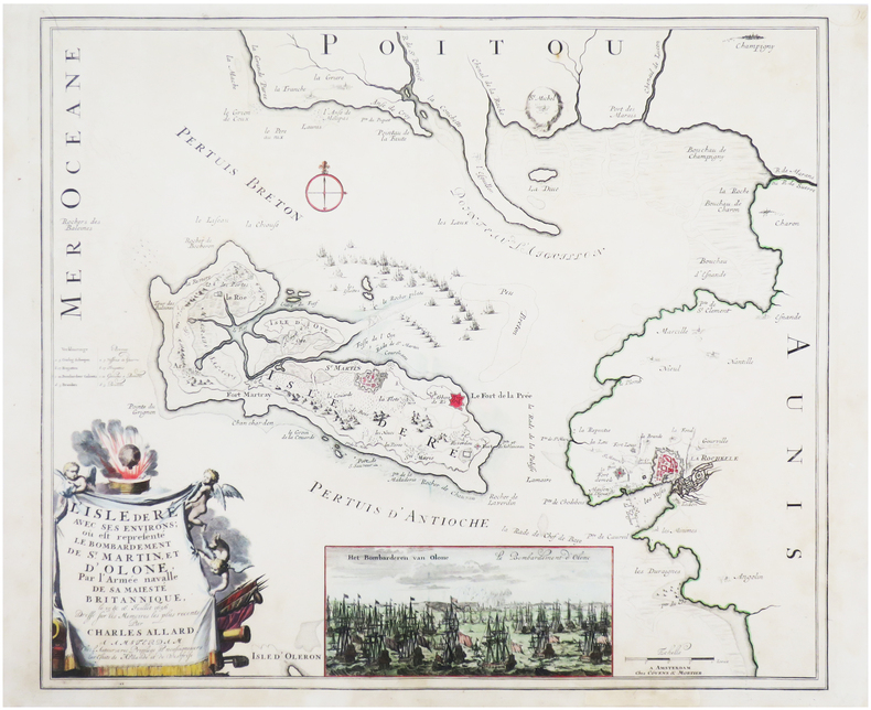
1700ref. LBW-7612Amsterdam, chez l'auteur, et chez Covens & Mortier, [circa 1700]. 496 x 579 mm.
1700ref. LBW-5518Amsterdam, [circa 1700]. 225 x 261 mm.
1951ref. WOC-1721Physique – Économique – Politique. Dressé par Maurice ALLAIN. Préface du Président Édouard HERRIOT. 1: France et Union Française. 50 cartes en couleurs dépliantes avec au dos illustrations en noir et blanc. 2: L'Europe – L'Asie – L'Afrique – L'Amérique – L'Océanie. 80 cartes en couleurs dépliantes avec au dos illustrations en noir et blanc. Paris, Strasbourg – Bruxelles – Buenos Aires, Librairie Aristide Quillet, 1951-1951. 2 volumes in-folio (45,5x25,5cm) percaline noire foncé gaufré, dos cuirs et les légendes dorées, gardes ornées de motifs de fleurs. 90pp. + 175pp.
2000ref. 0904219China Press 2000-01-01. hardcover. Used - Good. Ship out in 2 business day And Fast shipping Free Tracking number will be provided after the shipment.China CARTOGRAPHIC PUBLISHING HOUSE. Bei Jing. 1989. Hardcover. Book Condition: New. First Edition. 380x270mm. Language: Chinese and English bilingual 1989/298 pages China is in a unique geodynamic position and offer a good opportunity for study of dynamics of continental lithosphere. In the past 20 years a wealth of new data from all branches of earth sciences and from every provinces has been accumulated. Thus the time appeared right for an attempt at a comprehensive treatment of the new da. Satisfaction guaranteedor money back. China Press hardcover
2019ref. 500058031DRAGON D OR 2019 34 pages 19 4x21 8x0 6cm. 2019. Relié. 34 pages.
2019ref. 500072738DRAGON D OR 2019 34 pages 19 4x21 8x0 6cm. 2019. Relié. 34 pages.
2019ref. 500074454DRAGON D OR 2019 34 pages 19 4x21 8x0 6cm. 2019. Relié. 34 pages.
2019ref. 500092689DRAGON D OR 2019 34 pages 19 4x21 8x0 6cm. 2019. Relié. 34 pages.
2019ref. 500100509DRAGON D OR 2019 34 pages 19 4x21 8x0 6cm. 2019. Relié. 34 pages.
2019ref. 500111212DRAGON D OR 2019 34 pages 19 4x21 8x0 6cm. 2019. Relié. 34 pages.
2019ref. 500113231DRAGON D OR 2019 34 pages 19 4x21 8x0 6cm. 2019. Relié. 34 pages.
2019ref. 500391350DRAGON D OR 2019 34 pages 19 4x21 8x0 6cm. 2019. Relié. 34 pages.