11.756 resultados
ref. ORD-8404ND Photo. Série des Scènes Parisiennes. (Vers 1905). Carte postale (14x9cm) ayant voyagé, oblitération de 1906. Tout petit défaut à un coin sinon bon état. Rare.
1952ref. 9160DuBois PA: Samuel A. King 1952. Revised 1952. Folding map 25x19" printed in red and black. Sportsman's club label to upper margin with some offsetting to lower. Small split at fold intersections title and a few stains to blank verso otherwise a clean near fine example. Very popular map which was originally designed and published by Samuel A. King in 1951 and revised in 1952 and 54. According to OCLC there were also 1960s and 70s printings under slightly different titles. This map shows the Allegheny National Forest and surrounding counties with animal silhouettes tracks and a portrait of John O'Bail the Cornplanter last of the great Seneca chiefs. Made for motorists hunters and anglers it shows paved and clay roads trails pipe and power lines fire and lookout towers state parks game lands airports and towns with post offices. The early copies of this map are somewhat scarce and there are many modern reprints available. OCLC cites 8 holdings for the '51-54 editions with just 1 being the '52. A lovely example. . Samuel A. King unknown
Engraved map, printed from two plates and assembled. Ca. 1065 x 390 mm (printed area ca. 1005 x 350 mm). Large and decorative map of the Holy Land, printed from two plate, from Christian van Adrichem's "Theatrum terrae sanctae et biblicarum historiarum". Van Adrichem's map is oriented toward the east and shows the twelve tribes of Israel on both sides of the River Jordan. The coastline runs from Sidon in Lebanon to Alexandria in Egypt, also showing part of the Red Sea. In the Mediterranean, off the coast, several ships and sea monsters are visible. On the Dead Sea are four burning cities: Sodom, Gomorrah, Zeboim, and Adama. - Folds smoothed and reinforced in places. A good, strong impression.
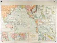
1930ref. 205997Sydney: H.E.C. Robinson. Circa1930s. Printed colour maps in all 65.5 x 99cm the main map roughly 50 x 65 cm on a single sheet 76 x 101.3 cms; a little carelessly folded decorative blue title cover a little dusty and a few fold splits and edgewear but in good condition. The exceptional feature of this map are the twenty six large scale inset maps of Pacific islands including: Malay States Singapore Hong Kong these at lower left Japan Philippine Islands Hawaiian Islands Fiji Solomon Islands Western and Eastern Samoa Tahiti Saipan New Caledonia and Dependencies and many others. The main map of the Pacific Ocean stretches from Southeast Asia including all of Australia and New Zealand the west coast of the Americas the Kamchatka Peninsula Manchukuo Manchuria and most of China. Korea and Taiwan are marked as Japanese Territory. Possessions of Britain France the Netherlands and the United States are highlighted. An incredibly rich source of information on the Pacific theatre during the years leading up to World War II. From the Sydney publisher H.E.C. Robinson the firm founded in 1895 by Herbert Robinson 1857-1933 a founder of the Royal Geographical Society of Australasia. . H.E.C. Robinson. unknown
ref. 19206Paris, début du XXe siècle. In-8, 46 pl., chagrin brun d'Antoine Maître, décor à froid sur les plats et le dos, tranches dorées (épidermures, fermoirs manquants).
2009ref. LFA-126728944Une carte géographique au 1:100.000e, éditée en 2008, bon état
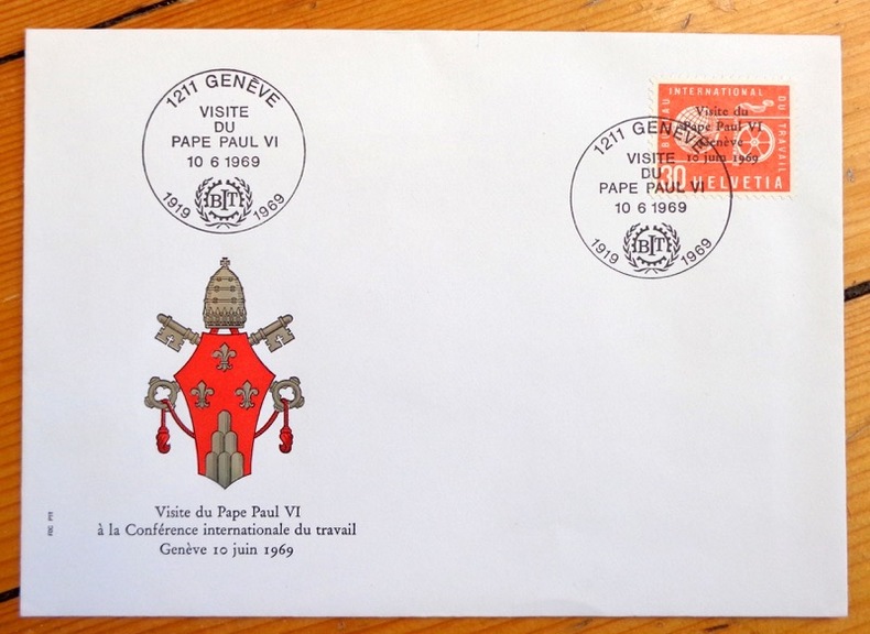
ref. 4579Enveloppe avec décor gaufré, timbre spécial édité à l'occasion de la visite papale, oblitéré à la date de la conférence. En parfaite condition.
1816ref. 175252Philadelphia.: Carey Mathew and Warner Benjamin. 1816. Engraved map 19 x 22.3 cm original folds some offsetting to the map marginal browning and staining small archival repairs to the outer margin but in good condition. Fine map Plate 19 prepared for Carey and Benjamin's "General Atlas.". . (Carey, Mathew and Warner, Benjamin). unknown
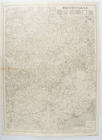
1572ref. 172829大阪. Osaka.: 大阪毎日新聞社. Osaka Mainichi Shinbunsha. 昭和 13 1938. Black and white map folded showing Hankow one of the three cities which merged to become Wuhan 54.5 x 49cm scale 1:2000000. Some light browning tiny closed tear upper margin neatly repaired with conservation standard tape. Good copy. This Hankow/Hankou War Situation Map is a supplement map of Osaka Mainichi Newspaper on 25 August 1938. The two inset maps show the region around Nanjing and Hong Kong. It gives detailed place names of Hankow area. . 大阪毎日新聞社. [Osaka Mainichi Shinbunsha]. unknown
1930ref. 56484Portland OR: Gilham’s Guide 1930. 8vo. 91 1 pp. Maps throughout. Tan printed softcovers minor darkening and thumbing to fore-edges 1 small corner creased still a VG copy. First edition of this scarce automobile travel map guide to Oregon for travelers and businessmen. Supplied with an extended index the strip maps all offer auto roads and stage roads for buses as well as showing railroad lines. In addition ferries post offices Western Union Express Offices and much more are shown. In addition there are mileage maps for Washington & Oregon included as well. Gilham 1882-1949 was a lifetime Portland OR resident who published gravel guides and histories on the Pacific Northwest but after losing his business during the Great Depression went to work for the Jones Lumber Co. Gilham’s Guide, paperback
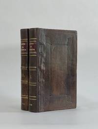
1708ref. 8917London: John Nicholson 1708. Full Leather. Very Good binding. Octavo. xxxviii 2 412; 2 382 2 ads 32 index pp. maps. First edition. Contemporary paneled-calf boards with modern reback. Title page to Volume 1 and four of the eight maps are lacking but are supplied in tasteful facsimile. The maps in facsimile are the North America New England Virginia and Maryland and Carolina. Bindings are solid and presently nicely; contents are clean and bright; but for the maps and title page this is an exceptional set. Of this work William Reese writes: "This basic 18th-century reference work on British America . . . offers an excellent comprehensive survey of Great Britain's American colonies at the point when those on the mainland of North America had grown past their initial phase and were expanding rapidly in population and productivity. . . . This important contemporary work would probably have been the first point of reference for any Englishman at the time" Reese Struggle for North America 1. Usually attributed to Oldmixon who penned the dedication but occasionally gets attributed to Moll according to Sabin. A significant work by the British historian. Howes O-61 "aa"; European Americana 1708/95; ESTC T45485; Sabin 57156. John Nicholson unknown
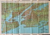
1928ref. List2973George J. Nostrand; Winkoop Hallenbeck Crawford Co 1928. Map measuring 20 x 29 inches; trifold measuring 8 ½ x 12 inches. Map folded with some small tears at folds slightly wrinkled pencil markings verso; very attractive. Overall excellent. Offered here is a large attractive bird’s-eye view map of New York City and the surrounding areas by George J. Nostrand a New York City-based lithographer and cartographer; and a small pamphlet advertising sightseeing tours by car or yacht with “lecturers accompanying each trip explaining all points of interest”. The map highlights the most car-friendly routes around the city and New Jersey as far west as Mountain View and is beautifully illustrated with buildings landmarks and ships in the harbor. It was likely produced between 1927 and 1929 given certain details for instance the George Washington Bridge is labeled only as “proposed”; we find two copies of the 1928 printing and four of the 1929 printing on OCLC. George J. Nostrand; Winkoop Hallenbeck Crawford Co unknown books
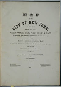
1872ref. 26020New York 1872. Hardcover. Very good condition. Maps of Manhattan's west side prior to the completion of Central Park which was finished in 1876. The maps were compiled by longtime New York City Department of Public Works map clerk and city surveyor Otto Sackersdorff noted for his 'Maps of Farms Commonly called The Blue Book 1815". The Blue Book was not published until 1868 as a demonstration of northern economic might at the end of the Civil War. The real estate maps show property lines existing roads parks shorelines wetlands and the Manhattan grid extending from west of 8th Avenue at 59th Street and Columbus Circle up to 222nd Street and Spuyten Duyvil & Kingsbridge. Parks and major thoroughfares include: Central Park St. Nicholas Avenue Fort Washington Park Kingsbridge Road and High Bridge Park. Folio 15 x 20 1/2" 14 maps in total: 1 full page and 13 double page 28 x 20" hand colored lithographed map sheets. Each map contiguous with one another. Period quarter green gilt leather and dark green buckram boards. Spine gently rubbed; the maps exceptionally bright and clean. Previous owner inscription in pencil E. B. Van Winkle from Chas. H. Myers July 1875. Van Winkle was a civil engineer with an interest in road construction and drainage having written a report on the drainage of the 23rd & 24th wards of New York City. Myers was an Assistant Engineer in Charge of Sewers for New York City. OCLC: 41175506 at Princeton and OCLC: 40671892 at Columbia and the New York Public Library. hardcover
1867ref. 63963New York NY: Taintor Brothers Merrill & Co. 758 Broadway c. 1867 ca. 1870. One large folio colour lithograph map sized 19.5 x 25 in. expertly mounted on linen decorative border neatline very faint dustsoiling marks from when originally folded very slight age toning at the former creases still a VG bright copy. Early printing of this splendid map depicting the five boroughs before their consolidation 30 years later in 1898 and offering a superb snapshot of the streets ferry lines waterways and Harbor. New York rapidly changed during the end of the 19th Century with tremendous influx of immigrants into the City and this map captures a pivotal time. Joseph Taintor 1835-1881 established this mapmaking firm with his brother Charles Taintor in 1866 and after 1868 when they changed the name of the firm they added their Uncle and entered the field of school book pubishing including the Analytical Readers series. See: David Rumsey Historical Map Collection City of New York No. 0973.003. Taintor Brothers, Merrill & Co., 758 Broadway, unknown
1928ref. List2973George J. Nostrand; Winkoop Hallenbeck Crawford Co 1928. Map measuring 20 x 29 inches; trifold measuring 8 ½ x 12 inches. Map folded with some small tears at folds slightly wrinkled pencil markings verso; very attractive. Overall excellent. Offered here is a large attractive bird’s-eye view map of New York City and the surrounding areas by George J. Nostrand a New York City-based lithographer and cartographer; and a small pamphlet advertising sightseeing tours by car or yacht with “lecturers accompanying each trip explaining all points of interest”. The map highlights the most car-friendly routes around the city and New Jersey as far west as Mountain View and is beautifully illustrated with buildings landmarks and ships in the harbor. It was likely produced between 1927 and 1929 given certain details for instance the George Washington Bridge is labeled only as “proposed”; we find two copies of the 1928 printing and four of the 1929 printing on OCLC. George J. Nostrand; Winkoop Hallenbeck Crawford Co unknown
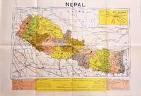
1979ref. 207710Dehli.: Indian Book Depot Map House. 1979. Colour map on blush coloured paper 44.2 x 63.6 cms; 53.6 x 75.9 cms sheet inset map of air service routes folding into pictorial card wrappers 25.5 x 19.3 cms issued into colour pictorial paper folder in very good condition. Map shows Nepal and surrounding borders with India Tibet and China provinces picked out in colour international and state boundaries sealed roads railway lines canals lakes springs rivers towns and villages tourist places temples and the inset map shows air services from Nepal to Thailand and India. The rear wrapper shows a view of Pashupatinath Temple the oldest Hindu temple in Kathmandu. . Indian Book Depot (Map House). unknown
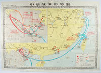
1978ref. 171343北京. Beijing.: 地图出版社.Di tu chu ban she. 1978. Large Chinese map in colour showing southern part of China and northern Vietnam folded in original envelope scale 1: 150000 inset map upper left corner scale 1:800000. Both maps show the battles between Qing court and French army between 23 Aug 1884 and 25 Mar 1885. Original paper envelope repaired with acidic free tape map in very good condition. Text in Chinese. Sheet measures 76.8 x 107.1cm. . 地图出版社.[Di tu chu ban she]. unknown
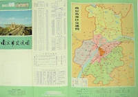
1977ref. 137003No place of publication.: 江苏人民出版社.Jiangsu ren min chu ban she. 1st Edition 2nd Printing. 1977. Colour Chinese transportation map featuring the city of Nanjing capital city of Jiangsu Province and its surrounding regions. Upper side: A transpiration map of Nanjing and neighbouring counties right section with a list of names of stations buses trains coaches ferries and their addresses lower right edge tourist guide including the addresses and phone numbers of major travel agents hospitals cinemas and more left section accompanied by two tables of bus routes. On reverse: a "Map of Nanjing Municipal Transpiration Map" scale not given a chart of terminus for bus and trolley bus lower right section. Some soiling on reverse stamp of a prior dealer in Guangzhou a handwritten date of "September 17th 1977" upper side light creases good copy. Text in Chinese. Sheet measures 37.8 x 52.3cm. . 江苏人民出版社.[Jiangsu ren min chu ban she]. unknown
1920Very Good Turkish, Ottoman (1500-1928) Original color map. Elephant folio. (59x75 cm). In Ottoman script. [OTTOMAN MILITARY MAP of PATAGONIA and FALKLAND ISLANDS: ROUTE of DRESDEN] Alman kruvazörü Dresden'in takîbi ve tahrîbi. SMS Dresden cruiser's routes between 1913-1915 (World War 1) on the Patagonian shelf; western shores of South America, Patagonia and Falkland Islands. Dresden spent much of her career overseas. After commissioning, she visited the United States in 1909 during the Hudson-Fulton Celebration, before returning to Germany to serve in the reconnaissance force of the High Seas Fleet for three years. In 1913, she was assigned to the Mediterranean Division. She was then sent to the Caribbean to protect German nationals during the Mexican Revolution. In mid-1914, she carried the former dictator Victoriano Huerta to Jamaica, where the British had granted him asylum. She was due to return to Germany in July 1914, but was prevented by the outbreak of World War I from doing so. At the onset of hostilities, Dresden operated as a commerce raider in South American waters in the Atlantic, then moved to the Pacific Ocean in September and joined Maximilian von Spee's East Asia Squadron. Dresden saw action in the Battle of Coronel in November, where she engaged the British cruiser HMS Glasgow, and at the Battle of the Falkland Islands in December, where she was the only German warship to escape destruction. She eluded her British pursuers for several more months, until she put into Robinson Crusoe Island in March 1915. Her engines were worn out and she had almost no coal left for her boilers, so the ship's captain contacted the local Chilean authorities to have Dresden interned. She was trapped by British cruisers, including her old opponent Glasgow. The British violated Chilean neutrality and opened fire on the ship in the Battle of Más a Tierra. The Germans scuttled Dresden and the majority of the crew escaped to be interned in Chile for the duration of the war. The wreck remains in the harbor; several artifacts, including her bell and compass, have been returned to Germany.
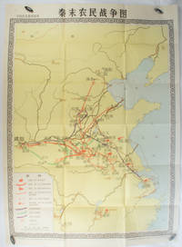
1981ref. 173280Beijing.: 地图出版社. Di tu chu ban she. 1st Edition 2nd Printing. 1981. Large Chinese coloured educational map folded scale 1:2000000. Legend lower left corner shows the routes of military advance led by peasant rebellion leaders' 陈胜Chen Sheng and 吴广Wu Guang in red and other military activities led by 项羽Xiang Yu and 刘邦Liu Bang in various colours. In original worn paper wrapper map in very good condition. Text in Chinese. Map measures 105.5 x 76.6cm. . 地图出版社. [Di tu chu ban she]. unknown
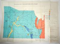
1960ref. 29317Sydney: Dept. of Mines NSW 1960. First printing. Maps. Overall very good condition. 21 loose folding maps of mining in New South Wales. Various sizes in the original stiff paper titled wrapper. Titled 'Maps for Technical Reports Volume 8 1960' on the spine in black. The "Folder of maps accompanies v. 8 1960 other volumes have maps in back pockets." Maps include: Geological Map of the Pike Creek Dam Site; Gold Occurrence in Portions 72 and 78 Parish Tomalla County Hawes; Sample Positions of Quartz Veins in Pportions 72 and 78 Parish Tomalla County Hawes; Plan of the Emu Creek Mine Area; Emu Creek Mine Inset "A"; Emu Creek Mining Syndicate Damsite; Mount Copper Area - Rockley; Plan of "The Mount" Copper Mine showing Rock Type; DLA 950 Sara River; Sections Looking Upstream Across Sara River on DLA950; Kopi Hollow Gypsum Deposit; Locality Map. Extractive Industries City of the Blue Mountains; Lower MacLeay River District; Wells of the Lower MacLeay River District; Conductive Map Lower MacLeay River District; Rainfall Map of the Wollombi Brook Catchment; Map of Wollombi Brook Warkworht-Broke Section; General Geology of the Wollombi Brook; General Geology of the Wollombi Brook; Geological Survey of the Border Rivers Inner Catchment. Maps in excellent condition on thick paper varied sizes 37.25 x 26.5" 26 x 18" 18 x 13" 13 x 9" in tan stiff paper folder torn. Listed in one of Libraries Australia ID 55570014 127080025 4104725 139998138 154863371. Dept. of Mines NSW unknown
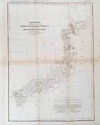
1878ref. 210211Philadelphia.: American Institute of Mining Engineers. Sherman & Co. printers. 1878. Large folding map of Japan showing "some of the more important Mining Districts Coal Fields etc." small fold split without loss tables 67pp. Covers a little scuffed and discoloured overall in very good condition. Scarce offprint separately paginated of a paper included in Volume V of the Transactions of the American Institute of Mining Engineers. The author Henry S. Munroe had been retained by the Japanese Government as Assistant Geologist and Mining Engineer with the Geological Survey of Yesso for the Hokkaidō Colonization Agency. His work laid the foundations for the future coal mining industry in Hokkaido. The report contains two lengthy tables relating to coal production and quality. . American Institute of Mining Engineers. Sherman & Co., printers. unknown
254 x 201 mm. Lithographed map. Scale 1:25,000,000. Gilt wooden frame (290 x 357 mm). Political map of the Middle East prior to WWI, detailing the Arabian Peninsula, the Gulf, Iran, and the Ottoman Empire, as well as parts of Africa, Russia and China. Among the labelled cities on the Gulf are Sharjah, Al-Wakrah and Manamah. With 4 inset maps showing Palestine (1:2,500,000) and Jerusalem with its surroundings (1:500,000) as well as the southern German states and Lake Constance for scale. - Early edition of Eduard Gaebler's map of western Asia, published published in "Neuester Hand-Atlas über alle Teile der Erde" (Leipzig, Gaebler's Geographisches Institut, 1892). The map saw numerous reissues; a revised edition appeared in Gaebler's "Kleiner Handatlas" as late as 1933. - Slight foxing. Frame shows some traces of worming; tiny piece of wood chipped near left margin. An appealing map in an attractive wooden frame with a gilt border.
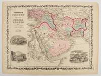
1860ref. 177019New York.: Johnson & Browning. circa1860. Engraved map 30.2 x 40.5 cm 34.5 x 45.5 cm sheet original hand-colour elaborate strapwork border three fine vignettes of Muscat Trebisond small marginal edge tears top corner chipped the map in very good condition. Most attractive decorative map of Arabia the Ottoman Empire Persia Afghanistan Beloochistan and surrounds by one of the most popular and successful 19th Century American atlas publishers. . Johnson & Browning. unknown
2004ref. LFA-126744324Une carte géographique "Local" au 1:150.000e, éditée en 2004, bon état