The EditorMareMagnum

2000Book in mint unread condition. 112pp. Trafford MBC publicity work with some information on culture, history, sport etc. Undated but ca 2000.
1998Expressive inscrption in Spanish to front end paper. No other marks or inscriptions. No creasing to covers or to spine. A very clean very tight copy with bright unmarked boards and no bumping to corners. 210pp. Lavish guide to Acapulco.
1978No marks or inscriptions. No creasing to covers. A very clean very tight boklet with bright unmarked boards, minor traces of storage and no bumping to corners. 20pp. Brochure for the town of Stockbridge in Massachusetts, North America with history, what to see and adverts. Scarce.
1975No marks or inscriptions. No creasing to covers, faint crease to spine. A very clean very tight copy with bright unmarked boards and no bumping to corners. Fold-out map intact and in good condition. 156pp. Local authority guide to the newly created county of West Yorkshire covering Leeds, Bradford, Huddersfield, Wakefield and Halifax as major towns/cities. Undated ca 1975. .
1955No marks or inscriptions. No creasing to covers or to spine. A very clean very tight book of fold-out postcards with bright unmarked boards and no bumping to corners. Thirty-eight coloured photographs of Yalta the Russian resort in the Crimea, most postcard size, a few half-size, some double size. Descriptions in English, French, Spanish, German and two Cyrilic languages. Undated, ca 1955. Very scarce.
1975Booklet in mint condition. 32pp.
1961No marks or inscriptions and no creasing to covers. A lovely clean very tight copy with bright unmarked boards, minor rubbing to spine ends and no bumping to corners. 168pp. Comprehensive concise review of the Hull, its industry, sport, shops, suburbs, transport, shipping etc. Undated but Lord Mayors listed up to 1960.
1982No marks or inscriptions to contents. No creasing to covers or to spine. A lovely clean tight copy with bright unmarked boards and no bumping to corners. Maps plus 224pp.
1650Without place, (Basel ca. 1650). 30x36 cm. Fine engraved map of North and South America from Terra del Fuego, Terra Australis Incognita and the Magellan Strait in the south to the unmapped regions in the north. A small map of the known parts og Greenland in inset. Outer left shows the coasts regions of Spain and Africa. Ships and whales in the see. Signed M. Merian fecit (lower right). Clean and fine, broad margins, uncoloured.
1940Originally printed in 1938 in Britain, this copy reprinted with permission in Canada in 1940 with amendments Nos. 1 and 2. Quite a detailed treatise with chapters entitled: Organization of a Coast Fortress in Peace; Responsibility for Training; Annual Training; Charts and Maps; Range-Finders and Other Instruments; Misc. Instruments; Laying; Ballistics; Gunnery Calculations; Gunnery Calculations - Automatic Sights; Range Tables and Initial Corrections; Calibration; Battery Drill and Fire Discipline; Instructions for Training and Examination in Range-Finding; Instructions for Training Examination in x, 224 pages. Plotting Room Duties; Instructions for Training and Examination in Laying; Instructions for Training and Examination in Telephony; Instructions for the Examination for Skill-At-Arms Badges for Gunnery; plus appendices on probability and the slide rule. Several fold-outs. Black and white diagrams. Unmarked with average wear. Binding tight. A sound copy of this vintage WWII reference. Book
1650ref. 44316Without place, (Basel ca. 1650). 30x36 cm. Fine engraved map of North and South America from Terra del Fuego, Terra Australis Incognita and the Magellan Strait in the south to the unmapped regions in the north. A small map of the known parts og Greenland in inset. Outer left shows the coasts regions of Spain and Africa. Ships and whales in the see. Signed M. Merian fecit (lower right). Clean and fine, broad margins, uncoloured.
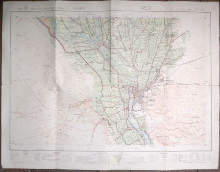
1934ref. 5731934 The Survey of Egypt (25/690), 1934 (33/885). Carte en couleurs de 53 x 69,5 cm montée sur toile par l'éditeur et pliée en 8.
1691ref. 43500Amsterdam, Huguetan & Mortier, 1691. 56x85 cm. Large engraved map of Terra Sancta with original colours in outline. With two large engraved cartouches. Small repairs to lower part of centerfold.
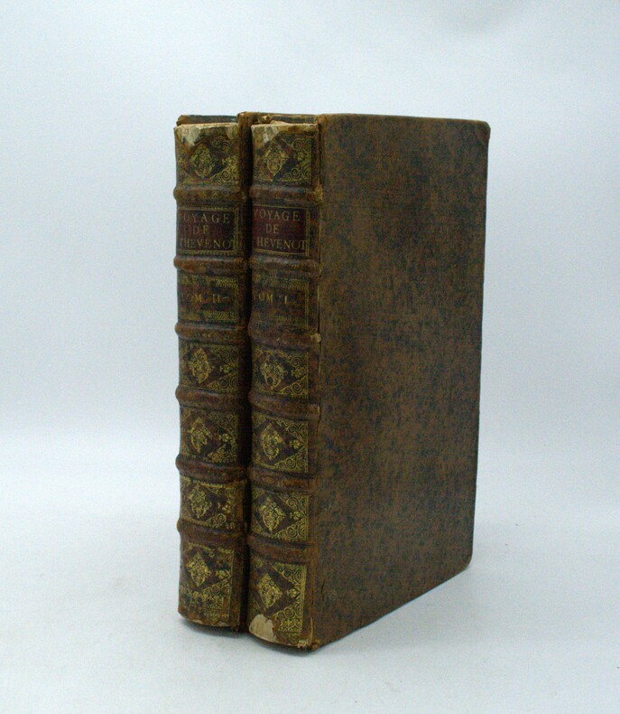
1696ref. PHO-1981Paris, Thomas Moette, 1696 ; 5 parties en 2 vol. in-folio (37x23,5cm), veau marbré, dos à nerfs richement orné de motifs dorés avec tomaison et pièce de titre grenat, quelques frottements, charnières fendillées, manque au dos, coins usés, coiffes absentes, 8 feuillets détachés, rousseurs, qlqs feuillets brunis. L’illustration comporte de nombreuses gravures et illustrations dans et hors texte, 6 cartes dont la carte de l’Indostan, de la Colchide, du Japon (qui regarde l’Amérique), carte de la route du voyage de Canton à Péking, carte de l’Éthiopie, carte de l'Éthiopie ["Entrée de quelques ports…"]. Il manque la Carte de Bassorah, les 2 planches de caractères Chaldéens, la carte de l’Australie, la carte des côtes d’Arabie et d’Asie, la carte des Costes de Sierlionne, la carte des Philippines et Chine, la carte de Chine
1663ref. PHO-2278A Paris, chez Jacques Langlois, 1663-1666 3 parties en 1 volumes in-folio (38x25cm). Veau tacheté époque, dos à nerfs ornés avec pièce de titre en maroquin et tomaison, tranches jaspées rouges. Réparations au dos et coins, mouillure, quelques rousseurs, réparation au titre, renforcement à la carte. Complet de ses relations de voyage selon Brunet & Camus
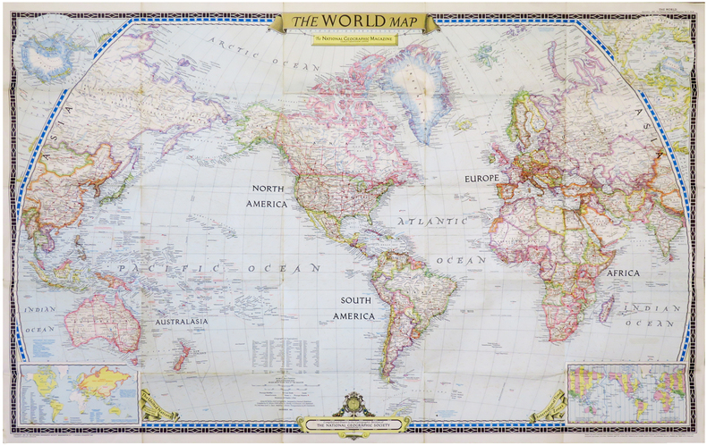
1951ref. LBW-6834Washington, D.C., The National Geographic Magazine, 1951. 0,65 x 1,02 m.
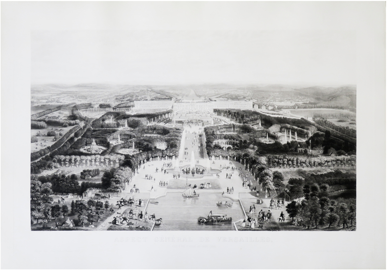
1856ref. LBW-8701Paris, Fatout, [1856]. 570 x 817 mm.
1861ref. LBW-8953Paris, Ch. Béranger, 1861-1893. En 27 sections montées sur toile et repliées, formant une carte de 0,62 x 1,16 m ; étiquette au dos de l'éditeur Charles Béranger.
1938ref. AUB-6937Paris, Larousse 1938. Bel exemplaire relié, dos orné avec titres dorés, in-4 (32 x 25), 304 pages avec illustrations, table + planches.
196188 pages. Features: Fantastic fold-out two-panel colour cover photo of the four Richardsons of Regina who are world curling champions; Brief article on how Nanaimo Realty paid its realtors to lose weight - and sales increased!; Nice one-page black and white Volkswagen photo ad entitled "Who backs up the Volkswagen?"; Nice one-page colour photo ad for Florida orange juice shows smiling girl wearing white ear muffs; What Winter Does to Canada - and vice versa; What to wear to a Fashion Opening - photo-illustrated article; Duel in the Kitchen (fiction); The Return of the Winter Carnivals; The Simple Joys of Camping in a Snowdrift; Hockey Isn't As Rough as it Used to Be - Part 1 of Jack Adams' "My 43 Years in Hockey" - photo-illustrated article (with large photo of Howie Meeker pounding a limp Canadien); The Second Splendid Discovery of Spices; How to Gain Entree to the Social Pages; Canada's world champions of Curling - Ernie Richardson and the Richardsons of Regina; Population Explosion on the Ski Slopes; Skier's Dream - two-page colour-photo-illustrated brief article with two maps describe how Franz Wilhelmsen and the Garibaldi Olympic Committee seek to have the massive potential of Whistler Mountain developed for the Winter Olympics of 1968; Best and Worst Movies of 1960; Escape to the Sun - Robert Thomas Allen's road trip from California to Florida; Seagrams ad features colour painting of winter carnival by Henry Simpkins; Large colour ad for Apollo Beach waterfront real estate development near Tampa; Canadian Club colour-photo one-page ad features Walter Gonnason falling into an ice crevasse on Mount Victoria Glacier in Alberta; Why color TV isn't here yet - and when it may be; Colour-photo Coke ad on back cover features skating couple; and more. Discrete six-inch clear archival tape repair to bottom left corner of front cover, otherwise unmmarked with average wear. A quality copy of this great vintage issue. Magazine
1991No marks or inscriptions. No creasing to covers. A very clean very tight copy with bright unmarked boards, minor traces of storage and no bumping to corners. 64pp. Government tourist publication describing the country's history, politics, culture, industry, sport and the rest.
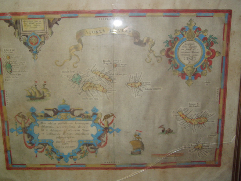
1584ref. 224251584 Orig. copper-engraving. Published by A. Ortelius after to L. Teixeira's map of the Açores. Dated 1584. Coloured. With title in decorative border, 3 ornamental cartouches, 2 ships, sea-monster and "Scala Leucarum". 32,5:46,5 cm (12 3/4 x 18 1/4 inch.) 2,5 x 46,5 cm Van der Krogt, Koeman's Atlantes Neerlandici, Vol. III B, 6350:31; Van den Broecke, Ortelius Atlas Maps, Nr. 24. - Stammt aus einer von fünf lateinischen Ausgaben, die in den Jahren 1595 - 1612 erschienen. Alle tragen das Datum 1584 in der großen Kartusche.A splendid sea chart of the Azores with three scrollwork cartouches; the ocean is decorated with sailing vessels. A fresh example of this scarce sea chart, based on Teixeira's single sheet map of Terceira from 1582, and a later manuscript atlas of the Azores islands. The Azores played a significant role in international sea trade as a victualling stop and shelter for ships sailing into the South Atlantic. In very good condition. The map was first issued in an edition of 100 examples in the Additamentum to the 1583 edition of Ortelius' Theatrum Orbis Terrarum, which is widely referred to as the first modern atlas and a landmark in the history of Western map making. Beginning in 1570, Abraham Ortelius and his successors published (and continuously added to) this monumental work for a period of over 40 years (not including the very rare edition of 1641), with text on the verso in Latin, Italian, German, Dutch, French, Spanish and English.References: Van Den Broecke 24. Meurs p 253-254.
1940Very Good Turkish Original 53 gelatin silver albumen photographs in a cloth photograph album. Oblong: 14x23 cm. Photos' sizes: 7x8,5 cm. No description and script. [FIRST TURKISH SKIING EXPEDITIONS] [Album of photograph: One of early Turkish skiing expeditions in Uludag Mt., Bursa]. Too many skiers seen in photographs. They are early and most important names for Turkish skiing. "In the same year in the course of Erzurum Kerim Hitli Fort set under the leadership of Albert Bilstein who came from Austria, the army engaged in skiing and the first skiers such as Arif Hikmet Koyunoglu Cemal Dursunoglu, Kemal Hasip had been brought up. A ski battalion composed of four companies was founded in Erzincan in 1917. In the same period the first ski school was set up in Susehri (Buldur Village) by Hikmet Koyunoglu. A Teacher of Galatasaray High School skiing in Uludag in 1933 boosted activity to the sport and afterwards the ski activities organised by Bursa Community Centre in Uludag in 1933-1934, Ankara Community Centre in Elmadag and Erzurum Community Centre in Palandöken had been important movements...". (Source: Skiingturkey - History).
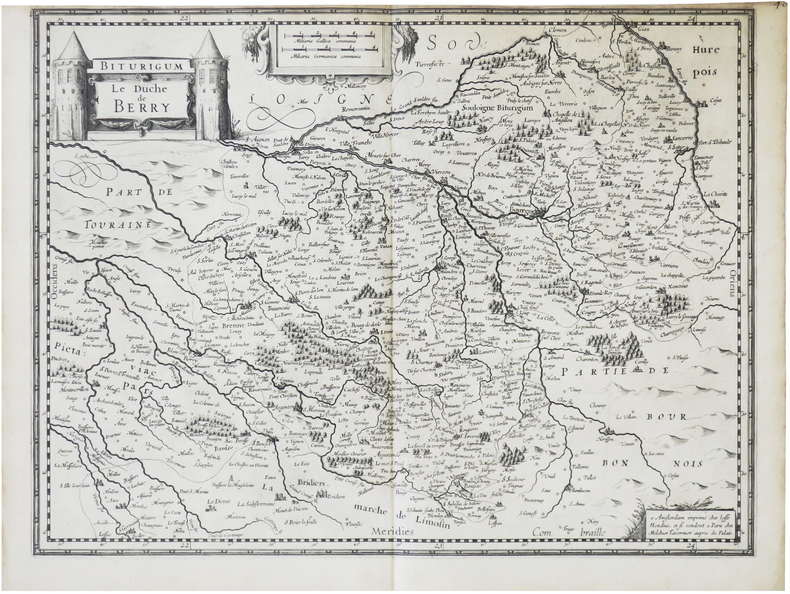
1632ref. LBW-8708Paris, Melchior Tavernier, [1632]. 370 x 488 mm.
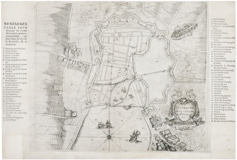
1621ref. LBW-6514Paris, Melchior Tavernier, [1621]. 384 x 575 mm.