Dury, G. H.MareMagnum

12.289 resultados
1965No marks or inscriptions. A lovely clean very tight copy with bright unmarked boards and no bumping to corners. Dust jacket not price clipped with slight rubbing, nicks to edges and very slight foxing to rear. 209pp.
194337 pages including index, selected references and black and white illustrations. Average wear. Binding sound. Former U.S. military copy with usual internal markings. No external markings. Solid working copy in maroon cloth-covered boards Book
1902"Sketch map showing the connexion between the Himalaya Mountains and the Tibetan table-land, and their relation to the adjacent plains and mountains." - from lower edge. Outside dimensions 14.5" x 10.5" Circa 1902. Centerfold. Light wear. Please see our photo for details. Book
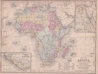
1869ref. 176603Philadelphia.: E. H. Butler. circa1869. Lithographed map with original hand-colour 21.2 x 27.6 cm two inset maps of Liberia and Sierra Leone; and Egypt showing the Suez Canal text and engravings for an unrelated entry on the verso; margins dusty top edge worn with small edge tears one affecting the border and marginal chip but in good condition. Detailed map of Africa before the escalation of colonial acquisition in the 1880s. . (E. H. Butler). unknown
1960ref. 78704Atladena California: Altadena Federal Savings and Loan Association 1960. Printed on both sides on an 18 1/2" x 23 1/2" sheet of white paper that folds to 4" x 9 1/4" 24 panels. There is printing in red and a color rendering of the Altadena Federal Savings building on one side. Handwritten name on the front panel; else near fine. Scarce OCLC locates no holdings. Fully indexed street map of the unincorporated Los Angeles County California community that was devastated by the Eaton Fire in January 2025. Situated next to and within the foothills of the San Gabriel Mountains Altadena has long resisted annexation to Pasadena though that city has taken 46 "bites" of it over the years seeking tax revenues. That independent spirit is reflected in the mosaic of ethnic diversity that made Altadena one of the most integrated communities in Southern California. Altadena Federal Savings and Loan Association unknown
1902Outside dimensions 14.5" x 10.5" Circa 1902. Centerfold. Light wear. Please see our photo for details. Book
1902Outside dimensions 14.5" x 10.5". Circa 1902. Centerfold. Light wear. Please see our photo for details. Book
1902Outside dimensions 14.5" x 10.5". Circa 1902. Centerfold. Light wear. Please see our photo for details. Book
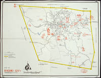
1960ref. 206510circa1960. Printed pictorial map 44.8 x 58 cm 46.7 x 60.3 cms sheet original folds a little wear but in very good condition. Attractive 1960s tourist map of Baguio city when it was the "Summer Capital" of the Philippines. Tourist attractions are shown pictorially in red blue triangles denote wood carving shops the city boundaries outlined in yellow sealed and unsealed roads are also shown. . unknown
1902Outside dimensions 14.5" x 10.5". Circa 1902. Centerfold. Light wear. Please see our photo for details. Book
1902Outside dimensions 14.5" x 10.5". Circa 1902. Centerfold. Light wear. Please see our photo for details. Book
Size: 60 x 49 cm (23 x 16 inch) with wide margins. Leaf: 69 x 51 cm (27 x 20 inch). Printed in red and green colour on thin paper. *Probably the 1878 edition. - "In 1858 William H. Rand, a native of Boston, established a printing office in Chicago and employed as a printer Andrew McNally. By 1868 Rand and McNally formed a partnership which soon acquired a reputation for printing railroad publications. In 1871 they introduced the Rand, McNally Railway Guide. That same year their business was destroyed in the Great Chicago Fire. Rand and McNally opened their new map department in late 1872. In January 1873 it was announced that "the house of Rand, McNally & Co. beg leave to inform their railroad friends and the patrons of the Railway Guide generally, that they have lately made extensive additions to their engraving department, and are now prepared to execute maps using relief-plate engraving [i.e., wax engraving] in the very highest style of the art." With the adoption of the wax engraving process, followed in May 1873 by the employment of a color printing process, the company`s reputation as one of the world`s leading commercial mapmakers was established. A major accomplishment of Rand, McNally was the publication in 1876 of the "New Railroad and County Map of the United States and Canada. Compiled from Latest Government Surveys, and Drawn to an Accurate Scale." That same year, the company used the plates from this map to produce its famous Commercial Atlas and Marketing Guide. This relief map of California and Nevada was included in Rand, McNally & Co.’s Business Atlas published in 1878-9. It shows cities, towns, waterways, and labeled railroad routes" (Historical maps). - Very good condition. Landkarten de
1989ref. 472372Dublin : Phoenix Maps 1989. Facsimile Edition. Softcover. Near fine folding map; slightly dust-dulled and edge-bumped. Remains well-preserved overall. Physical description; 1 map ; 79 x 58 cm. on sheet 101 x 62 cm. folded to 21 x 15 cm. Notes; Reproduced from an original made available by the Neptune Gallery Dublin; believed to be a section from a map by Willliam Larkin circa 1819. Facsimile reprint. Subjects; Republic of Ireland ; Maps. Dublin : Phoenix Maps paperback
1902Outside dimensions 14.5" x 10.5" Circa 1902. Centerfold. Light wear. Please see our photo for details. Book
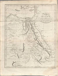
1803ref. 174955London. circa1803. Engraved map 23 x 18.5 cm original folds small split to one fold affecting the margin only paper age- toned lower corner darkened and on the verso inked circles to the lower half in an early hand but in good condition. Finely engraved early 19th Century map also showing to the north Syria Palestine and Cyprus and Darfur and Mountains of the Moon Sources of the Nile to the South. . unknown
1902Outside dimensions 14.5" x 10.5" Circa 1902. Centerfold. Light wear. Please see our photo for details. Book
197536" x 25.5". Indicates 25 foot contours, water bodies, roads, rail lines, structures, etc. Light wear. Unmarked. Book
1902Outside dimensions 14.5" x 10.5" Circa 1902. Centerfold. Light wear. Please see our photo for details. Book
197536" x 25.5". Indicates 25 foot contours, water bodies, roads, rail lines, structures, etc. Light wear. Unmarked. Book
1902Outside dimensions 14.5" x 10.5" Circa 1902. Centerfold. Light wear. Please see our photo for details. Book
1902Outside dimensions 14.5" x 10.5" Circa 1902. Centerfold. Light wear. Please see our photo for details. Book
1902Outside dimensions 14.5" x 10.5". Circa 1902. Centerfold. Light wear. Please see our photo for details. Book
1902Outside dimensions 14.5" x 10.5" Circa 1902. Centerfold. Light wear. Some staining at periperhy. Please see our photo for details. Book
1902Outside dimensions 14.5" x 10.5". Centerfold. "This map, with certain amendments, belongs to the "Story of Burnt Njal" by Sir George W. Dasent" - printed below map. Light wear. Nice copy. Please see our photo for further details. Book
1902Outside dimensions 14.5" x 10.5". Circa 1902. Centerfold. Light wear. "Colours denote - British Territory, Dependent & Subordinate Native States, Independent States." - from upper right corner. Please see our photo for details. Book