12.201 resultados
ref. SLIVCN-9782897422523CARACTERE EDITIONS (CA)
1934ref. vg325Librairie Vuibert Relié 1934 In-8 (14,8 x 23,5 cm), reliure pleine-toile, dos lisse, pièce de titre, 37 pages, avec deux cartes dont une en couleur ; mouillure sur les bords des premiers feuillets, papier bruni, par ailleurs assez bon état. Livraison a domicile (La Poste) ou en Mondial Relay sur simple demande.
1875ref. LBW-74651875. 87 x 60 cm, monté sur carton et entouré d'un passe-partout sur lequel sont remontés la date, le nom de l'auteur et le titre.
ref. 27373P., Grasset, 1950, in 8° broché, 249 pages (en partie non coupé) ; couverture illustrée en couleurs.
1840ref. LBW-5673[circa 1840]. 390 x 280 mm.
1927Approx. 42" x 36" coloured map. Average wear and soiling. Library markings. Book
1723ref. 54819Rainer Ottens. 1723. A most attractive map with early outline hand colour vertical fold barely visible diagonal crease upper half of map few very pale small brown spots otherwise a clean and bright image. Numbering in red pencil few annotations in pencil and light number stamp on reverse however not at all visible from front of map or affecting image. Sheet measures 46.6 x 60.2cm. . Rainer Ottens. unknown
1819ref. 1405618Paris: Menard et Desenne 1819. Dernière édition. Hardcover. Octavo 684 pages. In Fair minus condition. Spine is tan with gold print on red banner. Boards half bound with green leather to spine and corners and green cloth to boards; corner leather not present spine leather is toned with some rubbing and wear to hinges board cloth has worn edges rubbing shelf wear. Text block has deckle edges; cracked front hinge foxing and toning throughout. Illustrated: “Enrichie de sept Cartes géographiques conformes aux nouvelles divisions et ornée des Pavillons des vingt principales Puissances maritimes”— title page; however illustrations may not be present. Text in French. NOTE: Shelved in Netdesk Column W. 1405618. FP New Rockville Stock. Menard et Desenne hardcover
ref. 2398Chez l’auteur-Editeur, à la librairie nationale et étrangère, Paris, 1824
1819ref. 1405618Paris: Menard et Desenne 1819. Dernière édition. Hardcover. Octavo 684 pages. In Fair minus condition. Spine is tan with gold print on red banner. Boards half bound with green leather to spine and corners and green cloth to boards; corner leather not present spine leather is toned with some rubbing and wear to hinges board cloth has worn edges rubbing shelf wear. Text block has deckle edges; cracked front hinge foxing and toning throughout. Illustrated: “Enrichie de sept Cartes géographiques conformes aux nouvelles divisions et ornée des Pavillons des vingt principales Puissances maritimes”— title page; however illustrations may not be present. Text in French. NOTE: Shelved in Netdesk Column W. 1405618. FP New Rockville Stock. Menard et Desenne hardcover books
ref. 10192rédigé sur un plan nouveau par M. le Chevalier de RONJOUX. Petit in 8 demi-cuir, titre, filets dors. Faux-titre, frontispice (tableau carte de l’Europe) titre illustré, gravé, titre, II, 694 pages, texte sur 2 colonnes, 6 cartes dont 5 dépliantes, 6 planches de monnaies, hors-texte en couleurs. Paris à la librairie classique élémentaire et catholique de BELIN-MANDAR et DEVAUX et à BRUXELLES, même maison 1829. Mouillure angle inférieur droit en début de volume, quelques pages légèrement poussiéreuses.
ref. 11994rédigé sur un plan nouveau par M. Le chevalier de Roujoux. In 8 plein cuir fauve , pièce de titre cuir bleu, roulette, fers dorés. Carte dépliante et pavillons des différentes puissances, titre, 694 pages, 6 pages de monnaies, texte sur 2 colonnes. 5 cartes dépliantes A Limoges chez Barbou frères 1846.
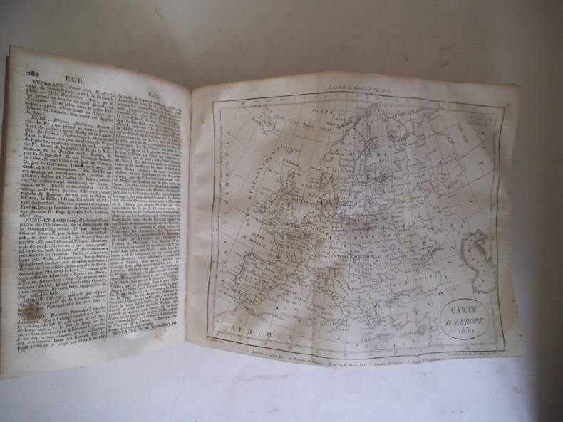
ref. 14571In 8 plein cuir fauve raciné pièce de titre chagrin rouge, fers, filets dorés. 135x205mm, faux –titre, frontispice dépliant (mappemonde ou carte générale de la terre) titre illustré gravé, titre, contient une description détaillée des royaumes, empires, états, contrées, villes, bourgs, villages, fleuves, rivières, mers, îles, lacs et montagnes du globe etc. rédigé sur un plan nouveau par M le Chevalier de RONJON ; Sixième édition revue et corrigée. Paris Chez LEBIGRE frères libraires 1832. 694 pages, texte sur 2 colonnes, tranches marbrées 1) tableau de l’Europe. Cartes : 1) de l’Afrique, dépliante 1830 2) Amérique méridionale, dépliante 3) Amérique septentrionale dépliante 4) Asie dépliante 1830 ; 5 Europe dépliante,6) France avec pavillons en couleurs des différentes puissances. En fin de volumes 6 planches de monnaies des différents pays en couleurs. (une déchirure réparée carte de l’Europe ; Sinon Bon état
ref. 0483222895.Gpaperback. Good. Access codes and supplements are not guaranteed with used items. May be an ex-library book. paperback
1702ref. 25843La Haye Jacob Van Elinckhuysen 1702 in-12 vélin souple, dos lisse muet [Rel. de l'époque]
ref. 8288Paris, Fayard, 1976 13 x 21, 108 pp., broché, bon état
ref. LBW-8929Paris, A. Leconte, [entre 1949 et 1952]. 535 x 688 mm et 520 x 681 ; replié.
1810ref. LBW-6591[vers 1810]. 20,5 x 27 cm, sur une feuille de 25 x 31 cm.
ref. 242581Bordeaux, Féret [Imprimerie centrale de Vve Lanefranque], 1870 in-12, [2] ff. n. ch. (réclames), 32 pp. de texte (tableau des voies), [3] ff. n. ch. (réclames), avec un grand plan dépliant (58 x 73 cm) aux contours rehaussés de couleurs, toile chagrinée cerise, dos lisse muet, encadrements à froid sur les plats, titre et armes de Bordeaux poussés au centre du plat supérieur (reliure de l'éditeur).
1968Une feuille 55x78 cm en pochette.
1784Paris, Dezauche, (1784). (58 x 87 cm.). Engraved map of Metz. A few small closed marginal tears to paper, not reaching image. A tear to lower part (3 cm) repaired on verso, no loss of image.
1784ref. 54704Paris, Dezauche, (1784). (58 x 87 cm.). Engraved map of Metz. A few small closed marginal tears to paper, not reaching image. A tear to lower part (3 cm) repaired on verso, no loss of image.
1858ref. LBW-8933Paris, A. Corion, 1858. En 36 sections montées sur toile vert bouteille et repliées, formant un plan de 646 x 940 mm, monté dans une reliure de chagrin marron avec pièce de titre rouge au dos ; carte des environs de Paris contrecollée au dos du premier plat.
1708Pianta a proiezione mista, orientata con il nord a sinistra, 1706 circa. Basata sula pianta di Roma di Lievin Cruyl del 1665 e successiva ristampa del 1696. Per Scaccia Scarafoni prima e Marigliani poi “fu pubblicata ad Amsterdam nel 1706 senza alcun aggiornamento e raffigura pertanto Roma come si presentava alla fine del ‘600. In alto a sinistra è riportata la piantina dei dintorni di Roma” (cfr. Marigliani p. 252). La pianta è inclusa nell'Atlas Historique, pubblicato ad Amsterdam tra il 1705 e il 1720. L'atlante, in 7 volumi, è innovativo per la sua epoca perché combina le mappe geografiche con incisioni e informazioni di carattere geografico, storico, etnografico e araldico. Acquaforte, in ottimo stato di conservazione. Henri Abraham Chatelain (1684 - 1743) era un pastore ugonotto di origini parigine. È meglio conosciuto come cartografo olandese e più specificamente per il suo contributo cartografico nell’Atlas Historique in sette volumi, pubblicato ad Amsterdam tra il 1705 e il 1720. Innovativo per il suo tempo, l'Atlas Historique combinava incisioni e opere d'arte con studi di geografia, storia, etnologia, araldica e cosmografia. Alcuni studiosi suggeriscono che l'Atlas Historique non fu compilato esclusivamente da Henri Chatelain, come si crede comunemente, ma piuttosto fu un'impresa familiare che coinvolse Henri, suo padre Zacharie e suo fratello, sempre Zacharie. Bibliografia Scaccia Scarafoni (1939): p. 113, n. 213; Marigliani (2007): p. 252, n. 158. Mixed projection map of Rome, oriented with north to the left, circa 1706. Based on the map of Rome by Lievin Cruyl (1665) and subsequent reprint of 1696. For Scaccia Scarafoni first and then Marigliani was published in Amsterdam in 1706 without any update and therefore represents Rome as it was at the end of '600. At the top left is the map of the surroundings of Rome (see Marigliani p. 252). The map is included in the Atlas Historique, published in Amsterdam between 1705 and 1720. Henri Abraham Chatelain (1684 - 1743) was a Huguenot pastor of Parisian origins. He is best known as a Dutch cartographer and more specifically for his cartographic contribution in the seminal seven volume Atlas Historique, published in Amsterdam between 1705 and 1720. Innovative for its time, the Atlas Historique combined fine engraving and artwork with scholarly studies of geography, history, ethnology, heraldry, and cosmography. Some scholarship suggests that the Atlas Historique was not exclusively compiled by Henri Chatelain, as is commonly believed, but rather was a family enterprise involving Henri, his father Zacharie and his brother, also Zacharie. Etching, in excellent condition. Literature Scaccia Scarafoni (1939): p. 113, n. 213; Marigliani (2007): p. 252, n. 158.
ref. 21053Paris, Logerot s.d. (1856). Grand plan entoilé repliable ( 60cm x 81cm) en noir et blanc, en très bon état. Dans son étui de carton de papier marbré, , titre au dos.