12.070 resultados
1993No marks or inscriptions. A very clean very tight fold-out map with bright unmarked uncreased cover and no bumping to corners. pp. Map of the Bethnal Green and Bow areas of London from 1914. Detailed description on reverse side.
1997Mint unused map pp. Map of the South Reddish & Brinnington districts of Stockport on Lancashire sheet No 112.05 from 1904.
1880pp. xii, 266 + Twenty-two folding maps and plans. Numerous text drawings. Decorated title page. Unopened. XLib. 8vo. Original full cloth binding, gold lettered spine. Gilt pictorial vignette of Romulus and Remus nursing on the she-wolf on front cover. Binding slightly faded. Hardbound. Though XLib, still a very nice 1880 handbook about the then existing ruins and monuments of ancient Rome. **PRICE JUST REDUCED! TRAVEL/2
1990223 pages including two indeces. Author continues the pursuit of her long standing interest in the education and training of professional psychologists. A valuable resource for instructors of graduate programs in Psychology, Social Work, Psychiatric Nursing, Psychiatry and Counseling. Clean, crisp and unmarked with negligible wear. Excellent copy. Book
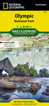
ref. Q-1566954029National Geographic Maps 2019-01-01. Map. New. In shrink wrap. Looks like an interesting title! National Geographic Maps unknown
150 x 130 cm. Scale: 1:3,000,000. Colour lithograph, dissected into 24 sections and mounted on original linen. Very rare, monumental wall map of the Ottoman Empire, featuring one of the largest and most detailed printed representations of the Arabian Peninsula produced in the Islamic World prior to World War I. Perhaps more than any other map, it reveals the immense logistic challenges faced by Hajj pilgrims just in advance of the construction of the Baghdad and Hejaz Railway systems. Printed for official use, the map appeared at a time when the Sublime Porte was going to great lengths to shore up its authority in the Red Sea region (Hejaz, Asir, and Yemen), while being pressured by Britain to retreat from the domains it claimed in the Arabian Gulf (Kuwait, Al-Qatif/Hofuf, and Qatar). - Indeed, the present map would have been of great value to Ottoman generals and cabinet officials for strategic planning, as Arabia was increasingly a focus of global attention and interference. It served as the ideal strategic aid to chart the future construction of the Hejaz Railway (built 1900-08) and the Baghdad Railway (extended from the Anatolian Railway, from 1903 onwards) and delineates some of the world's most strategically important railway lines before 1900. - The main map encompasses most of the Arabian Peninsula, from Qatar and the Hadramaut westwards (while far eastern Arabia, including Oman and what is today the United Arab Emirates is featured in an inset, lower left). The coastlines and rivers are crisply depicted; mountain ranges are expressed by delicate tan shading; all cities and towns of note are labelled; the names of regions and tribal areas are revealed, while all key roads and Hajj caravan routes are delineated. The map features stellar coverage of the western Gulf region, labelling Qatar (then an autonomous part of the Ottoman Empire), Bahrain (a British protectorate prized for its fine natural harbour), and Kuwait, an autonomous Sheikhdom within the Ottoman Empire that would shortly become a British protectorate. Inland, the map details the Saudi-Wahhabi domain Nejd, with its capital Riyadh, while to the northwest lies the territory of the rival Al-Rashid clan, with its capital Ha’il. - Minor soiling and waterstaining, occasional light edge wear. Tears in linen partly repaired. A rare survival. Osmanli cografya literatürü tarihi [History of geographical literature during the Ottoman period], pp. 756f. David Rumsey Map Collection 13186.000 (the single other copy known in the trade). Not in Al-Qasimi collection (1493-1931).
ref. SLIVCN-3760024990523MINUS EDITIONS
1968ref. 90688Strasbourg sans nom 1968 1 vol. broché 1 feuillet dactylographié recto-verso, daté du 3 décembre 1968, non signé. Tract strasbourgeois en réaction à la loi Faure du 12 novembre.
1994ref. Q-0719550173John Murray 1994-01-01. Hardcover. New. In shrink wrap. Looks like an interesting title! John Murray hardcover
1873(Washington : Government printing Office, 1873). 8vo. In later half cloth with the original wrappers pasted on to boards. From ""Mittheilungen aus der norddeutschen Seewarte"", von W. von Freeden. Abstract, translated from the ""Revue maritime et coloniale"". July, 1873. Stamp to front board and first leaf of text. 12 pp. + folded chart.
1873ref. 58308(Washington : Government printing Office, 1873). 8vo. In later half cloth with the original wrappers pasted on to boards. From ""Mittheilungen aus der norddeutschen Seewarte"", von W. von Freeden. Abstract, translated from the ""Revue maritime et coloniale"". July, 1873. Stamp to front board and first leaf of text. 12 pp. + folded chart.
1929Approx. 23" x 33" standard topographical map. Coloured. Library markings. Two-inch opening to bottom edge. Shorter openings to top and right edges. Somewhat above-average wear and soiling. Book
1764(København, 1764). Kobberstukket prospekt med både i kanalen. (19,5x32 cm.). Stukket af J. Haas.
1764ref. 53322(København, 1764). Kobberstukket prospekt med både i kanalen. (19,5x32 cm.). Stukket af J. Haas.
ref. G088130591XI5N00Thomas Brothers Maps. Unbound. Acceptable. Readable copy. Pages may have considerable notes/highlighting. ~ ThriftBooks: Read More Spend Less.Dust jacket quality is not guaranteed. Thomas Brothers Maps unknown
ref. 0881308269.Gpaperback. Good. Access codes and supplements are not guaranteed with used items. May be an ex-library book. paperback
1561Acquaforte e bulino, circa 1561. Magnifica prova, impressa su carta vergata coeva, con margini, in perfetto stato di conservazione. Esemplare in meravigliosa coloritura coeva.Carta tratta dalla "Geographia di Claudio Tolomeo", a cura del Ruscelli, pubblicata in Venezia in pù edizioni tra il 1561 ed il 1598. La carta è basata sulla "Geografia" di Giacomo Gastaldi, che probabilmente disegnò personalmente anche queste mappe, che vennero incise dai fratelli Sanuto. La peculiarità di queste mappe è che sono incise due per lastra e successivamente tagliate; questo il motivo per cui il segno del rame appare solo in tre lati della mappa. Il testo del Ruscelli e le sue carte sono considerate come il miglior atlante moderno fino alla prima versione del Thatrum di Ortelius, 1570. Solo la loro enorme diffusione ne impedisce una valutazione sostenuta nel mercato antiquario. L'opera infatti ebbe una prima stesura nel 1561, stampata da Vincenzo Valgrisi che ne curò anche la ristampa del 1562. Tre sono le edizioni firmate da Giordano Ziletti (due nel 1564 e una del 1574), mentre nel 1597 viene edita dai fratelli Calignani. Tutte queste edizioni contengono 64 tavole. Nel 1598 e 1599 vengono alla luce le due edizioni curate da Giuseppe Rosaccio e stampate dagli Eredi di Melchior Sessa. Queste ultime due edizioni comprendono 69 tavole; sono infatti aggiunte la carta del planisfero e dei continenti del Rosaccio. ORIGINAL COLOURINGEtching with engraving, about 1561. Magnificent proof, printed on contemporary laid paper, with margins, in perfect condition. Example in wonderful contemporary coloring.Map, taken from Ruscelli edition of Ptolemy's "Geographia", printed in Venice from 1561 to 1598. Ruscelli's Atlas is an expanded edition of Gastaldi's "Geografia" of 1548, which has been called the most comprehensive atlas produced between Martin Waldseemüller's Geographiae of 1513, and the Abraham Ortelius Theatrum of 1570. Ruscelli and Gastaldi's maps were beautifully engraved on copper, marking a turning point in the history of cartography. From that point forward, the majority of cartographic works used this medium. As it was a harder material than wood it gave the engraver the ability to render more detail. Gastaldi sought the most up-to-date geographical information available, making the modern maps in Ruscelli's Geographia among the best modern maps of the period. The maps are engraved by the Sanuto borthers.Only their enormous diffusion prevents a sustained evaluation in the antique market. The work in fact had a first issue in 1561, printed by Vincenzo Valgrisi who also edited the reprint of 1562. There are three editions signed by Giordano Ziletti (two in 1564 and one in 1574), while in 1597 it was edited by the Calignani brothers. All these editions contain 64 engraved maps. In 1598 and 1599 the two editions edited by Giuseppe Rosaccio and printed by the heirs of Melchior Sessa come to light. These last two editions include 69 plates; in fact the map of the planisphere and of the continents of Rosaccio are added.Only their ubiquity prevents an assessment supported in the antique market.
1561Carta tratta dalla "Geographia di Claudio Tolomeo", a cura del Ruscelli, pubblicata in Venezia in pù edizioni tra il 1561 ed il 1598. La carta è basata sulla "Geografia" di Giacomo Gastaldi, che probabilmente disegnò personalmente anche queste mappe, che vennero incise dai fratelli Sanuto. La peculiarità di queste mappe è che sono incise due per lastra e successivamente tagliate; questo il motivo per cui il segno del rame appare solo in tre lati della mappa. Il testo del Ruscelli e le sue carte sono considerate come il miglior atlante moderno fino alla prima versione del Thatrum di Ortelius, 1570. Solo la loro enorme diffusione ne impedisce una valutazione sostenuta nel mercato antiquario. L'opera infatti ebbe una prima stesura nel 1561, stampata da Vincenzo Valgrisi che ne curò anche la ristampa del 1562. Tre sono le edizioni firmate da Giordano Ziletti (due nel 1564 e una del 1574), mentre nel 1597 viene edita dai fratelli Calignani. Tutte queste edizioni contengono 64 tavole. Nel 1598 e 1599 vengono alla luce le due edizioni curate da Giuseppe Rosaccio e stampate dagli Eredi di Melchior Sessa. Queste ultime due edizioni comprendono 69 tavole; sono infatti aggiunte la carta del planisfero e dei continenti del Rosaccio.Buon esemplare. A nice example of Ruscelli's map of the world from his Geografia, the first double hemisphere world map to appear in an Atlas. One of two modern world maps in Ruscelli's Geografia, based upon Gastaldi's world map of 1548. The map is a copper plate engraving by Sanuto. The map is adapted from the oval projection used in Gastaldi's larger world map and is presented on Roger Bacon's circular projection, also used by Tramezzino's large world map of 1554. No southern continent is shown. The map clearly shows the broad mass of land joining Asia and America as Terra Incognita and the coastline as Littus Incongmitum. Map, taken from Ruscelli edition of Ptolemy's "Geographia", printed in Venice from 1561 to 1598. Ruscelli's Atlas is an expanded edition of Gastaldi's "Geografia" of 1548, which has been called the most comprehensive atlas produced between Martin Waldseemüller's Geographiae of 1513, and the Abraham Ortelius Theatrum of 1570. Ruscelli and Gastaldi's maps were beautifully engraved on copper, marking a turning point in the history of cartography. From that point forward, the majority of cartographic works used this medium. As it was a harder material than wood it gave the engraver the ability to render more detail. Gastaldi sought the most up-to-date geographical information available, making the modern maps in Ruscelli's Geographia among the best modern maps of the period. The maps are engraved by the Sanuto borthers.Only their enormous diffusion prevents a sustained evaluation in the antique market. The work in fact had a first issue in 1561, printed by Vincenzo Valgrisi who also edited the reprint of 1562. There are three editions signed by Giordano Ziletti (two in 1564 and one in 1574), while in 1597 it was edited by the Calignani brothers. All these editions contain 64 engraved maps. In 1598 and 1599 the two editions edited by Giuseppe Rosaccio and printed by the heirs of Melchior Sessa come to light. These last two editions include 69 plates; in fact the map of the planisphere and of the continents of Rosaccio are added.Small repairs at the white margins, otherwise very good. R. W. Shirley, "The Mapping of the world", 110
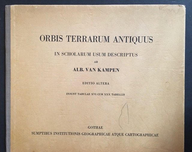
1964ref. 15649BBGotha, Haack, (1964). 4°. 1 Bl. 16 Seiten mit farbigen Karten. Orig.-Halbleinenband., 15649bb Einbanddeckel mit leichten Gebrauchsspuren.
S.l., s.e., s.a (c. 1950). Mapa excursionista revisado por el Dr. N. Llopis Lladó. Escala 1:25.000. Mapa entelado y plegado en carpeta de tela cerrada con goma. Muy buen ejemplar.
2001ref. SBBIH-4AW65CPC7JMOPhilip's 2001. spiral_bound. Good. Our good condition books are generally good for reading but not for gifting or collecting. They could have imperfections such as creasing fanning inscriptions margin notes yellowing staining on edge or cover or pages bumps scuffs etc etc sometimes multiple of these. It's a wide category that encompasses anything that isn't almost-new down to anything that is slightly better than poor. We would NOT recommend gifting Good books - these should be considered reading copies. Our books are dispatched from a Yorkshire former cotton mill. We list via barcode/ISBN so please note that the images are stock images and may not be the exact copy you receive furthermore the details about edition and year might not be accurate as many publishers reuse the same ISBN for multiple editions and as we simply scan a barcode or enter an ISBN we do not check the validity of the edition data when listing. If you're looking for an exact edition please don't order at least not without checking with us first although we don't always have time to check. We aim to dispatch prompty the service used will depend on order value and book size. We can ship to most countries see our shipping policies. Payment is via Abe only. Philip's unknown
2001ref. mon0000508121Philip's 01/10/2001 00:00:01. hardcover. Very Good. 1.9985 in x 26.9795 in x 19.1854 in. Philip's hardcover
ref. 0540084964.Gpaperback. Good. Access codes and supplements are not guaranteed with used items. May be an ex-library book. paperback
1929Folding coloured map on paper measuring 24 x 33 ins (approx. 61.0 x 84.0 cms) folding in 32 panels to 7.5 x 4.25 ins (approx. 19.0 x 11.0 cms), neat contemporary signature on front cover, one or two neat repairs at folds; original pictorial card wrappers, yapped edges, wrappers lightly age-soiled else a very good, bright, clean copy. The One Inch Tourist Map series was first published in 1924 with 'Official Royal Arms' artwork. The present copy is the 1929 revision; the cover is single red lineation on buff with black arms, red sheet name and location map. Browne, 8.1.a.1.