ORDNANCE SURVEYMareMagnum

12.070 resultados
1932Folding coloured map on cloth measuring 21.x 28.5 ins (approx. 53.0 x 72.0 cms) folding in 24 panels to 7.0 x 3.5 ins (approx. 18.0 x 9.0 cms); original pictorial card wrappers a very good bright clean copy. The famous Popular Edition One Inch series was first published in 1919 with striking 'cyclist' artwork by Ellis Martin. The present copy is the 1932 reissue; the covers are black with red sheet name and location map. Browne, 11.1.a
1930Folding coloured map on cloth measuring 22 x 30 ins (approx. 56.0 x 76.0 cms) folding in 21 panels to 7.5 x 4.5 ins (approx. 19.0 x 11.5 cms); original pictorial card wrappers, neat contemporary signature on upper wrapper, wrappers lightly age-soiled else a very good, bright, clean copy. The famous Popular Edition One Inch series was first published in 1919 with striking 'hiker' artwork by Ellis Martin. The present copy is the 1930 revision (roads revised to June 1926); the covers are the dark red and black variant with location map. Browne, 11.2.a
1926Folding coloured map on cloth measuring 21 x 30 ins (approx. 53.0 x 76.0 cms) folding in 24 panels to 7.0 x 3.75 ins (approx. 18.0 x 9.5 cms); original pictorial card wrappers, wrappers lightly age-soiled else a very good, bright, clean copy. The famous Popular Edition One Inch series was first published in 1919 with striking 'hiker' artwork by Ellis Martin. The present copy is the 1926 revision; the covers are the dark red and black variant with location map. Browne, 11.2.a
1923Previous owner's initials to front cover. No creasing to covers. A very clean unmarked map with creasing to some corners and a little rubbing to some of the map's folded corners and edges. Cloth backed edition. 1pp.
1923Folding coloured map on cloth measuring 22.0 x 28.5 ins (approx. 56.0 x 72.0 cms) folding in 21 panels to 7.5 x 4.25 ins (approx. 19.0 x 11.0 cms), small neat contemporary signature on front wrapper else a very good, bright, clean copy. The famous Popular Edition One Inch series was first published in 1919 with striking 'hiker' artwork by Ellis Martin. The present copy is the 1923; the covers are the dark red and black variant with location map. Browne, 11.2.a
1932Folding coloured map on cloth measuring 21.x 28.5 ins (approx. 53.0 x 72.0 cms) folding in 24 panels to 7.0 x 3.5 ins (approx. 18.0 x 9.0 cms); original pictorial card wrappers a very good clean copy. The famous Popular Edition One Inch series was first published in 1919 with striking 'cyclist' artwork by Ellis Martin. The present copy is the 1932 [third] reissue; the covers are black with red sheet name and location map. Browne, 11.1.a
1933Folding coloured map on cloth measuring 22.0 x 28.5 ins (approx. 56.0 x 72.0 cms) folding in 21 panels to 7.5 x 4.25 ins (approx. 19.0 x 11.0 cms), small neat contemporary signature on front wrapper else a very good, bright, clean copy. The famous Popular Edition One Inch series was first published in 1919 with striking 'hiker' artwork by Ellis Martin. The present copy is the 1933 revision (roads and railways) of the 1921 impression; the covers are the dark red and black variant with location map. Browne, 11.2.a
1935Previous owner's name to front cover. Light creasing to covers. A very clean unmarked map with minor creasing to some corners. Cloth backed edition. 1pp. Undated. 'First published --- 1923 with periodical corrected reprints', probably 1930s.
1925Folding coloured map on cloth measuring 22.0 x 28.5 ins (approx. 56.0 x 72.0 cms) folding in 21 panels to 7.5 x 4.25 ins (approx. 19.0 x 11.0 cms), covers lightly dust-soiled else a very good, bright, clean copy. The famous Popular Edition One Inch series was first published in 1919 with striking 'hiker' artwork by Ellis Martin. The present copy is the 1925 revision; the covers are the dark red and black variant with location map. Browne, 11.2.a
1931Folding coloured map on cloth measuring 21.x 28.5 ins (approx. 53.0 x 72.0 cms) folding in 24 panels to 7.0 x 3.5 ins (approx. 18.0 x 9.0 cms); original pictorial card wrappers a very good bright clean copy. The famous Popular Edition One Inch series was first published in 1919 with striking 'cyclist' artwork by Ellis Martin. The present copy is the 1931 reissue; the covers are black with red sheet name and location map. Browne, 11.1.a
1931Folding coloured map on cloth measuring 22.0 x 28.5 ins (approx. 56.0 x 72.0 cms) folding in 21 panels to 7.5 x 4.25 ins (approx. 19.0 x 11.0 cms), some light pencilled annotation in margins; original pictorial card wrappers, wrappers lightly age-soiled else a very good, bright, clean copy. The famous Popular Edition One Inch series was first published in 1919 with striking 'hiker' artwork by Ellis Martin. The present copy is the 1931 revision; the covers are the dark red and black variant with location map. Browne, 11.2.a
1932Folding coloured map on cloth measuring 22.0 x 28.5 ins (approx. 56.0 x 72.0 cms) folding in 21 panels to 7.5 x 4.25 ins (approx. 19.0 x 11.0 cms), small neat contemporary signature on front wrapper else a very good, bright, clean copy. The famous Popular Edition One Inch series was first published in 1919 with striking 'hiker' artwork by Ellis Martin. The present copy is the 1932 revision; the covers are the dark red and black variant with location map. Browne, 11.2.a
1919No added marks or inscriptions. Linen-backed map in excellent bright condition, not torn. Covers lightly marked and creased. 1pp. One-inch to one mile Ordnance Survey map of Wiltshire around Salisbury, Bulford and surrounding district published in 1919. Opens up to 22 x 30 inches. Extremely scarce.
1935Folding coloured map on cloth measuring 22 x 30 ins (approx.56.0 x 76.0 cms) folding in 21 panels to 7.5 x 4.5 ins (approx. 19.0 x 11.5 cms); original pictorial card wrappers, wrappers lightly frayed at edges else a very good, clean copy.
1925Folding coloured map on cloth measuring 22.0 x 28.5 ins (approx. 56.0 x 72.0 cms) folding in 21 panels to 7.5 x 4.25 ins (approx. 19.0 x 11.0 cms), covers lightly dust-soiled else a very good, bright, clean copy. The famous Popular Edition One Inch series was first published in 1919 with striking 'hiker' artwork by Ellis Martin. The present copy is the 1925 revision; the covers are the dark red and black variant with location map. Browne, 11.2.a
1930Folding coloured map on cloth measuring 21.x 28.5 ins (approx. 53.0 x 72.0 cms) folding in 24 panels to 7.0 x 3.5 ins (approx. 18.0 x 9.0 cms); original pictorial card wrappers a very good bright clean copy. The famous Popular Edition One Inch series was first published in 1919 with striking 'cyclist' artwork by Ellis Martin. The present copy is the 1930 reissue; the covers are black with red sheet name and location map. Browne, 11.1.a
1914Folding coloured map on cloth measuring 21.x 28.5 ins (approx. 53.0 x 72.0 cms) folding in 24 panels to 7.0 x 3.5 ins (approx. 18.0 x 9.0 cms); original pictorial card wrappers covers lightly browned else a very good bright clean copy. The One Inch Coloured Edition dates from 1904. The present copy is the 1914 reissue; the covers are Ellis Martin's Royal Arms with mantling, dark red and brown variant. Browne, 10.2. SCARCE.
1912Folding coloured map on cloth measuring 21.5 x 30.5 ins (approx. 54.5 x 77.5 cms) folding in 21 panels to 7.0 x 4.5 ins (approx. 17.75 x 11.5 cms), lightly age-soiled as usual ; original marbled wrappers, upper wrapper with printed paper label, two folds neatly reinforced with tape, wrappers mildly age-faded else a very good, clean copy. The survey for the Third Edition (the second revision of the New Series) was carried out between 1901 and 1912. Coverage extends to Reigate in the south. Scarce in the Stanford cover, immediately predating the first of the OS-branded covers published in 1914.
1959No marks or inscriptions. Clean, not torn folded 1:250, 000 map opens out to 28 x 35 inches. Tiny nicks/creasing to oversized part of slightly sunned covers. 1pp. Covers South West Ireland from Limerick in the north down to Cork and Killarney in the west across to Tipperary.
1935Folding coloured map on linen measuring 22.0 x 28.5 ins (approx. 56.0 x 72.0 cms) folding in 21 panels to 7.5 x 4.25 ins (approx. 19.0 x 11.0 cms); a very good, bright, clean copy. The famous One Inch Fifth Edition series was first published in 1934 with striking 'younger sitting hiker' artwork by Ellis Martin. The present copy is the 1935 revision; the covers are the blue and black variant with location map. Browne, 11.2.unrecorded.
1914Well used lightly tanned map with damp effect to rear only, no corresponding marks to actual map. No added marks or inscriptions. Not torn but well rubbed at all fold corners. 1pp. Hill-shaded half-inch to one mile Ordnance Survey map of Brighton and surrounding district published in 1914. Opens up to 21 x 30 inches. Extremely scarce.
1935Folding coloured map on paper measuring 22 x 30 ins (approx. 56.0 x 76.0 cms) folding in 21 panels to 7.5 x 4.25 ins (approx. 19.0 x 11.0 cms); original pictorial card wrappers, wrappers lightly age-soiled else a very good, bright, clean copy. The Half Inch series was first issued in 1919 with striking 'motorist' artwork by Ellis Martin. The present copy is the 1935 revision; the covers are the green and brown variant with green sheet name. Browne, 12.2.a
1939Folding coloured map on cloth measuring 22 x 30 ins (approx. 55.5 x 76.0 cms) folding in 21 panels to 7.5 x 4.25 ins (approx. 19.0 x 11.0 cms); original pictorial card wrappers, neat contemporary signature on front wrapper, wrappers lightly age-soiled else a very good, bright, clean copy. With the trade ticket of Moyse of Sheffield on rear wrapper. The Half Inch series was first published in 1919 with striking 'motorist' artwork by Ellis Martin. The present copy is the 1939 revision; the covers are the green and brown variant with green sheet name. Browne, 12.2.a
1908Folding coloured map on cloth measuring 20.5 x 28.5 ins (approx. 52.0 x 72.0 cms) folding in 24 panels to 7.0 x 3.75 ins (approx. 17.75 x 9.5 cms), some mild age-soiling; original white cloth wrappers blocked and lettered in black, wrappers mildly age-soiled and lightly frayed at extremities else a good, clean copy.
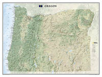
2012ref. 1-1597752401Natl Geographic Society Maps 2012. Map. New. rol map edition. 1 pages. 31.90x1.30x1.30 inches. Natl Geographic Society Maps unknown