12.070 resultados
37 x 48 cm. (Blatt: 46 x 57 cm). *Zeigt das Gebiet des Bistums Osnabrück, links unten mit einer kleinen kolorierten Ansicht in Kartusche. - Die kleine Ansicht und die Kartuschen teilweise koloriert. Sauber und sehr gut erhalten. Breitrandi. Landkarten de
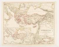
ref. 174950Gotha.: Justus Perthes. Map with original colour and outline hand-colour 32.2 x 40 cm text in German five inset maps central fold slight marginal toning and spotting on the verso but in very good condition. A most handsome and highly detailed map detailing the Eastern provinces of the Byzantine/Roman Empire in the time of the Roman Emperor Justinian 527-565. The inset maps depict Carthage Rome Constantinople Naples and a Western continuation of the main map originally issued for the "Hand-Atlas für die Geschichte des Mittelatters und die Neueren Zeit" . Justus Perthes. unknown
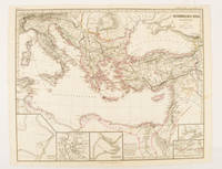
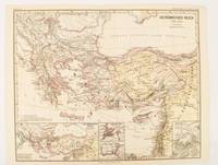
1874ref. 174914Gotha: Justus Perthes. 1874. Map with original colour and outline hand-colour 32.2 x 40 cm three inset maps text in German central fold slight marginal toning in very good condition. A most handsome map detailing the Eastern Roman Empire from the immigration of Hungarians in Ponnonia around 895 to the subjugation of the Bulgarian Empire by Emperor Basilius in 1019. The inset maps depict Divisions of the Empire Palestine and the Themata around Propontis present day Sea of Marmara issued for the "Hand-Atlas für die Geschichte des Mittelatters und die Neueren Zeit". . Justus Perthes unknown
1876ref. 174911Gotha: Justus Perthes. 1876. Map with original colour and outline hand-colour 32.2 x 40 cm text in German four inset maps central fold slight marginal toning and spotting on the verso but in very good condition. A most handsome and highly detailed map detailing the Eastern provinces of the Byzantine/Roman Empire before the Fourth Crusade. The inset maps depict Constantinople Divisions of the Empire and Antioch issued for the "Hand-Atlas für die Geschichte des Mittelatters und die Neueren Zeit" . Justus Perthes unknown
1974[12], 87 pages. Bilingual English/French. Printed upon glossy stock. Illustrated throughout in blue and brown. "From its very beginning to the present time, the history of the nation's capital unfolds from the cartographical material housed in the National Map Collection. The collection includes over three hundred maps directly relating to the Ottawa area; the selected maps reproduced in this book tell the highlights of the story. A list of Ottawa area maps appears in the appendix. This list should be of great value to historical researchers and all others interested in Canada's capital." - Preface. Moderate external wear. Contents clean and unmarked. A sound copy of this informative reference. Bishop p.36. Book
1999No marks or inscriptions. A lovely clean very tight copy with bright unmarked boards and no bumping to corners. Dust jacket not price clipped or marked or torn with slight creasing to edges and traces of storage. 208pp. Ottawa from her birth to the present day in very well captioned photographs. Scarce in the UK.
1977No marks or inscriptions to contents. Very faint creasing to covers, none to spine. A very clean very tight copy with very lightly marked boards, minor rubbing to edges and no bumping to corners. 192pp.
ref. 69649, Europese Bibliotheek / Het Laatste Nieuws, 1974 Softcover, pagina's niet genummerd, 14 x 20 cm, NL. *Goede staat.
Hardcover in-8 oblong (21x15cm), 168 pp. entierement illustrees en n&b, cartonnage illustre de l"editeur.- ISBN 9028800638 Excellent etat - VG++. [NV-29] Text in French + Flemish
ref. 872821988, 208 p., broché, avec un envoi de l'auteur, des pliures sur les plats, bords de la couverture frottés, intérieur propre.
1942ref. 27092A.A. Knopf New York 1942 HARDBACK NODustjacket 1942 Stated 1st EDITION First Printing NF/NF NOJACKET Dates Match on title & Copyright pg bound in GREEN buckram cloth with Gilt design & title 304 pages of clean bright highly illustrated text with no dust jacket Title and a decoration device are embossed into the front cover in bright gilt. Title Author's name as well as two decorative devices are embossed into the spine in bright gilt. Interior nice tight clean Light Wear Fox Index. Signed by Authors. 1st Edition. Hardcover. Near Fine/No Jacket. A.A. Knopf, New York, hardcover
1869524p. + Plus Engraved Frontis, map and full page plates. Large 8vo. Disbound. ". Over the plains - over the mountains - through the great interior basin-over the Sierra Nevadas-to and up and down the Pacific coast. With details of the wonderful natural scenery, agriculture, mines, busines, social life, progress, and prospects of Colorado, Wyoming, Utah, Idaho, Montana, Nevada, California, Oregon, Washington, and British Columbia; including a full description of the Pacific Railroad; and of the life of the Mormons, Indians, and Chinese." Rader 432; Flake 767; Sabin 7079. AMERICANA BOX 6
1983Signed and inscribed by author atop first blank leaf. xii, 322 pages. Bibliography. Index. Generously illustrated with black and white reproductions of archival photos. Presents the history of this community on the eastern shore of Georgian Bay in the Parry Sound District. Chapters include: The French; The Fur Trade; The Cartographers; Nineteenth Century Transients; The Loggers; The Fishermen; The Hotels; The Summer People; Pointe au Baril Station; The Islanders' Association; The Arts; and more. Average wear. Binding intact. A sound copy of this informative local history. Book
1953ref. 2083002116202803School Maps KK Educational Maps Study Group Edited by Kiyoshi Nobutoki Gakuhiko Miyanaga/Sashie Nishihara Hiroshi 1953. Soft Cover. Fine. The book is in fine condition. School Maps KK Educational Maps Study Group Edited by Kiyoshi Nobutoki Gakuhiko Miyanaga/Sashie Nishihara Hiroshi paperback
1978No marks or inscriptions and no creasing to covers. A very clean very tight copy with bright unmarked boards, one staple loose and no bumping to corners. Very large folded map in rear pocket in excellent condition. 48pp. A guide to leisure and sports opportunities in Cheshire. Undated, refers to 1979 in the future.
ref. mon0000499419Collins 07/02/2019 00:00:01. map. Very Good. 0.7994 in x 13.9894 in x 9.0931 in. Collins unknown
ref. SLIVCN-3760361290423KEROZENN
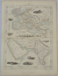
1850ref. 177525London.: The London Printing and Publishing Company. circa1850s. Lithographed map with original outline hand colour 33 x 24.5 cm including border and captions seven vignette illustrations two reference keys decorative border central fold light toning mainly at the central fold and to the verso of the sheet in very good condition preserved in a window mount. Attractive decorative map with fine vignettes of the London Post Office Suez Bombay Madras. Aden Malta Gibraltar and a wonderful camel train led by a carriage and horses crossing North Africa originally by the great mapmaker and publisher John Tallis. The two reference keys note steam packet routes railways electric telegraph and the Suez Canal. . The London Printing and Publishing Company. unknown
19981st edition. One pop-out map in card covers. Fine condition. ISBN 1841390070. 19241. eng
ref. 0540089451.Gpaperback. Good. Access codes and supplements are not guaranteed with used items. May be an ex-library book. paperback
ref. 38009901Korea late 18th-early 19th century 1780-1810. Eight color gouache pastel tinted maps ca. 57.5 x 90.1 cm.contemporary re-backing very solid clean examples complete set of all provinces hand-painted gouache manuscripts. RARE & OBSCURE . . . . A RARE & COMPLETE SET OF ANTIQUARIAN MANUSCRIPT KOREAN . . . YI PERIOD PROVINCIAL MAPS . . "P'ALTO CHIDO" OR "EIGHT PROVINCES MAPS" . . . DELUXE ELEPHANT FOLIO SIZE SHEETS . . . HAND-COLORED GOUACHE PASTELS . This is a very RARE & COMPLETE set of eight Korean provincial manuscript maps. Drawn circa 1780-1810 by an unsigned Korean cartographer. These maps are of historical importance giving place names isolating the time frame. . Painted on very thin finely hand-made mulberry-fiber tissue paper contemporary re-backed with a stiff hand-made paper. Beautifully hand-painted & colored in gouache pastels. . The record shows several reliable verities of manuscript maps showing the eight ancient Korean provinces. . Commonly these maps had no title cartographer's name date or other critical bibliographic colophon data. This is a common theme with Korean manuscript maps. . Political divisions of Korea are by and large mostly stable making name comparisons easier. . PROBABLE MAP TITLES INCLUDE: . a. The "SINJUNG-TONGGUK-YOJI-SUNGNAM:" "EIGHT SEPARATE MAPS EACH SHOWING ONE COMPLETE PROVINCE OF THE EIGHT KOREAN PROVINCES similar in intention to the "P'ALTO CHIDO." . The eight provinces were established during the Chosen dynasty 1392-1910 alternately and commonly called the Yi dynasty. . The eight provinces are from the north to south: . 1. Hamgyong 2. P'yong'an 3. P'yongyang 4. Kangwon 5. Hwanghae 6. Kanghwa 7. Kyongsang 8. Cholla'ungch'ong . During the Sejo reign 1455-68 Yang Songji made the first "P'Alt-do "P'ALTO CHIDO" type maps of the eight provinces this type and style became the "standard" for future examples. There after his style and format were copied by others for centuries. . b. A second version and style of the above eight provinces maps is called "TONGGUK CHIDO: MAP OF THE EASTERN COUNTRY i.e. KOREA" showing a compressed northern frontier along Manchuria the characteristic "CHONG CH'OK" style. . c. A third similar map: "P'ALDO-CHONGDO: A SINGLE MAP SHOWING THE EIGHT PROVINCES OF KOREA." . These maps are pictorially beautiful and artistically drawn in detail. Graphics expressing a primitive naive folk charm depicts prominent geological landscape features. Mountain ranges hills forests in green streams/rivers blues political district seats distinctively painted cartouches box-like in various differing colors for each province. Roads paddy coastal shore line & islands in blue tints with other features nicely colored. . There are a large number of name throughout each map all written in Hanzi traditional Chinese characters called "Hanja" in Korean as was the common practice at that time for Koreans. There are no Hangul characters at all. The Hanja identify navigational directions names of surrounding ocean harbors beaches geographical names city towns villages mountains rivers roads and the like. . Each of the eight maps illustrates a complete single province. Within each of the various political divisions and boundaries outlined and named. . RARITY OF KOREAN ANTIQUITIES: Antiquarian Korean examples are sparse when compared to items of the same period in China and Japan. Korean works are less than 10% of those created elsewhere. . Fewer Korean items were made survived and preserved. The attrition rate: bad weather unstable ancient mud building structures fires natural disasters earthquakes war and other factors diminished the remaining examples. . Those the numbers that come to marked are steadily reduced while the value continues to appreciate. Many never return to market when acquired by institutions or private collectors who eventually donate to museums. . DATING THESE MAPS: These were mostly undated. . There are three possible methods of dating. . a. BY PLACE NAME: there are details in the reference books about county seat names being colored or put in various kinds of 'boxes' on the map depending on that according to the resources approximate dates can be derived. . b. PAPER TECHNOLOGY & FIBERS: Koreans have been using hand-made mulberry bark and fiber paper from the Zhenguan period AD 627-649 printing Buddhist sutras by woodblocks on similar kinds of paper. . These two technologies papermaking and woodblock printing was transmitted to Japan around 700 AD. . Since that time both Koreans & Japanese have utilized mulberry paper Washi in Japanese to woodblock print and paint a large variety of items including maps books and single page works. . By comparing the paper of these maps with known dated printed Japanese books a very close approximate date can be derived. . These Korean map papers are nearly identical to dated woodblock-printed Japanese examples we have. It is therefore highly possible these maps were painted on hand-made mulberry paper from circa 1780-1810 period. . In ancient times sheet size was limited to a small size then joined to other sheets to create a large size single sheet. These maps are of that format. See McCune below where he states the kind of paper used which matches our examples. . CONDITION: Per McCune we summarize: as usual these maps were folded several times from their creation time so they could be safely stored and carried in small 'book' format in covers with a tied string. See McCune below. . Being painted on very fine & thin hand-made mulberry paper most all examples were eventually re-backed. Ours as typical have period re-backing using the same character hand-made mulberry fiber paper of a thicker quality. . They are well preserved however nevertheless as usual there remains some old original wear at the folds the expected light water stains dustiness with other typical very minor flaws for an item of this grand size being 200 years old. These do not detract from the overall excellent impression and stunning appeal. . RARITY: . The complete set is RARE! The work is nicely executed in a firm hand with artistic value illustrating artistically hills mountains and other features of the map pictorially. It is not only a map but a work of art. Tastefully colored in subtle pastels nice representation of water rives and sea. . Such early and beautifully artistic examples seldom come to market. . A RARE AND FRESH EXAMPLE NEVER BEEN ON THE MARKET IN THE LAST 120 YEARS ! . PROVENANCE: These items were acquired from a former missionary's estate who was stationed in Korea from circa 1900-1930's. They have been in this private collection since and have never been on the market. . Color scans are posted to our website. . REFERENCES: . TOOLEY Ronald V. et al.: Article: Shannon McCune: SOME KOREAN MAPS pp.70-102 with illustrations. McCUNE Shannon.: KOREAN MAPS OF THE YI DYNASTY KOREAN CULTURE Korean Consulate General L.A. Ca. Sept. 1983 pp.21-31 34 back cover color plate color & b.w. illustrated. . He discusses "P'ALTO CHIDO""EIGHT PROVINCES MAP" origins maps without scale and were copies of a Korean scholar named Won his title was: Haksaeng works based on Chong Ch'ok's 1390-1475 TONGGUK CHIDO MAP OF THE EASTERN COUNTRY then modified by Won to be the more typical "P'ALTO CHIDO" "EIGHT PROVINCES MAP" but in his new style. This new style clearly resembles our maps in layout format color of county seats and similar boxes around them and other critical details. KOREAN CONSUL GENERAL KOREAN CULTURE September 1983 pp.21-31 34 color map on back cover color and b.w. illustrated. . It was from these maps that the later versions similar to ours eventually emerged mostly by Imperial Order by the ".Yi Dynasty court specifically decreed that both magistrates and governors should prepare up-to-date maps of their territories udder their supervision." p.25. HARLEY J.B. ed. et al.: CARTOGRAPHY IN THE TRADITIONAL EAST AND SOUTHEAST ASIAN SOCIETIES. Ahead of Title: THE HISTORY OF CARTOGRAPHY Vol. 2 Book 2 an excellent article by Gari Ledyard: CARTOGRAPHY IN KOREA pp. 235-345239 figures 10.23 10.24 et al. NAKAMURA Hiroshi.: EAST ASIA IN OLD MAPS. . --. NIHON KO CHIZU TAISEI: GREAT COLLECTION OF OLD JAPANESE MAPS MONUMENTA CARTOGRAPHICA JAPONICA . --. OLD CHINESE WORLD MAPS PRESERVED BY THE KOREANS. Article in IMAGO MUNDI IV 1958. LEE Chan. CH'AN Yi.: OLD MAPS OF KOREA. Han'guk ko chido. By: Ch'an Yi Hong-gyu Che Han'guk Tosogwanhak Yon'guhoe. He discusses and illustrates a good number of similar examples. On pp.226-27 he outlines an early Yi Dynasty example of: THE MAP OF EIGHT provinces found in TONGGUK YOJI SUNGNAM Chong Sang-gi's Tongguk Chido. These manuscripts were on large paper one province per sheet. Many other fine related examples are illustrated & discussed. . --. OLD MAPS OF KOREA: HISTORICAL SKETCH. He traces the early origins of Early Yi dynasty1392-1910 Eight Provinces Map origins and progressions excellent lucid article with illustrations and references to Yi HOE's MAP OF EIGHT PROVINCES. Excellent essay on provincial maps. SHIN Michael D. ed.: KOREAN HISTORY IN MAPS: From Prehistory to the Twenty-First Century. British Museum similar examples cited: commons-wikimedia-org/wiki/Category:Room_67_British_Museum# /media/File:Map_of_the_Jeolla_Province_British_Library_c.27. f.14_fol.12_n02.jpg Library of Congress: Young Il Kim: dong-kookyu-do: A RECENTLY DISCOVERED MANUSCRIPT OF A MAP OF KOREA. Imago Mundi vol.21 1967 pp.31-49 illustrated. . . unknown
2012ref. 1-1597751189Natl Geographic Society Maps 2012. Map. New. lam map edition. 1 pages. 46.00x30.00x2.00 inches. Natl Geographic Society Maps unknown
2010ref. DADAX1566958504National Geographic 2022-01-01. 2022. map. New. 4.60x0.30x10.30. Buy with confidence. Excellent Customer Service & Return policy. National Geographic unknown
2014ref. 1-1597755834Natl Geographic Maps 2014. Map. New. lam map edition. 1 pages. 18.50x2.00x2.00 inches. Natl Geographic Maps unknown
2020ref. 1-1566958504Natl Geographic Society Maps 2020. Paperback. New. fol map edition. 132 pages. 9.25x4.25x0.50 inches. Natl Geographic Society Maps paperback