RENAUD Alexandre (traduction)Livre Rare Book
11.756 resultados
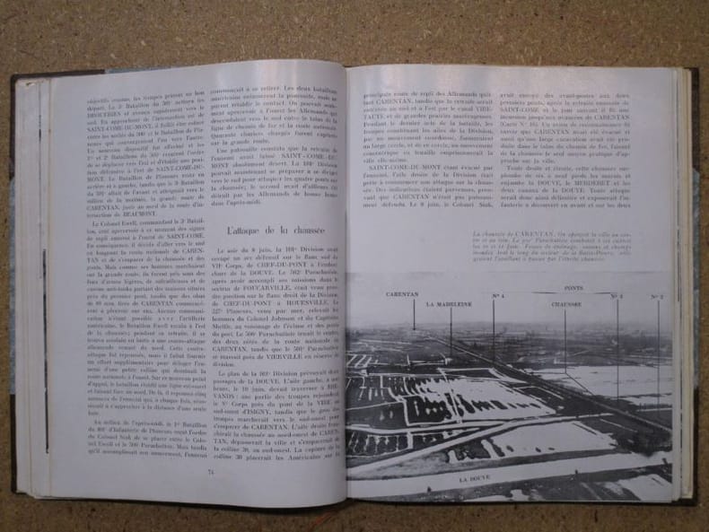
ref. 117558Editions Leclerc Imprimeur, Saint-Lo, Edité en Amérique par La Division historique du Département de l'Armée, traduit par Alexandre Renaud, sans date, VIII-197 p. et XIV cartes in fine, demi-maroquin à coins marron, environ 28x22cm. Une tache discrète sur le mors-peau du premier plat, premier plat d'origine découpé et contrecollé, un dessin au stylo sur la page de titre, de pâles rousseurs, certaines pages sont un peu froissées, la carte I a été restaurée, de petites déchirures sur les bords des cartes. Bon état pour le reste.
1987No marks or inscriptions. A lovely clean crisp tight copy with bright boards and no bumping to corners. Dust jacket not price clipped or torn with a little light creasing to edges. 160pp. A very personal guided tour of the world's largest country by it's most famous 'grandson'. This is an amusing and attractive book which also opens the door to a Russia only a few have been able to see and appreciate. Over 100 original photos, many taken by the author himself.
Colour-printed map, 730 x 560 mm. Scale 1:1,000,000. On verso: legend, aeronautical information, and index map. First edition. - Pilot's map of Wadi Sirhan in the border region of Iraq, Saudi Arabia and Transjordan. It shows international boundaries populated places, roads and tracks, railways, wireless telegraph stations, forts, wadis, wells, vegetation and terrain features. Shows also parts of Transjordan and Iraq, including the zigzagging border between Saudi Arabia and Transjordan. - In excellent condition.
Colour printed map, 765 x 565 mm. Scale 1:1,000,000. On verso aeronautical symbols and world aeronautical chart index. Third edition. - Pilot's map of the Suez region with the 1949 Armistice border, the de facto borders of the State of Israel from 1949 until the Six-Day War in 1967. In addition, the chart shows parts of the Mediterranean, the Gulf of Suez and the Gulf of Aqaba, and details major cities including Cairo, Port Said, al-Mansura, al-Fayyum, and Jerusalem, as well as main roads, wadis, and landmarks such as Saint Catherine's Monastery on Mount Sinai. - Very well-preserved.
1650Rarissima ristampa della lastra anonima - attribuita ad Antonio Lafreri, databile al 1555/60. Esemplare nel quarto stato di quattro descritto in Bifolco-Ronca, pagina 2377, con l'indirizzo di Jollain. In alto a sinistra l’iscrizione Urbis Rome totius olim orbis domitricis, situs: cum adhuc extantibus, sacrosancte vetustatis monumentis PIRRHO LIGORIO NEAP. INVENTOR. Orientazione nei quattro lati al centro con il nome dei punti cardinali SEPTENTRIO, MERIDIES, ORIENS, OCCIDENS, il nord a sinistra. Anonima pianta prospettica della città, basata sulla pianta di Pirro Ligorio, edita da Michele Tramezzini nel 1552. La pianta è inserita in alcuni esemplari dello Speculum Romanae Magnificentiae di Antonio Lafreri, al quale, pertanto, viene attribuita. Il grande interesse storico di questa pianta non è dato dall’opera stessa, una semplice copia del lavoro del Ligorio, ma è rappresentato dalle tirature successive di questa lastra. Il secondo stato, databile alla seconda metà del XVII secolo, è completamente emendato ed arricchito da toponomastica in lingua francese. Viene inserita anche una lunga descrizione della città, sempre in lingua francese. Alla morte di Antonio Lafreri (1577), i due terzi delle lastre furono divisi tra i nipoti Stefano e Claudio Duchetti. Il restante terzo venne suddiviso tra più editori. Questa lastra, quindi, potrebbe avere preso la via di Parigi, dove venne ristampata circa un secolo dopo. In alternativa, la carta potrebbe essere stampata Roma ed emendata in lingua francese. Tale edizione viene descritta da Hülsen (1915), che la annovera tra le “Copie e ristampe”, come "Incisa nel sec. XVII ex.ovvero XVIII. Ne vidi una copia presso il sig. Lang nel 1914" (la libreria antiquaria Lang di Roma). Un altro esemplare, che tuttavia potrebbe essere lo stesso citato da Hülsen, è descritto nella biblioteca della British School of Rome, appartenuto alla celebre collezione di Thomas Ashby (1874-1931), direttore dell’accademia dal 1906 al 1925. Sempre Hülsen cataloga lo stato finale dell’opera, con l’indirizzo dell’editore francese Francois Jollain. L’opera appartiene allo Speculum Romanae Magnificentiae, la prima iconografia della Roma antica. Lo Speculum ebbe origine nelle attività editoriali di Antonio Salamanca e Antonio Lafreri (Lafrery). Durante la loro carriera editoriale romana, i due editori - che hanno lavorato insieme tra il 1553 e il 1563 - hanno avviato la produzione di stampe di architettura, statuaria e vedutistica della città legate alla Roma antica e moderna. Le stampe potevano essere acquistate individualmente da turisti e collezionisti, ma venivano anche acquistate in gruppi più grandi che erano spesso legati insieme in un album. Nel 1573, Lafreri commissionò a questo scopo un frontespizio, dove compare per la prima volta il titolo Speculum Romanae Magnificentiae. Alla morte di Lafreri, due terzi delle lastre di rame esistenti andarono alla famiglia Duchetti (Claudio e Stefano), mentre un altro terzo fu distribuito tra diversi editori. Claudio Duchetti continuò l’attività editoriale, implementando le lastre dello Speculum con copie di quelle “perdute” nella divisione ereditaria, che fece incidere al milanese Amborgio Brambilla. Alla morte di Claudio (1585) le lastre furono cedute – dopo un breve periodo di pubblicazione degli eredi, in particolare nella figura di Giacomo Gherardi - a Giovanni Orlandi, che nel 1614 vendette la sua tipografia al fiammingo Hendrick van Schoel. Stefano Duchetti, al contrario, cedette le proprie matrici all’editore Paolo Graziani, che si associò con Pietro de Nobili; il fondo confluì nella tipografia De Rossi passando per le mani di editori come Marcello Clodio, Claudio Arbotti e Giovan Battista de Cavalleris. Il restante terzo di matrici della divisione Lafreri fu suddiviso e scisso tra diversi editori, in parte anche francesi: curioso vedere come alcune tavole vengano ristampate a Parigi da Francois Jollain alla m... A very rare map of the city, published in Paris in the mid-seventeenth century using the plate made in Rome by Antonio Lafreri. Example of the fourth state of four, with the Jollain's imprint. The map is based on that of Pirro Ligorio, 1552, edited by Michele Tramezini in Rome, and its subsequent and numerous variants. In the upper left the inscription Urbis Rome totius olim orbis domitricis, situs: cum adhuc extantibus, sacrosancte vetustatis monumentis PIRRHO LIGORIO NEAP. INVENTOR. Orientation in the four sides to the center with the name of the cardinal points SEPTENTRIO, MERIDIES, ORIENS, OCCIDENS, the north on the left. Anonymous map of the city, based on the work byPirro Ligorio, published by Michele Tramezzini in 1552. The ma is inserted in some of the Speculum Romanae Magnificentiae of Antonio Lafreri, to which therefore it is attributed. The great historical interest of this map is not given by the work itself, a simple copy of Ligorio's work, but is represented by the subsequent issues of this plate. The second state, datable to the second half of the seventeenth century, is completely amended and enriched by toponymy in French. A long description of the city is also included, again in French. It is known that, at the death of Antonio Lafreri (1577), two thirds of the plates were divided between his nephews Stefano and Claudio Duchetti. The remaining third was divided among several publishers. This plate therefore may have taken the road to Paris, where it was reprinted about a century later. This edition is described by Hülsen (1915), who lists it among the "Copies and reprints", as "Engraved in the seventeenth century ex.ovvero XVIII. According with Bifolco-Ronca this is the final state of the work, with the address of the French publisher Francois Jollain. The work belongs to the Speculum Romanae Magnificentiae, the earliest iconography of ancient Rome. The Speculum originated in the publishing activities of Antonio Salamanca and Antonio Lafreri (Lafrery). During their Roman publishing careers, the two editors-who worked together between 1553 and 1563-started the production of prints of architecture, statuary, and city views related to ancient and modern Rome. The prints could be purchased individually by tourists and collectors, but they were also purchased in larger groups that were often bound together in an album. In 1573, Lafreri commissioned a frontispiece for this purpose, where the title Speculum Romanae Magnificentiae appears for the first time. Upon Lafreri's death, two-thirds of the existing copperplates went to the Duchetti family (Claudio and Stefano), while another third was distributed among several publishers. Claudio Duchetti continued the publishing activity, implementing the Speculum plates with copies of those "lost" in the hereditary division, which he had engraved by the Milanese Amborgio Brambilla. Upon Claudio's death (1585) the plates were sold - after a brief period of publication by the heirs, particularly in the figure of Giacomo Gherardi - to Giovanni Orlandi, who in 1614 sold his printing house to the Flemish publisher Hendrick van Schoel. Stefano Duchetti, on the other hand, sold his own plates to the publisher Paolo Graziani, who partnered with Pietro de Nobili; the stock flowed into the De Rossi typography passing through the hands of publishers such as Marcello Clodio, Claudio Arbotti and Giovan Battista de Cavalleris. The remaining third of plates in the Lafreri division was divided and split among different publishers, some of them French: curious to see how some plates were reprinted in Paris by Francois Jollain in the mid-17th century. Different way had some plates printed by Antonio Salamanca in his early period; through his son Francesco, they goes to Nicolas van Aelst's. Other editors who contributed to the Speculum were the brothers Michele and Francesco Tramezzino (authors of numerous plates that flowed in part to the Lafreri printing house), Tommaso Barlacchi,...
1716Pianta a proiezione mista, orientata con il nord a sinistra, ripresa dalla pianta di Giovan Battista Falda. "E' una copia della pianta di Johannes De Ram senza alcun aggiornamento. In alto a destra lo stemma di Clemente XI (1700-1721). Sebbene stampata intorno al 1720 raffigura la città alla fine del Seicento, come avviene per un cospicuo nucleo di piante derivate dal Falda ed edite nel Nord Europa in questo periodo, nelle quali tutti i cambiamneti si concentrano nei nuovi apparati decorativi e non nel contenuto della pianta stessa" (cfr. Marigliani p. 229, n. 133). La carta fu realizzata da Homann per il suo Grosser Atlas. Johann Baptist Homann è stato un geografo e cartografo tedesco; nel 1702 fondò la sua casa editrice. Homann acquisì fama come uno dei principali cartografi tedeschi, e nel 1715 fu nominato geografo imperiale dall'imperatore Carlo VI. Nello stesso anno fu anche nominato membro dell'Accademia Prussiana delle Scienze a Berlino. Nel 1716 Homann pubblicò il suo capolavoro Grosser Atlas ueber die ganze Welt. Numerose mappe furono redatte in collaborazione con l'incisore Christoph Weigel. Homann morì a Norimberga nel 1724. Gli successe suo figlio Johann Christoph (1703-1730). L'azienda continuò dopo la sua morte come azienda degli eredi Homann, gestita da Johann Michael Franz e Johann Georg Ebersberger. Dopo successivi cambiamenti nella gestione, l'azienda si sciolse nel 1852. Acquaforte, bella coloritura coeva editoriale, in buono stato di conservazione. Mixed projection map, oriented with north on the left, based on the map of Giovan Battista Falda. It is a close copy of the map of Johannes De Ram without any update. In the upper right corner is the coat of arms of Clemente XI (1700-1721). Although printed around 1720 it depicts the city at the end of the seventeenth century, as is the case for a large group of maps derived from Falda and published in Northern Europe in this period, in which all the changes are concentrated in the new decorative apparatus and not in the content of the map itself (see Marigliani p. 229, n. 133). The map was made by Homann for his Grosser Atlas. Johann Baptist Homann was a German geographer and cartographer; in 1702 he founded his own publishing house. Homann acquired renown as a leading German cartographer, and in 1715 was appointed Imperial Geographer by Emperor Charles VI. In the same year he was also named a member of the Prussian Academy of Sciences in Berlin. In 1716 Homann published his masterpiece Grosser Atlas ueber die ganze Welt; numerous maps were drawn up in cooperation with the engraver Christoph Weigel the Elder. Homann died in Nuremberg in 1724 and was succeeded by his son Johann Christoph (1703-1730). The company carried on upon his death as Homann heirs company, managed by Johann Michael Franz and Johann Georg Ebersberger. After subsequent changes in management the company folded in 1852. Etching with fine original colour, good condition. Huelsen (1915): n. 124a; Scaccia Scarafoni (1939): n. 210; C. Marigliani, "Le Piante di Roma delle collezioni private", tav. 133.
1575Pianta archeologica di Roma, a proiezione verticale obliqua, orientata con il nord in alto.La pianta deriva da quella che Pirro Ligorio disegna per l'editore Michele Tramezzino nel 1552. Si tratta della prima derivazione stampata all'estero ed è ridotta leggermente nelle dimensioni. Erroneamente viene indicata come data d'esecuzioni il 1570, invece del 1552. Appare per la prima volta nel 1575, inserita nel Civitates Orbis Terrarum, il primo atlante devoto esclusivamente alle piante e vedute delle principali città del mondo. L’opera è inserita nel Civitates Orbis Terrarum, il primo atlante devoto esclusivamente alle piante e vedute delle principali città del mondo. Il primo volume delle Civitates Orbis Terrarum fu pubblicato a Colonia nel 1572. Il sesto e ultimo volume apparve nel 1617. Questo grande atlante di città – cartografia urbana - curato da Georg Braun e inciso in gran parte da Franz Hogenberg, conteneva 546 prospettive, vedute a volo d'uccello e vedute cartografiche di città di tutto il mondo. Franz Hogenberg realizzò le tavole dei primi quattro volumi e Simon van den Neuwel (Novellanus, attivo dal 1580) quelle dei volumi V e VI. Georg Braun (1541-1622), un ecclesiastico di Colonia, fu il principale redattore dell'opera e fu molto aiutato nel suo progetto dalla vicinanza e dal continuo interesse di Abraham Ortelius, il cui Theatrum Orbis Terrarum del 1570 fu, come raccolta sistematica e completa di mappe di stile uniforme, il primo vero atlante. Le Civitates, in effetti, erano destinate ad accompagnare il Theatrum, come indicato dalla somiglianza dei titoli e dai riferimenti contemporanei sulla natura complementare delle due opere. Tuttavia, le Civitates erano progettate per avere un approccio più popolare, senza dubbio perché la novità di una raccolta di piante e vedute di città rappresentava un'impresa commerciale più rischiosa di un atlante mondiale, per il quale c'erano stati diversi precedenti di successo. Franz Hogenberg (1535-1590) era figlio di un incisore di Monaco che si era stabilito a Malines. Incise la maggior parte delle tavole del Theatrum di Ortelius e la maggior parte di quelle delle Civitates, e potrebbe essere anche indicato come il responsabile dell'origine del progetto. Oltre un centinaio di artisti e cartografi diversi, il più importante dei quali fu l'artista di Anversa Georg Hoefnagel (1542-1600), fornirono i disegni per le tavole delle Civitates. Hoefnagel non solo contribuì alla maggior parte del materiale originale per le città spagnole e italiane, ma rielaborò e modificò anche quello di altri collaboratori. Dopo la morte di Hoefnagel, il figlio Jakob continuò il lavoro per le Civitates. Gli autori della raccolta si proponevano di raffigurare "non icones et typi urbium", cioè non immagini generiche e tipizzate, "sed urbes ipsae admirabili caelaturae artificio, spectantium oculis subiectae appareant": non intendeva alludere o idealizzare, ma rappresentare fedelmente sulla carta, riprodurre esattamente, e in tempo reale, ciò che l'occhio vede, come annunciato nella prefazione al primo volume delle Civitates Orbis Terrarum. Incisione in rame, finemente colorata a mano, in ottimo stato di conservazione. Archeological map of Rome published in the Civitates Orbis Terrarum of 1575.The map is a close copy of the Pirro Ligorio map of Rome (1552, published by Michele Tramezzino) reduced in size. Latin text edition. The work is included in the Civitates Orbis Terrarum, the first atlas devoted exclusively to plans and views of the world's major cities. Printed in six volumes between 1572 and 1617 it was so successful and widespread that several editions translated into Latin, German and French were printed. The first volume of the Civitates Orbis Terrarum was published in Cologne in 1572. The sixth and the final volume appeared in 1617. This great city atlas, edited by Georg Braun and largely engraved by Franz Hogenberg, eventually contained 546 prospects, bird-eye views and map views of cities from all over the world. Fransz Hogenberg produced the plates for the first four books, and Simon van den Neuwel (Novellanus, active since 1580) those for volumes V and VI. Georg Braun (1541-1622), a cleric of Cologne, was the principal editor of the work, and was greatly assisted in his project by the close, and continued interest of Abraham Ortelius, whose Theatrum Orbis Terrarum of 1570 was, as a systematic and comprehensive collection of maps of uniform style, the first true atlas. The Civitates, indeed, was intended as a companion for the Theatrum, as indicated by the similarity in the titles and by contemporary references regarding the complementary nature of two works. Nevertheless, the Civitates was designs to be more popular in approach, no doubt because the novelty of a collection of city plans and views represented a more hazardous commercial undertaking than a world atlas, for which there had been a number of successful precedents. Franz Hogenberg (1535-1590) was the son of a Munich engraves who settled in Malines. He engraved most of the plates for Ortelius's Theatrum and the majority of those in the Civitates, and may have been responsible for originating the project. Over a hundred of different artists and cartographers, the most significant of whom was Antwerp artist Georg Hoefnagel (1542-1600), engraved the cooper-plates of the Civitates from drawings. He not only contributed most of the original material for the Spanish and Italian towns but also reworked and modified those of other contributors. After Hoefnagel's death his son Jakob continued the work for the Civitates. The author set out to depict "non icones et typi urbium," that is, not generic and typified images, "sed urbes ipsae admirabili caelaturae artificio, spectantium oculis subiectae appareant": not intended to allude or idealize but to represent faithfully on paper, to reproduce exactly, and in real time, what the eye sees, as announced in the preface to the first volume of Civitates Orbis Terrarum. Copperplate with fine later hand colour, good condition. Scaccia Scarafoni p. 29, n. 22.
1574Pianta archeologica a proiezione verticale con alzato incisa da Etienne Duperac per l’editore Lorenzo Vaccari. Ricostruzione ideale della Roma Antica eseguita dal Duperac dopo un serio esame della pianta Severiana e della pianta archeologica di Pirro Ligorio, il maggiore studioso dei monumenti antichi di Roma dell’epoca. All’interno della città, è delineato ciascun edificio, riportando i nomi di quelli principali; questi includono il Colosseo, il Pantheon, le Terme di Diocleziano e il Circo Massimo. Fuori città sono contrassegnati le tenute di campagna (per esempio, i Giardini di Domiziano), i monumenti funerari (come i Mausolei di Adriano e di Augusto, ed i circhi di Nerone e Adriano). La lastra è stata intagliata dall’incisore ed editore parigino Étienne Dupérac, che si fece chiamare Stephanus durante il suo periodo di lavoro a Roma (1569-1582). Nella dedica a Carlo IX, l’autore stesso spiega come questa carta sia il frutto di quindici anni di studio di tutte le rovine e dei monumenti della Roma Antica e dei testi letterari correlati. In particolare, viene riportato un dettagliato resoconto della scoperta della pianta Severiana, i cui resti furono scoperti nella chiesa dei SS. Cosma e Damiano nel 1562. Hülsen segnala come unico esemplare originale conosciuto quello conservato al British Museum, che reca il nome dello stampatore Francesco Villamena. Inoltre, aggiunge che, nel catalogo della stamperia dei Vaccari è annoverata la “Roma antica d’otto fogli reali, intagliata per mano di Stefano Duperach Parisino”, a lui sconosciuta. Frutaz obietta giustamente che la tiratura di Villamena sia solo una ristampa, databile ai primi del ‘600, quando l’editore era attivo a Roma. Nelle nostre ricerche, abbiamo finalmente rinvenuto un esemplare originale della pianta, finora sconosciuto, che è assolutamente da identificarsi con la “Roma antica d’otto fogli reali” del catalogo Vaccari, citata da Hülsen. Infatti l’esemplare, conservato nella collezione cartografica della Newberry Library di Chicago, reca proprio l’imprint di Lorenzo Vaccari, editore anche della raccolta I Vestigi dell’Antichità di Roma Raccolti et Ritratti in Perspettiva con ogni diligentia da Stefano Dv Perac Parisino (1575). Tra il 1649 ed il 1660, Gian Giacomo de Rossi ne pubblica una ristampa, utilizzando i medesimi rami (presumibilmente acquisiti dalla bottega del Villamena), ma aggiungendo scene dell’Antica Roma e una legenda tipografica con 159 richiami a monumenti. L’opera è descritta nell’ultimo catalogo della tipografia de Rossi, redatto da Lorenzo Filippo nel 1735 (p. 16, n. 1) come “Roma Antica di Stefano du Perac Parigino intagliata a bulino da Francesco Villamena co’ trionfi de Romani antichi, intagliati a bulino da Jacopo Lauro in dodici fogli reali grandi”. Dunque le tavole aggiuntive dei trionfi sono, secondo il catalogo, incise da Giacomo Lauro. Tale attribuzione viene respinta da Ashby e quindi da Hollstein, che attribuisce la lastre a Peter de Jode. La tipografia de Rossi fu venduta da Lorenzo Filippo, costituendo il fondo principale della neonata (1738) Calcografia Camerale (poi Regia, quindi Nazionale e oggi Istituto Centrale per la Grafica), luogo in cui sono ancora conservati i rami originali, erroneamente sotto il nome di Francesco Villamena. In alto, lungo il bordo superiore, è impresso il titolo: URBIS ROMAE SCIOGRAPHIA EX ANTIQUIS MONUMENTIS ACCURATISS. DELINEATA. A sinistra lo stemma con la sigla S.P.Q.R. (Senatus Populus Que Romanus). Nel cartiglio in basso a destra, con la raffigurazione dei gemelli Romolo e Remo, troviamo incisa la dedica: KAROLO IX GALLIARUM REGI CHRISTIANISSIMO STEPHANUS DU PERAC PARISIENSIS Quanta fuerit veteris illius popuki R. potentia atque amplitudo, karole regu[m] maxime, omnes sciunt:quae autem ipsius urbis, antiquis temporibus, maiestas ac pulchritudo, non alinde melius ac certius cognosci potest, quam ex admirabilibus veterum aedifitioru[m] vestigiis, q... Vertical projection archaeological map, engraved by Etienne Duperac for the publisher Lorenzo Vaccari. Ideal reconstruction of Ancient Rome carried out by Duperac after a serious examination of the Severian map and the archaeological work by Pirro Ligorio, the greatest scholar of ancient monuments in Rome at the time. Inside the city, each building is outlined with the names of the main ones; these include the Colosseum, the Pantheon, the Baths of Diocletian and the Circus Maximus. Outside the city are marked the country estates (for example, the Gardens of Domitian), the funerary monuments (such as the Mausoleums of Hadrian and Augustus, and the circuses of Nero and Hadrian). The plate was carved by the Parisian engraver and publisher Étienne Dupérac, who called himself Stephanus during his period of work in Rome (1569-1582). In the dedication to Charles IX, the author himself explains how this work is the result of fifteen years of study of all the ruins and monuments of Ancient Rome and related literary texts. In particular, a detailed account is given of the discovery of the Severian map, the remains of which were discovered in the church of Saints Cosma and Damiano in 1562. Hülsen reports as the only known original example the one preserved at the British Museum, which bears the name of the printer Francesco Villamena. Furthermore, he adds that the catalogue of the Vaccari print shop includes the "Roma antica d’otto fogli reali, intagliata per mano di Stefano Duperach Parisino”, unknown to him. Frutaz rightly objects that the Villamena's edition is only a reprint, datable to the early 17th century, when the publisher was active in Rome. In our research, we finally found an original example of the map, hitherto unknown, which is absolutely to be identified with the "Ancient Rome of eight royal sheets" of the Vaccari catalogue, quoted by Hülsen. In fact the exemplar, preserved in the cartographic collection of the Newberry Library of Chicago, bears the imprint of Lorenzo Vaccari, publisher also of the collection I Vestigi dell'Antichità di Roma Raccolti et Ritratti in Perspettiva con ogni diligentia by Stefano Dv Perac Parisino (1575). Between 1649 and 1660, Gian Giacomo de Rossi published a reprint, using the same plates(presumably acquired from the Villamena workshop), but adding scenes from Ancient Rome and a typographical legend with 159 references to monuments. The work is described in the last catalogue of de Rossi's printing house, edited by Lorenzo Filippo in 1735 (p. 16, n. 1) as "Roma Antica di Stefano du Perac Parigino intagliata a bulino da Francesco Villamena co’ trionfi de Romani antichi, intagliati a bulino da Jacopo Lauro in dodici fogli reali grandi”. So the additional plates of the triumphs are, according to the catalogue, engraved by Giacomo Lauro. This attribution is rejected by Ashby and then by Hollstein, who attributes the plate to Peter de Jode. The de Rossi printing house was sold by Lorenzo Filippo, constituting the main fund of the newborn (1738) Calcografia Camerale (later Regia, then Nazionale and now Istituto Centrale per la Grafica), where the original plates are still preserved, mistakenly under the name of Francesco Villamena. Example of the third state of four (cfr. Bifolco-Ronca, p. 2359) with the imprint Cura et Tipis Io. Iacobi de Rubeis in Romae ad Templ. Stae. Mae. De Pace cum Privil. Sum. Pont. Excudebat Romae Io. Iacob. De Rubeis. Etching with engraving, a very good example of the De Rossi edition, with decorations and the key-numbers on the lower part; minor repairs perfectly realized, otherwise in excellent condition. Literature Bifolco-Ronca, Cartografia e topografia italiana del XVI secolo, pp. 2358-59, tav. 1214, III/IV; Destombes (1970): n. 96; Caldana (2013): n. I.12; Frutaz (1962): n. XXII e tavv. 37-50; Grelle Iusco (1996): pp. 172, 379; Hollstein (1952): IX, p. 202, nn. 403-414; Hülsen (1915): XI, pp. 60-62, nn. 56-59; Mostra Bergamo (2016): n. 72; Sca...
1618Piccola pianta di Roma proiezione obliqua, orientata col nord a sinistra. "E' evidente la derivazione di questa pianta da quella più grande del Florimi, come giustamente rilevato dalla Jatta nel catalogo Roma Veduta. In basso a sinistra si legge Romae Anno 1618 cum privilegio Summi POntifici ed a destra: Jacobus Laurus f. Sul margine inferiore una legenda di 95 numeri che prosegue nel cartiglio in alto a destra fino al n. 121" (cfr. Marigliani, p. 185). Tuttavia, ci sembra improbabile che sia derivazione del Florimi - che, tra l'altro, comprende una legenda di soli 86 numeri di legenda. Sembra più probabile la derivazione con le piante incise da Ambrogio Brambilla per il Franzini prima e per Nicola van Aelst poi (1590). Pianta tratta dall'Antiquae Urbis Splendor di Giacomo Lauro, opera per la prima volta pubblicata nel 1612, importante e ricercata raccolta di vedute e antichità romane, rappresenta il più importante lavoro del Lauro e godette di una incredibile fortuna. L'opera interamente illustrata con sintetici testi didascalici sulle bellezze e gli splendori di Roma antica e Roma moderna venne ristampata ed accresciuta. Le edizioni posteriori fanno sempre riferimento alla data di pubblicazione del 1612. La data e lo stampatore sono però dedotti dalla dedica di Giovanni Alto (jan Alten) da Lucerna, curatore del volume, ai lettori. Acquaforte e bulino, stampata su carta vergata coeva, in ottimo stato di conservazione. Bibliografia Frutaz n. 26; Scaccia Scarafoni n. 180; Huelsen 49; Roma Veduta n. 22; Marigliani p. 185, n. 90. Small map of Rome with an oblique projection, oriented with the north on the left. It is evident the derivation of this map from the larger one of Florimi, as rightly noted by Jatta in the catalog Roma Veduta. In the lower left corner it reads Romae Anno 1618 cum privilegio Summi POntifici and on the right: Jacobus Laurus f. On the lower margin a legend of 95 numbers that continues in the cartouche in the upper right up to n. 121" (cf. Marigliani, p. 185). However, it seems unlikely to us that it is a derivation of the Florimi - which, by the way, includes a legend of only 86 numbers. It seems more likely to be derived from the maps engraved by Ambrogio Brambilla for Franzini first and then for Nicola van Aelst (1590). The map is taken from Antiquae Urbis Splendor by Giacomo Lauro, a work published for the first time in 1612, an important and sought-after collection of Roman views and antiquities, it represents Lauro's most important work and enjoyed an incredible fortune. The work, entirely illustrated with concise didactic texts on the beauties and splendors of ancient and modern Rome, was reprinted and enlarged. Later editions always refer to the date of publication of 1612. The date and the printer are however deduced from the dedication of Giovanni Alto (jan Alten) from Lucerne, editor of the volume, to the readers. Etching and engraving, printed on contemporary laid paper, in excellent condition. Literature Frutaz n. 26; Scaccia Scarafoni n. 180; Huelsen 49; Roma Veduta n. 22; Marigliani p. 185, n. 90.
1755Pianta geometrica con elevazione, pubblicata a Norimberga dalla tipografia degli eredi di Johannes Baptiste Homann nel 1755. Si tratta di una rielaborazione, senza alcun aggiornamento, dell'importante rilievo di Leonardo Bufalini (1551), riportato in voga da Giovan Battista Nolli nel 1748. La legenda di 307 rimandi in latino è ripesa proprio dalla riduzione di Nolli, e ne dimostra la diretta derivazione. Tuttavia la pianta degli eredi Homann, stampata su quattro fogli e quindi di dimensioni maggiori, risulta decisamente più leggibile. "La pianta di Roma di Leonardo Bufalini è la prima rappresentazione coerente della città e la più importante raffigurazione ortogonale fino alla pianta grande di Giambattista Nolli (1748). Bufalini si occupò di tutte le fasi della sua realizzazione, dal rilievo all’incisione, impiegando un lungo tempo: sette anni, secondo Onofrio Panvinio, venti secondo l’editore Antonio Trevisi. La Pianta di Roma fu stampata presso il tipografo Antonio Blado il 26 maggio 1551 a Roma, con privilegio decennale della Repubblica di Venezia e la dedica a Carlo V e a papa Giulio III. Si tratta di un’opera monumentale: una xilografia in dodici fogli e quattro strisce laterali. Nessun esemplare della prima edizione è noto; se ne conoscono solo tre della seconda edizione, pubblicata sempre a Roma, dall’editore Antonio Trevisi da Lecce, due conservati alla Biblioteca Vaticana (di cui uno incompleto) e un terzo alla British Library di Londra. Sebbene la pianta sia basata su rilievi effettuati dall’autore con grande perizia, non mancano elementi di fantasia: molti monumenti antichi sono stati aggiunti, completati e ricostruiti liberamente. Del resto, è lo stesso autore a sottolineare questa ambivalenza, dichiarando di voler presentare “la città che oggi è abitata…aggiungendo la [città] antica, un tempo sovrana del mondo…” Bufalini incluse nella pianta anche un autoritratto in cui è raffigurato con in mano il compasso a due punte, mentre a sinistra sono rappresentati i suoi strumenti di lavoro, fra cui la squadra e la bussola nautica. Per una più completa trattazione degli strumenti di misurazione utilizzati e per l’accuratezza della pianta bufaliniana si rimanda ai numerosi studi pubblicati. La fonte primaria utilizzata da Bufalini è la Roma antica di Bartolomeo Marliano, inserita nella sua Urbis Romae Topographia, che ha lo stesso orientamento e la stessa precisione nei particolari. Fin dalla sua pubblicazione nel 1551, la pianta del Bufalini esercitò una notevole influenza sulle successive piante della città fino al 1748, anno in cui Giambattista Nolli ne pubblicò una copia ridotta insieme alla sua pianta grande, che si impose quale nuovo modello" (cfr. B/R p. 2372). Johann Baptist Homann è stato un geografo e cartografo tedesco; nel 1702 fondò la sua casa editrice. Homann acquisì fama come uno dei principali cartografi tedeschi, e nel 1715 fu nominato geografo imperiale dall'imperatore Carlo VI. Nello stesso anno fu anche nominato membro dell'Accademia Prussiana delle Scienze a Berlino. Nel 1716 Homann pubblicò il suo capolavoro Grosser Atlas ueber die ganze Welt. Numerose mappe furono redatte in collaborazione con l'incisore Christoph Weigel. Homann morì a Norimberga nel 1724. Gli successe suo figlio Johann Christoph (1703-1730). L'azienda continuò dopo la sua morte come azienda degli eredi Homann, gestita da Johann Michael Franz e Johann Georg Ebersberger. Dopo successivi cambiamenti nella gestione, l'azienda si sciolse nel 1852. Acquaforte, 4 lastre di dimensioni 495x365 mm ciascuna, stampate su altrettanti fogli di carta vergata coeva, con margini e ancora da unire, in perfetto stato di conservazione. Bibliografia Huelsen (1915), n. 3; Scaccia Scarafoni (1939), n. 136; Marigliani (2007): n. 32. Per la pianta del Bufalini: Bifolco/Ronca (2018), Cartografia e topografia italiana del XVI secolo, pp. 2372-73, tav. 1221. Geometric plan with elevation, published in Nuremberg by the printing hose of Johannes Baptiste Homann's heirs in 1755. It is a reworking, without any updating, of the important relief by Leonardo Bufalini (1551), brought back by Giovan Battista Nolli in 1748. The key-legend of 307 references in Latin is taken from Nolli's reduction, and demonstrates its direct derivation. However, the map of the Homann heirs, printed on four sheets and therefore larger in size, is much more clear. Leonardo Bufalini's map of Rome is the first coherent representation of the city and the most important orthogonal representation up to the large plan by Giambattista Nolli (1748). Bufalini took care of all the phases of its realization, from relief to engraving, using a long time: seven years, according to Onofrio Panvinio, twenty according to the publisher Antonio Trevisi. The Map of Rome was printed at the typographer Antonio Blado on May 26, 1551 in Rome, with the ten-year privilege of the Republic of Venice and dedicates it to Charles V and Pope Julius III. It is a monumental work: a woodcut in twelve sheets and four lateral strips. Although the map is based on reliefs made by the author, there is no lack of elements of fantasy: many ancient monuments have been added, completed and rebuilt freely. The primary source used by Bufalini is Bartolomeo Marliano's ancient Rome, inserted in his Urbis Romae Topographia, which has the same orientation and the same precision in detail. Since its publication in 1551, Bufalini's map exerted a notable influence on the subsequent plans of the city until 1748, the year in which Giambattista Nolli published a reduced copy together with his large plan, which became the new model. Johann Baptist Homann was a German geographer and cartographer; in 1702 he founded his own publishing house. Homann acquired renown as a leading German cartographer, and in 1715 was appointed Imperial Geographer by Emperor Charles VI. In the same year he was also named a member of the Prussian Academy of Sciences in Berlin. In 1716 Homann published his masterpiece Grosser Atlas ueber die ganze Welt; numerous maps were drawn up in cooperation with the engraver Christoph Weigel the Elder. Homann died in Nuremberg in 1724 and was succeeded by his son Johann Christoph (1703-1730). The company carried on upon his death as Homann heirs company, managed by Johann Michael Franz and Johann Georg Ebersberger. After subsequent changes in management the company folded in 1852. Etching, 4 plates 495x365 mm each, printed on as many sheets of coeval laid paper, with margins and yet to be joined, in perfect condition. Literature Huelsen (1915), no. 3; Scaccia Scarafoni (1939), n. 136; Marigliani (2007): n. 32.
1785Urbis Ichnographiam A Leonardo Bufalino Ligneis formis Evulgatam Servata Proportione contractam Atq. Aeri incsam Jo. Bapta. Nolli. . Pianta geometrica con elevazione, pubblicata a Roma dalla tipografia di Carlo Losi nel 1785. Si tratta di una rielaborazione, senza alcun aggiornamento, dell'importante rilievo di Leonardo Bufalini (1551), riportato in voga da Giovan Battista Nolli nel 1748. La legenda di 307 rimandi in latino è ripesa proprio dalla riduzione di Nolli, e ne dimostra la diretta derivazione. T "La pianta di Roma di Leonardo Bufalini è la prima rappresentazione coerente della città e la più importante raffigurazione ortogonale fino alla pianta grande di Giambattista Nolli (1748). Bufalini si occupò di tutte le fasi della sua realizzazione, dal rilievo all’incisione, impiegando un lungo tempo: sette anni, secondo Onofrio Panvinio, venti secondo l’editore Antonio Trevisi. La Pianta di Roma fu stampata presso il tipografo Antonio Blado il 26 maggio 1551 a Roma, con privilegio decennale della Repubblica di Venezia e la dedica a Carlo V e a papa Giulio III. Si tratta di un’opera monumentale: una xilografia in dodici fogli e quattro strisce laterali. Nessun esemplare della prima edizione è noto; se ne conoscono solo tre della seconda edizione, pubblicata sempre a Roma, dall’editore Antonio Trevisi da Lecce, due conservati alla Biblioteca Vaticana (di cui uno incompleto) e un terzo alla British Library di Londra. Sebbene la pianta sia basata su rilievi effettuati dall’autore con grande perizia, non mancano elementi di fantasia: molti monumenti antichi sono stati aggiunti, completati e ricostruiti liberamente. Del resto, è lo stesso autore a sottolineare questa ambivalenza, dichiarando di voler presentare “la città che oggi è abitata…aggiungendo la [città] antica, un tempo sovrana del mondo…” Bufalini incluse nella pianta anche un autoritratto in cui è raffigurato con in mano il compasso a due punte, mentre a sinistra sono rappresentati i suoi strumenti di lavoro, fra cui la squadra e la bussola nautica. Per una più completa trattazione degli strumenti di misurazione utilizzati e per l’accuratezza della pianta bufaliniana si rimanda ai numerosi studi pubblicati. La fonte primaria utilizzata da Bufalini è la Roma antica di Bartolomeo Marliano, inserita nella sua Urbis Romae Topographia, che ha lo stesso orientamento e la stessa precisione nei particolari. Fin dalla sua pubblicazione nel 1551, la pianta del Bufalini esercitò una notevole influenza sulle successive piante della città fino al 1748, anno in cui Giambattista Nolli ne pubblicò una copia ridotta insieme alla sua pianta grande, che si impose quale nuovo modello" (cfr. B/R p. 2372). Nel margine inferiore, la sottoscrizione dell'editore C. Losi e, nell'angolo opposto, quella dell'incisore Giovanni Brun. In basso, a sinistra, il Pantheon e il Foro di Nerva; a destra, l'arco di Giano quadrifronte. Acquaforte e bulino, impressi su carta vergata coeva, applicata su tela, più volte ripiegata. Astuccio di custodia originale, in cartonato. In ottimo stato di conservazione. Geometric plan with elevation, published in Rome by Carlo Losi in 1785 and engraved by Giovanni Brun. It is a reworking, without any updating, of the important relief by Leonardo Bufalini (1551), brought back by Giovan Battista Nolli in 1748. The key-legend of 307 references in Latin is taken from Nolli's reduction, and demonstrates its direct derivation. Leonardo Bufalini's map of Rome is the first coherent representation of the city and the most important orthogonal representation up to the large plan by Giambattista Nolli (1748). Bufalini took care of all the phases of its realization, from relief to engraving, using a long time: seven years, according to Onofrio Panvinio, twenty according to the publisher Antonio Trevisi. The Map of Rome was printed at the typographer Antonio Blado on May 26, 1551 in Rome, with the ten-year privilege of the Republic of Venice and dedicates it to Charles V and Pope Julius III. It is a monumental work: a woodcut in twelve sheets and four lateral strips. Although the map is based on reliefs made by the author, there is no lack of elements of fantasy: many ancient monuments have been added, completed and rebuilt freely. The primary source used by Bufalini is Bartolomeo Marliano's ancient Rome, inserted in his Urbis Romae Topographia, which has the same orientation and the same precision in detail. Since its publication in 1551, Bufalini's map exerted a notable influence on the subsequent plans of the city until 1748, the year in which Giambattista Nolli published a reduced copy together with his large plan, which became the new model. Below, left, the Pantheon and the Forum of Nerva; right, the four-sided Arch of Janus. Etching and engraving, printed on contemporary laid paper, applied to cloth, folded several times. Original slipcase, in hardback. In excellent state of preservation. Hulsen, p. 40, d. Per la pianta del Bufalini: Bifolco/Ronca (2018), Cartografia e topografia italiana del XVI secolo, pp. 2372-73, tav. 1221.
[Viaggi umbria Urbino](cm. 20) Brossura editoriale illustrata a colori. 125 + 3 con la mappa e l'indice. Stampato su carta molto peante, ricchissimo di immagini fotografiche a colori anche a doppia pagina. Presenta il Palazzo ducale, il Duomo, Il palazzio dell'università, ed organizza il giro della città in 2 itinerari. In ottime condizioni Libro
191742p. + Plus four double page maps. Inked ownership of John Mears, Talbot House. 12mo. Original stiff paper wraps, gold lettered. Slight loss on spine. SCIENCE BOX 4
ref. 1334743568.Gpaperback. Good. Access codes and supplements are not guaranteed with used items. May be an ex-library book. paperback
2002Book in mint unread condition. 132pp. For those who come to the Lake District to unwind and enjoy some time relaxing in a glorious waterside setting. This book tells you the places to go.
1973No marks or inscriptions. No creasing to covers or to spine. A very clean very tight copy with bright unmarked cream cloth boards, slight rubbing to spine ends and no bumping to corners. Dust jacket price clipped but not marked with nicks to upper and lower edges and traces of storage. 200pp. Three itineraries which take us firstly through the ancient buildings of Athens, Cape Sounion, Marathon and Delphi and then Corinth, Epidaurus, Sparta, Mycenae and Olympia.
1610Rara carta del mondo pubblicata separatamente da Luigi Rosaccio. La carta deriva dal planisfero murale di suo padre, Giuseppe Rosaccio (1597, Bifolco-Ronca n. 31). Rodney Shirley nota che “This curiously elaborate world map is to be found in a speculative world geography by Giuseppe Rosaccio... The right-hand hemisphere is surrounded by bands denoting the climates; the left-hand one by lively windheads and celestial constellations. In the centre cusp is a dyspeptic portrait of the young Duke Cosimo II de Medici, and in the spandels are circular representations of the four elements. The lower part of the engraving consists of a neatly engraved Ptolemaic map of the world and a set of spherical diagrams showing the zones, meridians, and geographical features”. La mappa è molto rara; questo è un esempio del secondo stato, con una barba aggiunta al ritratto di Cosimo de Medici. Priva di datazione, la carta risulta stampata a Firenze, dove la famiglia Rosaccio si era trasferita dopo il periodo veneziano, il 28 novembre 1606, ottenendo il privilegio della stampa per le proprie opere - vedi Casali, Il 'Teatro "del mondo. GR (ca 1530-1620) tra Firenze e Bologna, in L'Europa divisa e i nuovi mondi. Per Adriano Prosperi, II, a cura di M. Donattini - G. Marcocci - S. Pastore, Pisa 2011, p. 56. Aloisio, Aluigio, Alovigi o probabilmente Luigi Rosaccio, figlio del cosmografo Giuseppe Rosaccio, si formò a Firenze, forse con Antonio Tempesta, alla corte dei Medici. Fin dai primi anni Novanta, Giuseppe Rosaccio si stabilì a Firenze, dove il 13 luglio 1594 entrò nella compagnia dell'"Arte dei medici e speziali" (Casali, 2011, p. 56 e n. 15 p. 62) come venditore di libri, ponendosi al servizio e sotto la protezione del Granduca dal suo 'banco' aperto sulla prestigiosa Piazza del Palazzo e dedicando alcune delle sue opere più significative a Ferdinando, Cosimo II e alla granduchessa Cristina. Sempre nella città dei Medici, il 28 novembre 1606 ottenne il privilegio di stampare per le proprie opere (Casali, 2011, pp. 56 s.). Luigi Rosaccio si cimentò nell'arte incisoria, traducendo in stampa le numerose opere del padre. Nel 1610 realizzò il ciclo di illustrazioni incluse nella descrizione delle "Esequie d'Arrigo Quarto cristianissimo re di francia e di Navarra celebrate in Firenze dal Serenissimo DON COSIMO II Gran Duca di Toscana". Descritto da Giuliano Giraldi pubblicato a Firenze da Bartolomeo Sermartelli, importante come testimonianza visiva del complesso delle decorazioni più che per le qualità stilistiche e tecniche, non particolarmente brillanti. Sempre al periodo fiorentino sono legate le tre splendide carte geografiche raffiguranti l'Italia, una grande carta che precede l'Italia Nova di Giovanni Antonio Magini, la Toscana (la cosiddetta "Carta del Cavallo"), e il Piemonte. Bibliografia Shirley, The Mapping of The World, #268. Rare separately published map of the World by Luigi Rosaccio, after the of the largest World Map of his father Giuseppe Rosaccio (1597, Bifolco-Ronca n. 31). Rodney Shirley notes: “This curiously elaborate world map is to be found in a speculative world geography by Giuseppe Rosaccio... The right-hand hemisphere is surrounded by bands denoting the climates; the left-hand one by lively windheads and celestial constellations. In the centre cusp is a dyspeptic portrait of the young Duke Cosimo II de Medici, and in the spandels are circular representations of the four elements. The lower part of the engraving consists of a neatly engraved Ptolemaic map of the world and a set of spherical diagrams showing the zones, meridians, and geographical features” The map was engraved by Giuseppe’s relative Alovisio Rosaccio and is very scarce. This is an example of the second state, with a beard added to the portrait of de Medici. Without the data, the map is printed in Florence, where the Rosaccio family was transferred after the Venetian period, on 28 November 1606, obtaining the privilege of printing for their works - see Casali, Il 'Teatro "del mondo. GR (ca 1530-1620) tra Firenze e Bologna, in L’Europa divisa e i nuovi mondi. Per Adriano Prosperi, II, a cura di M. Donattini - G. Marcocci - S. Pastore, Pisa 2011, p. 56. Aloisio, Aluigio, Alovigi or probably Luigi Rosaccio, son of the cosmographer Giuseppe Rosaccio, was trained in Florence, perhaps with Antonio Tempesta, at the Medici court. Since the early nineties, Giuseppe Rosaccio settled in Florence, where on 13 July 1594 joined the company of “Arte dei medici e speziali (Art of doctors and apothecaries)” (Casali, 2011, p. 56 and n. 15 p. 62) as a seller of books, placing himself at the service and under the protection of the Grand Duke from his 'bench' opened on the prestigious Piazza del Palazzo and dedicating some of his most significant works to Ferdinando, Cosimo II and the Grand Duchess Cristina.. Still in the city of the Medici, on 28 November 1606 he obtained the privilege of printing for his own works (Casali, 2011, pp. 56 s.). Luigi Rosaccio tried his hand at engraving art, translating his father's numerous works into a print. In 1610 he made the cycle of illustrations included in the description of the “Esequie d’Arrigo Quarto cristianissimo re di francia e di Navarra celebrate in Firenze dal Serenissimo DON COSIMO II Gran Duca di Toscana”. Described by Giuliano Giraldi published in Florence by Bartolomeo Sermartelli, important as visual testimony of the complex of the decorations rather than for the stylistic and technical qualities, not particularly brilliant. Always in the Florentine period are related to the three wonderful geographic maps depicting Italy, a great map preceding the Italia Nova of Giovanni Antonio Magini, Tuscany (the so-called “Carta del Cavallo”), and Piedmont. Bibliografia Shirley, The Mapping of The World, #268.
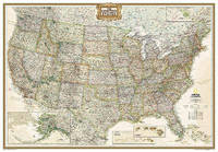
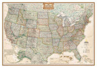
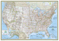
2011ref. 1-0792233794National Geographic Maps 2011. Paperback. New. lam map en edition. 1 pages. 50.00x4.33x4.33 inches. National Geographic Maps paperback
2011ref. 1-0792293215Natl Geographic Society Maps 2011. Map. New. rol map en edition. 1 pages. 50.50x2.00x1.80 inches. Natl Geographic Society Maps unknown
2012ref. 1-0792233786Natl Geographic Society Maps 2012. Map. New. lam map edition. 1 pages. 31.00x2.00x1.70 inches. Natl Geographic Society Maps unknown
ref. A9780792293217Sheet map rolled. New. unknown
ref. A9780792233794Sheet map. New. unknown
ref. A9780792283195Sheet map. New. unknown
ref. A9780792229872Sheet map. New. unknown
ref. A9780792293194Sheet map rolled. New. unknown