Maria do Socorro Mendes CA´rtesBiblio.com

11.756 resultados
ref. ria9786209420948_inpPaperback. New. New Book; Fast Shipping from UK; Not signed; Not First Edition; Die Pflege unter dem Gesichtspunkt der ganzheitlichen Betreuung umfasst die Verknüpfung verschiedener Kenntnisse und Tätigkeiten die miteinander verbunden sind und den Menschen als Ganzes einzigartig und unteilbar biopsychosozial be paperback
198527 pages. List of sources. Oblong 13.5" x 9". "Commemorates the beginning of the second millennium of Christianity in Ukraine-Rus' with a cartographic survey of three millennia of Ukrainian history." - from half-title page. Clean and unmarked with moderate wear. A quality copy. Book
1020 x 850 mm. Kupferstichkarte in 24 Segmenten, auf Leinen aufgezogen und gefaltet. In Schuber. Zeigt das Gebiet zwischen Amsterdam, Kopenhagen, Königsberg, Warschau, Peterwardein, Triest, Lyon und Paris, jeweils mit der Jahreszahl der militärischen Auseinandersetzung neben dem Ort.
ref. 1933911387.Gmap. Good. Access codes and supplements are not guaranteed with used items. May be an ex-library book. unknown
Very Good English Türkiyemiz. Kultur ve sanat dergisi. No: 56 Year: 18 Ekim 1988. [Special issue: Galata, Pera, Beyoglu]., Paperback. Pbo. Very good. 54 p. Roy. 8vo. (25 x 17.5 cm). B/w and color ills and photos. In Turkish and English. Articles: Gecmisi ozlerim, huzuru ve cilesi ile birlikte, Sevgi ve ozlem. =[Love and nostalgia.], Aydin Boysan. Nostaljik duygularin disinda haritalarla bes yüz yil boyunca Beyoglu. =[Except nostalgia, with maps five hundred years of Beyoglu.], Cahit Kayra. Arastirmacisini, sanatcisini bekliyen Galata ve Beyoglu: Bir cevre, bir umut. =[An environment, a hope, Galata and Beyoglu waiting for its artist and researcher.], Necat Askin. Dün-bugün arasinda bir semt: Beyoglu'nun animsattiklari =[A village between yesterday-today: Reminiscences of Beyoglu.], Fahir Aksoy.
1880ref. LBW-4110[circa 1880]. 340 x 470 mm.
1958ref. 208122Couverture souple. Broché. 154 pages.
1598Carta tratta dalla prima edizione della Cosmographia Universalis di Paulus Merula, stampata ad Amsterdam nel 1605. Le mappe usate per illustrare la prima edizione della Cosmografia di Merula sono realizzate nel 1598 da Jodocus Hondius e Pieter Van den Keere (Kaerius) e quindi utilizzate dall'editore Cornelis Claesz per illustrare lavori di Apian, Linschoten e Merula. Incisione in rame, inserita in una pagina di testo, in perfette condizioni. Map of the World from the first edition of Cosmographia Universalis by Paul Merula, printed in Amsterdam in 1605.The map was first issued in 1598 by Cornelis Claesz and engraved and realized by Jodocus Hondius and Pietre vand den Keere (Kaerius). Claesz used the plate to illustrate various works he published by Peter Apian, Jan van Linschoten, Paul Merula and others. Copperplate, inset in a page text, very good conditions. King, Miniature Maps, pp. 80/81.
1616Carta geografica tratta dal Tabularum Geographicarum contractarum libri septem di Petrus Bertius, edizione latina del 1616. L'opera contiene 219 carte che illustrano questa nuova versione della geografia del Bertius, per la prima volta pubblicata nel 1612 con le carte di Barent Langenes. Le carte derivano dal grande atlante di Mercator/Hondius, delle quali molte rappresentano una semplice riduzione. "After the death of Cornelis Claesz in 1609, Jodocus Hondius II became the new publisher of the work, composed by 7 parts in 1, with engraved title-page and 220 full-page engraved maps in text. All the maps were newly engraved and slightly larger in size, because Hondius was not able to acquire the original plates. With the new plates the work was definitely improved and enjoyed a growing demand of the public, which at that time had the choice between the Atlas Minor by Mercator and Bertius' Tabularum Geographicarum. The 219 plates, with the oval world map appearing twice, were produced to illustrate a new version of the geography of Bertius, published in 1616. According to King, their correct attribution is by Hondius, after Mercator and Hondius, taken from Bertius, who was only responsible for revising his text again" [cfr. G. King, Miniature Antique Maps]. Incisione in rame, perfette condizioni. A superior rival to the pocket Ortelius atlas appeared about 1598, under the imprint of Barent Langenes and Cornelis Claesz. Claesz also published the Tabularum Geographicarum contractarum libri septem, edition with texy by Petrus Bertius, in 1600. After the death of Cornelis Claesz in 1609, Jodocus Hondius II became the new publisher of the work, composed by 7 parts in 1, with engraved title-page and 220 full-page engraved maps in text. All the maps were newly engraved and slightly larger in size, because Hondius was not able to acquire the original plates. With the new plates the work was definitely improved and enjoyed a growing demand of the public, which at that time had the choice between the Atlas Minor by Mercator and Bertius' Tabularum Geographicarum. The 219 plates, with the oval world map appearing twice, were produced to illustrate a new version of the geography of Bertius, published in 1616. According to King, their correct attribution is by Hondius, after Mercator and Hondius, taken from Bertius, who was only responsible for revising his text again. "After the death of Cornelis Claesz in 1609, Jodocus Hondius II became the new publisher of the work, composed by 7 parts in 1, with engraved title-page and 220 full-page engraved maps in text. All the maps were newly engraved and slightly larger in size, because Hondius was not able to acquire the original plates. With the new plates the work was definitely improved and enjoyed a growing demand of the public, which at that time had the choice between the Atlas Minor by Mercator and Bertius' Tabularum Geographicarum. The 219 plates, with the oval world map appearing twice, were produced to illustrate a new version of the geography of Bertius, published in 1616. According to King, their correct attribution is by Hondius, after Mercator and Hondius, taken from Bertius, who was only responsible for revising his text again" [cf. G. King, Miniature Antique Maps]. Copperplate, in very good conditions. Koeman p. 42; King p. 96/99.
1616Carta geografica tratta dal Tabularum Geographicarum contractarum libri septem di Petrus Bertius, edizione latina del 1616. L'opera contiene 219 carte che illustrano questa nuova versione della geografia del Bertius, per la prima volta pubblicata nel 1612 con le carte di Barent Langenes. Le carte derivano dal grande atlante di Mercator/Hondius, delle quali molte rappresentano una semplice riduzione. "After the death of Cornelis Claesz in 1609, Jodocus Hondius II became the new publisher of the work, composed by 7 parts in 1, with engraved title-page and 220 full-page engraved maps in text. All the maps were newly engraved and slightly larger in size, because Hondius was not able to acquire the original plates. With the new plates the work was definitely improved and enjoyed a growing demand of the public, which at that time had the choice between the Atlas Minor by Mercator and Bertius' Tabularum Geographicarum. The 219 plates, with the oval world map appearing twice, were produced to illustrate a new version of the geography of Bertius, published in 1616. According to King, their correct attribution is by Hondius, after Mercator and Hondius, taken from Bertius, who was only responsible for revising his text again" [cf. G. King, Miniature Antique Maps]. Incisione in rame, perfette condizioni. A superior rival to the pocket Ortelius atlas appeared about 1598, under the imprint of Barent Langenes and Cornelis Claesz. Claesz also published the Tabularum Geographicarum contractarum libri septem, edition with texy by Petrus Bertius, in 1600. After the death of Cornelis Claesz in 1609, Jodocus Hondius II became the new publisher of the work, composed by 7 parts in 1, with engraved title-page and 220 full-page engraved maps in text. All the maps were newly engraved and slightly larger in size, because Hondius was not able to acquire the original plates. With the new plates the work was definitely improved and enjoyed a growing demand of the public, which at that time had the choice between the Atlas Minor by Mercator and Bertius' Tabularum Geographicarum. The 219 plates, with the oval world map appearing twice, were produced to illustrate a new version of the geography of Bertius, published in 1616. According to King, their correct attribution is by Hondius, after Mercator and Hondius, taken from Bertius, who was only responsible for revising his text again. "After the death of Cornelis Claesz in 1609, Jodocus Hondius II became the new publisher of the work, composed by 7 parts in 1, with engraved title-page and 220 full-page engraved maps in text. All the maps were newly engraved and slightly larger in size, because Hondius was not able to acquire the original plates. With the new plates the work was definitely improved and enjoyed a growing demand of the public, which at that time had the choice between the Atlas Minor by Mercator and Bertius' Tabularum Geographicarum. The 219 plates, with the oval world map appearing twice, were produced to illustrate a new version of the geography of Bertius, published in 1616. According to King, their correct attribution is by Hondius, after Mercator and Hondius, taken from Bertius, who was only responsible for revising his text again" [cf. G. King, Miniature Antique Maps]. Copperplate, in very good conditions. Shirley 291
1939Very Good Turkish Original TLS document signed 'Aziz Ogan' as 'the general director of Istanbul Archaeological Museums'. 32,5x21 cm. In Turkish. 1 p. Full. Typescript document with autograph corrections and signature. Including request of the photographs of listed 25 Seljuk and Ottoman architectural buildings such as mosques, fountains, hans, tombs etc. Dated 12-9-1939. Addressed to Nuri [Ebussuudoglu from the member board of the Turkish Antiquities Protection Council. Letterhead 'TC Istanbul Müzeleri Genel Direktörlügü' [i.e. The General Directory of Istanbul Museums]. Ogan was a Turkish archaeologist and museologist. He was the one of the earliest archaeologists of the Turkish Republic. He founded Izmir Archeology Museum and was the director of Istanbul Archeology Museums. He is the father of the first Turkish female archaeologist Jale Inan.
1902Outside dimensions 14.5" x 10.5". Circa 1902. Centerfold. Light wear. Please see our photo for details. Book
1784ref. 25892London: Harrison & Co 1784. 1 vols. 10 x 7 3/4 inches. Extracted from a volume. Some light marginal discoloration folds else in very good condition. 1 vols. 10 x 7 3/4 inches. The first "A General Stereographic Map on the Plane of the Meridian" and the other showing a "Stereographic Projection on the Plane of the Horizon" and "Orthographic Projection on the pLane of the Meridian" Maps of the Hemispheres. Harrison & Co unknown
1601ref. b2-4-3Smithsonian Institution 1916-01-01. Hardcover. Good. 636 pages with 21 plates 31 maps 1 diagram and index. Quarto 11 1/2" x 8 1/4" issued in olive green with gilt lettering to spine and pictorial to cover. Previous owner's name and address is on inside front board. Red price number on fep. Hinges cracked and pages yellowing. Corners worn to board and bent. Worn edges and wavy cloth on boards. Inside pages clean and binding is tight. Smithsonian Institution hardcover
1891ref. 5664Washington, Government Printing Office, 1891. 4°. With many plates, illustrations and maps, 6 folding pocket maps. 675 pp. Original gold stamped cloth. Mit zahlreichen Tafeln, Textabbildungen und Karten, 6 Faltkarten in Anhangtasche. Orig.-Leinen mit Deckelvergoldung, Rückengoldprägung. - Content: The origin and nature of soils; The lafayette formation; The north american continent during cambrian time; The eruptive rocks of electric peak and sepulchre mountain, yellowstone national park etc. Binding scratched. Einband berieben.
1805(København, 1805). Originalt håndkoloreret kobberstik. (21 x 14,5 cm.). Indrammet i ""sølvramme"" (29 x 21 cm.). Frisk eksemplar.
1805ref. 52215(København, 1805). Originalt håndkoloreret kobberstik. (21 x 14,5 cm.). Indrammet i ""sølvramme"" (29 x 21 cm.). Frisk eksemplar.
1816ref. 175252Philadelphia.: Carey Mathew and Warner Benjamin. 1816. Engraved map 19 x 22.3 cm original folds some offsetting to the map marginal browning and staining small archival repairs to the outer margin but in good condition. Fine map Plate 19 prepared for Carey and Benjamin's "General Atlas.". . (Carey, Mathew and Warner, Benjamin). unknown
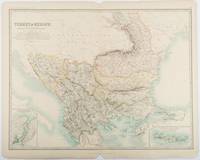
1893ref. 177055Edinburgh & London.: W. & A. K. Johnston. 1893. Engraved map with original outline hand-colour 44 x 57.4 cm map two inset maps of the Bosphorus and Crete; central fold corners chipped with loss lower edge with several small marginal tears neatly repaired head and foot clipped at the fold with loss to the margin but the map in very good condition. Detailed and finely engraved map also showing submarine telegraph lines and relief by hachures. Re-issue of the map first published in 1863 for "Keith Johnston's Royal Atlas of Modern Geography". . W. & A. K. Johnston unknown
1855ref. LBW0394eNew York 1855 332 x 402 mm.
1661ref. LBW025381661 106 x 128 mm.
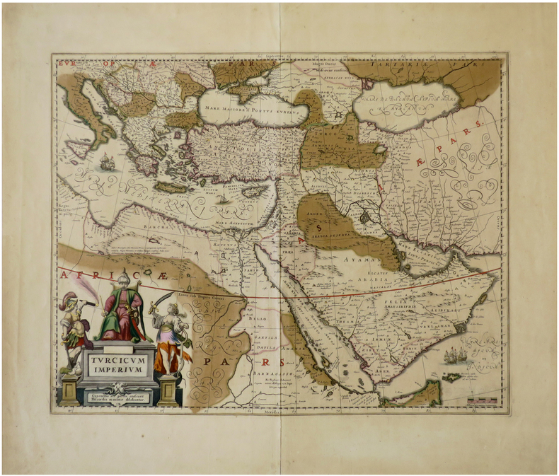
1640ref. LBW-6792[Amsterdam, circa 1640]. 410 x 517 mm.
1598ref. LBW-1428Anvers 1598 81 x 105 mm.
1748ref. LBW02e6e1748. 162 x 195 mm.
1991No marks or inscriptions. No creasing to covers or to spine. A very clean very tight copy with bright unmarked lightly indented boards and no bumping to corners. 344pp. With descriptions of the culture, history and tourism of the North African country this travel book takes the reader into some of its lesser known delights as well as the sand and sea tourist spots.