Compass Maps LtdBiblio.com

11.756 resultados
2008ref. SBBIH-OISOHDMGSCZLPopOut Maps 2008. map. Good. Our good condition books are generally good for reading but not for gifting or collecting. They could have imperfections such as creasing fanning inscriptions margin notes yellowing staining on edge or cover or pages bumps scuffs etc etc sometimes multiple of these. It's a wide category that encompasses anything that isn't almost-new down to anything that is slightly better than poor. We would NOT recommend gifting Good books - these should be considered reading copies. Our books are dispatched from a Yorkshire former cotton mill. We list via barcode/ISBN so please note that the images are stock images and may not be the exact copy you receive furthermore the details about edition and year might not be accurate as many publishers reuse the same ISBN for multiple editions and as we simply scan a barcode or enter an ISBN we do not check the validity of the edition data when listing. If you're looking for an exact edition please don't order at least not without checking with us first although we don't always have time to check. We aim to dispatch prompty the service used will depend on order value and book size. We can ship to most countries see our shipping policies. Payment is via Abe only. PopOut Maps unknown
1981No marks or inscriptions to contents. A very clean very tight copy with bright unmarked boards with fainly intented rear and no bumping to corners. Dust jacket not price clipped or marked or torn or creased with faintly indented rear. Unpaginated pp. A pictorial account of the Hungarian regions of Bodrogkoz, Hegyalja, Hegykos and the Tokaj Hills. Almost all text in English, a little in Hungarian. With 136 colour plates, many full or double page. Scarce in the UK.
1981No marks or inscriptions. No creasing to covers or to spine. A lovely clean very tight copy with bright unmarked boards and no bumping to corners. Protected in fully-removable proprietary plastic sleeve. 64pp. Tucked in is a large fold-out plan of Pompeii. Travel guide with 110 coloured illustrations.
Undated, colour map. eng
1986240 pages. Bibliography. Index of names. Index of geographical references. Handsome reproductions of historic maps and illustrations. Printed upon glossy stock. Chapters include: Galleons, Pirates, Pearls and Fantastic Straits - California, XVIIth Century; Russian, French, British and American Incursions into "The Spanish Lake"; The Spanish Presence on the Northwest Coast - Sea-going Expeditions (1774-1793); Spanish Cartographic Surveys of the Northwest Coast in the XVIIIth Century - The Corps of Naval Steersmen; The Culture of the Indians of the Northwest Coast; Faces in the Forest - Mozino's Noticias de Nutka; A Personal View of the Northwest Coast - The journal of Tomas de Suria (1791); Nootka - the Crisis of 1789. Fore-edge of front free endpaper rumpled, othwerwise book clean and unmarked with light wear. Average wear to dust jacket which is now preserved in glossy new archival-grade Brodart. A sound copy of this handsome and very informative work. Book
1770Tavola astronomica tratta dall’A New Royal and Universal Dictionary of Arts and Sciences, London 1770-1771, Printed of J. Cooke Si tratta di un’opera in due grandi volumi, cm 35,5 x 23,5, rispettivamente pubblicati a Londra nel 1770 e nel 1771, che raccoglie in ordine alfabetico alcune centinaia di voci illustranti sia le conoscenze scientifiche e tecnologiche che lo sviluppo delle arti e dei mestieri dell’epoca. Le singole voci, scritte dai più autorevoli esperti europei, sono state poi riviste e redazionate da M. Hinde per il settore relativo all’anatomia, medicina e chimica, da W. Squire per le matematiche, da T. Marshall per la Botanica e da Thomas Cooke per le materie umanistiche. Centouno tavole prodotte da relative incisioni su rame illustrano i due volumi. Le incisioni, equamente ripartite sui vari saperi, riproducono sia soggetti della natura che i più aggiornati strumenti usati per indagarla. Una considerevole parte riguarda invece gli strumenti di lavoro delle varie arti e mestieri. L’opera è giunta a noi in pochissimi esemplari, se ne conoscono soltanto ventitré copie, in quanto le piastre in rame furono in un primo momento confiscate, prima della stampa, dalla Court of Chancery of London in conseguenza del fallimento dell’editore di Bevis, Johan Neale. Le ventitré copie conosciute fanno parte di una tiratura prodotta successivamente nel 1786 da John Horsfall, l’esecutore testamentario di Bevis, con il titolo di Atlas Celeste. Per il momento è ancora da ricostruire la storia di come le dodici tavole contenute nell’A New Royal and Universal Dictionary of Arts and Sciences abbiano potuto anticipare di circa quindici anni la diffusione degli originali che imitano. L’enciclopedia, oggi abbastanza rara e quasi non indagata dalla critica, subì l’influsso della più conosciuta e più antica Cyclopaedia: Or An Universal Dictionary of Arts and Sciences di Ephraim Chambers (ca. 1680-1740), pubblicata in Inghilterra nel 1728 (cfr. Felice Stoppa, Atlas Coelestis, http://www.atlascoelestis.com/Universal%20dictionary%20pagina.htm). Incisione in rame, finemente colorata a mano, in ottimo stato di conservazione. Astronomical plate taken from A New Royal and Universal Dictionary of Arts and Sciences, London 1770-1771, Printed of J. Cooke This is a work in two large volumes, 35.5 x 23.5 cm, respectively published in London in 1770 and 1771, which collects in alphabetical order a few hundred entries illustrating both scientific and technological knowledge and the development of arts and crafts of the time. The single entries, written by the most authoritative European experts, were then revised and edited by M. Hinde for the field related to anatomy, medicine and chemistry, by W. Squire for mathematics, by T. Marshall for Botany and by Thomas Cooke for the humanities. One hundred and one plates produced by relative copper engravings illustrate the two volumes. The engravings, equally divided among the various fields of knowledge, reproduce both natural subjects and the most up-to-date instruments used to investigate them. A considerable part concerns instead the working tools of the various arts and crafts. The work has come down to us in very few copies, only twenty-three copies are known, because the copper plates were initially confiscated, before printing, by the Court of Chancery of London as a result of the bankruptcy of the publisher of Bevis, Johan Neale. The twenty-three known copies are part of a print run produced later in 1786 by John Horsfall, the executor of Bevis' will, under the title of Atlas Celeste. For the moment, the story of how the twelve plates contained in A New Royal and Universal Dictionary of Arts and Sciences were able to anticipate by about fifteen years the diffusion of the originals they imitate is still to be reconstructed. The encyclopedia, now quite rare and almost unexamined by critics, was influenced by the better known and older Cyclopaedia: Or An Universal Dictionary of Arts and Sciences by Ephraim Chambers (ca. 1680-1740), published in England in 1728 (see Felice Stoppa, Atlas Coelestis, http://www.atlascoelestis.com/Universal%20dictionary%20pagina.htm).
1994Signed 'Scott Stallard' to title page. No other marks or inscriptions. A lovely clean very tight copy with bright unmarked boards and no bumping to corners. Dust jacket not price clipped or marked or torn or creased with minor traces of storage. pp. Lavishly illustrated book with 117 mainly full-page coloured photographs of Bermuda and an introduction by Peter Benchley.
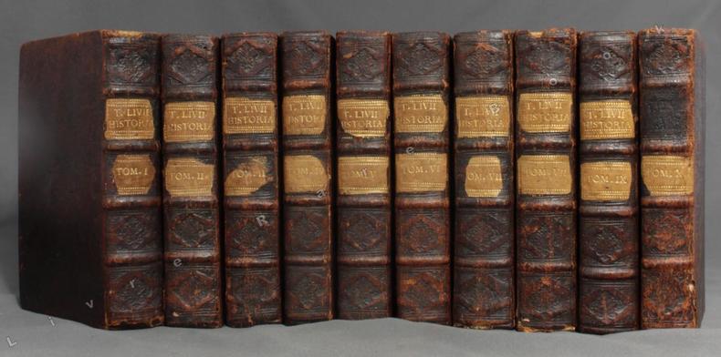
1710ref. 2869Amstelaedami, Apud Henricum Wetstenium, 1710. 10 vol. in-8 de [30]-455 + 490 + 470 + 446 + 460 + 495 + 506 + 496 + 504 + 363 pages. Pleine basane marron, dos à nerfs ornés de filets et fleurons à froid, pièces de titre et tomaison blondes. Dos frottés, accroc aux coiffes sup. des vol. 1 et 7, accroc aux coiffes inf. des vol. 1 et 8, coiffe inf. vol. 7 manquante, mors 1er plat fendus en leur part. inf. sur les vol. 7 et 10, pièce de titre manquante au vol. 10.
ref. LFA-126713406Un ouvrage de 50 pages, format 170 x 235 mm, illustré, broché couverture couleurs, s.d., Presses Parisiennes de Publications, bon état
1967No inscriptions or marks. No creasing to covers or to spine. A lovely clean crisp very tight copy with bright unmarked covers and no bumping to corners. Browning to page edges. 127pp. The Observer Guide to hotels and restaurants.
197060 pages. Features: Arthur Erickson and Canada's mirror-sheathed pavilion at Expo '70; Clarence Eckert and his Rolls-Royce; Angela Davis; Black Panther Lonnie McLucas and the New Haven Eight; Who's Come a Long Way, Baby? - Feature article on women's rights; The Liberation of Kate Millett; What it Would Be Like if Women Win; Middle East - Toward the Start of Talks; Watch on the Suez - Intelligence Gaps - air photos purport to show Egypt installing SAM-2 missiles in cease-fire zone; Maps of possible Israel/Egypt border; Lovely one-page color photo of Senegalese Dancer Issa Teuw Niang with friends in Dakar; Three additional pages of nice color photos of prominent black women in Africa; The Spetsopoula Incident; Urban Trend in Vietnam - with photo of horrific canal-side squatter structures; Joseph Rhodes Jr. and the Kent State investigation; Musical group "The Band" - photo and article; Cholera epidemic in Lebanon; Film producers Christopher Dewey and Dennis Friedland; Reuben Maury; Aquaculture - article with photo of streetcar being lowered into the Sea of Japan to provide 'apartments' for fish; Golfer Dave Stockton; Sculptor Alberto Sanchez; Passing of Leo Ciceri, Beniamino Fubano, Eugene Barnett, General Archimede Mischi and William Hamm Jr.; The Energy Shortage Worsens; Blighted corn in the U.S. South; Financial challenges for U.S. airlines as the upgrade to the 747; Interesting one-page color Hitachi ad illustrates "Floating Train of the Future"; and more. Moderate wear. Unmarked. A sound copy. Magazine
2005ref. LFA01804Revue mensuelle concernant la philatélie : environ 110 pages en couleurs, format 300 x 210 mm, illustrée, brochée couverture couleurs + fiches détachables
ref. LFA01da2Revue mensuelle concernant la philatélie : environ 110 pages en couleurs, format 300 x 210 mm, illustrée, brochée couverture couleurs + fiches détachables
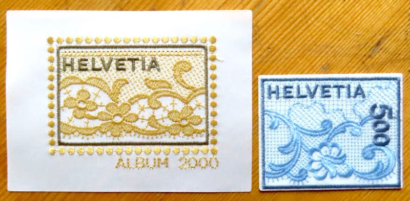
2000ref. 27086Saint-Gall, Bischoff AG, 2000. 1 timbre autocollant et la vignette de l'album 2000, brodés. En étoffe Satin tissé brillant 100 % polyester, fil à broder fin 100 % polyester.
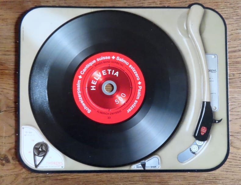
2014ref. 20821Poste Suisse, 2014. Timbre à la valeur faciale de 5.-, sur un carton au format 17 x 13,5 cm. Très très léger pli à un bord, la rondelle centrale commence à se détacher, en très bon état néanmoins.
1583Magnifico esemplare di questa rara carta del mondo di Philippe Galle, realizzata per la prima edizione dello Spieghel del Werelt, il primo atlante tascabile pubblicato nel 1577. Questa carta del mondo è una fedele ed accurata riduzione della prima mappa del mondo di Ortelius del 1570, che era la tavola di apertura del suo celebre atlante Theatrum Orbis Terrarum (Shirley, 122; Koeman, Ort 1; Karrow: 1/6, van der Krogt AN: 0001:31A). La lastra incisa da Philippe Galle, reca la data del 1574, sebbene la prima edizione dell'Epitome (secondo il titolo che diventerà comune nei secoli successivi), sia stata pubblicata nel 1577.Questa mappa verrà utilizzata per le sole edizioni dell'Epitome edite dal 1577 al 1585, e sarà poi sostituita da una lastra più piccola, a partire dal 1588. A differenza delle altre carte dell'Epitome, il mappamondo ha un formato più largo. La citazione latina nel margine inferiore, già presente nel modello di Ortelius, è da Cicerone (Tusculanae Disputatianes IV. 1 7. 37) "Quid ei potest videri magnum in rebus humanis, cui aeternitas omnis, totiusque mundi nota sit magnitudo" ovvero "Che cosa, tra le vicende umane, può sembrare grande a colui al quale è nota la grandezza del mondo e l'eternità dell'universo?".La carta del mondo di Ortelius, incisa e firmata da Franciscus Hogenberg, è di fondamentale importanza per la storia della cartografia in quanto costituisce la PRIMA MAPPA DEL MONDO a essere realizzata per un atlante di formato uniforme e non composito, quali gli atlanti del Lafreri. Le fonti cartografiche della carta sono il mappamondo di Mercator del 1569, quello di Gastaldi del 1561 e il portolano dell'Atlantico di Diego Gutierrez. La forma ovale rimanda, invece, ad Appiano e Bordone.Esemplare tratto dalla seconda edizione in lingua francese de Le Miroir du Monde.Le Miroir du Monde è l’edizione in lingua francese in prosa dello Spieghel der Werelt, il primo atlante tascabile pubblicato nel 1577, in lingua olandese, da Philip Galle, con testo in rima curato da Peeter Heyns, e stampato dalla tipografia Plantin. Lo Spieghel der Werelt era una versione ridotta del Theatrum Orbis Terrarum di Ortelius.Le lastre, quasi tutte derivate dal Theatrum, furono disegnate e incise da Philip Galle. Due anni dopo, nel 1579, fu data alle stampe l’edizione in lingua francese in prosa, perché Heyns non aveva avuto il tempo necessario per la resa in versi, col titolo Le Miroir du Monde. Il successo di questa edizione francese, è provato proprio dalla seconda edizione pubblicata a soli 4 anni di distanza, nel 1583.Complessivamente Galle pubblicò 5 edizioni in lingua francese, di cui solo le prime due con il titolo Le Miroir du Monde; a partire dal 1588, e così per le edizioni del 1590 e del 1598, il titolo dell’opera fu modificato in Epitome du thétre du Monde d’Abraham Ortelius, e il nome di Peeter Heyns non figurò più sul frontespizio. Rispetto alla prima edizione del 1579, che conteneva 72 mappe, la seconda edizione fu aumentata di 11 nuove mappe, per un totale di 83 tavole.Dal 1577 al 1598, Galle & Heyns pubblicarono ben 11 edizione, di cui l’ultima – edita nell’anno della morte di Ortelius – conteneva ben 123 mappe. Fine example of Philippe Galle's rare map of the World, engraved for the first edition of his Spieghel del Werelt, the first miniature edition of Ortelius' Theatrum Orbis Terrarum.This map is a neatly-engraved smaller copy of Ortelius' first world map plate, published in 1570, that is the first map of the Theatrum Orbis Terrrarum (Shirley, 122; Koeman, Ort 1; Karrow: 1/6, van der Krogt AN: 0001:31A). The Galle's plate is dated 1574 although the first printing of Galle's atlas did not taken place until 1577. The motto below the map is a quotation from Cicero (Tusculanae Disputatianes IV. 1 7. 37) Quid ei potest videri magnum in rebus humanis, cui aeternitas omnis, totiusque mundi nota sit magnitudo (For what human affairs can seem important to a man who keeps all eternity before his eyes and knows the vastness of the universe?). The worl map published by Galle is larger that the other maps in the atlas. The cartographic sources for the Ortelius world map are: Gerard Mercator's 1569, Gastaldi's 1561 world map and Diego Gutierrez' portolan map of the Atlantic. The oval shape goes back to Apianus and/or Bordonius. The world map by Ortelius, signed by Franciscus Hogenberg, is first one occurring in the first regular atlas the "Theatrum Orbis Terrarum", so the map is of fundamental importance in the history of cartography.This map appeared only in the earliest editions of Ortelius' Epitome, published between 1577-1585 - and from 1588 was replaced by the much smaller Typus Orbis Terrarum.Shirley quotes the rarity fo this map as "S" (Scarce). Map published taken from the second French edition of ‘Le Miroir du Monde’, published by Galle & Heyns in 1583, printed by Plantin. Le Miror du Monde is the French transaltion of the Duch poems Spieghel der Werelt, the first modern pocket-atlas, published by Philip Galle with text by Peeter Heyns in 1577, based on Abraham Ortelius’ Theatrum Orbis Terrarum. The maps were drawn and engraved by Galle. Two years later, in 1579, Galle & Heyns published the first French edition: Heyns translated the Dutch poems into French prose because he did not find time to put them into rhyme. This French edition became very popular and in 1583 an amplified reprint appeared.Galle & Heyns published 5 French edition, two with the title Miroir, and three (1588, 1590, 1598) with the title Epitome du thétre du Monde d’Abraham Ortelius, that appeared from 1588 onwards (Peeter Heyns’ name no longer figures on the title pages of the Antwerp editions).Second French edition of this rare miniature atlas, "enlarged with eleven maps... six are double sized" (Koeman p. 275).Compared to the first edition of 1579, which contained 72 maps, the second edition was increased by 11 new maps, for a total of 83 plates.Between 1577 & 1598 Galle issued 11 editions, all printed by Christopher Plantin. Shirley, 132; Koeman, Ort 47
1994ref. 0105671994 Gemeentekrediet Hardcover As New
1561ref. LBW-5048[Venise, 1561]. 184 x 245 mm.
ref. 206667Paris, chez l'auteur [étiquette de Desnos apposée ultérieurement], 1788 carte in-folio de 80 x 104 cm, contours rehaussés de couleurs, en feuille.
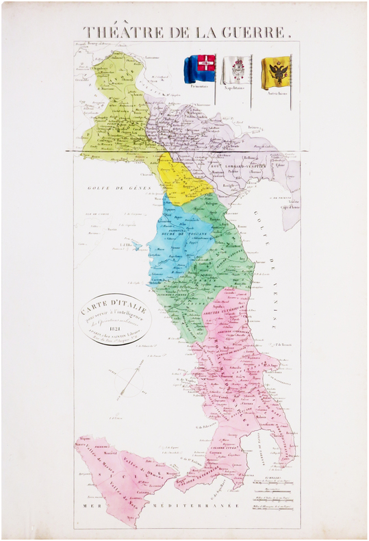
1821ref. LBW-8033Paris, Saintin, 1821. 535 x 241 mm.
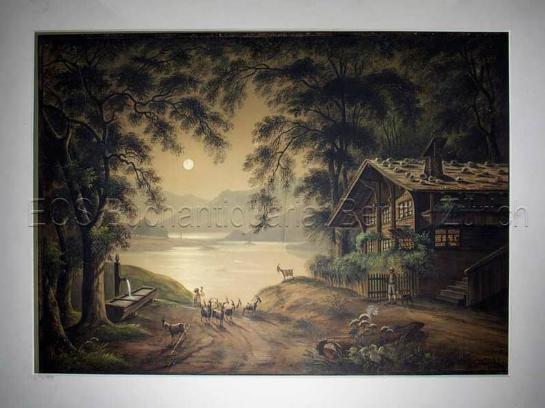
1850ref. 597BG(um 1850). Gouache. Bildgrösse: 34,5 x 48 cm. Blattgrösse: 42 x 55,5 cm. + Wichtig: Für unsere Kunden in der EU erfolgt der Versand alle 14 Tage verzollt ab Deutschland / Postbank-Konto in Deutschland vorhanden +, Abb.
1850ref. 597BG(um 1850). Gouache. Bildgrösse: 34,5 x 48 cm. Blattgrösse: 42 x 55,5 cm.
1965Slightly marked front. Has been stored neatly folded in two. 20pp. With 23 town plans from Almeiria to Zaragoza plus 8 district through routes. A fascinating reminder of the pre-satnav days.
1965A few stains to first two pages, not affecting maps. Calculations on blank part of cover. Has been stored folded in two. 40pp. With 66 town plans from Abbeville to Vichy plus 3 district through routes. A fascinating reminder of the pre-satnav days.