SAINTIN (Claude-Auguste).Livre Rare Book
12.070 resultados
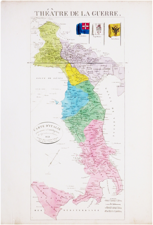
1821ref. LBW-8033Paris, Saintin, 1821. 535 x 241 mm.
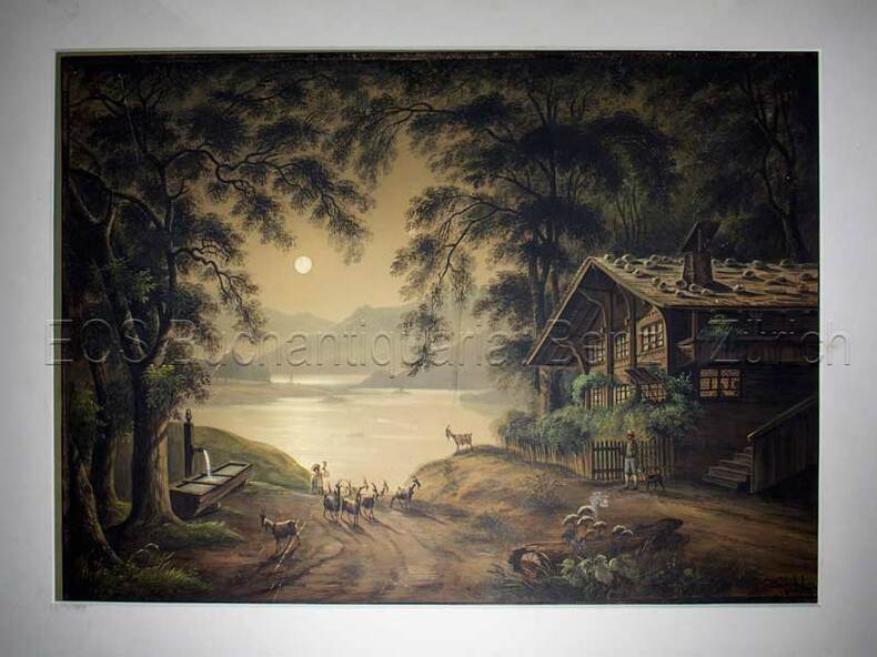
1850ref. 597BG(um 1850). Gouache. Bildgrösse: 34,5 x 48 cm. Blattgrösse: 42 x 55,5 cm. + Wichtig: Für unsere Kunden in der EU erfolgt der Versand alle 14 Tage verzollt ab Deutschland / Postbank-Konto in Deutschland vorhanden +, Abb.
1850ref. 597BG(um 1850). Gouache. Bildgrösse: 34,5 x 48 cm. Blattgrösse: 42 x 55,5 cm.
1965Slightly marked front. Has been stored neatly folded in two. 20pp. With 23 town plans from Almeiria to Zaragoza plus 8 district through routes. A fascinating reminder of the pre-satnav days.
1965A few stains to first two pages, not affecting maps. Calculations on blank part of cover. Has been stored folded in two. 40pp. With 66 town plans from Abbeville to Vichy plus 3 district through routes. A fascinating reminder of the pre-satnav days.
1590Carta della Tracia antica, che si estende da Bisanzio (Istanbul) e dallo stretto del Bosforo alla Macedonia, pubblicata da Abraham Ortleius.La regione comprende l'attuale Grecia nordorientale, la Bulgaria meridionale e la Turchia nord-occidentale.La mappa si basa sulla mappa di Gastaldi dell'Europa sudorientale e sulle informazioni di numerose fonti antiche, in particolare Erodoto, Plinio, Strabo, Appiano, Virgilio, Plutarco e Sidone. Opera tratta dal Parergon, il primo atlante storico mai pubblicato. Fu inizialmente concepito da Ortelius come appendice del suo Theatrum Orbis Terrarum ma visto il notevole successo di queste carte storiche divenne in seguito un lavoro indipendente e rimase la fonte principale di tutti i lavori simili per tutto il XVII secolo. Come sottolinea Koeman “il Parergon deve essere considerato come lavoro personale di Ortelius. Per quest'opera, infatti, diversamente dal Theatrum, non copiò le mappe di altri cartografi, ma ne disegnò lui stesso di nuove ed originali…prese luoghi, regioni e territori delle civiltà classiche illustrandone e spiegandone la storia, una materia molto vicina al suo cuore. Le mappe e le lastre del Parergon devono essere valutate come le più importanti incisioni che rappresentano il diffuso interesse per la geografia classica nel XVI secolo”. Il Theatrum Orbis Terrarum e che è considerato il primo vero “atlante” moderno. L’opera fu pubblicata in 7 lingue e 36 edizioni, per il quale – nel 1570 - Ortelius ottenne il privilegio, ovvero una sorta di diritto d'autore che impediva ad altri cartografi di pubblicare i propri lavori. Il Theatrum rappresentava il lavoro più avanzato del lavoro della descrizione cartografica. L’Ortelius vi raccolse il sapere geografico e cartografico del suo tempo, proponendo in 147 spettacolari tavole incise l’immagine più fedele del mondo allora conosciuto e, in alcune straordinarie “carte storiche”, regioni e itinerari tratti dalla letteratura, dalla mitologia, dalla tradizione. Incisione in rame, fine coloritura, in ottimo stato di conservazione. Fine map of ancient Thrace, extending from Byzantium (Istanbul) and the Bosphorus Straits to Macedonia, published by Abraham Ortleius. This finely engraved map shows Thrace, present-day north eastern Greece, southern Bulgaria, and northwest Turkey, and identifies main settlements with their original latinised names. The map is based on Gastaldi's 1560 map of South East Europe, and on information from numerous ancient sources, specifically Herodotus, Plinius, Strabo, Appianus, Virgilius, Plutarchus, and Sidonius. Portions of the Black Sea, Sea of Marmara, and Thrakikon Pelagos, all stipple engraved and fully colored, make this a very handsome map. Map taken from the Parergon, the first historical atlas ever published. It was initially conceived by Ortelius as an appendix to his Theatrum Orbis Terrarum, but given the considerable success of these historical maps it later became an independent work and remained the main source of all similar works throughout the seventeenth century. Koeman wrote: "This atlas of ancient geography must be regarded as a personal work of Ortelius. For this work he did not, as in the Theatrum, copy other people's maps but drew the originals himself... He took many places and regions from the lands of classical civilization to illustrate and clarify their history, a subject very close to his heart... The maps and plates of the Parergon have to be evaluated as the most outstanding engravings depicting the wide-spread interest in classical geography in the 16th century." The Theatrum Orbis Terrarum, which is considered the first true modern "Atlas". The work was published in 7 languages and 36 editions, for which - in 1570 - Ortelius obtained the privilege, a kind of copyright that prevented other cartographers from publishing his works. The Theatrum represented the most advanced work of cartographic description. Ortelius collected in it the geographical and cartographic knowledge of his time, proposing in 147 spectacular engraved plates the most faithful image of the world then known and, in some extraordinary "historical maps", regions and routes taken from literature, mythology, tradition. Copper engraving, contemporary coloring, in good condition. Van den Broecke #214.
1786Carta gegrafica tratta da "Christophori Cellarii Smalcaldensis Geographia antiqua" stampata a Londra da Sumptibus J & T Pote nel 1786.Incisione in rame, firmata da R. W. Scale, finemente colorata a mano, in ottimo stato di conservazione. Carta gegrafica tratta da "Christophori Cellarii Smalcaldensis Geographia antiqua" stampata a Londra da Sumptibus J & T Pote nel 1786.Incisione in rame, firmata da R. W. Scale, finemente colorata a mano, in ottimo stato di conservazione.
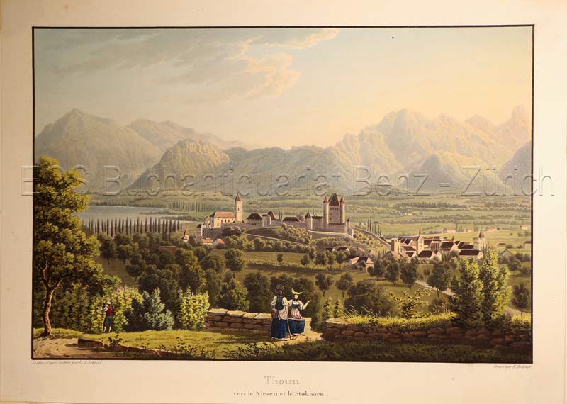
1830ref. 627DG(Zürich, Keller & Füssli), um 1830. Altkolorierte Aquatinta von Rudolf Bodmer (1805-1841). Bildgrösse: 16 x 24,1 cm. Blattgrösse: 19,4 x 27 cm. + Wichtig: Für unsere Kunden in der EU erfolgt der Versand alle 14 Tage verzollt ab Deutschland / Postbank-Konto in Deutschland vorhanden +, Abb.
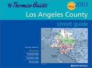
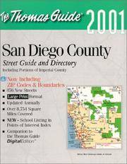
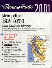
ref. G0528853910I3N00Thomas Brothers Maps 1891. Paperback. Good. Pages can have notes/highlighting. Spine may show signs of wear. ~ ThriftBooks: Read More Spend Less.Dust jacket quality is not guaranteed. Thomas Brothers Maps paperback
1999ref. mon0004114102Thomas Brothers Maps 1999-09-01. Spiral-bound. Good. 1.1000 12.0000 8.3000. Thomas Brothers Maps unknown
2000ref. G1581741294I5N00Thomas Brothers Maps 2000. Unknown. Acceptable. Readable copy. Pages may have considerable notes/highlighting. ~ ThriftBooks: Read More Spend Less.Dust jacket quality is not guaranteed. Thomas Brothers Maps unknown
ref. 1581742584.Gpaperback. Good. Access codes and supplements are not guaranteed with used items. May be an ex-library book. paperback
ref. 1581743521.Gspiral_bound. Good. Access codes and supplements are not guaranteed with used items. May be an ex-library book. unknown
ref. 1581742363.Gpaperback. Good. Access codes and supplements are not guaranteed with used items. May be an ex-library book. paperback
ref. 0881308641.Gspiral_bound. Good. Access codes and supplements are not guaranteed with used items. May be an ex-library book. unknown
ref. 1581742401.Gpaperback. Good. Access codes and supplements are not guaranteed with used items. May be an ex-library book. paperback
ref. 0528956612.Gpaperback. Good. Access codes and supplements are not guaranteed with used items. May be an ex-library book. paperback
ref. 0528956477.Gpaperback. Good. Access codes and supplements are not guaranteed with used items. May be an ex-library book. paperback
ref. 1581742495.Gpaperback. Good. Access codes and supplements are not guaranteed with used items. May be an ex-library book. paperback
ref. 1581742886.Gpaperback. Good. Access codes and supplements are not guaranteed with used items. May be an ex-library book. paperback
2002ref. Q-0528956485Thomas Brothers Maps 2002-01-01. Spiral-bound. New. In shrink wrap. Looks like an interesting title! Thomas Brothers Maps unknown
ref. 1581743408.Gpaperback. Good. Access codes and supplements are not guaranteed with used items. May be an ex-library book. paperback
ref. 1581741928.Gmap. Good. Access codes and supplements are not guaranteed with used items. May be an ex-library book. unknown
ref. 1581742797.Gpaperback. Good. Access codes and supplements are not guaranteed with used items. May be an ex-library book. paperback
ref. 1581742509.Gspiral_bound. Good. Access codes and supplements are not guaranteed with used items. May be an ex-library book. unknown