National Geographic MapsBiblio.com
12.209 resultados
2013ref. 1-0792250109Natl Geographic Society Maps 2013. Map. New. lam map edition. 1 pages. 23.70x1.70x1.10 inches. Natl Geographic Society Maps unknown
1936ref. 91525Milano: Touring Club Italiano 1936. Very Good. 12 of 37 unbound sheets. 4p.center 2 pages are 34 cm. x 25 cm. map. Partly colored. Scale: 1:1000000. Italian text. Touring Club Italiano unknown books
1936ref. 91525Milano: Touring Club Italiano 1936. Very Good. 12 of 37 unbound sheets. 4p.center 2 pages are 34 cm. x 25 cm. map. Partly colored. Scale: 1:1000000. Italian text. Touring Club Italiano unknown
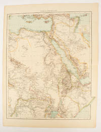
1895ref. 175108London.: Times Atlas of the World. 1895. Double-page folding map printed in colour 46.5 x 36.5 cm. edges gilt central fold with an inset map of Somaliland Somalia and the island of Sokotra key to European possessions outlined in colour small edge fold tears affecting the margin only and two other small edge tears slight toning at the edgaes but in very good condition. Attractive and detailed map prepared for the first edition of "The Times Atlas of the World". . (Times Atlas of the World). unknown
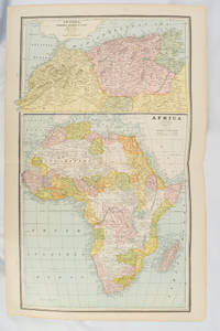
1894ref. 177068Chicago.: Geo. F. Cram. 1894. Chromolithographed maps 54.3 x 34.1 cm sheet central fold a few small edge tears and marginal age toning but in very good condition. Detailed maps prepared for George F. Cram's 1894 "Standard American Atlas": one of the first American firms to publish a world atlas. Maps of Oceania and South Africa printed on the verso. . Geo. F. Cram. unknown
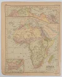
1877ref. 177229New York.: Ivison Blakeman Taylor & Co. circa1877. Printed colour map 27.5 x 21.7 cm large inset of Northern Africa and a smaller of Southern Africa two small edge tears lower corner neatly strengthened the sheet toned but the map in good condition unrelated text printed on the verso. Map of Africa as a whole before the Imperial race for colonies in the 1880s with interesting insets of Northern and Southern Africa. . Ivison, Blakeman, Taylor & Co. unknown
1961408p. + Plus photographs. Full page text maps. Map endpapers. 8vo. Original full cloth binding. Original dust jacket. AFRICA/3
1830ref. 176607London.: Robert Jennings. 1830. Engraved map 11.5 x 14.3 cm showing route of European explorers faint added outline colour in an early hand and manuscript note to the verso in the same ink edges age-toned but in very good condition. Detailed pre-colonial map of Africa "Regions Unexplored" marked and "no fresh water to be found" on the west coast. An early manuscript inscription on the verso refers to Lander's ."wanderings of Clapperton" the Scottish naval officer and explorer. Richard Lander had returned with Hugh Clapperton's journal following his death and the account was published in the same year as Fenner's "Pocket Atlas of Modern & Ancient Geography" for which this map was prepared. . (Robert Jennings) unknown
2012ref. 1-0792250222Natl Geographic Society Maps 2012. Map. New. lam map edition. 1 pages. 23.50x30.25x2.25 inches. Natl Geographic Society Maps unknown
1590Splendida carta del Mondo Antico pubblicata nel Parergon, l'atlante di Ortelius dedicato alla geografia antica.La mappa presenta i territori conosciuti fino al 1492, all'interno di una proiezione ovale in cui sono rappresentate le fasce climatiche canonizzate da Tolomeo. Ortelius, inoltre, nella realizzazione del planisfero tiene conto del passo di Strabone (II, 5,6) nel quale sostiene che la terra abitata occupi meno della metà dell'emisfero boreale. Pur con queste premesse, il disegno dell'ecumene è moderno, come mostrano i profili del golfo di Guinea, del Madagascar e della penisola indocinese.Il planisfero è circondato da una ricca cornice decorativa nei cui angoli sono contenute le mappe, di formato circolare, dei quattro continenti. Tratta dal Parergon, il primo atlante storico mai pubblicato. Fu inizialmente concepito da Ortelius come appendice del suo Theatrum Orbis Terrarum ma visto il notevole successo di queste carte storiche divenne in seguito un lavoro indipendente e rimase la fonte principale di tutti i lavori simili per tutto il XVII secolo. Come sottolinea Koeman “il Parergon deve essere considerato come lavoro personale di Ortelius. Per quest'opera, infatti, diversamente dal Theatrum, non copiò le mappe di altri cartografi, ma ne disegnò lui stesso di nuove ed originali…prese luoghi, regioni e territori delle civiltà classiche illustrandone e spiegandone la storia, una materia molto vicina al suo cuore. Le mappe e le lastre del Parergon devono essere valutate come le più importanti incisioni che rappresentano il diffuso interesse per la geografia classica nel XVI secolo”. Il Theatrum Orbis Terrarum e che è considerato il primo vero “atlante” moderno. L’opera fu pubblicata in 7 lingue e 36 edizioni, per il quale – nel 1570 - Ortelius ottenne il privilegio, ovvero una sorta di diritto d'autore che impediva ad altri cartografi di pubblicare i propri lavori. Il Theatrum rappresentava il lavoro più avanzato del lavoro della descrizione cartografica. L’Ortelius vi raccolse il sapere geografico e cartografico del suo tempo, proponendo in 147 spettacolari tavole incise l’immagine più fedele del mondo allora conosciuto e, in alcune straordinarie “carte storiche”, regioni e itinerari tratti dalla letteratura, dalla mitologia, dalla tradizione. Incisione su rame, finemente acquarellata, in ottimo stato di conservazione. Esemplare dall'edizione tedesca pubblicata nel 1602. This interesting map presents the regions of the earth that were known in classic times within a large oval projection showing the relative size of the now-known world. The map extends into Asia as far east as Sumatra and south to Madagascar and the Mountains of the Moon in Africa. The climate zones are shown as Zona frigida, temperata, and torrida, with the Zona frigida noted as being uninhabitable. An ornate border surrounds the map and incorporates four small insets: Europe, Asia, Africa and America representing the "modern" world. Map taken from the Parergon, the first historical atlas ever published. It was initially conceived by Ortelius as an appendix to his Theatrum Orbis Terrarum, but given the considerable success of these historical maps it later became an independent work and remained the main source of all similar works throughout the seventeenth century. Koeman wrote: "This atlas of ancient geography must be regarded as a personal work of Ortelius. For this work he did not, as in the Theatrum, copy other people's maps but drew the originals himself... He took many places and regions from the lands of classical civilization to illustrate and clarify their history, a subject very close to his heart... The maps and plates of the Parergon have to be evaluated as the most outstanding engravings depicting the wide-spread interest in classical geography in the 16th century." The Theatrum Orbis Terrarum, which is considered the first true modern "Atlas". The work was published in 7 languages and 36 editions, for which - in 1570 - Ortelius obtained the privilege, a kind of copyright that prevented other cartographers from publishing his works. The Theatrum represented the most advanced work of cartographic description. Ortelius collected in it the geographical and cartographic knowledge of his time, proposing in 147 spectacular engraved plates the most faithful image of the world then known and, in some extraordinary "historical maps", regions and routes taken from literature, mythology, tradition. From the 1602 German edition of the Parergon. Copperplate, with fine colouring, good conditions. Shirley #176; Van den Broecke #186.
ref. ORD-638Oilettes after the Original Drawings by G.T. CLARKSON. Raphael Tuck & Sons. London. Paris & New York. s.d. (vers 1914). 6 belles cartes postales couleurs représentant chacune une position d'aéroplane en plein vol dans leur rare pochette d'origine (un peu passée). Cartes à l'état neuf.|Les mêmes sans la pochette: 250FF.
1660Orientata con il Nord a destra, la mappa raffigura nel dettaglio la regione compresa tra la valle del Nilo e il Mar Rosso. Dall'Atlas MajorDoppio cartiglio, uno per il titolo e uno per la dedica in francese a "A Monsieur Monsieur Doviat Sgr. de Montreuille, Con.er du Roy, et Maistre Ordinaire en sa Chambre des Comptes Par son Très humble et obéisant Serviteur P. Duval Géographe de sa Maiesté". Johannes Janssonius, figlio dell'editore di Arnhem Jan Janssen, sposò Elisabeth Hondius, figlia di Jodocus Hondius, ad Amsterdam nel 1612. Dopo il suo matrimonio, si stabilì in questa città come libraio ed editore di materiale cartografico. Nel 1618 si stabilì ad Amsterdam accanto alla libreria di Willem Jansz. Blaeu, entrando in una seria competizione. Le sue attività non riguardavano solo la pubblicazione di atlanti e libri, ma anche di mappe singole e un vasto commercio di libri con filiali a Francoforte, Danzica, Stoccolma, Copenaghen, Berlino, Koningsbergen, Ginevra e Lione. Nel 1631 iniziò a pubblicare atlanti insieme a Henricus Hondius. Nei primi anni 1640 Henricus Hondius lasciò l'attività di pubblicazione di atlanti completamente a Janssonius. La concorrenza con Joan Blaeu, figlio e successore di Willem, nella produzione di atlanti spinse Janssonius ad ampliare il suo Atlas Novus finalmente in un'opera di sei volumi, in cui furono inseriti un atlante marino e un atlante del Vecchio Mondo. Dopo la morte di Joannes Janssonius, il negozio e la casa editrice furono continuati dagli eredi sotto la direzione di Johannes van Waesbergen (c. 1616-1681), genero di Joannes Janssonius. Le matrici degli atlanti di Janssonius furono in seguito vendute a Schenk e Valck. Map oriented with north on the right. It presents a colorful and detailed picture of the region between the fertile Nile River valley and the Red Sea. The map is adorned with a strapwork title cartouche with a credit to Pierre du Val. Includes a note in a decorative cartouche: "A Monsieur Monsieur Doviat Sgr. de Montreuille, Con.er du Roy, et Maistre Ordinaire en sa Chambre des Comptes Par son Très humble et obéisant Serviteur P. Duval Géographe de sa Maiesté".Published in Janssonius' Atlas Major. Johannes Janssonius (Arnhem, 1588-1664), son of the Arnhem publisher Jan Janssen, married Elisabeth Hondius, daughter of Jodocus Hondius, in Amsterdam in 1612. After his marriage, he settled down in this town as a bookseller and publisher of cartographic material. In 1618 he established himself in Amsterdam next door to Blaeu’s book shop. He entered into serious competition with Willem Jansz. Blaeu.. His activities not only concerned the publication of atlases and books, but also of single maps and an extensive book trade with branches in Frankfurt, Danzig, Stockholm, Copenhagen, Berlin, Koningsbergen, Geneva, and Lyon. In 1631 he began publishing atlases together with Henricus Hondius. In the early 1640s Henricus Hondius left the atlas publishing business completely to Janssonius. Competition with Joan Blaeu, Willem’s son and successor, in atlas production prompted Janssonius to enlarge his Atlas Novus finally into a work of six volumes, into which a sea atlas and an atlas of the Old World were inserted. After the death of Joannes Janssonius, the shop and publishing firm were continued by the heirs under the direction of Johannes van Waesbergen (c. 1616-1681), son-in-law of Joannes Janssonius. The copperplates from Janssonius’s atlases were afterwards sold to Schenk and Valck. Van der Krogt 1
ref. 6237Casterman, 1995. 6 cartes doubles avec enveloppes, sous pochette illustrée.
1955208 pages including index and black and white illustrations. "From much accumulated data we have woven a non-fiction historical book which it is hoped will fill a practical need in the literature of the Pacific Coast and the Hawaiian Islands, and may interest readers in Canada, the United States, Hawaii and Great Britain... Extracts of Vancouver's original 1798 charts were photographed and are included, while in some instances these are compared with modern maps." - from foreward. Decorated front board. Average wear. Binding intact. Solid copy. Book
ref. 59537BBo.J. Matthäus Merian der Ältere, geboren am 22. September 1593 in Basel, gestorben am 19. Juni 1650 in Langenschwalbach. Schweizerisch-deutscher Kupferstecher und Verleger. [3 Warenabbildungen]
Gotha, Justus Perthes, s.a. (1902). Gran Folio; 4 h. con portada e Índice, 95 mapas a doble página en color, y 201 pp. de Índice alfabético de nombres. Encuadernación de época en media piel con puntas.
1940ref. 3843BUm 1940. 15 x 10,5 cm.
ref. SLIVCN-9830096007994PASSE-TEMPS EDITIONS
ref. 1597752258.Gmap. Good. Access codes and supplements are not guaranteed with used items. May be an ex-library book. unknown
2023ref. DADAX1597752258National Geographic 2023-01-01. 2023. map. New. 4.25x0.50x9.25. Buy with confidence. Excellent Customer Service & Return policy. National Geographic unknown
ref. SLIVCN-9782897422530CARACTERE EDITIONS (CA)
ref. SLIVCN-9782897422554CARACTERE EDITIONS (CA)
ref. SLIVCN-9782896424931CARACTERE EDITIONS (CA)
ref. 0875304435.Gpaperback. Good. Access codes and supplements are not guaranteed with used items. May be an ex-library book. paperback
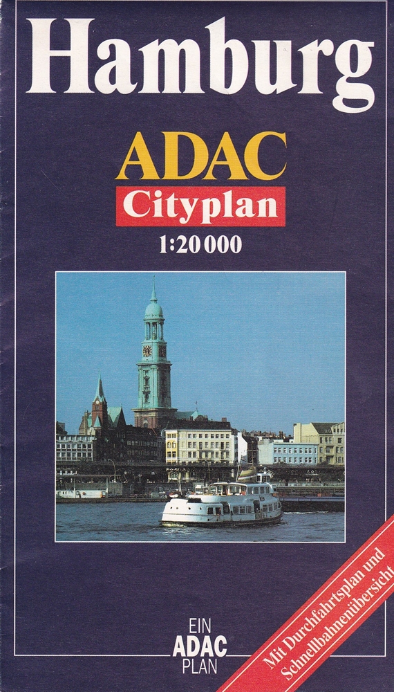
1994ref. 71236(Bad Soden/Ts. Haupka Verlag, Kartographisches Institut, [1994]. Mehrfach gefalt. farbiger Straßenplan, Maßstab 1:20.000. Mit Durchfahrtsplan (1:150.000), Plan der Innenstadt (1:10.000) u. Schnellbahnen-Netz. (= Ein ADAC-Plan). Blattgröße 68 x 100 cm, gefaltet auf 17 x 10 cm.