12,289 results
2007New Turkish Original bdg. HC. Folio. (42 x 34 cm). Text in Turkish and French. [xx], [66], 37, [1] p., color maps. Charles Edouard Goad'in Istanbul sigorta haritalari. Fire insurance maps of Istanbul by Charles Edouard Goad, (1848-1910). He was a cartographer and civil engineer, was born on 15 March 1848 at High Street, Camberwell, Surrey, the second son of Charles Goad, plumber, of London, and his wife, Caroline Ann (née Vogel). 1000 copies were printed.
1958Very Good Turkish Modern cloth bdg. 4to. (30 x 24 cm). In Turkish. 27 p. text; 21 numerous map feuilles in Ottoman script and modern Turkish. 19. asirda Istanbul haritasi. Ekrem Hakki Ayverdi was raised at a time in which Istanbul was undergoing its late Ottoman-early Republican period. Apart from his persona as an engineer-architect, restorer, and architectural historian, he was a collector passionately dedicated to Ottoman art. Undertaking the construction of different public buildings in Istanbul, Bursa and Edirne, as well as the restoration of many architectural works, Ayverdi not only brought together the most select and refined works of Ottoman art, which had begun to lose its prestige amidst the changing values of high culture in the time he lived, but he also paid particular attention to their conservation and preservation. Ayverdi's two seminal corpuses that study Ottoman architecture from its early days until the end of the Mehmed II era, as well as its examples in Roumelia, continue to maintain their place as the most important reference books for those working in this field. This is a detailed research on a 19th century map of Istanbul city.
1802pp. v, (4), 226, (2) + Plus engraved Frontis, Plates of scenes and large folding maps and charts. One map includes the sketch of soils, canals, etc of Lancashire. LACKS full page plate of Furness Abbey. View of Keswick Lake repeated on page 107 and 125. View of Bassenthwaite omitted. Two pages have old tape repairs with no loss. Map of the districts has small tape repair on one fold. Offsetting from Frontis on title page. Age stained and foxed. Engraved amoral bookplate of William Scott Elliot of Arkleton. 8vo. 215 mm. Original full leather binding. Boards detached. Small loss on spine. Binding worn. Hardbound. A rather poor copy of a great book. SCARCE. **PRICE JUST REDUCED! TRAVEL/7
1824Four volumes in two. Two folding maps and one single full page map (as called for in OCLC). Deckled edges. Foxed. Mildly XLib. XLib stamp of the A.R. Wentz Library Lutheran Theological Seminary Gettysburg, PA on top edges and verso of the dedication page. 8vo. 235 mm. S&S/AI 17982. First American from the fifth London edition. Original boards and label binding, broken. Best to consider as virtually disbound. Text very good. PAIMP 24
1828348 p. Folding colored map of Massachusetts. The map could use some minor repairs at folds, etc. 12mo. Contemporary full leather binding. American Imprints 35374; Howes S-839; Sabin 89563. Atlas Case. QUITE SCARCE. **PRICE JUST REDUCED!
ref. SKU1748713Academic Press 2017-04-20. paperback. New. 6x1x9. New Book Ships with Tracking Academic Press paperback
ref. SKU0620141Academic Press 2017-04-20. paperback. New. 6x0x9. New Textbook Ships with Tracking Academic Press paperback
1902Outside dimensions 14.5" x 10.5". Circa 1902. Includes railroads and street car lines. Centerfold. Light wear. Please see our photo for details. Book
1902Outside dimensions 14.5" x 10.5". Circa 1902. Centerfold. Light wear. Please see our photo for details. Book
1902Outside dimensions 7.5" x 10.5". Circa 1902. Centerfold. Light wear. Please see our photo for details. Book
1902Outside dimensions 14.5" x 10.5". Circa 1902. Also shows Prince Edward Island and the Magdelen Islands. Centerfold. Light wear. Please see our photo for details. Book
1902"Sketch map showing the connexion between the Himalaya Mountains and the Tibetan table-land, and their relation to the adjacent plains and mountains." - from lower edge. Outside dimensions 14.5" x 10.5" Circa 1902. Centerfold. Light wear. Please see our photo for details. Book
1902Outside dimensions 14.5" x 10.5". Circa 1902. Centerfold. Light wear. Please see our photo for details. Book
1902Outside dimensions 14.5" x 10.5" Circa 1902. Centerfold. Light wear. Please see our photo for details. Book
1902Outside dimensions 14.5" x 10.5". Circa 1902. Centerfold. Light wear. Please see our photo for details. Book
1902Railroads and street car lines indicated. Outside dimensions 14.5" x 10.5" Circa 1902. Centerfold. Light wear. Please see our photo for details. Book
1902Outside dimensions 14.5" x 10.5". Circa 1902. Centerfold. Light wear. Some soiling to lower left corner. Please see our photo for details. Book
1902Outside dimensions 14.5" x 10.5". Circa 1902. Centerfold. Light wear. Bit of soiling along top edage. Please see our photo for details. Book
37 x 48,5 cm. (Blatt: 46 x 56 cm). *Das Bistum Münster. Schönes flächiges Altkoloriit, sauber und sehr gut erhalten, breitrandig. Landkarten de
ref. 66108CBo.J. [3 Warenabbildungen] (Jacques-Nicolas Bellin, geb. 1703 in Paris, gest. 21. März 1772 in Versailles, französischer Kartograph, Ingenieur-Geog
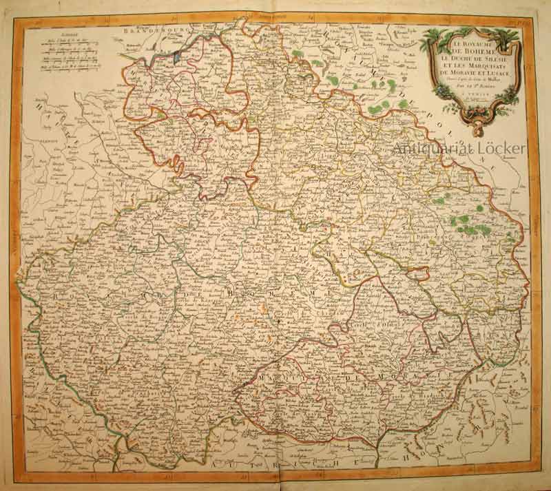
1777ref. KART0153Venise, P. Santini chez M. Remondini 1777. Kartengröße: 55x48,5 cm; Blattgröße:76x53,2 cm; rechts oben dekorative Titelkartusche, li. oben Maßstabsskala, kolorierte Randleiste, Mittelalz leicht gebräunt und unten über die Randleiste eingerissen, rundum Randrisse im weißen Rand. Die Karte zeigt das Gebiet Böhmens, Tschechiens, Schlesiens etc.
1758Dressé sur les dernières Observations par J. B. Nolin Géographe, gravée par Vallet, carte au format 535 x 650 mm, limites des présidiaux et bailliages rehaussées en couleurs, Chez Longchamps, Paris, 1758 Mouill. et frott. en marge droite. Prix en l'état. Français