Streetwise MapsBiblio.com
12,289 results
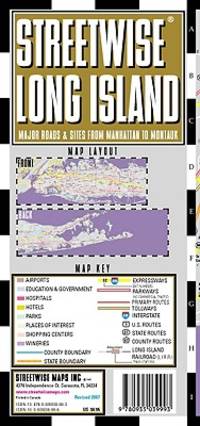
ref. 0935039996.Gmap. Good. Access codes and supplements are not guaranteed with used items. May be an ex-library book. unknown
1772ref. 78798Kopenhagen, André Philippe de Pretot, 1772. Blattmaß 28 x 40 cm; Bildmaß 18 x 28,5 cm.
1904ref. 26332Carte entoilée en couleur au format 94 x 68 cm, échelle 1 : 3500000, Maison Andriveau-Goujon, Henry Barrère, Paris, 1904 (mention rev. 1904), carte n° 15, atlas usuel n° 21 ; atlas universel n° 34, gravé : le trait par Smith, la topographie par Gérin, les Ecritures par Rousset, les Eaux par Mme Fontaine
4 reproductions montées sur carton fort, cachet de Maître Troquart, Notaire à Blaye Bon ensemble (cartons un peu salis). Français
ref. 3844349561.Gpaperback. Good. Access codes and supplements are not guaranteed with used items. May be an ex-library book. paperback
Madrid, Imprenta de Don Ramón Ballone, 1857. Folio; portada, 379 pp., 4 hs. y 16 mapas coloreados, litografíados por Bachiller. Encuadernación de época en media piel.
ref. 0540087726.Gpaperback. Good. Access codes and supplements are not guaranteed with used items. May be an ex-library book. paperback
ref. GOR002367632Paperback. Very Good. paperback
ref. 0008370001.Gpaperback. Good. Access codes and supplements are not guaranteed with used items. May be an ex-library book. paperback
ref. DADAX0226534677New unknown
2001ref. 104559Irvine CA: Thomas Bros. Maps 2001. 2001 Ed. Spiral-bound. Near fine; some creasing to wraps near spine; top corner a tad warped toward back of book; else clean and bright; still very useful and readable. Small folio metal spiral bound atlas; various pagings: color maps ; 29 cm; includes indexes and mileage chart. Looking for a more analog big-picture way to travel Look no further than the trusty Thomas Guide seat pocket companion of yore that will either pluck at nostalgic heartstrings or delight curious digital natives. Features: over 257000 square miles covered 79 pages of detail city maps digital cartography for greater accuracy and detail large print and scale for easier reading information on scenic highways distances and mileages and statewide shaded relief maps. Cartographic Mathematical Data: Scales differ. Relief shown by hachures and spot heights on some maps. Includes indexes and mileage chart. // California Maps Roads Roads California Maps. Thomas Bros. Maps unknown
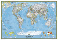
2012ref. 1-0792294580National Geographic 2012. Map. New. map edition. 1 pages. 38.50x5.00x4.00 inches. National Geographic unknown
ref. 0964540401.Gpaperback. Good. Access codes and supplements are not guaranteed with used items. May be an ex-library book. paperback
19204to [29 x 25 cm, 11.5 x 9.7 inches]; large folding colored map measuring 78 x 122 cm or 37.5 x 48 inches that folds to 29 x 25 cm. original cloth covers, title lettering on cover and spine, joint cracked but firm, marbled endpapers, original ribbon ties, map near fine and clean, linen-backed sectional map as originally issued, in very good original cover. A picture of this book is av A very detailed map, showing all of Europe including Western Russia to Iceland, part of north Africa, Lebanon, most of Caspian Sea. It shows cities, railways, mail and other steamers routes, wireless stations, canals, Lloyd's signal states, each country is shown in different color, also shows altitudes, etc. The scale is 72 mile to the inch or 1:4,500,000.
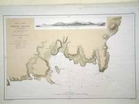
ref. 6279Paris: 1868. No binding. Very Good. 305 x 470 mm. in very good condition. A fine large scale plan of the harbour of 'Porto Praya' Praia on Santiago the capital of the Cape Verde Islands. It is situated on the south coast and shows wonderfully how the town has grown; the whole area to the south and west of the town is now developed. A prospect of the approach is shown above. The roads and individual buildings are shown as are numerous soundings in the Bay. The original survey in 1834 is the work of Lieutenant William Arlett of the British Royal Navy who is duly credited in the title. 1868 unknown
1927Approx. 42" x 36" coloured map. Average wear and soiling. Library markings. Book
1926Approx. 46" x 30" coloured map indicating mineral deposits. Clear tape repairs to upper edge. Library markings. Average wear. Map
1929Approx. 23" x 33" standard topographical map. Coloured. Library markings. Two-inch opening to bottom edge. Shorter openings to top and right edges. Somewhat above-average wear and soiling. Book
196142 pages. Features: Revised Fresh Water Fishing Spots and Maps of British Columbia; Nice one-page illustrated ad for Gibbs fishing tackle; One-page illustrated ad for Hardy and Milward split cane fishing rods from England; Marine fir plywood ad; Clay Chips - article with photos of Mr. & Mrs. Bert Whelan, Ray Gray, Virgil Poppe, Rudy Wiley, Earl Caldwell, Don McKay, Paul Maylor, Larry French, C.H. Reinhard, and Verne Greensword; Yacht Bureau begins research and product testing program; Boats; Nice framable one-page ad inside back cover by the B.C. Department of Recreation and Conservation entitled "Good Fishing!"; Nice photo-illustrated Lucky Lager ad on back cover; Many additional nostalgic ads. Unmarked with moderate wear. A quality vintage copy. Book
1939Handsome colour-illustrated 1939 map of the Colony of Fiji with inset map of the Lau Group/Eastern District Islands. 19.5" x 15". Folds to 9.25" x 6.5". Clean and unmarked with light wear. Map
1889Outer dimensions: 10.75" x 14.5". Includes many street names. Clean and unmarked with light wear. An attractive vintage copy. Book
1889Outer dimensions: 10.75" x 14.5". Counties individually colored. Clean and unmarked with light wear. An attractive vintage copy. Book
1889Outer dimensions: 10.75" x 14.5". Counties individually colored. Clean and unmarked with light wear. An attractive vintage copy. Book
1889Outer dimensions: 10.75" x 14.5". Counties individually colored. Clean and unmarked with light wear. A quality vintage copy. Bonus: includes separate extensive list of Kansas counties and cities/towns, complete with (1889) population of each. Book
1889Outer dimensions: 10.75" x 14.5". Counties individually colored. Clean and unmarked with light wear. A quality vintage copy. Bonus: includes separate extensive list of Missouri counties and cities/towns, complete with (1889) population of each. Book