12,267 results
1832ref. 61842collection of 18 hand coloured folding maps including Derbyshire Devonshire Durham Essex Hampshire Kent Lancashire Leicestershire Norfolk Northamptonshire Northumberland Nottinghamshire Shropshire Somersetshire Staffordshire Suffolk Surrey & Sussex each are by Robert K. Dawson 1798‱861 - an English surveyor and cartographer. Plus reports from some of the counties reports signed L. B. Allen or J. G. S. Lefevre" hardcover
1873ref. 8667Paris 1873. French naval chart sheet 3119 50 x33 cm black and white blank verso. Chart of the island of Montserrat in the British West Indies featuring coastal profiles dominated by the Soufrière Hills volcano and an inset of Plymouth the former capital of the island which was destroyed in the volcanic eruptions of the mid 1990s. Map unknown
1872ref. 8668Paris 1872. French naval chart sheet 3068 sheet size 36 x 53 cm engraved by Régnier black and white blank verso. The anchorage at San Juan Bautista located on Cumberland Bay Robinson Crusoe Island; the main settlement in the Juan Fernández Islands off the coast of Chile. Map unknown
1840ref. 344261840. Lg. format. Green cloth. gilt. Bound maps numbered 1 - 110. Numbers not bound in: 92224314546606979109. 100 maps bound in. Plus 23 maps bound in rear from Lewis's Topographical Dictionary. 41 hand-coloured maps 59 plates hand-coloured Town Plans taken from the "View of the Representative History of England Samuel Lewis". A very nice copy. hardcover
1998ref. 109297Granta Books London. 1998. Granta Books London. 1998. Paperback. Illustrated. Covers slightly worn to extremities. Page edges foxed and pages browned o/w clean and sound. SCARCE. paperback
2011ref. BN341322Collins 2011. 2011. Discovering Dublin Illustrated Map Collins Travel Guides Discovering Dublin Illustrated Map Collins Travel Guides Maps Collins Collins unknown
ref. BN209964Good Vibrations- Verlag 2005. Motorrad Powerkarten - Nord- und Ostdeutschland - 8 Karten laminiert Motorrad Powerkarten - Nord- und Ostdeutschland - 8 Karten laminiert Nabelt maps and more Good Vibrations- Verlag, 2005 unknown
1908XIV, 154 pages. Index. Six nice maps plus one more on back cover. Printed upon glossy stock. Many nice black and white photos. "The main idea has been to dispel, by means of facts and photographs, the notion held by many people that the county is 'bleak and stony'." - from Preface. Above-average external wear and soiling. Unmarked. A worthy vintage copy. Book
ref. BN330515Editions du BRGM. Carte géologique : Les côtes de France Carte géologique : Les côtes de France Cartes BRGM Editions du BRGM unknown
2007152 pages. Bibliography. Index. Wonderfully illustrated, often in colour. Printed upon glossy stock. Handsomely produced. "Plot's Nova Scotia's growth through the careful examination and analysis of maps from the nineteenth century. An exciting time in Nova Scotia's history, this period saw the first serious attempts to gain knowledge of the entire province, its resources and its inhabitants. Traces developments in our province that today are taken for granted." - from back cover. Clean, bright and unmarked with light wear. A high-quality copy. Book
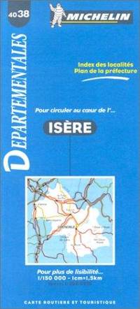
ref. BN328198Michelin Editions des Voyages. Carte routière : Isère N°4038 Carte routière : Isère N°4038 Cartes Michelin Michelin Editions des Voyages unknown
2022ref. BN348216PopOut Maps 2022. 2022. Bath PopOut Map PopOut Maps Bath PopOut Map PopOut Maps Maps PopOut PopOut Maps unknown
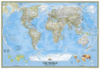
2012ref. BN200358National Geographic Maps 2012. 2012. World Classic Enlarged & Tubed World Classic Enlarged & Tubed National Geographic Maps National Geographic Maps unknown
1730ref. 35071Nürnberg, Homann ohne Jahr [um 1730]. Altkolorierte Kupferstich-Karte. 58,5 x 49 cm (Plattenrand). An den Rändern stellenweise etwas bestoßen und fleckig sowie rechts mit einem Einriß bis in die Umrahmung (hinterlegt).
ref. 51388Paris 1775 1 carte entoilée, carte pliée de format: 45 cms x 50,5 cms, décrivant la Pologne, la Lituanie et la Courlande. Carte gravée, aux contours rehaussés en couleurs à l'époque des possessions ou partages de ce territoire entre les russes, les prussiens et les autrichiens (entoilage de l'époque sur tissu écru). La Courlande (Kurland) est une des 4 régions de la Lettonie actuelle. En haut à gauche grand cartouche gravé: POLEN LITAUEN UND KURLAND (Russischer Antheil, Prussischer Antheil, Oestereichscher Antheil). Bel exemplaire
ref. 5853"P., Haar et Steinert, sans date. In 8 cartonnage orné de l'éditeur, XII pp; et 100 planches en couleurs de réussites, très bel exemplaire dans son emboîtage (un peu défraîchi)."
ref. 20567Tablette recouverte de papier maroquiné rouge, décor de roulettes dorées sur les plats, ardoise façon vélin pour la marque de points d'un coté avec son crayon en étain, tableau imprimé des paiements du Boston au verso, Molette tournante pour le comptage des points (quelques usures sur les tranches). Dix-neuvième siècle, (100 x 155 mm). Bon état compte tenu de la fragilité de l'objet.
1998ref. 54500Honkomagome-Bunkyok-Tokyo, Kashiwashobo, 1998. 4°. Mit zahlr. Abbildungen. 270 S., 1 Bl., OLwd. m. illustr. OUmschlag.
1870Pianta tratta dalla monumentale opera di Felix Benoist Rome dans sa grandeur. Vues, monument ancient et modernes stampata a Parigi in 3 volumi, da Henri Charpentier, nel 1870. La pubblicazione, illustrata da 100 litografie, fu preceduta da una campagna di disegni preparatori, a far data dal 1864 sino al 1869, eseguita soprattutto da Félix Benoist e in parte da Philippe Benoist. Alla vigilia del Concilio Ecumenico Vaticano I, l’11 agosto 1869, Pio IX decretava la realizzazione di una Esposizione romana delle opere d’ogni arte eseguite per il culto cattolico, che venne inaugurata, il 17 febbraio 1870, nel chiostro della Certosa di Santa Maria degli Angeli. In quell’occasione, vennero presentati i tre volumi in folio Rome dans sa grandeur. I volumi, rilegati in modo sfarzoso, con impresso al centro in oro, lo stemma di Pio IX, sono suddivisi in tre sezioni. Il primo volume tratta di Roma antica, il secondo, di Roma cristiana, ed il terzo, dei monumenti e le realizzazioni della Roma moderna. Una visione preziosa della Roma papale alla vigilia della profonda trasformazione di Roma in capitale dell’Italia unita. Un documento che evidenzia la notevole impronta lasciata da Pio IX nella Città Eterna. L’opera rappresenta il capolavoro dell’artista francese, dove ogni veduta è realizzata in litografia tinta, processo ottenuto usando un diverso numero di pietre. Il risultato è un’opera di grande effetto, tanto da porre il Benoist tra la schiera dei più grandi artisti di interni e vedute del suo tempo. Litografia tinta, finemente colorata a mano, in ottimo stato di conservazione. Map taken from the monumental work of Felix Benoist Rome dans sa grandeur. Vues, monument ancient et modernes printed in Paris in 3 volumes, by Henri Charpentier, in 1870. The publication, illustrated by 100 lithographs, was preceded by a campaign of preparatory drawings, from 1864 to 1869, executed mainly by Felix Benoist and partly by Philippe Benoist. On the eve of the First Vatican Ecumenical Council, August 11, 1869, Pius IX decreed the creation of the Esposizione romana delle opere d’ogni arte eseguite per il culto cattolico (a Roman Exhibition of the works of art created for Catholic worship), which was inaugurated on February 17, 1870, in the cloister of the Charterhouse of Santa Maria degli Angeli. On that occasion, the three volumes in folio Rome dans sa grandeur were presented. The volumes, magnificently bound, with the coat of arms of Pius IX stamped in gold in the center, are divided into three sections. The first volume deals with ancient Rome, the second with “Christian” Rome, and the third with the monuments and achievements of modern Rome. A precious vision of papal Rome on the eve of the profound transformation of Rome into the capital of united Italy. A document that highlights the remarkable imprint left by Pius IX in the Eternal City. The work represents the masterpiece of the French artist, where each view is made in tinted lithography, a process achieved by using a different number of stones. The result is a work of great effect, so much so as to place Benoist among the ranks of the greatest artists of interiors and views of his time. Tinted lithograph, finely hand-colored, in excellent condition.
1713Pubblicata per la prima volta nel "Teatro d'Italia" di Pietro Bertelli nel 1599. Questo esemplare è tratto dall'opera Universus terrarum orbis scriptorum calamo delineatus ... qui de Europae, Asiae, Africae, & Americae regnis, provinciis, populis, civitatibus.... pubblicata a Padova nel 1713, presso Matteo Cadorin, da Raffaello Savonarola, sotto lo pseudonimo di Lasor a Varea (o Varela). L'opera era una sorta di enciclopedia che conteneva notizie sulle varie località del mondo disposte in ordine alfabetico, arricchita da mappe e vedute di tutto il mondo che appartengono a celebri raccolte cartografiche del passato – Bertelli, Valegio, Camocio, Bonifacio, Nelli, Magini e altri – del quale probabilmente l’editore Cadorin era in possesso delle matrici originali. Acquaforte, testo latino nella parte superiore, inferiore e sul verso del foglio, dove sono presenti anche tre figure con abiti dell'epoca, in ottimo stato di conservazione. This example is taken from the work Universus terrarum orbis scriptorum calamo delineatus ... qui de Europae, Asiae, Africae, & Americae regnis, provinciis, populis, civitatibus.... published in Padua in 1713, at Matteo Cadorin, by Raffaello Savonarola, under the pseudonym of Lasor a Varea (or Varela). The work was a kind of encyclopedia containing news about the various localities of the world arranged in alphabetical order, enriched with maps and views of the whole world belonging to famous cartographic collections of the past-Bertelli, Valegio, Camocio, Bonifacio, Nelli, Magini, and others-of which the publisher Cadorin probably possessed the original plates. Copper engraving, in excellent condition.
2004ref. 91916(Berlin, Coron bei Kindler, 2004). 56 Blatt, 56 Farbtafeln, 15 TextS. (= Coron Exclusiv). Folio. 42,5 cm. Rotbraunes Ganzleder auf 6 imit. Bünden mit reicher Vergoldung und Ganzgoldschnitt.
ref. 66506CBo.J. [3 Warenabbildungen] (John Cary, geb. ca. 1754, gest. 1835, englischer Kartograph, Graveur, Globenmacher und Verleger).
1792ref. LBW-7966Paris, Au Bureau de l'Atlas National, [1792]. 183 x 201 mm.
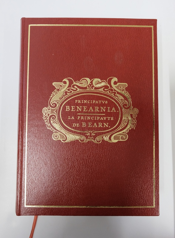
ref. REG5303M1980, SNERD, Pau. 2 volumes in-4 comprenant Principatus Benearnia et son Atlas historique. Principatus Benearnia, fort volume relié plein simili grenat, plats estampés, 637pp largement illustrées. Atlas Historique, cartographie Monique Morales, broché, plats marrons, 91pp. Page de titre épidermée sur volume Atlas. Bon ensemble en très bel état.
1777ref. 142441777 trois règles de jeu reliées en un volume, reliure plein veau havane raciné in-douze (binding full calfskin duodecimo), dos à nerfs (spine with raised bands) - décoration or (gilt decoration) à filets or (gilt lines) et à froid (blind-stamping decoration), entre-nerfs à fleuron au fer plein (between the raised bands floweret with full blocking stamp) et évidé (between the raised bands floweret with hollowed out blocking stamp) - titre frappé or (gilt title) - pièce de titre sur fond grenat (label of title) avec filet et roulette or (label of title with gilt line and fillets), coiffes manquantes (are missing the head and tail of the spine), manque de cuir en pied sur 1/4 de cm2, charnière du premier plat fendue sur 3cm (joint of the front cover cracked) et du quatrième plat sur 1,5 cm (joint of the back cover cracked), coins émoussés (corners blunt), un coin écorné (corner dog-eared), coupes légèrement frottées (rubbed lightly cuts), tête lisse (top edge smooth), toutes tranches lisses (all smooth edges) rouges (all red edges), Ex-Libris "Pierre Dervaux", sans illustration (no illustration), excepté une vignette de titre (title page decorated with a vignette of title) gravée sur bois en noir (engraving wood) + orné de bandeaux et de culs-de-lampe (illuminated of headpieces and tailpieces) gravés sur bois en noir (engraving wood) + toutes les pages des deux derniers volumes sont imprimées dans un encadrement d'un double filet en noir, 120 + 40 + 45 pages +En fin, 3 pages de tableaux vierges, puis 24 pages de modèles de tableaux des pertes et des gains de chaque mois de l'année, 1777 + 1773 + 1777 Amsterdam et Paris chez Fournier Libraire Editeur,