ORDNANCE SURVEYMareMagnum

12,289 results
1930Folding coloured map on cloth measuring 21.x 28.5 ins (approx. 53.0 x 72.0 cms) folding in 24 panels to 7.0 x 3.5 ins (approx. 18.0 x 9.0 cms); original pictorial card wrappers a very good bright clean copy. The famous Popular Edition One Inch series was first published in 1919 with striking 'cyclist' artwork by Ellis Martin. The present copy is the 1930 reissue; the covers are black with red sheet name and location map. Browne, 11.1.a
1914Folding coloured map on cloth measuring 21.x 28.5 ins (approx. 53.0 x 72.0 cms) folding in 24 panels to 7.0 x 3.5 ins (approx. 18.0 x 9.0 cms); original pictorial card wrappers covers lightly browned else a very good bright clean copy. The One Inch Coloured Edition dates from 1904. The present copy is the 1914 reissue; the covers are Ellis Martin's Royal Arms with mantling, dark red and brown variant. Browne, 10.2. SCARCE.
1912Folding coloured map on cloth measuring 21.5 x 30.5 ins (approx. 54.5 x 77.5 cms) folding in 21 panels to 7.0 x 4.5 ins (approx. 17.75 x 11.5 cms), lightly age-soiled as usual ; original marbled wrappers, upper wrapper with printed paper label, two folds neatly reinforced with tape, wrappers mildly age-faded else a very good, clean copy. The survey for the Third Edition (the second revision of the New Series) was carried out between 1901 and 1912. Coverage extends to Reigate in the south. Scarce in the Stanford cover, immediately predating the first of the OS-branded covers published in 1914.
1959No marks or inscriptions. Clean, not torn folded 1:250, 000 map opens out to 28 x 35 inches. Tiny nicks/creasing to oversized part of slightly sunned covers. 1pp. Covers South West Ireland from Limerick in the north down to Cork and Killarney in the west across to Tipperary.
1935Folding coloured map on linen measuring 22.0 x 28.5 ins (approx. 56.0 x 72.0 cms) folding in 21 panels to 7.5 x 4.25 ins (approx. 19.0 x 11.0 cms); a very good, bright, clean copy. The famous One Inch Fifth Edition series was first published in 1934 with striking 'younger sitting hiker' artwork by Ellis Martin. The present copy is the 1935 revision; the covers are the blue and black variant with location map. Browne, 11.2.unrecorded.
1914Well used lightly tanned map with damp effect to rear only, no corresponding marks to actual map. No added marks or inscriptions. Not torn but well rubbed at all fold corners. 1pp. Hill-shaded half-inch to one mile Ordnance Survey map of Brighton and surrounding district published in 1914. Opens up to 21 x 30 inches. Extremely scarce.
1935Folding coloured map on paper measuring 22 x 30 ins (approx. 56.0 x 76.0 cms) folding in 21 panels to 7.5 x 4.25 ins (approx. 19.0 x 11.0 cms); original pictorial card wrappers, wrappers lightly age-soiled else a very good, bright, clean copy. The Half Inch series was first issued in 1919 with striking 'motorist' artwork by Ellis Martin. The present copy is the 1935 revision; the covers are the green and brown variant with green sheet name. Browne, 12.2.a
1939Folding coloured map on cloth measuring 22 x 30 ins (approx. 55.5 x 76.0 cms) folding in 21 panels to 7.5 x 4.25 ins (approx. 19.0 x 11.0 cms); original pictorial card wrappers, neat contemporary signature on front wrapper, wrappers lightly age-soiled else a very good, bright, clean copy. With the trade ticket of Moyse of Sheffield on rear wrapper. The Half Inch series was first published in 1919 with striking 'motorist' artwork by Ellis Martin. The present copy is the 1939 revision; the covers are the green and brown variant with green sheet name. Browne, 12.2.a
1908Folding coloured map on cloth measuring 20.5 x 28.5 ins (approx. 52.0 x 72.0 cms) folding in 24 panels to 7.0 x 3.75 ins (approx. 17.75 x 9.5 cms), some mild age-soiling; original white cloth wrappers blocked and lettered in black, wrappers mildly age-soiled and lightly frayed at extremities else a good, clean copy.
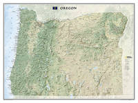
2012ref. 1-1597752401Natl Geographic Society Maps 2012. Map. New. rol map edition. 1 pages. 31.90x1.30x1.30 inches. Natl Geographic Society Maps unknown
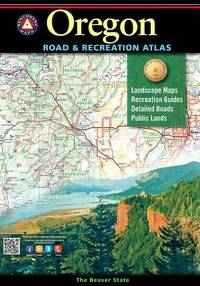
ref. DADAX0929591607Benchmark 2018-01-05. 8th Edition. paperback. New. 10.50x0.50x15.00. Buy with confidence. Excellent Customer Service & Return policy. Benchmark paperback
2024ref. SONGB0DLLLZ7KCBenchmark Maps 2024-12-15. 2024th ed. paperback. Used: Good. 11.00x1.00x16.00. Buy with confidence. Excellent Customer Service & Return policy. Benchmark Maps paperback
2022ref. 88352MissoulaMontana: Mountain Press Publishing 2022. Second Printing. Softcover. Near Fine. Perfectbound folio 9 in. x 8 1/4 in. A guide to 60 of the most compelling geologic sites in the state.with "destinations that span the state's geologic history from the Triassic marble at Oregon Caves to the 240 year-old lava dome on Mt. Hood. Covers Coast Range; Klamath Mountains; Cascade Range; Lava Plateaus; Blue Mountains; Basin and Range; With gGossary References and Index. Great maps and lovely color illustrations . 154 pages. Mountain Press Publishing unknown
ref. 6133466529National Geographic Maps . Other. New. pp. 1 National Geographic Maps unknown
No publication date (1950s?) eng
Madrid, 1856. Un mapa de 84 x 111 cm., plegado a 21 x 14 cm., coloreado, con planos particulares de Orense; Contornos de Orense; Ribadavia; Allariz; Ginzo de Limia (sic); Monte-Rey, y Verín. Encuadernación original en cartoné y media tela.
2025ref. 199506Spain: Meninas Cartoneras Editorial 2025. First edition. Cardboard Covers. New. 253p. illus. cardboard covers. "Orgullosamente Libres" commemorates 50 years of LGTBI struggle and progress in Spain compiling material that honors the history of the movement and its advances in rights and visibility. Meninas Cartoneras Editorial unknown
1956ref. 76405San Jose: H.M. Gousha Co. on or before 1956. First edition of this gathering. Folio 13 1/4 x 18 inches. 62 unused road maps in color and with inserts each neatly divided by side tabs. All maps bound on stubs. Original red cloth portfolio with flap and snap fasteners the Shell logo stamped on front cover some soiling or darkening to extremities. The portfolio has some expected wear but the maps are fresh and clean. Shell maps of this era are notable for their high-quality cartography colorful graphics and often included travel tips local advertisements and information about Shell services. None located by OCLC. Harry Mathias Gousha a former Rand McNally went independent in 1926 and relocated to California in 1947. It was a propitious time as the 50s in most respects witnessed the onset of the great American phenomenon of the Road Trip. With the improvement in cars longer and longer trips became feasible. None of the great Interstates as we know them today were in existence at that time so road maps were essential for any successful road trip. The H.M. Gousha Company was one of the "Big Three" major producers of road maps and atlases in the United States during the 25 years following World War II General Drafting and Rand McNally were the other two. Shell maps of this era although free are notable for their high-quality cartography colorful graphics and often included travel tips local advertisements and information about Shell services. The H. M. Gousha Company produced millions of oil company road maps used as marketing tools distributed at no charge at gas stations by customers that included Gulf Oil Conoco Shell Standard Oil and dozens of others. Though most Gousha maps were produced for oil companies many others were issued for customers not related to the petroleum industry including automobile clubs state governments banks and realtors. Ironically the company was purchased by Rand McNally in 1996. H.M. Gousha Co. hardcover
1708pp. [12], 915, (41) [Index] + Engraved frontis title page (drawn by Joseph Mulder and engraved by Willem de Broen) showing an enormous globe, the author and allegorical figures; Plus + Folding engraved map of the Old World (31 x 42 cm.) - "Orbis Terrarum Veteribus Cogniti Tabula" by Christoph CELLARIUS, showing not only Europe, Africa and Asia, but also Australia; and four woodcut decorated initial letters. Regular title printed in red and black with the Wetstein's engraved whetstone publisher's device. Latin text in roman types, with extensive passages in italic and Greek, and occasional Hebrew and fraktur. 4to. 205 mm. Old damp stain on the first few leaves. The early full leather binding is quite worn. ** The front pastedown bears an early autograph ownership - apparently that of Noel Antoine Pluche (1688-1761), noted French naturalist and writer. Full Title: Nicolai Gurtleri Origines Mundi & in eo Regnorum, Rerumpubl. Populorum; horumque Duces, Migrationes, Dii, Religio, Mores, Instituta, Res gesta, civiles, sacra, bellica. Referuntur omnia ad loca & tempora sua, & ex ipsis fontibus, fereque propriis Historicorum verbis ad modum Historiae Universalis, cum maxime Ecclesiasticae reprasentantur. Cum Indicibus necessariis, iisque locupletissimis. First and only edition of a detailed history of the ancient world, covering and comparing the cultures, religions, governments, (civil and ecclesiastical) legal systems, etc. of societies throughout the Old World. After a brief discussion of the pre-diluvian world, it covers the ancient Middle East, Africa, Asia and Europe country by country or region by region, citing both biblical and classical sources. The Cellarius map appears to be based on the 1664 map of the same title by Johannes Strubius (Shirley 434, in the same projection and showing the same regions, but not including Australia), but its more accurate and up-to-date cartographic data appears to have been taken from one of the world maps in two hemispheres that were common from at least 1658 (Visscher's, Shirley 406). As in those maps, the coast of Australia shows a small break at 30 degrees south latitude. Cellarius (1638-1707) had produced a series of historical maps for his Notitia Orbis Antiqui, first published at Leipzig in 1701, and the present map may be based on one from that book. A detailed ancient history, with an attractive and unusually accurate folding map of the Old World. SCARCE. NCC (5 copies); OCLC WorldCat (7 copies); STCN (1 copy). **PRICE JUST REDUCED! W153
1945No marks or inscriptions. No creasing to covers or to spine. A very clean very tight copy with bright unmarked boards, very slight foxing to page edges and no bumping to corners. 286pp. Detailed guide to the Orkney Islands, to the north of Scotland's mainland.
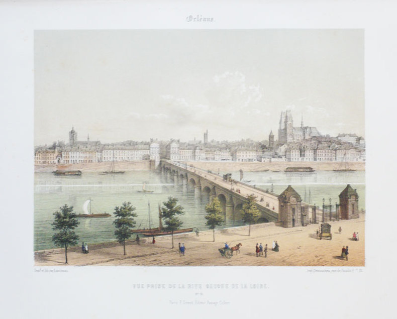
1855ref. LBW-888Paris F. Sinnett circa 1855 242 x 275 mm.
ref. LBW03d6bParis Benard circa 1850 216 x 295 mm.
ref. 1841395730.Gmap. Good. Access codes and supplements are not guaranteed with used items. May be an ex-library book. unknown
ref. GrayTPB2KW087Trakker Maps Inc. Trade paperback. Good. Prompt shipment with tracking. we ship in CLEAN SECURE NEW boxes Good trade paperback map some stains Trakker Maps, Inc paperback
40 x 55 cm. Blattgröße: 51 x 62 cm. *Gleichmäßig leicht gebräunt, sonst gut erhalten. Landkarten de