(ed), C C J Bond (Maps) W R FeasbyBiblio.com

12,365 results
1956ref. 15240Ottawa: Edmond Cloutier Queens' Printer and Controller of Stationery. Very Good in Very Good- dust jacket. 1956. First Edition. Hardcover. Volume I has no dust jacket the red coth covered boards dated 1956 some shelf soil to page edges top back corner bumped. Volume II dated 1953 has chipped DJ 1 inch tear bottom front panel and 2 inch tear top back panel.; Fold-out maps in Vol. I and map endpapers appear undamaged B&W and color illustrations in Vol II; Color Illustrations . Edmond Cloutier, Queens' Printer and Controller of Stationery hardcover
1938ref. 041686Ottawa: The Minister Of National Defence 1938. Book. Near Fine. Hardcover. 1st Edition. 4to - over 9¾ - 12" tall. 460 Pages Maps. The Minister Of National Defence Hardcover
1914ref. CJSBM18X1914. Hardcover. Fair. . These are a collection of First World War maps from the 1920s and 30s detailing battles and tactics.They are associated with similar volumes of text but would befit anyone who has an appetite for old war maps war history or those seeking original research.Some are unopened from their original paper clasps and are in almost pristine condition save a bit of fading and the odd library sticker mark.A very rare find.Ex private library stock so expect some library markings and sparse annotations in the text. Binder in good to very good condition with only a few signs of wear considering age. All maps present. Some yellowing of pages and some bleaching on spine. Foxing on some maps and boxes. Please note that the image above is a stock photo and may differ somewhat to that of the item delivered. 1918 variant includes both text AND maps.Many thanks for looking. hardcover
1914ref. CJSBM16K1914. Hardcover. Fair. . These are a collection of First World War maps from the 1920s and 30s detailing battles and tactics.They are associated with similar volumes of text but would befit anyone who has an appetite for old war maps war history or those seeking original research.Some are unopened from their original paper clasps and are in almost pristine condition save a bit of fading and the odd library sticker mark.A very rare find.Ex private library stock so expect some library markings and sparse annotations in the text. Binder in good to very good condition with only a few signs of wear considering age. All maps present. Some yellowing of pages and some bleaching on spine. Foxing on some maps and boxes. Please note that the image above is a stock photo and may differ somewhat to that of the item delivered. 1918 variant includes both text AND maps.Many thanks for looking. hardcover
1935ref. 624644London: Macmillan and Co Ltd 1935. Eight volumes complete. Ex-library red cloth hardcovers with gilt lettering to the spines no dust jackets from Chris Church College Oxford in very good condition for their age. Maps and sketches by Major A.F. Becke. Book 1: The German march offensive and its preliminaries. Book 2: The German march offensive and its preliminaries: Appendices. Box 1: Maps. Book 3: March-April: Continuation of the German offensives. Box 2: Maps. Book 5: May-July: The German diversion offensives and the first allied counter-offensive. Volume IV: 8th August-26th September: The Franco-British Offensive. Volume V: 26th September-11 November: The advance to victory. Boards are somewhat sunned with labels on the lower spines. Spine ends are slightly bumped Page blocks and endpapers are lightly foxed with some foxing on occasional pages. Within customary array of labels and stamps. Bindings are sound and pages are otherwise clear. LW. Hardcover. Very Good/No Dust Jacket. Used. Macmillan and Co Ltd Hardcover
1957ref. 86782chOttawa: Minister of National Defence 1957. Book. Near Fine. Hardcover. 8vo - over 7¾" - 9¾" tall. Three-volume set all gilt red cloth hardcovers. Published 1957 1958 and 1960 respectively incorporating corrections. Apart from moderate handling to covers slight toning to edges and an old owner's name inside front cover of each volume these are all clean tight and unmarked volumes. Very neat -- a sound and handsome set. Endpaper maps. Illustrated frontispiece. Illustrations and folding maps. Minister of National Defence Hardcover
ref. 0881300748.Ghardcover. Good. Access codes and supplements are not guaranteed with used items. May be an ex-library book. hardcover
Aufgefaltet: 59 x 78 cm. Aufgezogen auf Leinen und gefaltet in 18 Segmenten *Sauber und gut erhalten. Landkarten de
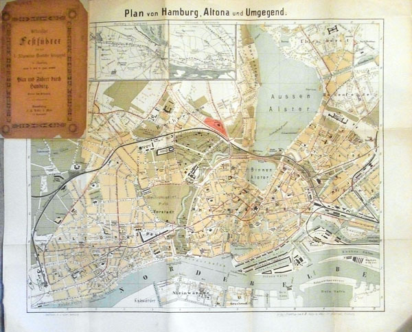
1883ref. 56804Hamburg, F. H. Nestler & Melle, ( 1883). X, 24 S. (davon 6 S. Anzeigen). Mit 1 mehrfach gefalt. farb. lithograph. Plan (Blattgröße 41 x 50,5 cm, Bildgr. 34,5 x 42,5 cm). Kl.-8vo. Spät. Kart. mit mont. Orig.-Brosch.-Deckeln (diese beschädigt).
1992VG paperback . Auction catalogue. 10090 eng
1999ref. 104692Vestal Press 1999 In-4 broché 27,5 cm sur 20,5. Livre en anglais. 207 pages. Très bon état d’occasion.
1840ref. 344261840. Lg. format. Green cloth. gilt. Bound maps numbered 1 - 110. Numbers not bound in: 92224314546606979109. 100 maps bound in. Plus 23 maps bound in rear from Lewis's Topographical Dictionary. 41 hand-coloured maps 59 plates hand-coloured Town Plans taken from the "View of the Representative History of England Samuel Lewis". A very nice copy. hardcover
1993No marks or inscriptions. A very clean very tight fold-out map with bright unmarked uncreased cover and no bumping to corners. pp. Map of the Bethnal Green and Bow areas of London from 1914. Detailed description on reverse side.
1997Mint unused map pp. Map of the South Reddish & Brinnington districts of Stockport on Lancashire sheet No 112.05 from 1904.
1880pp. xii, 266 + Twenty-two folding maps and plans. Numerous text drawings. Decorated title page. Unopened. XLib. 8vo. Original full cloth binding, gold lettered spine. Gilt pictorial vignette of Romulus and Remus nursing on the she-wolf on front cover. Binding slightly faded. Hardbound. Though XLib, still a very nice 1880 handbook about the then existing ruins and monuments of ancient Rome. **PRICE JUST REDUCED! TRAVEL/2
1990223 pages including two indeces. Author continues the pursuit of her long standing interest in the education and training of professional psychologists. A valuable resource for instructors of graduate programs in Psychology, Social Work, Psychiatric Nursing, Psychiatry and Counseling. Clean, crisp and unmarked with negligible wear. Excellent copy. Book
ref. Q-1566954029National Geographic Maps 2019-01-01. Map. New. In shrink wrap. Looks like an interesting title! National Geographic Maps unknown
150 x 130 cm. Scale: 1:3,000,000. Colour lithograph, dissected into 24 sections and mounted on original linen. Very rare, monumental wall map of the Ottoman Empire, featuring one of the largest and most detailed printed representations of the Arabian Peninsula produced in the Islamic World prior to World War I. Perhaps more than any other map, it reveals the immense logistic challenges faced by Hajj pilgrims just in advance of the construction of the Baghdad and Hejaz Railway systems. Printed for official use, the map appeared at a time when the Sublime Porte was going to great lengths to shore up its authority in the Red Sea region (Hejaz, Asir, and Yemen), while being pressured by Britain to retreat from the domains it claimed in the Arabian Gulf (Kuwait, Al-Qatif/Hofuf, and Qatar). - Indeed, the present map would have been of great value to Ottoman generals and cabinet officials for strategic planning, as Arabia was increasingly a focus of global attention and interference. It served as the ideal strategic aid to chart the future construction of the Hejaz Railway (built 1900-08) and the Baghdad Railway (extended from the Anatolian Railway, from 1903 onwards) and delineates some of the world's most strategically important railway lines before 1900. - The main map encompasses most of the Arabian Peninsula, from Qatar and the Hadramaut westwards (while far eastern Arabia, including Oman and what is today the United Arab Emirates is featured in an inset, lower left). The coastlines and rivers are crisply depicted; mountain ranges are expressed by delicate tan shading; all cities and towns of note are labelled; the names of regions and tribal areas are revealed, while all key roads and Hajj caravan routes are delineated. The map features stellar coverage of the western Gulf region, labelling Qatar (then an autonomous part of the Ottoman Empire), Bahrain (a British protectorate prized for its fine natural harbour), and Kuwait, an autonomous Sheikhdom within the Ottoman Empire that would shortly become a British protectorate. Inland, the map details the Saudi-Wahhabi domain Nejd, with its capital Riyadh, while to the northwest lies the territory of the rival Al-Rashid clan, with its capital Ha’il. - Minor soiling and waterstaining, occasional light edge wear. Tears in linen partly repaired. A rare survival. Osmanli cografya literatürü tarihi [History of geographical literature during the Ottoman period], pp. 756f. David Rumsey Map Collection 13186.000 (the single other copy known in the trade). Not in Al-Qasimi collection (1493-1931).
1873ref. 58308(Washington : Government printing Office, 1873). 8vo. In later half cloth with the original wrappers pasted on to boards. From ""Mittheilungen aus der norddeutschen Seewarte"", von W. von Freeden. Abstract, translated from the ""Revue maritime et coloniale"". July, 1873. Stamp to front board and first leaf of text. 12 pp. + folded chart.
ref. SLIVCN-3760024990523MINUS EDITIONS
1968ref. 90688Strasbourg sans nom 1968 1 vol. broché 1 feuillet dactylographié recto-verso, daté du 3 décembre 1968, non signé. Tract strasbourgeois en réaction à la loi Faure du 12 novembre.
1968ref. 90688Strasbourg sans nom 1968 1 vol. broché 1 feuillet dactylographié recto-verso, daté du 3 décembre 1968, non signé. Tract strasbourgeois en réaction à la loi Faure du 12 novembre.
1994ref. Q-0719550173John Murray 1994-01-01. Hardcover. New. In shrink wrap. Looks like an interesting title! John Murray hardcover
1873(Washington : Government printing Office, 1873). 8vo. In later half cloth with the original wrappers pasted on to boards. From ""Mittheilungen aus der norddeutschen Seewarte"", von W. von Freeden. Abstract, translated from the ""Revue maritime et coloniale"". July, 1873. Stamp to front board and first leaf of text. 12 pp. + folded chart.
1929Approx. 23" x 33" standard topographical map. Coloured. Library markings. Two-inch opening to bottom edge. Shorter openings to top and right edges. Somewhat above-average wear and soiling. Book