Antiquariat.de
12,201 results
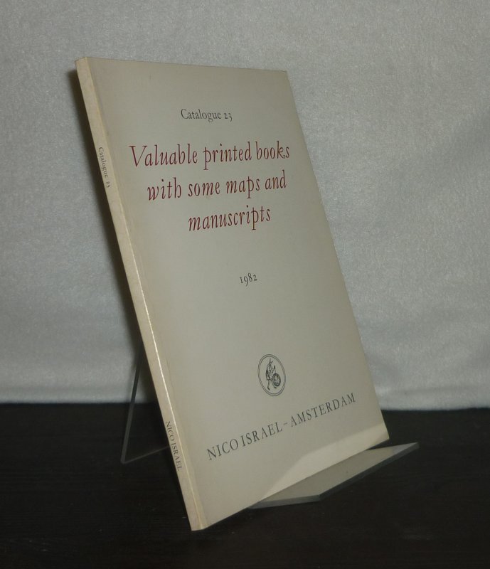
1982ref. 3127139Amsterdam: Nico Israel 1982. 85 Seiten. Mit vereinzelten Illustrationen. 8° (17,5-22,5 cm). Illustrierte Orig.-Broschur. [Softcover / Paperback].
ref. 13668s.l., s.n., 1906, 1 date "1906", en chiffres dorés et gauffrés avec 3 vues de Vales les Bains insérées en médaillons dans les ovales des chiffres "9", "0" et "6". carte postale de 14 x 9 cm ;
ref. 9119s.l., Novelta, correspondance manuscrite au dos, datée de 1918, 1 carte postale de 13 x 8 cm, enfants au premier plan, personnages au second plan.
ref. 12728s.l., collection "Vals Société Générale", s.d. (début XXème), 1 carte postale de 14 x 9 cm.
ref. 12802s.l., collection Société Générale, s.d. (début XXème), 1 carte postale de 14 x 9 cm.
ref. 12803s.l., collection "Vals Société Générale", s.d. (début XXème), 1 carte postale de 14 x 9 cm ;
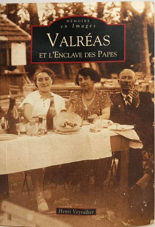
2010ref. 6829Editions Sutton 2010 128 pages 16 4x0 8x23 4cm. 2010. broché. 128 pages. Cet ouvrage d'Henri Veyradier historien local utilise des cartes postales anciennes pour restituer la vie des habitants de Valréas au début du XXe siècle. Il retrace l'histoire de l'Enclave des Papes un territoire formé par Valréas Grillon Richerenches et Visan qui fut propriété pontificale pendant plus de quatre siècles au cœur du royaume de France
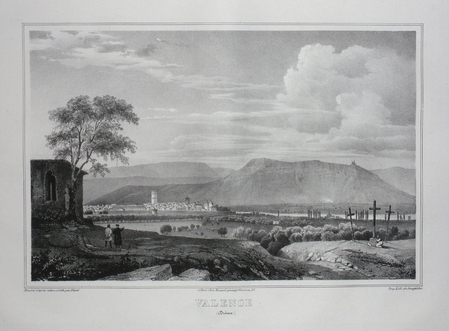
ref. LBW03d5cParis Benard circa 1850 218 x 297 mm.
196380 pages. Provides colour maps and information on accommodation, entertainment, bush pilots, fishing regulations, and more. Dozens of great vintage ads for related local businesses. Nice colour photo ad for Thitfield Lodge, Hotel & Motel inside front cover. Back cover ad for Sudbury sponsored by their Chamber of Commerce features colour photo of molten slag being poured with belching smokestacks in background (Say what?). Other nice ads for Caswell Motor Hotels, Rusty Myers Flying Service, Camp Beaverhead, Camp Manitou, Dalseg's Shopping Centre, Swenson's Camp, Sabourin Lake Lodge (in colour), Barney's Ball Lake and God's Lake Lodges, Doug Hook's Separation Lake Camp, Sault Airways, Wawa's Lakeview Hotel, The Kitchener Hotel in Parry Sound, Moose Lake Lodge, Eden Roc Motel, Larry's Tavern in Pointe Au Baril, Red Pines Lodge, and dozens more. Somewhat above-average wear. Bit of writing atop front cover and small bookseller's stamp inside back cover. A great vintage item sure to help readers recount happy vacation times spent in Northern Ontario many moons ago. Book
ref. SLIVCN-3770007879905KEROZENN
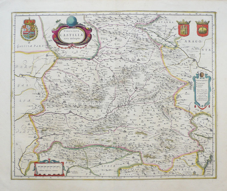
1638ref. LBW-949Amsterdam 1638-1640 411 x 501 mm.
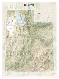
ref. A9781597752466Sheet map rolled. New. unknown
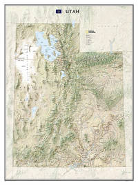
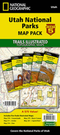
2012ref. 1-1597752460Natl Geographic Society Maps 2012. Map. New. rol map edition. 1 pages. 31.70x2.00x1.70 inches. Natl Geographic Society Maps unknown
ref. ANAIS-1597755974National Geographic Maps. other. Good. 4.3x0.6x9.3. Buy with confidence. Excellent Customer Service & Return policy. National Geographic Maps unknown
ref. 1597755974.Gmap. Good. Access codes and supplements are not guaranteed with used items. May be an ex-library book. unknown
2023ref. SONG1597755974National Geographic 2023-01-01. 2023. map. Used: Good. 4.25x0.50x9.25. Buy with confidence. Excellent Customer Service & Return policy. National Geographic unknown
2023ref. DADAX1597755974National Geographic 2023-01-01. 2023. map. New. 4.25x0.50x9.25. Buy with confidence. Excellent Customer Service & Return policy. National Geographic unknown
ref. ING9781597755979National Geographic Maps. New. Special order direct from the distributor National Geographic Maps unknown
ref. 117558Editions Leclerc Imprimeur, Saint-Lo, Edité en Amérique par La Division historique du Département de l'Armée, traduit par Alexandre Renaud, sans date, VIII-197 p. et XIV cartes in fine, demi-maroquin à coins marron, environ 28x22cm. Une tache discrète sur le mors-peau du premier plat, premier plat d'origine découpé et contrecollé, un dessin au stylo sur la page de titre, de pâles rousseurs, certaines pages sont un peu froissées, la carte I a été restaurée, de petites déchirures sur les bords des cartes. Bon état pour le reste.
1987No marks or inscriptions. A lovely clean crisp tight copy with bright boards and no bumping to corners. Dust jacket not price clipped or torn with a little light creasing to edges. 160pp. A very personal guided tour of the world's largest country by it's most famous 'grandson'. This is an amusing and attractive book which also opens the door to a Russia only a few have been able to see and appreciate. Over 100 original photos, many taken by the author himself.
Colour-printed map, 730 x 560 mm. Scale 1:1,000,000. On verso: legend, aeronautical information, and index map. First edition. - Pilot's map of Wadi Sirhan in the border region of Iraq, Saudi Arabia and Transjordan. It shows international boundaries populated places, roads and tracks, railways, wireless telegraph stations, forts, wadis, wells, vegetation and terrain features. Shows also parts of Transjordan and Iraq, including the zigzagging border between Saudi Arabia and Transjordan. - In excellent condition.
Colour printed map, 765 x 565 mm. Scale 1:1,000,000. On verso aeronautical symbols and world aeronautical chart index. Third edition. - Pilot's map of the Suez region with the 1949 Armistice border, the de facto borders of the State of Israel from 1949 until the Six-Day War in 1967. In addition, the chart shows parts of the Mediterranean, the Gulf of Suez and the Gulf of Aqaba, and details major cities including Cairo, Port Said, al-Mansura, al-Fayyum, and Jerusalem, as well as main roads, wadis, and landmarks such as Saint Catherine's Monastery on Mount Sinai. - Very well-preserved.
1650Rarissima ristampa della lastra anonima - attribuita ad Antonio Lafreri, databile al 1555/60. Esemplare nel quarto stato di quattro descritto in Bifolco-Ronca, pagina 2377, con l'indirizzo di Jollain. In alto a sinistra l’iscrizione Urbis Rome totius olim orbis domitricis, situs: cum adhuc extantibus, sacrosancte vetustatis monumentis PIRRHO LIGORIO NEAP. INVENTOR. Orientazione nei quattro lati al centro con il nome dei punti cardinali SEPTENTRIO, MERIDIES, ORIENS, OCCIDENS, il nord a sinistra. Anonima pianta prospettica della città, basata sulla pianta di Pirro Ligorio, edita da Michele Tramezzini nel 1552. La pianta è inserita in alcuni esemplari dello Speculum Romanae Magnificentiae di Antonio Lafreri, al quale, pertanto, viene attribuita. Il grande interesse storico di questa pianta non è dato dall’opera stessa, una semplice copia del lavoro del Ligorio, ma è rappresentato dalle tirature successive di questa lastra. Il secondo stato, databile alla seconda metà del XVII secolo, è completamente emendato ed arricchito da toponomastica in lingua francese. Viene inserita anche una lunga descrizione della città, sempre in lingua francese. Alla morte di Antonio Lafreri (1577), i due terzi delle lastre furono divisi tra i nipoti Stefano e Claudio Duchetti. Il restante terzo venne suddiviso tra più editori. Questa lastra, quindi, potrebbe avere preso la via di Parigi, dove venne ristampata circa un secolo dopo. In alternativa, la carta potrebbe essere stampata Roma ed emendata in lingua francese. Tale edizione viene descritta da Hülsen (1915), che la annovera tra le “Copie e ristampe”, come "Incisa nel sec. XVII ex.ovvero XVIII. Ne vidi una copia presso il sig. Lang nel 1914" (la libreria antiquaria Lang di Roma). Un altro esemplare, che tuttavia potrebbe essere lo stesso citato da Hülsen, è descritto nella biblioteca della British School of Rome, appartenuto alla celebre collezione di Thomas Ashby (1874-1931), direttore dell’accademia dal 1906 al 1925. Sempre Hülsen cataloga lo stato finale dell’opera, con l’indirizzo dell’editore francese Francois Jollain. L’opera appartiene allo Speculum Romanae Magnificentiae, la prima iconografia della Roma antica. Lo Speculum ebbe origine nelle attività editoriali di Antonio Salamanca e Antonio Lafreri (Lafrery). Durante la loro carriera editoriale romana, i due editori - che hanno lavorato insieme tra il 1553 e il 1563 - hanno avviato la produzione di stampe di architettura, statuaria e vedutistica della città legate alla Roma antica e moderna. Le stampe potevano essere acquistate individualmente da turisti e collezionisti, ma venivano anche acquistate in gruppi più grandi che erano spesso legati insieme in un album. Nel 1573, Lafreri commissionò a questo scopo un frontespizio, dove compare per la prima volta il titolo Speculum Romanae Magnificentiae. Alla morte di Lafreri, due terzi delle lastre di rame esistenti andarono alla famiglia Duchetti (Claudio e Stefano), mentre un altro terzo fu distribuito tra diversi editori. Claudio Duchetti continuò l’attività editoriale, implementando le lastre dello Speculum con copie di quelle “perdute” nella divisione ereditaria, che fece incidere al milanese Amborgio Brambilla. Alla morte di Claudio (1585) le lastre furono cedute – dopo un breve periodo di pubblicazione degli eredi, in particolare nella figura di Giacomo Gherardi - a Giovanni Orlandi, che nel 1614 vendette la sua tipografia al fiammingo Hendrick van Schoel. Stefano Duchetti, al contrario, cedette le proprie matrici all’editore Paolo Graziani, che si associò con Pietro de Nobili; il fondo confluì nella tipografia De Rossi passando per le mani di editori come Marcello Clodio, Claudio Arbotti e Giovan Battista de Cavalleris. Il restante terzo di matrici della divisione Lafreri fu suddiviso e scisso tra diversi editori, in parte anche francesi: curioso vedere come alcune tavole vengano ristampate a Parigi da Francois Jollain alla m... A very rare map of the city, published in Paris in the mid-seventeenth century using the plate made in Rome by Antonio Lafreri. Example of the fourth state of four, with the Jollain's imprint. The map is based on that of Pirro Ligorio, 1552, edited by Michele Tramezini in Rome, and its subsequent and numerous variants. In the upper left the inscription Urbis Rome totius olim orbis domitricis, situs: cum adhuc extantibus, sacrosancte vetustatis monumentis PIRRHO LIGORIO NEAP. INVENTOR. Orientation in the four sides to the center with the name of the cardinal points SEPTENTRIO, MERIDIES, ORIENS, OCCIDENS, the north on the left. Anonymous map of the city, based on the work byPirro Ligorio, published by Michele Tramezzini in 1552. The ma is inserted in some of the Speculum Romanae Magnificentiae of Antonio Lafreri, to which therefore it is attributed. The great historical interest of this map is not given by the work itself, a simple copy of Ligorio's work, but is represented by the subsequent issues of this plate. The second state, datable to the second half of the seventeenth century, is completely amended and enriched by toponymy in French. A long description of the city is also included, again in French. It is known that, at the death of Antonio Lafreri (1577), two thirds of the plates were divided between his nephews Stefano and Claudio Duchetti. The remaining third was divided among several publishers. This plate therefore may have taken the road to Paris, where it was reprinted about a century later. This edition is described by Hülsen (1915), who lists it among the "Copies and reprints", as "Engraved in the seventeenth century ex.ovvero XVIII. According with Bifolco-Ronca this is the final state of the work, with the address of the French publisher Francois Jollain. The work belongs to the Speculum Romanae Magnificentiae, the earliest iconography of ancient Rome. The Speculum originated in the publishing activities of Antonio Salamanca and Antonio Lafreri (Lafrery). During their Roman publishing careers, the two editors-who worked together between 1553 and 1563-started the production of prints of architecture, statuary, and city views related to ancient and modern Rome. The prints could be purchased individually by tourists and collectors, but they were also purchased in larger groups that were often bound together in an album. In 1573, Lafreri commissioned a frontispiece for this purpose, where the title Speculum Romanae Magnificentiae appears for the first time. Upon Lafreri's death, two-thirds of the existing copperplates went to the Duchetti family (Claudio and Stefano), while another third was distributed among several publishers. Claudio Duchetti continued the publishing activity, implementing the Speculum plates with copies of those "lost" in the hereditary division, which he had engraved by the Milanese Amborgio Brambilla. Upon Claudio's death (1585) the plates were sold - after a brief period of publication by the heirs, particularly in the figure of Giacomo Gherardi - to Giovanni Orlandi, who in 1614 sold his printing house to the Flemish publisher Hendrick van Schoel. Stefano Duchetti, on the other hand, sold his own plates to the publisher Paolo Graziani, who partnered with Pietro de Nobili; the stock flowed into the De Rossi typography passing through the hands of publishers such as Marcello Clodio, Claudio Arbotti and Giovan Battista de Cavalleris. The remaining third of plates in the Lafreri division was divided and split among different publishers, some of them French: curious to see how some plates were reprinted in Paris by Francois Jollain in the mid-17th century. Different way had some plates printed by Antonio Salamanca in his early period; through his son Francesco, they goes to Nicolas van Aelst's. Other editors who contributed to the Speculum were the brothers Michele and Francesco Tramezzino (authors of numerous plates that flowed in part to the Lafreri printing house), Tommaso Barlacchi,...
1716Pianta a proiezione mista, orientata con il nord a sinistra, ripresa dalla pianta di Giovan Battista Falda. "E' una copia della pianta di Johannes De Ram senza alcun aggiornamento. In alto a destra lo stemma di Clemente XI (1700-1721). Sebbene stampata intorno al 1720 raffigura la città alla fine del Seicento, come avviene per un cospicuo nucleo di piante derivate dal Falda ed edite nel Nord Europa in questo periodo, nelle quali tutti i cambiamneti si concentrano nei nuovi apparati decorativi e non nel contenuto della pianta stessa" (cfr. Marigliani p. 229, n. 133). La carta fu realizzata da Homann per il suo Grosser Atlas. Johann Baptist Homann è stato un geografo e cartografo tedesco; nel 1702 fondò la sua casa editrice. Homann acquisì fama come uno dei principali cartografi tedeschi, e nel 1715 fu nominato geografo imperiale dall'imperatore Carlo VI. Nello stesso anno fu anche nominato membro dell'Accademia Prussiana delle Scienze a Berlino. Nel 1716 Homann pubblicò il suo capolavoro Grosser Atlas ueber die ganze Welt. Numerose mappe furono redatte in collaborazione con l'incisore Christoph Weigel. Homann morì a Norimberga nel 1724. Gli successe suo figlio Johann Christoph (1703-1730). L'azienda continuò dopo la sua morte come azienda degli eredi Homann, gestita da Johann Michael Franz e Johann Georg Ebersberger. Dopo successivi cambiamenti nella gestione, l'azienda si sciolse nel 1852. Acquaforte, bella coloritura coeva editoriale, in buono stato di conservazione. Mixed projection map, oriented with north on the left, based on the map of Giovan Battista Falda. It is a close copy of the map of Johannes De Ram without any update. In the upper right corner is the coat of arms of Clemente XI (1700-1721). Although printed around 1720 it depicts the city at the end of the seventeenth century, as is the case for a large group of maps derived from Falda and published in Northern Europe in this period, in which all the changes are concentrated in the new decorative apparatus and not in the content of the map itself (see Marigliani p. 229, n. 133). The map was made by Homann for his Grosser Atlas. Johann Baptist Homann was a German geographer and cartographer; in 1702 he founded his own publishing house. Homann acquired renown as a leading German cartographer, and in 1715 was appointed Imperial Geographer by Emperor Charles VI. In the same year he was also named a member of the Prussian Academy of Sciences in Berlin. In 1716 Homann published his masterpiece Grosser Atlas ueber die ganze Welt; numerous maps were drawn up in cooperation with the engraver Christoph Weigel the Elder. Homann died in Nuremberg in 1724 and was succeeded by his son Johann Christoph (1703-1730). The company carried on upon his death as Homann heirs company, managed by Johann Michael Franz and Johann Georg Ebersberger. After subsequent changes in management the company folded in 1852. Etching with fine original colour, good condition. Huelsen (1915): n. 124a; Scaccia Scarafoni (1939): n. 210; C. Marigliani, "Le Piante di Roma delle collezioni private", tav. 133.
1575Pianta archeologica di Roma, a proiezione verticale obliqua, orientata con il nord in alto.La pianta deriva da quella che Pirro Ligorio disegna per l'editore Michele Tramezzino nel 1552. Si tratta della prima derivazione stampata all'estero ed è ridotta leggermente nelle dimensioni. Erroneamente viene indicata come data d'esecuzioni il 1570, invece del 1552. Appare per la prima volta nel 1575, inserita nel Civitates Orbis Terrarum, il primo atlante devoto esclusivamente alle piante e vedute delle principali città del mondo. L’opera è inserita nel Civitates Orbis Terrarum, il primo atlante devoto esclusivamente alle piante e vedute delle principali città del mondo. Il primo volume delle Civitates Orbis Terrarum fu pubblicato a Colonia nel 1572. Il sesto e ultimo volume apparve nel 1617. Questo grande atlante di città – cartografia urbana - curato da Georg Braun e inciso in gran parte da Franz Hogenberg, conteneva 546 prospettive, vedute a volo d'uccello e vedute cartografiche di città di tutto il mondo. Franz Hogenberg realizzò le tavole dei primi quattro volumi e Simon van den Neuwel (Novellanus, attivo dal 1580) quelle dei volumi V e VI. Georg Braun (1541-1622), un ecclesiastico di Colonia, fu il principale redattore dell'opera e fu molto aiutato nel suo progetto dalla vicinanza e dal continuo interesse di Abraham Ortelius, il cui Theatrum Orbis Terrarum del 1570 fu, come raccolta sistematica e completa di mappe di stile uniforme, il primo vero atlante. Le Civitates, in effetti, erano destinate ad accompagnare il Theatrum, come indicato dalla somiglianza dei titoli e dai riferimenti contemporanei sulla natura complementare delle due opere. Tuttavia, le Civitates erano progettate per avere un approccio più popolare, senza dubbio perché la novità di una raccolta di piante e vedute di città rappresentava un'impresa commerciale più rischiosa di un atlante mondiale, per il quale c'erano stati diversi precedenti di successo. Franz Hogenberg (1535-1590) era figlio di un incisore di Monaco che si era stabilito a Malines. Incise la maggior parte delle tavole del Theatrum di Ortelius e la maggior parte di quelle delle Civitates, e potrebbe essere anche indicato come il responsabile dell'origine del progetto. Oltre un centinaio di artisti e cartografi diversi, il più importante dei quali fu l'artista di Anversa Georg Hoefnagel (1542-1600), fornirono i disegni per le tavole delle Civitates. Hoefnagel non solo contribuì alla maggior parte del materiale originale per le città spagnole e italiane, ma rielaborò e modificò anche quello di altri collaboratori. Dopo la morte di Hoefnagel, il figlio Jakob continuò il lavoro per le Civitates. Gli autori della raccolta si proponevano di raffigurare "non icones et typi urbium", cioè non immagini generiche e tipizzate, "sed urbes ipsae admirabili caelaturae artificio, spectantium oculis subiectae appareant": non intendeva alludere o idealizzare, ma rappresentare fedelmente sulla carta, riprodurre esattamente, e in tempo reale, ciò che l'occhio vede, come annunciato nella prefazione al primo volume delle Civitates Orbis Terrarum. Incisione in rame, finemente colorata a mano, in ottimo stato di conservazione. Archeological map of Rome published in the Civitates Orbis Terrarum of 1575.The map is a close copy of the Pirro Ligorio map of Rome (1552, published by Michele Tramezzino) reduced in size. Latin text edition. The work is included in the Civitates Orbis Terrarum, the first atlas devoted exclusively to plans and views of the world's major cities. Printed in six volumes between 1572 and 1617 it was so successful and widespread that several editions translated into Latin, German and French were printed. The first volume of the Civitates Orbis Terrarum was published in Cologne in 1572. The sixth and the final volume appeared in 1617. This great city atlas, edited by Georg Braun and largely engraved by Franz Hogenberg, eventually contained 546 prospects, bird-eye views and map views of cities from all over the world. Fransz Hogenberg produced the plates for the first four books, and Simon van den Neuwel (Novellanus, active since 1580) those for volumes V and VI. Georg Braun (1541-1622), a cleric of Cologne, was the principal editor of the work, and was greatly assisted in his project by the close, and continued interest of Abraham Ortelius, whose Theatrum Orbis Terrarum of 1570 was, as a systematic and comprehensive collection of maps of uniform style, the first true atlas. The Civitates, indeed, was intended as a companion for the Theatrum, as indicated by the similarity in the titles and by contemporary references regarding the complementary nature of two works. Nevertheless, the Civitates was designs to be more popular in approach, no doubt because the novelty of a collection of city plans and views represented a more hazardous commercial undertaking than a world atlas, for which there had been a number of successful precedents. Franz Hogenberg (1535-1590) was the son of a Munich engraves who settled in Malines. He engraved most of the plates for Ortelius's Theatrum and the majority of those in the Civitates, and may have been responsible for originating the project. Over a hundred of different artists and cartographers, the most significant of whom was Antwerp artist Georg Hoefnagel (1542-1600), engraved the cooper-plates of the Civitates from drawings. He not only contributed most of the original material for the Spanish and Italian towns but also reworked and modified those of other contributors. After Hoefnagel's death his son Jakob continued the work for the Civitates. The author set out to depict "non icones et typi urbium," that is, not generic and typified images, "sed urbes ipsae admirabili caelaturae artificio, spectantium oculis subiectae appareant": not intended to allude or idealize but to represent faithfully on paper, to reproduce exactly, and in real time, what the eye sees, as announced in the preface to the first volume of Civitates Orbis Terrarum. Copperplate with fine later hand colour, good condition. Scaccia Scarafoni p. 29, n. 22.