1951Very Good French A rare color lithograph map of French Indochina, showing international and provincial boundaries, transportation, and water features. Relief is shown by shading, spot heights, and bathymetric contours, as well as Cambodge, Thailande, Hai-Nan Island, Golfe du Tonkin, Mer de Chine, Yunnan Kouang-si, Kouang-Toung, Laos, Annam, Tonkin, Golfe du Siam, Bangkok, etc. Depths shown by contours. Prime meridians: Greenwich and Paris. "Compliled and drafted by l'Institut ge?ographique national, 1938. Revised by the Service ge?ographique de l'Indochine, 1948. Copied by AMS, 1951.". Original color map. Good. Folded. Double elephant folio. (93 x 66 cm). In French. 2 copies in OCLC (1948 Edition).; LCCN map59000405. Scale: 1/2000000. Restored on folded trace on right corner. A good copy.
1926Very Good Turkish, Ottoman (1500-1928) Original map of Kars Fortress. Oblong: 45x57 cm. In Ottoman script. Scale: 1/21000. [PLAN OF KARS FORTRESS] Kars Kal'asi plâni (Based on 1898 discoveries and 1908 practice). A very detailed plan in Ottoman script of Kars Fortress and is environment. Some red markings. Extremely rare.
1900Very Good German Original b/w city plan. Atlas folio. (58x47 cm). In German. Folded. [CITY PLAN of BRAILA -IBRAIL-] Stadtplan von Braila. Scale (Masstab): 1/10.000. No cartographer. 33 descriptive articles on bottom-right corner of the plan. Slightly chipped at extremities of paper and soiling. It shows Braila and Donau. Braila (Turkish: Ibrail) is a city in Muntenia, eastern Romania, a port on the Danube and the capital of Braila County. There's some Ottoman manuscript including translations of the German descriptive text on the plan, and also "'Ibrail' sehir plâni" written on verso in Ottoman script. Extremely rare.
1977réf. 101504Peregrine Smith, Inc., Santa Barbara, 1977. 50,5 x 42,5 cm ; Leinen
1781réf. 85108Sans éditeur 1781 Les cartes sont dressées par M. Bonne, Ingénieur Hydrographe de la Marine. In-4, reliure, titre gravé en double page, 37 doubles cartes gravées montées sur onglets. et une planche 19e siècle contre collée. Reliure restaurée amateur, recouverte de papier kraft, gardes fragilisées annotations à l’encre d’époque et au crayon papier. Manque 7 cartes sur 44. Mouillures. Rousseurs.
réf. 132714 vol. in-4° reliure éditeur en demi-chagrin noir, dos lisse avec titre doré, plats de toile chagrinée bleue avec alternance de filets dorés minces et gras. Avec médaillon doré entouré d'une couronne de feuilles de chêne et de glands au plat supérieur du volume sur la France. Visage de la France, introduction d'Henri de Régnier, 1926. 582 p. + illustrations. La France Lointaine : 407 p. + Illustrations. (AOF. AEF. Indochine. Mandats et Possessions. Madagascar. Réunion, Martinique et Guadeloupe. Guyane. Nouvelles Calédonie. Océanie. Saint Pierre et Miquelon. Afrique du Nord. Préface de Lyautey. Algérie par Georges Rozet. Tunisie par Myriam Harry. Maroc par J. et J. Tharaud. 306 p. + illustrations. Album. Réunion d'illustrations pour servir de frontispice en tête de chapitre de Collection.
réf. 309391 volume petit in folio relié pleine toile sous jaquette illustrée, 240 p. illustrations. Très bel état.
1927réf. 217243Würzburg u. München, 1898-1927. M. Ktn. u. Abb. In 14 Hlwdbdn. Teilw. St. u. Sign. a. Tit. Bd. 18 Einbd. Wasserschaden. Fehlt: Bd. 22 TI.
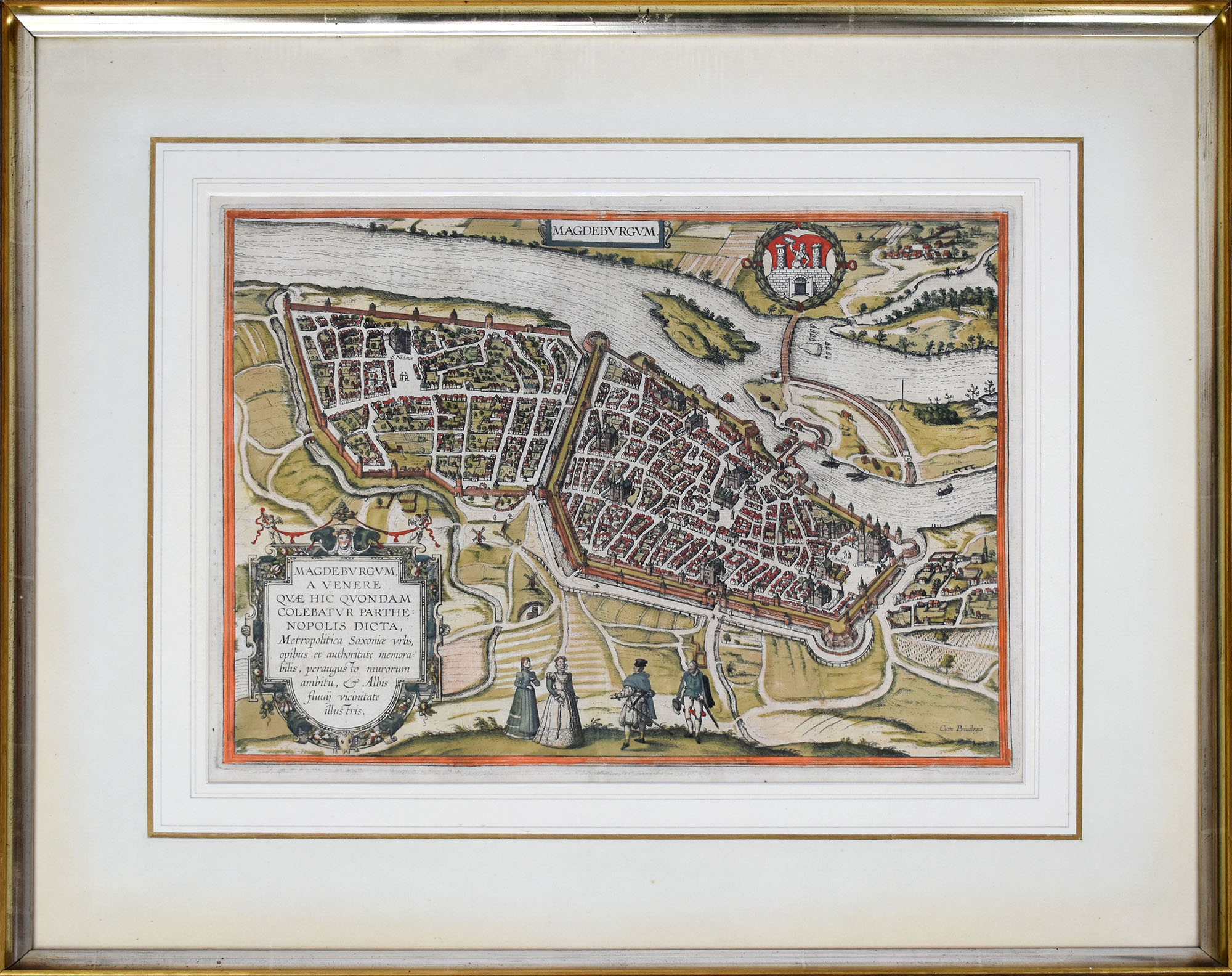
réf. 63001BBo.J. (Frans Hogenberg, geboren 1535 in Mechelen, gestorben 1590 in Köln. Kupferstecher und Radierer. Georg Braun, geboren 1541 in Köln, gestorben 1622 ebenda. Theologe, Kanoniker. Braun und Hogenberg waren in den Jahren von 1572 bis 1618 Herausgeber des Städteansichtenbuches 'Civitates Orbis Terrarum').. [3 Warenabbildungen]
Incisione in rame, 1561 ca., b/n, cm 19,5 x 26,5 ca. (alla lastra). Ruscelli fu l’editore della versione riveduta e ampliata della “Geographia” di Claudio Tolomeo, stampata a Venezia svariate volte tra il 1561 e la fine del secolo, il 1598. Le carte di Ruscelli erano, a loro volta, in generale, basate su quelle catalogate da Giacomo Gastaldi per la sua edizione veneziana del 1548, lei stessa basata sulla “Geographia”. La presente carta geografica è quindi una variante di quella di Giacomo Gastaldi, che probabilmente è anche il disegnatore di questa lastra. Bella impressione, ampi margini, ottimo stato di conservazione..
Augusta, 1740 circa. Tratta dall “Atlas novus indicibus instructus”, incisione in rame, colore d’epoca, cm 50 x 58 (alla lastra). Carta raffigurante il territorio tirolese, l'impostazione è molto simile alla carta di J.B. Homann edita nel 1716. Anche le decorazioni che accompagnano il titolo ricordano quella dell' Homann, con la fortezza di Covelo sullo sfondo e diverse figure allegoriche nel primo piano. (Bibl. “Il territorio trentino - tirolese nell’antica cartografia” di Gino Tomasi, scheda n. 56). Ingiallimento della brachetta centrale, peraltro a pieni margini e in buono stato di conservazione.
2004Historical overwiew Nikos Andriotis, Translation P.Kapsambelis. Text in english and greeke. Book in beautiful blue canvas with golden tits on the plate and back, with hundreds of color illustrations, pp 345. Very rare book - Cartography
1923Very Good English Original b/w portolan chart. Folded. A little foxing and some pencil markings and notes in Ottoman script in its period. Oblong double elephant folio. (70 x 102 cm). In English. Bosphorus to Kerempeh from the Russian survey of 1834 with additions and corrections by Commander W. J. L. Wharton., R. N. 1872-80. It's written 'London published according to Act of Parliament at the Hydrographic Office of the Admiralty Jare. 16th 1854. Also shows Killa Bay (Shile Bay) from a survey by Lieut. Comm. W. R. Pristen and the midshipmen of H. M. S. Royal Sovereign, 1920. Topography partly from a Turkish map. Up side of map, engraved a view from sea of entrance of the Bosphorus, Rumili (sic. Rumeli) Lighthouse and environment with several hills. And also shows Amastra (Ancient Amastris) from Russian surveys, 1834-41; Kosku Bay from a surbey by Capt. Spratt R. N. 1854; and Sungul Bay (Zonguldak) from the Heraclee Companys plans to 1915. A rare navigation chart.
Amsterdam, Tj. van Holkema,, 1885, ingelijst in frame. 12 losse gekleurde lithografische platen in fraaie lijst ingekaderd, In 14 kleuren op Hollandsch papier gedrukt door Tresling & Co. te Amsterdam. Boek in linnen is erbij. afmeting lijst; 1460x1160mm
1585réf. 17559Cologne ca. 1585 in-folio Cuivre 310 x 475 mm. (avec marges 420 x 550 mm), coloris ancien un peu passé, texte latin au dos
1998Two volumes, complete. The monumental catalogue raisonnÈ of maps and views of Barcelona printed from 1572 to 1900. LXXII, 1093 pp. with 740 large high-quality color plates. Text in Spanish, Catalan, and English. Edition limited to 1000 sets. Large oblong folio (31 x 44 cm). Publisher's cloth, with a design by Antoni T‡pies. FINE AND BRIGHT, WITH NO DEFECTS. As new.
réf. 41368aafZürich, Orell, Füssli, 1840, gr. in-4to, XVI + 240 S. + 1 grosse mehrfach gefalt. lithographierte Uebersichtskarte-Karte (vom Schweizer Triangulations-Netz von 1840), moderner Halbleinenband mit rotem goldgeprägten Rückenschildchen, die Deckel mit Marmorpapier bezogen, etwas fleckiger Original-Umschlag liegt lose bei. Schönes Exemplar.
réf. 14299aafAmstelodami), Ioannes Ianßonius (1588-1664) / Excudit. Petrus Kaerius Caelavit (1571-1624). um 1630, 34x47 cm, Schöne teils handkolorierte Kupferstich-Karte von Strassburg, links unten Titel in Kartusche, rechts oben 2 heraldische Wappen, ca. 1650, 34 x 50 cm, kleine Beschädigungen am Rand links unten.
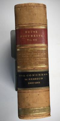
1901réf. 025183Washington: Government Printing Office 1901. SEE PHOTOS. A handsome example of the 1901 first edition in quite scarce original leather binding with 3 titles bound together as sometimes seen -- NOT print on demand edition or modern reprint. Very Good condition. NOT a library discard. NO owner's name or bookplate. Hinges are perfect. Minor offset as usual from the leather binding to edges of the endpapers. Front free endpaper has light soil and 4 small edge chips. Pages are otherwise clean and unmarked. NO foxing. 1901. First Edition. 1137pp. Bound in the original full leather calf binding we say "original" because we have seen other first editions in an identical leather binding including its 3 attractive leather spine labels -- in red black and brown -- although none of them were in condition as nice as this one. Leather is only moderately rubbed. SEE PHOTOS. All gilt stamping is still bright and shiny. This is House of Representatives Document No. 516 1901. Also bound in are: A LIST OF BOOKS WITH REFERENCES TO PERIODICALS ON PORTO RICO by A. P. C. Griffin. Senate Document No. 222. 55pp. 1901.; and A LIST OF BOOKS WITH REFERENCES TO PERIODICALS ON THE DANISH WEST INDIES by A. P. C. Griffin. Senate Document No. 223. 18 pp. 1901. Oversize Hardcover. 7.25" wide by 10.25" tall by 3" thick. This large heavy book will require extra postage for Priority and International shipments but only the standard charge for media mail. Sheehy 1986 CL287: "Lists maps to be found in books and atlases as well as those separately issued. Describes many old state and country maps and city plans.". First Edition. Oversize Hardcover. Very Good condition. Illus. by NOT a library discard. 1137pp. 55pp. 18pp. Great Packaging Fast Shipping. Government Printing Office Hardcover
1809réf. Map939Paternoster Row London: Longman Hurst Rees & Orme 1809. 1st Edition 1st Printing. No Binding. Fine. Original early 19th century map MAP OF CHINA BY AARON ARROWSMITH. A FINE CLEAN AND DARK IMPRESSION. Original folding plate covering THE WHOLE OF CHINA AND THE EASTERN SEA Watermarked heavy paper dated 1808. A scarce example and in fine un-coloured original condition. An occasional light foxing mark. 41x27cms. Double-page folding map.Engraved by Russell. Longman, Hurst, Rees & Orme unknown
18388°, pp. 479, completo delle 12 tavole incise fuori testo che illustrano alcuni monumenti e le carte geografiche di alcuni percorsi intrapresi. Rilegatura novecentesca in mezza tela, ex libris privato applicato al contropiatto, esemplare molto buono e con barbe. L'opera descrive un viaggio intorno al San Bernardo, da Torino ad Aosta, da Aosta a Chamounix, e intorno al San Bernardo, dal Gran San Bernardo a Losanna; inoltre il viaggio da Losanna a Friburgo e Ginevra, da Ginevra a Lione, da Lione a Parigi e da Parigi a Londra, infine da Ginevra a Milano, passando per il Sempione e con sosta sul Lago Maggiore
1640BLAU GUILJELMUN TERRITORIO DEL CADORINO CON IL FELTRINO. , 1640, Molto buono (Very Good) Buon es.. acquaforte cm. 50 x 38
1829In-folio, mm 440x330, pp. (16), 32 carte geografiche, incise su doppio foglio, alcune ripiegate, legatura coeva in mezza pelle blu notte, firmata Hirou, fregi decorativi alle estremità del dorso titoli in oro, abrasioni alle estremità del dorso, piccole spellature agli angoli e una rottura al margine della cuffia inferiore ma nel complesso bell'esemplare, ex libris Biblioteca Sommi Picenardi al contro-piatto, occhietto e bel frontespizio calligrafico a pagina doppia, segue "Avertissement" a doppia pagina, segue sempre a doppia pagina "Liste des Cartes" e "Division du Nouveau Cours de Géographie Générale". Le 32 carte, in coloritura coeva, sono inquadrate da tabelle didascaliche ricche di dettagli, notizie, statistiche storiche, geografiche, naturali, minerali, militari etc., raffigurano i confini europei nei diversi periodi storici, dall'antichità agli inizi del XIX secolo. Le carte sono incise da Richard Wahl, datate tra il 1829 e il 1831. Edizione originale assai rara, un solo esemplare censitio in tutte le biblioteche italiane. Biblioteca Reale di Torino. ID 6488
Francoforte, 1680 circa. Philippo Cluvero designatore. In Topographia Italiae, stampata a Francoforte in diverse edizioni a partire dal 1640, la carta ha avuto numerose ristampe, sino al 1688. Incisione in rame, b/n, cm 29 x 36 (alla lastra). Titolo in alto, a destra, entro cartiglio sormontato da aquila. Margine non graduato. Mattheo Merian (Basilea 1593 – 1650) fu un famoso incisore svizzero, istruitosi a Zurigo e trasferitosi poi a Francoforte, dove incontrò Theodore de Bry, divenendone successivamente suo genero. Trascorse la maggior parte della sua vita lavorativa a Francoforte e, insieme al geografo Tedesco Martin Zeiller (1589 - 1661), e dopo con suo figlio, produsse la Topographia, costituita da 21 volumi, incluso un alto numero di piante di città, mappe degli stati e un mappamondo. Quest’opera, di notevole successo, conobbe molte edizioni. Si interessò anche, e completò, le ultime parti e le edizioni dei Grand Voyages e dei Petits Voyages, inaugurati dal De Bry nel 1590 Bell’esemplare, fresco, marginoso e dalla bella impressione.
SANTINI PAOLO Lotto di 2 mappe: ROYAUME DE PORTUGAL. Venezia, Remondini Seconda metà XVIII sec., Lotto di due mappe dall' "Atlas Universel" stampato a Venezia nel 1776 e nel 1784,comprendente:- Partie septentrionale du Royaume de Portugal. - Partie meridionale du Royaume de Portugal. Buono (Good) Buon es.. acquaforte acquerellata a mano cm. 57,2 x 50 (inciso)