Estrada, JavierBiblio.com

5.303 resultados
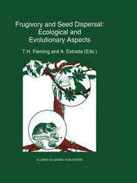
1996ref. SONG0471960128Wiley 1996-04-19. 1. hardcover. Used: Good. 6.26x1.13x9.09. Buy with confidence. Excellent Customer Service & Return policy. Wiley hardcover
ref. 9781634843560NOVA SCIENCE PUBLISHERS INC
2012ref. 2-9401047677Springer 2012. Paperback. New. reprint edition. 404 pages. 10.00x7.75x0.75 inches. Springer paperback
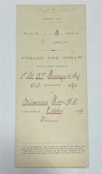
1875ref. 320963Standing Rock 1875. unbound. Partly printed military document signed 6th Infantry seven months before Little Big Horn 16.75 x 10.75 inches Standing Rock Nov. 1 1875 "A Statement Of Forage and Straw Issued to and Consumed by the Public Animals under my direction at Standing Rock Dakota Territory during the month of October 1875" for transient animals from Fort Rice signed by Captain and Commander of Post James S. Poland an officer who served under Major Reno at the Little Big Horn and was erroneously reported as "Killed In Action" when severely wounded in the back. At the time this document was signed Poland was ordered to cease his sale of rifles and ammunition to Indians at the Standing Rock Reservation as the recipients were closely connected with Sitting Bull's band. One month later the Commissioner of Indian Affairs called for the use of troops against those Indians. Also signed by Lieutenant William Badger a close friend of Custer who survived the Black Hills Campaign. His son Tom who filled out the body of this document became General Custer's personal secretary in 1876 and was killed at Little Big Horn. Also included: a Xerox of a rare photograph of the 7th cavalry 6th infantry in uniform with accoutrements all identified including Custer Badger and Poland. Partial tearing along one of the folds; otherwise near fine condition. unknown
1875ref. 320963Standing Rock 1875. unbound. Partly printed military document signed 6th Infantry seven months before Little Big Horn 16.75 x 10.75 inches Standing Rock Nov. 1 1875 "A Statement Of Forage and Straw Issued to and Consumed by the Public Animals under my direction at Standing Rock Dakota Territory during the month of October 1875" for transient animals from Fort Rice signed by Captain and Commander of Post James S. Poland an officer who served under Major Reno at the Little Big Horn and was erroneously reported as "Killed In Action" when severely wounded in the back. At the time this document was signed Poland was ordered to cease his sale of rifles and ammunition to Indians at the Standing Rock Reservation as the recipients were closely connected with Sitting Bull's band. One month later the Commissioner of Indian Affairs called for the use of troops against those Indians. Also signed by Lieutenant William Badger a close friend of Custer who survived the Black Hills Campaign. His son Tom who filled out the body of this document became General Custer's personal secretary in 1876 and was killed at Little Big Horn. Also included: a Xerox of a rare photograph of the 7th cavalry 6th infantry in uniform with accoutrements all identified including Custer Badger and Poland. Partial tearing along one of the folds; otherwise near fine condition. unknown books
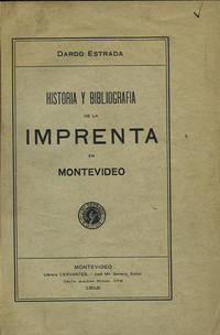
1912ref. 35822Montevideo: Libreria Cervantes 1912. First edition. Cloth. A very good copy original wrappers lightly worn. 318 pp. Sm. 4to. Palau 84328. Jones 2829. Libreria Cervantes hardcover
1912ref. 35822Montevideo: Libreria Cervantes 1912. First edition. Cloth. A very good copy original wrappers lightly worn. 318 pp. Sm. 4to. Palau 84328. Jones 2829. Libreria Cervantes hardcover books
1992ref. 047410Pachuca Mexico: Consejo de Recursos Minerales 1992 Book. As New. Hardcover. 1st US Ed. The state of Zacatecas is one of Mexico's most historically and economically significant mining regions often highlighted in specialized geological reports including this comprehensive Geological-Mining Monograph of the State of Zacatecas with its detailed text stratigraphic charts and geological maps often in 1:250000 scale that serve as a guide for exploration and academic study of this major mining region. Published by the Consejo de Recursos Minerales now part of the Mexican Geological Survey - SGM 155 p. illus charts col large format fold out maps in rear pockets. As new except for an ownerhip stamp NOTE : Very Heavy 1.5 kg/ large format volume. 35 x24 x24 cm. Consejo de Recursos Minerales hardcover
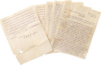
1901ref. 325474Central Valley N.Y. 1901. 5 pp. 4to. Some splitting at folds with minor loss more on last leaf. Fragile. 5 pp. 4to. Palma 1832-1908 was the president of the Cuban Republic in Arms during the Ten Years' War and the first President of Cuba between 1902-1906. He worked with José Martí to gather support for a revolution in Cuba and was the head of the Cuban Revolutionary party. He was elected while living in the United States at his homebase in Central Valley NY where he founded a multilingual co-ed private school licensed by New York State. Written to a newspaper during his presidential campaign the letter outlines the siutuation in Cuba and his hopes for the country. He was media-savy and used Hearst newspapers to spread his message and worked with the US Congress to pass a resolution renouncing the Spanish colonial hold on Cuba and announcing support for the creation of an independent Republic of Cuba. Upon his election in absentia at age 67 he returned to a Cuba from which he'd been effectively exiled a quarter-century before. He was elected to a second term in 1905 and died in 1908. unknown
1901ref. 325474Central Valley N.Y. 1901. 5 pp. 4to. Some splitting at folds with minor loss more on last leaf. Fragile. 5 pp. 4to. Palma 1832-1908 was the president of the Cuban Republic in Arms during the Ten Years' War and the first President of Cuba between 1902-1906. He worked with José Martí to gather support for a revolution in Cuba and was the head of the Cuban Revolutionary party. He was elected while living in the United States at his homebase in Central Valley NY where he founded a multilingual co-ed private school licensed by New York State. Written to a newspaper during his presidential campaign the letter outlines the siutuation in Cuba and his hopes for the country. He was media-savy and used Hearst newspapers to spread his message and worked with the US Congress to pass a resolution renouncing the Spanish colonial hold on Cuba and announcing support for the creation of an independent Republic of Cuba. Upon his election in absentia at age 67 he returned to a Cuba from which he'd been effectively exiled a quarter-century before. He was elected to a second term in 1905 and died in 1908. unknown books
ref. DADAX006113726XNew unknown
2003ref. BN155401comedia-Verlag 2003. 2003. Hardcover. Das trikontinentale Solidaritätsplakat Deutsch Spanisch Englisch Französisch Das trikontinentale Solidaritätsplakat Deutsch Spanisch Englisch Französisch Richard Frick Texte: Ulises Estrada Lescaille Nirta Muniz Reinaldo Morales Campos Jorge R. Bermúdez Alfredo G. Rostgaard Olivio Martinez Lázaro Abreu Padrón René Lechleiter comedia-Verlag hardcover
1924ref. 015720Paris Au Sans Pareil 1924 In-12 Broché, couverture illustrée Edition originale
1996ref. __0471960128John Wiley & Sons Inc 1996. Hardcover. New. 1st edition. 375 pages. 9.50x6.25x1.00 inches. John Wiley & Sons Inc hardcover
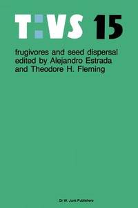
1986ref. x-9061935431Dr W Junk Pub Co 1986. Hardcover. New. 406 pages. 11.34x8.58x1.10 inches. Dr W Junk Pub Co hardcover
ref. SONG1557885400Used: Good unknown
ref. DADAX0690043430New unknown
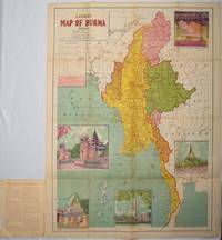
1951ref. 214601Delhi.: S.B. Makhija & Brothers. circa1951. Printed colour map 98.6 x 69 cm folding into pictorial wrappers 25.3 x 19.5 cm five pictorial colour inserts of pagodas and the Shwethalyaung reclining Buddha wrappers a little chipped marginal wear and three small fold splits in the map but overall in very good condition. Attractive large map of Burma with the provinces coloured steamship routes shown in red and printed in the booklet a range of information printed based on the 1951 census including climate agriculture and form of government "Burma became an independent nation completely outside the British Empire on January 4 1948 and is now a sovereign independent republic known as the Union of Burma". . S.B. Makhija & Brothers. unknown
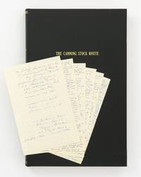
ref. 147183First Edition. Hardcover. Fine. Small folio; morocco-grain cloth lettered in gilt; in fine condition. The volume contains: a manuscript personal diary of the trip octavo 6 leaves removed from a small journal and loosely inserted; a typed transcript of the diary quarto 4 leaves printed rectos only; typed transcripts of journals kept by two other members of the same expedition both quarto printed rectos only the first 10 leaves plus signed cover letter the second i ii 34 leaves plus a map complimentary copy number 7 inscribed and signed by the author; and 74 colour photographs each 88 × 130 mm mounted next to printed captions they show desert scenery waterholes Aboriginal rock art explorers' inscriptions and more. Also bound in are photocopies of four publications or extracts relating to the Canning Stock Route. hardcover
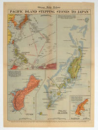
1944ref. 208880Chicago.: Chicago Daily Tribune. 28 September1944. Colour pictorial map on a single newspaper leaf archivally laid down on linen 50 x 39.2 cms; 59.3 x 43.3 cms sheet including captions faint toning to fold lines very good condition. Vivid colour maps of the Palau Islands Guam and Saipan in the Marianas and an inset location map published in the "Chicago Daily Tribune" in September 1944 months after the landing of US and Allied Forces in the offensive against the Japanese during the Pacific War. . Chicago Daily Tribune. unknown
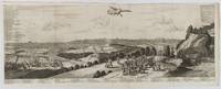
1720ref. 180201A Leide. Leiden.: Chez Pierre van der Aa. circa1720. Engraved panorama on watermarked laid paper 28.5 x 77.5 including captions; 31 x 79.5 cm sheet title cartouche engraved key in French and Dutch the upper margin trimmed to the platemark original folds edgewear and toning neat sealed tear to the outer edge barely visible 5mm intrusion to the image a very good dark impression. Finely composed and engraved panorama of Tokyo prepared for the monumental work "Galerie Agreable du Monde" by the master Dutch publisher Pieter Van de Aa 1659-1733. The detailed key in Dutch and French notes myriad buildings and temples on the horizon and in the foreground two processions converge: of nobles and their attendants dancers a trio of dogs and a priest or religious attending a suppliant. Pieter van der Aa 1659-1733 was born in Leiden Holland and started his own book publishing business when he was only twenty-three. His prolific output of highly decorated maps and atlases culminated in his magnum opus “Galerie Agreable du Monde” which illustrated the world known to Europeans in the early eighteenth century. Comprising 66 volumes it was the of plates published at that time it has been estimated that only 100 copies were published. . Chez Pierre van der Aa unknown
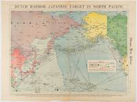
1942ref. 180751Chicago.: Chicago Daily Tribune. Friday June 51942. Printed colour map on a single newspaper leaf 37.5 x 53.2 cm; 44.7 x 59.8 cm sheet inset legend marginal browning and at the folds some undulation of paper and tide mark along lower section but in remarkably bright very good condition. Strategic map published in the Chicago Daily Tribune "The World's Greatest Newspaper" on June 5th 1942 two days after the Japanese attack on Dutch Harbor the site of the US army and navy bases in the Aleutians and as it transpired at the outset of the Battle of MIdway. The owner and proprietor of the Tribune Robert McCormick was staunchly against the United States entering the war and had firm views once it had occurred that American resources should not be used defending the British Empire. Famously the Tribune published the "Victory Program" Roosevelt’s military plan to prepare the United States for possible entry into World War II and was subject to prosecution for an alleged violation of the Espionage Act relating to the newspaper’s front-page account of the Battle of Midway 4-7 June 1942. It became an important test case for the limits of free speech and censorship during war-time. The Legend shows territorial Control of Ocean Areas marking Japanese Naval and Air bases as of 1941 and "according to latest reports" those established in the first six months of 1942. Also shown are pre-war sovereignties as at the bombing of Pearl Harbour on December 7th 1941. The Anson Archipelago is shown but a question mark "indicates islands etc. whose existence or give position is doubtful…". . Chicago Daily Tribune. unknown
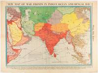
1942ref. 180782Chicago.: Chicago Daily Tribune. April 211942. Printed colour map on a single newspaper leaf 37.5 x 53.2 cm; 60 x 45 x 59.6 cm sheet marginal browning and at the folds but remarkably bright in very good condition. World War II map of Asia save for Japan showing British allies colonies and lines of supply and marking Japanese territorial occupation published in the Chicago Daily Tribune "The World's Greatest Newspaper" in April 1942. "The Indian Ocean and the Bay of Bengal are the strategic waters in this campaign in which the occupied parts of Burma and the Andaman Islands serve as bases" caption ". the historic Chicago Tribune was an innovator in color inks and printing but also a pioneer in bringing colorful art in the form of illustrations photographs cartoons and advertisements to the average person in an everyday medium." see The Janet A. Ginsburg Chicago Tribune Collection Michigan State University Libraries. . Chicago Daily Tribune. unknown
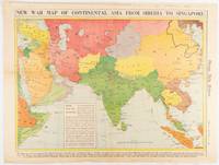
1942ref. 180760Chicago.: Chicago Daily Tribune. January 91942. Printed colour map on a single newspaper leaf 37.2 x 53.4 cm; 45 x 59.9 cm sheet inset legend marginal browning and at the folds lower margin with small edges tears not affecting the caption but remarkably bright in very good condition. Rare map of Asia "Between Suez on the west and Shanghai on the east" showing territorial interests and theatres of war published in the Chicago Daily Tribune in January 1942 barely two months after the Uniited States had joined the war effort after the bombing of Pearl Harbour. Thailand and Vietnam "French Indo-China" are marked "Occupied by the Japanese" and north-eastern China similarly marked Iran "Anglo-Russian Occupation" and the Gulf states "British Ally". The caption notes that "The map inludes waters thru which runs the British life line from the Suez canal to remote Australia and New Zealand. Nearly half the people in the world live in the lands shown on this map--more than 450 million for example in China and more than 375 million in India". ". the historic Chicago Tribune was an innovator in color inks and printing but also a pioneer in bringing colorful art in the form of illustrations photographs cartoons and advertisements to the average person in an everyday medium." see The Janet A. Ginsburg Chicago Tribune Collection Michigan State University Libraries. . Chicago Daily Tribune. unknown
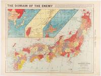
1941ref. 180789Chicago.: Chicago Daily Tribune. December 121941. Printed colour map on a single newspaper leaf 41.5 x 53 cm; 45.1 x 59.9 cm sheet three inset maps of the Japanese Empire; Taiwan and Ryukyu Islands; and Hokkaido and Chisima marginal browning and at the central fold but remarkably bright in very good condition. Map of the Japanese Empire ominously titled published in the Chicago Daily Tribune one week after the bombing of Pearl Harbour. Prefectures are attractively coloured. Based on a Rand McNally map the Tribune briskly got to work issuing maps for readers showing the beginnings of the war with Japan. Later maps were also published for sale separately but remarkably few have survived. ". the historic Chicago Tribune was an innovator in color inks and printing but also a pioneer in bringing colorful art in the form of illustrations photographs cartoons and advertisements to the average person in an everyday medium." see The Janet A. Ginsburg Chicago Tribune Collection Michigan State University Libraries. . Chicago Daily Tribune. unknown