4,389 results
2012ref. 2081502111907996Shandong University 2012. Soft Cover. Fine. Size: B5 hardcover book Shandong University paperback
1946ref. 001621Paris Editions du Pré Aux Clercs 1946
1913Half-leather binding. Telephone Talk was the glossy bimonthly publication of the British Columbia Telephone Company. It was written by employees for employees to present information of interest to those engaged in the plant, traffic, commercial, operating, accounting and other departments of the service. Each issue is replete with black and white photos and information on topics such as: company, industry and technological news, traffic levels, expansion plans, personnel announcements, publicity and social events, deaths, weddings, lists of exchanges, and more. As such, these issues serve as a vital preserve of rare and fascinating British Columbia history. This volume covers topics including: North Vancouver feature - 5 pages with photos; Activity in Plant Department - construction of many apartments in Victoria and Vancouver causing new conditions; Abbottsford exchange burned; Year's Business Shows Fine Increase; Monthly traffic record; New island route; Photo of the company's Victoria hockey team; New Westminster switchboard in action; Organisation Chart of the Traffic Department; Table showing 'Exchanges in order of per cent good toll calls'; Statement of Development - showing the number of operating phones in each exchange in the province; 7-page Feature on the Bayview area with several large photos of prominent home; Early spring construction; Traffic department conference; Full-page photo of the Western Fuel Company (Coal) Number One Mine at Nanaimo; New Central Building on Seymour; 5-page feature on Nanaimo with photos of salteries, the herring fishery, Mayor Shaw, the Nanaimo Exchange, and a great shot overlooking downtown Nanaimo and its harbour; Timing Conversations with a Calculagraph; Large photo of the Eburne sawmills; Fire damage at New Westminster Exchange; 4-page feature on Eburne with photos; Company bowling team - Victoria Commercial League Champions; Photo montage of operator's telephone sets; Great full-page photo of a commercial corner building in Duncan, Cowichan Merchants, Ltd.; 5-page feature on Duncan with several photos including one of the highly successful Duncan Creamery; photo of yachting on Cowichan Bay; Many gangs busy in the field; Weighing service; photos of telephone men at work in the field; photo of Comox and the wharf; 6-page feature article on Comox, including excellent photo of 'Flying Machine' logging in progress; Many extensions to outside plant; How telephone cable is made, 3 pages with photos; Full page photo of the Tug Dola with her tow the Princess Louise, at anchor off Port Grey; Super photo of Dozens of notable men aboard cable ship; Steveston Feature article with 3 pages and photos; 11-page major feature article on the consummation of the cable project connecting Vancouver to Nanaimo - great photos including erection of the highest telephone poles in the province at Brechin Mine, near Nanaimo, several nautical shots, cross-section of the Gulf cable, and more; Saanich Inlet cable installation; photo of the visit of H.M.S. New Zealand showing Hon. J.D. Hazen, minister of marine, Commander Halsey, Sir Richard McBride and Hon. H.E. Young, provincial secretary; Five-page feature on Nelson and area with photos; New Zealand's gift to the Imperial Navy - 2 page illustrated feature on the visit of the H.M.S. New Zealand to Vancouver, including shot of two of the monster eight 12" guns; Full-page displaing the 6 chief (lady) operators in Vancouver; 5-page feature on the Saanich Peninsula with photos of subjects including the Brentwood Bay power house, Mr. Luke Pither's model poultry ranch, the Holland Bulb Farm and more; Growth demands more outside plant; Photo of company baseball team; Illustrations of railway telephone device; Photos of the 3 chief operators of Victoria; The Growing of Hops at Agassiz - several pages and photos; Phones for Forest Protection; Manufacturing Protector Micas - raw material obtained from India; Photo of the City of Rossland; 4-page illustrated feature Book
2000ref. mon0000679700Covenant Books 3/12/2021 12:00:00 A. hardcover. Very Good. 0.3150 in x 10.3150 in x 8.3071 in. Crease on cover Covenant Books hardcover
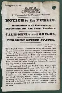
1850ref. List2416Great Britain 1850. Broadside measuring 9 ⅞ x 15 ⅜ inches. Some chipping and wear to edge ink number written in corner two small section of loss due to improper mounting very good overall. Coat of arms of the United Kingdom above printed text. Very Good. A scarce broadside relating to British postal rates across the Panama Route through the Chagres River which supplied mail to California and Oregon beginning in 1848 before eventually being replaced by the Overland route in 1860. The service was characterized by long delay times as steamships on either side of the isthmus were often not coordinated causing major delays in the delivery. Several different steamship companies operated privately some carrying express mail. The letters were transported by canoe or pack animal across the isthmus. Postmaster General Cave Johnson began establishing post offices in California in 1848. Johnson also oversaw the transition to the prepaid delivery system. The broadside here of which we find no other records does state that postage must be prepaid and that the route can be accessed by writing “via New York” on the letters. A scarce postal history item relating to the expansion of mail services to California. We find no other records of this institutionally or in the trade. unknown
1850ref. List2416Great Britain 1850. Broadside measuring 9 ⅞ x 15 ⅜ inches. Some chipping and wear to edge ink number written in corner two small section of loss due to improper mounting very good overall. Coat of arms of the United Kingdom above printed text. Very Good. A scarce broadside relating to British postal rates across the Panama Route through the Chagres River which supplied mail to California and Oregon beginning in 1848 before eventually being replaced by the Overland route in 1860. The service was characterized by long delay times as steamships on either side of the isthmus were often not coordinated causing major delays in the delivery. Several different steamship companies operated privately some carrying express mail. The letters were transported by canoe or pack animal across the isthmus. Postmaster General Cave Johnson began establishing post offices in California in 1848. Johnson also oversaw the transition to the prepaid delivery system. The broadside here of which we find no other records does state that postage must be prepaid and that the route can be accessed by writing “via New York” on the letters. A scarce postal history item relating to the expansion of mail services to California. We find no other records of this institutionally or in the trade. unknown books
Very Good Turkish, Ottoman (1500-1928) A modern fine black leather bdg. Small 4to. (26 x 18 cm). In Ottoman script. 3 volumes set: ([13], 448, [11], [6] p.; 386, [12], [6] p.; 203 p). Ibn Battuta was the greatest medieval Muslim traveler and the author of one of the most famous travel books, the Ri?lah (Travels). His great work describes his extensive travels covering some 75,000 miles (120,000 km) in trips to almost all of the Muslim countries and as far as China and Sumatra (now part of Indonesia). Ibn Battuta was from a family that produced a number of Muslim judges (qadis). He received the traditional juristic and literary education in his native town of Tangier. In 1325, at the age of 21, he started his travels by undertaking the pilgrimage (hajj) to Mecca. At first his purpose was to fulfill that religious duty and to broaden his education by studying under famous scholars in Egypt, Syria, and the Hejaz (western Arabia). That he achieved his objectives is corroborated by long enumerations of scholars and Sufi (Islamic mystic) saints whom he met and also by a list of diplomas conferred on him (mainly in Damascus). Those studies qualified him for judicial office, whereas the claim of being a former pupil of the then-outstanding authorities in traditional Islamic sciences greatly enhanced his chances and made him thereafter a respected guest at many courts. That renown was to follow later, however. In Egypt, where he arrived by the land route via Tunis and Tripoli, an irresistible passion for travel was born in his soul, and he decided to visit as many parts of the world as possible, setting as a rule "never to travel any road a second time." His contemporaries traveled for practical reasons (such as trade, pilgrimage, and education), but Ibn Battuta did it for its own sake, for the joy of learning about new countries and new peoples. He made a living of it, benefitting at the beginning from his scholarly status and later from his increasing fame as a traveler. He enjoyed the generosity and benevolence of numerous sultans, rulers, governors, and high dignitaries in the countries he visited, thus securing an income that enabled him to continue his wanderings. From Cairo, Ibn Battuta set out via Upper Egypt to the Red Sea but then returned and visited Syria, there joining a caravan for Mecca. Having finished the pilgrimage in 1326, he crossed the Arabian Desert to Iraq, southern Iran, Azerbaijan, and Baghdad. There he met the last of the Mongol khans of Iran, Abû Sa'îd (ruled 1316-36), and some lesser rulers. Ibn Battuta spent the years between 1327 and 1330 in Mecca and Medina leading the quiet life of a devotee, but such a long stay did not suit his temperament. Embarking on a boat in Jiddah, he sailed with a retinue of followers down both shores of the Red Sea to Yemen, crossed it by land, and set sail again from Aden. This time he navigated along the eastern African coast, visiting the trading city-states as far as Kilwa (Tanzania). His return journey took him to southern Arabia, Oman, Hormuz, southern Persia, and across the Persian Gulf back to Mecca in 1332. There a new, ambitious plan matured in his mind. Hearing of the sultan of Delhi, Mu?ammad ibn Tughluq (ruled 1325-51), and his fabulous generosity to Muslim scholars, he decided to try his luck at his court. Forced by lack of communications to choose a more indirect route, Ibn Battuta turned northward, again passed Egypt and Syria, and boarded ship for Asia Minor (Anatolia) in Latakia. He crisscrossed that "land of the Turks" in many directions at a time when Anatolia was divided into numerous petty sultanates. Thus, his narrative provides a valuable source for the history of that country between the end of the Seljuq power and the rise of the house of Ottoman. Ibn Battuta was received cordially and generously by all the local rulers and heads of religious... Hejra: 1333; 1335; 1336 = Roumi: 1335 ; 1337; 1340 = Gregorian: 1917; 1919; 1921. Ozege: 21289. For fihrist: 5771.
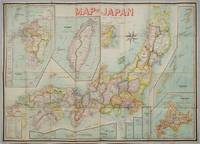
1906ref. 197908Kobe Japan.: Fuku-In-Kwan. 1906. Printed colour folding map on two conjoined sheets laid down 73.8 x 105 cm foxing on verso not affecting map single pinhole in each corner scant spotting small fold splits no loss a few soft fold creases but in good condition. Very rare striking map of Japan published for the Western market. Created under the direction of Takachika Okishio featuring 10 inset maps: Chishima Kurile Islands Hokushu Hokkaido Ogasawara-Jima Bonin Islands Hachijo-Shima Ioshima Okinawa Saki-Shima Kyushu Saikaido Taiwan Formosa and Eastern Asia. The insets of Taiwan and Kyushu are the largest and centrally positioned. A Glossary and Explanation of Signs is printed at the foot of the map which list Towns Railway Stations Boundaries of Prefectures Notable Places Hot Springs Water-falls rapids Volcanoes Light-Houses Gold Silver and Coal-Oil fields. The Japanese Government Railway series of Travellers' Maps of Japan appear to have been modelled after this design. . Fuku-In-Kwan. unknown
1846ref. 2090502128300687Not Available 1846. Soft Cover. Fine. The book is in fine condition. Not Available paperback
1840ref. 018232London: Printed and Published By J. Barfield 1840. Book. Very Good. Hardcover. Fourth Edition. Folio 30 x 46cm. "Revised Collated and Considerably Enlarged by John Satchell Esq." Seventy-four double-page engraved genealogical tables and geographical maps all with original hand colouring contemporary . half black morocco gilt with green cloth boards. Binding good with some general wear and rubbing leather chipped with loss to the base of the spine joints rubbed but still strong corners worn. All edges gilt./ Contents clean and tight contemporary ink stain effecting the fore-edges of the first few pages but not affecting text or maps most noticeable to the front end papers with also have a pencil inscription dated 30 November 1935. All maps and charts in very good condition. Notwitstanding wear to the binding a very good copy. Printed and Published By J. Barfield Hardcover
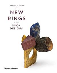
ref. Z1-M-015-02686Thames & Hudson. Used - Good. Ships from UK in 48 hours or less usually same day. Your purchase helps support Sri Lankan Children's Charity 'The Rainbow Centre'. Ex-library so some stamps and wear but in good overall condition. 100% money back guarantee. We are a world class secondhand bookstore based in Hertfordshire United Kingdom and specialize in high quality textbooks across an enormous variety of subjects. We aim to provide a vast range of textbooks rare and collectible books at a great price. Our donations to The Rainbow Centre have helped provide an education and a safe haven to hundreds of children who live in appalling conditions. We provide a 100% money back guarantee and are dedicated to providing our customers with the highest standards of service in the bookselling industry. Thames & Hudson unknown
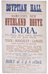
ref. 99252London Printed by S. Golbourn February 1876. . Broadsheet 51.25 x 31.4 cm printed in blue and tan horizontal centre fold short split short splits to head a good example. Rare broadsheet advertising an exhibition at the Egyptian Hall. The Egyptian Hall was a leading venue for exhibitions featuring original artwork and relics. London, Printed by S. Golbourn, February 1876. unknown
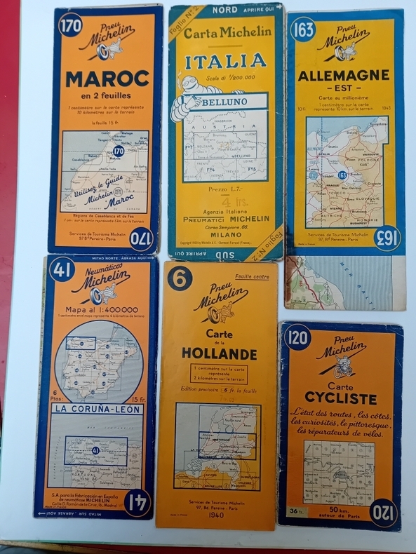
ref. S52Ensemble d'environ 600 cartes.
1835ref. 23580MÉXICO: Impreso por Ignacio Cumplido 1835. Primera edición.- 4º.- Plena piel jaspeada de época lomera con filetes y florones dorados.- 2 tomos en 1 volumen.- I: 32 páginas.- II: 56 páginas.- III: 44 páginas. El Apéndice de documentos no indica lugar ni año. El primer documento lleva la fecha de México 24 de febrero de 1835 y el último es de 23 de mayo del mismo año. Procedencia: Ejemplar de Joaquín Gómez de la Cortina Marqués de Morante. Palau 111572 para la segunda edición y 74785 Impreso por Ignacio Cumplido unknown
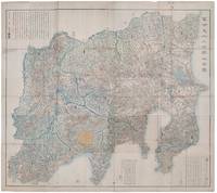
1418ref. 159850Shūseidō 衆星堂. Reprint. Tenpō 14 1843. Large folding handcoloured map of the thirteen provinces from which Mt. Fuji can be viewed. 159 x 178cm. Folds into paper covered card covers measuring 40 x 24cm. Title label upper cover. A little browning along folds occasional spotting and soiling. A little worming causing approximately 1cm of loss in places. Two chops in lower section. A very striking and attractive map. This very large handsome map is a detailed map of the thirteen provinces from which one can see Mt. Fuji. Provinces shown are the eight provinces of the Kantō region Sagami 相模 Musashi 武蔵 Kazusa 上総 Shimofusa 下総 Awa 安房 Kōzuke 上野 Shimotsuke 下野 and Hitachi 常陸 and five other provinces Izu 伊豆 Suruga 駿河 Tōtōmi 遠江 Kai 甲斐 and Shinano 信濃. The map offers a large amount of detailed information such as province and county borders rivers high ways post towns checkpoints villages and scenic spots. The cartographer Akiyama Einen or Nagatoshi 秋山永年 came from Edo and the editor Funakoshi Seizō 船越清蔵 studio name: Shugu 守愚 1805-62 a Confucian scholar from Nagato Province now the western half of present-day Yamaguchi Prefecture. A dedication by Funahashi Akira 舟橋徴 is dated 1843. . Shūseidō 衆星堂 unknown
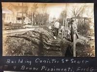
1913ref. 53568Hornell NY & Low Moor VA: Homer A. Sitterley Asst. City Engineer for Hornell NY; Chief Mining Engineer Low Moor Iron Co. 1913-1917. Oblong 8vo. 10 x 7 in. 142 pp unpaginated. thick black paper stock w/ 298 original photographs sized from 2 x 3 in. up to 3.25 x 5.5 inches 280 this size 2 of them cyanotype and the majority with neat white ink manuscript descriptions linen-backed frontisp. map of Hornell NY dated 1915. Contemporary limp black-cloth post-binder sewn at gutter margin w/ black silk braid minor soiling tidemark to outer fore-edges of front cover first couple leaves minor fraying & wear to corners still a VG- exemplar w/ most images with strong contrast. This remarkable album documents the tremendous range of road building projects sewer improvements bridge building and dam construction in and around Hornell NY in Steuben County in the years before World War I. Steuben County was the next to the last County in New York State to join the Good Roads Board sponsored by the American Automobile Association in 1907 primarily because during the opening decades of the 20th century that area of New York had some of the worst roads. These images show the construction and building of sewer lines on Crosby Street Canister Street paving projects on East Ave. Jane Street West Street -- with fantastic images of early Foote Concrete Machinery Co. road paver in operation pouring concrete West Genesee Street Church Street and others. Sitterley b. 1889 makes a study of the filtering systems and sewer plant for New York City at the time includes photo of the newly opened Hornell trolley “Subway” as well as numerous photos of poor condition sidewalks which were slated for modernization as an adjunct of the Good Roads agenda hand-in-hand with laying of new sewer lines. In addition he has included photo of himself with surveyor’s transom and the Hornell City Engineer together with the City Park Superintendent. A significant portion of the album is devoted to the building of the Seneca Street Bridge including the building of the coffer dams to hold back the water to pour the piers the construction of the abutments and finally the finished bridge. That bridge would later be rebuilt by a WPA project in 1936 and now is up for replacement again. Sitterley’s last major projects were overseeing the building of the new Hornell city dams and city reservoirs together with road improvements gate houses and spillways. In March 1916 he leaves Hornell NY to become Chief Mining Engineer for the Low Moor Iron Co. which was a producer of pig iron in Alleghany County of Western Virginia which operated from 1872-1930. The company was often plagued with labor unrest as they maintained very poor “Company” towns and were constantly struggling with the Chesapeake & Ohio Railroad to ship their ore. In 1916 they were on the upswing as a company as the growing steel demands of World War I began to lift all ore producers at the time. See: Corning Convention of Good Roads Associations Good Roads Magazine April 1907 pp. 134-135; Homer Aldrich Sitterley Bi-Monthly Bulletin of the American Institute of Mining Engineers No. 126 June 1917 p. xxxv; Russell Story of the Great Flood and Cyclone Disasters in New York State 1913 New York Roots 1999; Papers of the Low Moor Iron Company 1873-1927 Special Collections Univ. of Virginia Library 2010. Homer A. Sitterley, Asst. City Engineer for Hornell, NY; Chief Mining Engineer, Low Moor Iron Co., hardcover
1740ref. 19595(Augsburg), Matthäus Seutter, um 1740. Ca. 50 cm x 58 cm (Platte).
2016ref. 120005Promopress. New. Hardcover. FREE UPGRADE to Courier/Priority Shipping Upon Request - IN STOCK AND IMMEDIATELY AVAILABLE FOR SHIPMENT - Flawless copy brand new pristine never opened. Text in English French Spanish and Italian. -- with a bonus offer-- . 2016. 8416504083 . Promopress hardcover
2011ref. 88890Verlag Fur Moderne Kunst. New. Hardcover. FREE UPGRADE to Courier/Priority Shipping Upon Request - IN STOCK AND IMMEDIATELY AVAILABLE FOR SHIPMENT - Flawless copy brand new pristine never opened -- Text in German and English. 96 pp; 41 color illustrations. -- with a bonus offer--; Comparing the shared textures of woven and painted works of art and craft this volume juxtaposes a burial cloth from Peru a poncho from Guatemala silk ikat from Southeast Asia and woven fabrics from Persia with works by artists such as Eduardo Chillida Adolfo Estrada Helmut Federle Johannes Itten and Sean Scully. . 2011. 3869841362 . Verlag Fur Moderne Kunst hardcover
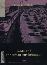
ref. Z1-N-007-00593sold by OECD Publications Center. Used - Good. Ships from UK in 48 hours or less usually same day. Your purchase helps support Sri Lankan Children's Charity 'The Rainbow Centre'. Ex-library so some stamps and wear but in good overall condition. 100% money back guarantee. We are a world class secondhand bookstore based in Hertfordshire United Kingdom and specialize in high quality textbooks across an enormous variety of subjects. We aim to provide a vast range of textbooks rare and collectible books at a great price. Our donations to The Rainbow Centre have helped provide an education and a safe haven to hundreds of children who live in appalling conditions. We provide a 100% money back guarantee and are dedicated to providing our customers with the highest standards of service in the bookselling industry. [sold by] OECD Publications Center unknown
1953ref. 013812New York Ace Books, Inc. - Collection « Ace double books » D-15 1953 In-12 broché, couverture illutrée Signé par l'auteur
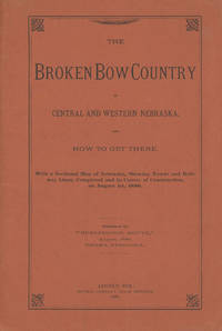
1886ref. 47038Lincoln: Journal Company State Printers 1886. 1886. NEBRASKA RAILROAD. First edition. 8vo. Original orange printed wrappers 16 pp. folding map: Map of Nebraska 1886. 59 x 99 cm. 23 1/4" x 41" 12 miles to one inch. The map was the project of the Burlington Route for selling land. Very detailed and routes outlined in bright red. Broken Bow was to be the new center of life in Nebraska. The map is in fine condition some splitting at the bottom two inches of the spine due to the folded size of the map and a tiny closed tear and a few minor nicks to the rear cover fore-edge overall a near fine copy. Journal Company, State Printers, 1886. unknown
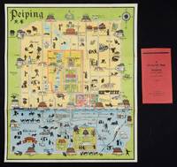
1934ref. 158433Peiping.: Peiyang Press. circa1934. Coloured folding plan of Peking with original envelope. 60 x 50cm. A few neat repairs at folds two panels evenly browned on reverse. A very good copy of a scarce pictorial plan with its envelope. This delightful and scarce pictorial map of Peking with landmarks and streets in romanised Chinese with occasional Chinese characters is surprisingly scarce. Although apparently issued in several editions in the 1920s and 30s it appears relatively infrequently on the market. The divisions of the Legation District are indicated by their flags - this edition shows the German Legation by use of the black white and red bands of the German flag. This flag which was no longer used after 1935 helps date this edition. Other landmarks and attractions shown included theatres foreign shopping area adjacent to the legations quarter Liu Li Chang Curio District the racecourse the many city gates etc. . Peiyang Press. unknown
ref. GOR010663244Paperback. Very Good. paperback
1882ref. 2111902160200908Ikaho bussan 1882. Soft Cover. Fine. Volume: 1 Ikaho bussan paperback