3 757 résultats
1905réf. 10770Paris, Ch. Béranger, Encyclopédie des Travaux Publics, 1905 ; 2 tomes brochés : texte, in-8 ; atlas, in-folio ; (4), 306 pp., 104 figures ; (4), 8 très grandes planches dépliantes de 6 à 14 pages ; couvertures jaunes imprimées.
réf. DQO-366Editions Jacques Haumont, Paris, 1931. In-8, broché, 96 pages. 88 photographies et 87 légendes par Germaine Krull . Préface de Claude Farrère. Premier et unique livre paru dans la collection Voir. Edition originale,(il n'a pas été tiré de grands papiers)
1907réf. boz_006219Free eBay listing template designed by dewiso.com Paul Déroulède. Tapuscrit de 103 pages "Feuilles de route, Lyon 1886", 1907 Poète, auteur dramatique, romancier et militant politique français. Tapuscrit de 103 pages de Paul Déroulède, de son œuvre intitulée "Feuilles de route", avec quelques ratures et corrections au crayon. Important et volumineux ensemble de 103 pages dactylographiées constituant une étape de travail essentielle pour l'édition de l'œuvre majeure de Paul Déroulède, Feuilles de route. Dans cet ouvrage autobiographique et patriotique emblématique, l'auteur livre ses souvenirs poignants de la guerre franco-prussienne de 1870 et de sa captivité. Dimensions : 21 x 27 cm État : Voir photos et description pour plus de détails. Nombre de pages : 103 pages Paul Déroulède Paul Déroulède, né le 2 septembre 1846 à Paris et mort le 31 janvier 1914 à Nice, sur le mont Boron, est un poète, auteur dramatique, romancier et militant politique français. Son rôle de fondateur de la Ligue des patriotes et son revanchisme en font un acteur important de la droite nationaliste en France. Wikipédia Contactez-nous Lettres autographes, vieux papiers, livres anciens, photographies, gravures, timbres... Nous expertisons et/ou rachetons dans toute la France vos lettres, collections de lettres et livres anciens. Une question ? Une précision ? N'hésitez pas à me contacter Paiement Sont acceptés les paiements par eBay, par PayPal, par virement ou par chèque. Envoi Envoi soigné dans un emballage rigide et étanche sous trois jours. Prévoir les délais postaux habituels en plus. Retour Satisfait ou remboursé. Si vous n'êtes pas entièrement satisfait, retour à la charge du vendeur pour l'Europe. À la charge de l'acheteur pour le reste du monde.
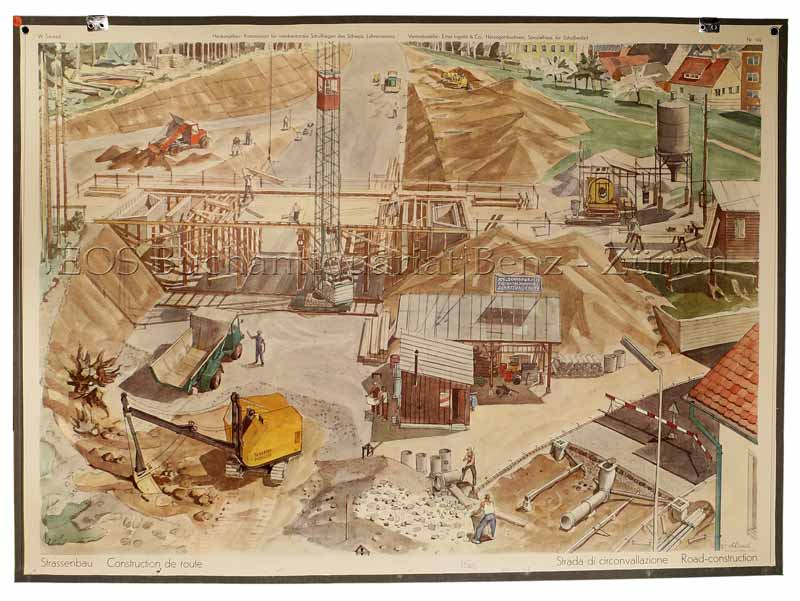
1959réf. 498BGHerzogenbuchsee, Ernst Ingold, 1959. Farbiger Offsetdruck auf Papier auf Leinen aufgezogen. Bildformat: 66 x 90 cm. + Wichtig: Für unsere Kunden in der EU erfolgt der Versand alle 14 Tage verzollt ab Deutschland / Postbank-Konto in Deutschland vorhanden +, bild
réf. SONG1479811513New York University Press 2019-07-16. hardcover. Used: Good. 6.25x0.75x9.00. Buy with confidence. Excellent Customer Service & Return policy. New York University Press hardcover
réf. 46118831like new. unknown
réf. 27285281like new. unknown
réf. 27285281-nnew. unknown
réf. 38691306like new. unknown
2019réf. x-1479811513New York Univ Pr 2019. Hardcover. New. 207 pages. 9.00x6.25x0.75 inches. New York Univ Pr hardcover
2013réf. x-1475779135Springer 2013. Paperback. New. 253 pages. 9.25x6.10x0.58 inches. Springer paperback
réf. ria9783110655643_inpHardcover. New. New Book; Fast Shipping from UK; Not signed; Not First Edition; Experiencing ethics not only refers to being confronted with a situation in which one must choose a course of action; it also makes reference to giving a narrative account of the circumstances and chain of events leading to such crossro hardcover
réf. 30752156like new. unknown
réf. 3031175611.Ghardcover. Good. Access codes and supplements are not guaranteed with used items. May be an ex-library book. hardcover
2026réf. x-1479843318New York University Press 2026. Hardcover. New. 272 pages. 6.00x2.00x9.00 inches. New York University Press hardcover
2020réf. x-3030396878Springer Verlag 2020. Paperback. New. 404 pages. 9.25x6.10x0.95 inches. Springer Verlag paperback
1749réf. 136827Paris. Circa1749. Engraved map on watermarked laid paper 20 x 27.3 cm of Fuzhou and coastline of Fujian Province original folds designed by the great French cartographer Jacques-Nicolas Bellin. This map is from the impressive 15-volume "Histoire Génèrale des Voyages" compiled by Antoine François Prévost map no. 2 Vol. 6. This map shows the estuary of Yangtze River Rivière de Chang. Very light browning on sheet edges but in very good condition. . unknown
1749réf. 136826Paris. circa1749. Black and white engraved map on watermarked laid paper 20.9 x 32.7cm showing coastal area of Zhejiang Province Province de Che-kiang including Zhoushan Archipelago Isle de Chusan Zhoushan Bay Bay de Chusan and Xiangshan County Siang-chan-luen a walled city outside of upper border Ningbo Ning-po prefecture under Qing administration title cartouche lower left original folds. This map is No. 3 Vol. 6 from the impressive 15-volume "Histoire Generale des Voyages" compiled by Antoine François Prévost. Even browning mainly to the sheet edges in very good condition. . unknown
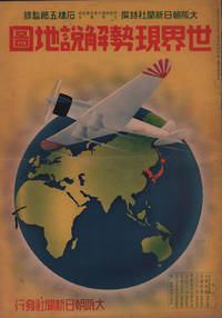
1937réf. 208633大阪朝日新聞社. Osaka Asahi Shinbunsha. Showa 12 1937. 10 colour maps not including insets or sketch maps in text on 12 pages. Handsome world map features as the centre fold colour pictorial paper wrappers. A little light soiling and horizontal crease wrappers. An attractive atlas. 38 x 26.7cm. A large format atlas with six pages of coloured maps showing the nations of the world and five pages of Japanese text. The publication seems to have been produced to celebrate the 1937 world record flight from Tokyo to London by Iinuma Masaaki and Tsugayoshi Kenji in their plane 'Kamikaze' which was sponsored by the Asahi Newspaper. The front cover depicts the plane soaring over a map of the world while the back cover also had a colour image of the 'Kamikaze' with an advertisement for the Oji Paper Company which we are told donated a hundred million yen to support the flight. The name 'Kamikaze" had at that stage not yet taken on the connotations which it acquired during the Pacific War. The maps inside the volume show political boundaries major cities and transport routes. The opening pages show the Japanese Empire including Japan proper Korea Karufuto and Manchukuo with small insets covering Taiwan the Chishima Archipelago and Japan's South Sea mandate. The accompanying text focuses on Japan's newly acquired client state of Manchukuo detailing its area population principle products etc while the map includes graphs illustrating Japan's trade with the world and with Manchukuo. China receives an entry of its own with a map of the Chinese Republic and information on the political situation population trade and infrastructure. The central pages of the volume are taken up with a double-spread map of the world including depictions of the flags of a selection of the world's nations. Other sections of the work cover Asia Europe America Africa and Oceania grouped together. The discussion of Oceania includes a section on Hawaii and some small and improbable depictions of Maori and Indigenous Australians. . 大阪朝日新聞社. [Osaka Asahi Shinbunsha]. unknown
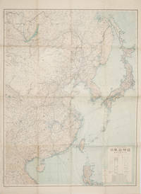
1419réf. 160524Tokyo.: 大日本帝國陸地測量部. 昭和14 1939. Large colour folding Japanese WWII map. Scale 1:5000000 featuring Japan Korea Taiwan Karafuto Eastern China parts of French Indochina and the Northern Philippines US colony in detail. Legend includes territorial boundaries national and regional and shows some borders as unclear i.e. Taiwan and bordering region along Northeast China the Soviet Union and Mongolia air routes submarine communication cables linking major costal cities i.e. Hong Kong Xiamen Shanghai Nagasaki etc. airports radio stations mining fields and more. A small chart shows the names of mountains rivers and lakes also included adjacent to legend. Some small holes at folds creases and some minor loss edges generally very good. Text in Japanese. 109 x 77.8cm. . 大日本帝國陸地測量部. unknown
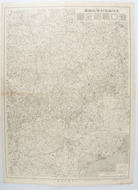
1572réf. 172829大阪. Osaka.: 大阪毎日新聞社. Osaka Mainichi Shinbunsha. 昭和 13 1938. Black and white map folded showing Hankow one of the three cities which merged to become Wuhan 54.5 x 49cm scale 1:2000000. Some light browning tiny closed tear upper margin neatly repaired with conservation standard tape. Good copy. This Hankow/Hankou War Situation Map is a supplement map of Osaka Mainichi Newspaper on 25 August 1938. The two inset maps show the region around Nanjing and Hong Kong. It gives detailed place names of Hankow area. . 大阪毎日新聞社. [Osaka Mainichi Shinbunsha]. unknown
1819réf. 162103Tokyo.: Tōseisha. Showa 18 1943. Folding colour map of Australia 54.2 x 76.4cm. Some foxing particularly along folds and upper right margins a few repaired tears and small holes at folds.With original sleeve. The 15th map in the Standard Maps of Greater East Asia series of 20 maps. Shows the natural resources such as sheep gold pearl diary regions opals etc. Tasmania appears as an inset in the bottom right corner. Text in Japanese. . Tōseisha. unknown
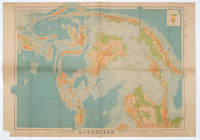
1572réf. 160533Tokyo.: 日本名所圖繪社.Nihon Meisho Zuesha. 昭和 17 1942. Folding Japanese coloured map of the Malay Archipelago and Thailand during World War II scale 1:8500000. Legend in lower corner indicates altitudes. Ink annotation in Japanese left edge. Pin holes at three corners upper right corner torn with loss evenly browned otherwise very good. Text in Japanese and English. 52.8 x 75.6cm. This map shows most of Thailand former Indochina Hainan Province and South China Sea Sumatra and Java Sea Borneo the Philippine Islands Celebes Timor New Guinea and parts of Micronesia. Natural resources such as tobacco spices wood sugar metal mines tin iron and etc. rice and other resources are indicated on the map. . 日本名所圖繪社.[Nihon Meisho Zuesha]. unknown
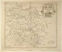
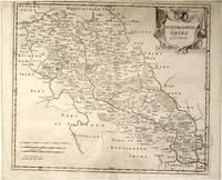
réf. 64216London.: Gibson. Early 18th Century. Black and white map from Camden's Britannia showing towns roads rivers and landforms 38 x 46.5 cm. . [Gibson.] unknown
réf. 64139London.: Gibson. Early 18th Century. Engraved map on watermarked paper central fold 38 x 46.5 cm decorative title cartouche towns roads rivers and landforms shown; from Gibson's edition of Camden's Britannia upper edge trimmed by the original binder causing minor loss to the border at the inner edge but in very good condition. . [Gibson.] unknown