CANEDO, LUIS - LUIS ESTRADABiblio.com

4.388 Ergebnisse
Best.-Nr. 9681619234.Gpaperback. Good. Access codes and supplements are not guaranteed with used items. May be an ex-library book. paperback
Best.-Nr. 6205661268.Gpaperback. Good. Access codes and supplements are not guaranteed with used items. May be an ex-library book. paperback
Best.-Nr. 3659074012.Gpaperback. Good. Access codes and supplements are not guaranteed with used items. May be an ex-library book. paperback
Best.-Nr. 620566125X.Gpaperback. Good. Access codes and supplements are not guaranteed with used items. May be an ex-library book. paperback
Best.-Nr. 6205661233.Gpaperback. Good. Access codes and supplements are not guaranteed with used items. May be an ex-library book. paperback
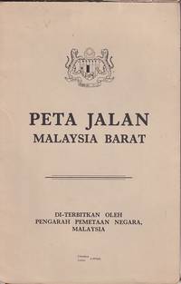
1970Best.-Nr. 223469Kuala Lumpur.: Pengarah Pemetaan Negara. 1970. Large colour folding map in original paper wrappers. Text in Malay and English. 83.5 x 53.5cm folded 21 x 15cm. Closed tear along spine of trifle soiled upper wrapper otherwise a very good copy. . Pengarah Pemetaan Negara. unknown
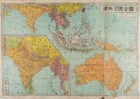
1572Best.-Nr. 159290東京 Tokyo.: 金鈴社 Kinrei-sha. 昭和十八 October 101943. Two maps printed in colour on a single side of a folded sheet. The map titled "Complete Map of India and Australia" shows the region covering Australia southern India western mainland south-east Asia Indonesia the Philippines and New Guinea. The other map titled "India and Burma" shows the region covering India Afghanistan the western section of China Burma and Thailand on the lower left side. New Zealand is in an inset map in the lower right corner. As the note on the cover says "Including the detailed descriptions of the Solomons New Guinea and southern islands" this map shows the theatres of the Pacific War and the surrounding areas. The map indicates agricultural and mineral resources as well as cities roads railways sea routes national borders etc. Cover and publication details printed on two panels on the reverse. Some marking and browning. . 金鈴社 [Kinrei-sha]. unknown
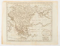
1816Best.-Nr. 175252Philadelphia.: Carey Mathew and Warner Benjamin. 1816. Engraved map 19 x 22.3 cm original folds some offsetting to the map marginal browning and staining small archival repairs to the outer margin but in good condition. Fine map Plate 19 prepared for Carey and Benjamin's "General Atlas.". . (Carey, Mathew and Warner, Benjamin). unknown
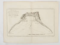
1774Best.-Nr. 174257Paris.: Chez Saillant et Nyon rue Saint-Jean-de-Beauvais Chez Panckoucke Hotel de Thou rue des Poitevins. 1774. Engraved map on laid paper 18.5 x 31cm 25.6 x 34.4cm sheet size central fold slight marginal toning but a very good dark impression. Map of Bonthain Bay situated southeast of Macassar on the island of Celebes finely re-engraved for the French edition of Captain James Cook's First Voyage 1768-1771 "Relation des voyages.pour faire des decouvertes dans l'hemisphere meridional et successivement executes par le commodore Byron le capitaine Carteret le capitaine Wallis & le capitaine Cook.". . Chez Saillant et Nyon, rue Saint-Jean-de-Beauvais, [Chez] Panckoucke, Hotel de Thou, rue des Poitevins. unknown
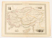
1851Best.-Nr. 174952London & New York.: Tallis J & F. 1851. Lithographed map 24.5 x 32.3 cm borders picked out in original hand colour four inset vignette illustrations decorative Greek key border edge worn and discoloured paper toned but the attractive map in good condition. Attractive decorative map prepared for "Tallis's illustrated atlas and modern history of the world." one of the last great illustrated series of world maps. The fine vignettes are of Mt. Olympus Rhodes a ketch in the Mediterranean Sea and two costumed Ottomans. . Tallis, J & F. unknown
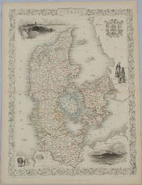
1850Best.-Nr. 175779London & New York.: John Tallis & Company. Circa1850s. Lithographed map with original outline hand colour 34.5 x 24.7 cm including border and captionsfive fine vignette illustrations decorative border central fold edges with light toning in very good condition. Attractive decorative map with fine vignettes of Copenhagen Sleswig and Elsinore figures in costume the coat of arms of Denmark and an amiable equine pair by the great mapmaker and publisher John Tallis. . John Tallis & Company. unknown
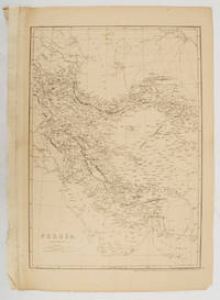
1863Best.-Nr. 177017London.: Cassell Petter and Galpin. circa1863. Engraved map 43.1 x 30.3 cm 50.7 x 34.5 cm sheet central fold small edge tears one neatly repaired lower corner chipped slight age toning but in very good condition. Impressive large map of Persia Iran by noted map maker Edward Weller in original uncoloured state re-issued by the publisher for inclusion as map 26 in Cassell's Atlas. . Cassell, Petter and Galpin. unknown
Best.-Nr. A9783110655643Hardback. New. Experiencing ethics not only refers to being confronted with a situation in which one must choose a course of action; it also makes reference to giving a narrative account of the circumstances and chain of events leading to such crossroads. Between both there is a chasm a space of indeterminacy into which R. Musil and L. Sterne delve with aesthetic means. Their poetics move in opposite directions but by following them to their last critical consequences this study reveals a kindred ethical stance. This interpretation sheds light on the ethics revolving around character construction by examining the constraints thwarting any attempt to complete a biographical account or convey a protagonist that led his or her life. Neither Musil nor Sterne posit a narrative agenda that could reach a last chapter or lead to a groundwork determining their ethics. A closer look into their tight-knit prose reveals that both rely on the narrating on a skill that must be incessantly cultivated through a digressive or essayistic style. Equipped with a vast theoretical repertoire this approach makes a strong case for a new constellation in comparative literature. hardcover
1968Best.-Nr. Q-0803815298Hastings House 1968-01-01. Hardcover. New. New. In shrink wrap. Looks like an interesting title! Hastings House hardcover
1818Best.-Nr. ZB353063Washington: Printed by E. de Krafft 1818. 6 pp. 2 folding tables; issued as 15th Congress 1st Session H 201; extraction roughness at spine general age toning lower outside corner crumpled disbound in self wrappers; things are progressing well with average cost per mile $9744.21. - If you are reading this this item is actually physically in our stock and ready for shipment once ordered. We are not bookjackers. Buyer is responsible for any additional duties taxes or fees required by recipient's country. Photos available upon request. Washington: Printed by E. de Krafft, unknown
Best.-Nr. 45986Gonon.1955.In-8 br.avec étui.231 p.Nombreuses illustrations en couleurs.Ex.1316.1er.tirage. TBE.
Best.-Nr. 63549938MacMillan . Hardback. New. pp. 228 MacMillan hardcover
1975Best.-Nr. 006933New York: ATLAS SEABOARD 1975. Magazine. Illus. by REECE RALPH : SPARLING JACK : MARCOS PABLO. As New. Magazine. 1st Edition. Magazine - 1st. Print VF/NM - Includes Satans Domain The Lost Tomb of Nefertiri Lay of the Sea Midnight Muse Merchants of Evil plus an adaptation of Shakespeares The Tempest. Also an article about the vampires of cinema. Part of the short-lived Atlas line from former Marvel publisher Martin Goodman. Cover by Alberto Pujolar was later reused for Vampirella #111. . ATLAS SEABOARD Paperback
Best.-Nr. DADAX0761863265UPA 2014-04-15. hardcover. New. 6.32x0.59x9.29. Buy with confidence. Excellent Customer Service & Return policy. UPA hardcover
Best.-Nr. 7L-ANI1-GG4FGood. Hardcover in Dust jacket 1932 Hardcover. 2nd Printing thus. Corner chipped dust jacket. FAST Daily Shipping! Z-6 hardcover
2016Best.-Nr. 1-3841756972Editorial Académica Española 2016. Paperback. New. 216 pages. Spanish language. 8.66x5.91x0.49 inches. Editorial Académica Española paperback
2026Best.-Nr. x-1032661895Taylor & Francis Ltd 2026. Paperback. New. 560 pages. 7.00x1.20x10.00 inches. Taylor & Francis Ltd paperback
1933Best.-Nr. 58148Chicago: Chicago Burlington & Quincy Railroad Printed by Poole Bros. Inc. 1933. Tall 8vo. 4 x 9 in. which folds out into 8 x 9 in. 4to. 20 pp unpaginated illustrated & printed in red & black throughout numerous photo illustrations text illustrations 1 double-page maps 1 double-page. Colour-illustrated softcovers cover art on front of the Hall of Sciences back cover w/ pictorial map of Burlington Routes slight shelfwear NF copy. First edition of this very scarce promotional brochure advertising the low round trip rates being offered by the Burlington Route for tourists to the 1933 Chicago World’s Fair. Detailed descriptions are included of the Exposition exhibits a birds-eye view of the Century of Progress grounds amenities in Chicago and the Travel & Transport Building which held a special Burlington Route exhibit. Kaufmann & Fabry was an active commercial photographic firm specializing in architectural photography in Chicago from before 1910 and are still in existence. No copies located in Worldcat. Chicago, Burlington & Quincy Railroad, [Printed by Poole Bros., Inc.,] paperback
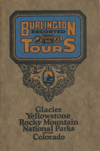
1925Best.-Nr. 48702N.P.: Privately printed n.d. ca 1925. ca 1925. 9" x 6" color pictorial wrappers. 47 pages tinted illustrations maps tour plans. Numerous tour itineraries and schedules with numerous beautifully colored photographs of various areas buildings and parks. Tours discussed include Glacier and Yellowstone; Colorado and Yellowstone; Inter-Mountain Route From Colorado to Yellowstone and Glacier; Colorado and Glacier. General information for the tourist including cost of tours discussion of climate apparel booklets of possible interest a list of ticket routing for various tours calendar schedules for various tours etc. Separate map depicting each tour. Very good plus. Privately printed, n.d. [ca 1925]. unknown
1863Best.-Nr. 40799Cleveland: Fairbanks Benedict & Co. 1863. Stitched in original printed wrappers. 33 1 blank pp folding table. Wrappers with extremity chipping and old rubberstamp. Rear wrap detached but present. Title page with rubberstamp. Old bookplate. Good plus. This is a joint report of the Bellefontaine & Indiana Rail Road and the Indianapolis Pittsburgh & Cleveland Rail Road. Wikipedia says: "The Indianapolis and Bellefontaine Railroad I&B was an American railroad founded in 1848. It changed its name to the Indianapolis Pittsburgh and Cleveland Railroad IP&C in 1854. Its counterpart in Ohio was named the Bellefontaine and Indiana Railroad B&I. The B&I ceased to exist as an independent company when it merged into the Bellefontaine Railway in September 1864. The Bellefontaine Railway merged with the Cleveland Columbus and Cincinnati Railroad to form the Cleveland Columbus Cincinnati and Indianapolis Railway in December 1864." OCLC 12696870 11 as of March 2025. Fairbanks, Benedict & Co. unknown