4418 risultati
1978rif. Q-0840751214Thomas Nelson Publishers 1978-12-01. Hardcover. New. In shrink wrap. Looks like an interesting title! Thomas Nelson Publishers hardcover
rif. 9686258604.Gpaperback. Good. Access codes and supplements are not guaranteed with used items. May be an ex-library book. paperback
rif. 9879395514.Ghardcover. Good. Access codes and supplements are not guaranteed with used items. May be an ex-library book. hardcover
rif. Lene Burkard and SuzanneNot in perfect condition. unknown
rif. 6209135765.Gpaperback. Good. Access codes and supplements are not guaranteed with used items. May be an ex-library book. paperback
rif. 6209093752.Gpaperback. Good. Access codes and supplements are not guaranteed with used items. May be an ex-library book. paperback
rif. 6209032362.Gpaperback. Good. Access codes and supplements are not guaranteed with used items. May be an ex-library book. paperback
rif. 6209073344.Gpaperback. Good. Access codes and supplements are not guaranteed with used items. May be an ex-library book. paperback
rif. 6209110878.Gpaperback. Good. Access codes and supplements are not guaranteed with used items. May be an ex-library book. paperback
rif. 9583381616.Gunknown_binding. Good. Access codes and supplements are not guaranteed with used items. May be an ex-library book. unknown
rif. 23669289like new. unknown
rif. 23669289-nnew. unknown
1984rif. 3791984 - broché - Editions Road Movies / Greno - 1984 - In-8 (24 x 19 cm) - 511 pages - Nombreuses photographies en couleurs et en noir et blanc - ISBN : 3-921568-11-0 / 9783921568118 - Ouvrage trilingue français, allemand et anglais - Paris, Texas est un drame ouest-germano-français réalisé par Wim Wenders, sorti en 1984. Il obtient la Palme d'or au Festival de Cannes 1984.
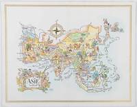
1964rif. 195995Pan American World Airways. 1964. Colour pictographic/pictorial map of Asia 23.2 x 30.1 cm gilt double-rule border printed on a folding decorative menu card 32 x 50 cms open highlighted in gilt text in English French and Japanese central fold and later central vertical crease in very good condition. Pan Am menu card for First Class passengers dubbed "The President Special" the deluxe cuisine by fabled Maxim's of Paris "Good food is the basis for true happiness". Passengers were feted with gourmet meals on bone china with silver cutlery. The witty pictorial cover-map of Asia was by French artist and commercial illustrator Jacques Liozu 1910-1974 also known for his larger scale maps. . Pan American World Airways. unknown
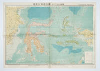
1572rif. 160554Tokyo 東京: 統制社Tosei-sha. 昭和 Showa 18. 1943. Colour folding map 54 x 75.5cm with original envelope. Envelope a little torn some occasional browning very good. The 13th map in this Standard Maps of Greater East Asia series of 20 maps. All text in Japanese. Shows railways shipping routes administrative boundaries airfields ports lighthouses mines oil wells etc. . 統制社(Tosei-sha) unknown
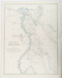
1861rif. 177021Edinburgh & London.: William Blackwood & Sons. 1861. Engraved map with original outline hand-colour 57 x 43.8 cm 61.1 x 49 cm sheet central fold very slight edge toning but the map in very good bright condition. First edition. Fine large folding map: the Nile delta and river with attractive original outline colour railways and canals marked and name references to biblical and classical geography. Published for inclusion as map 39 in "Keith Johnston's royal atlas of modern geography" . William Blackwood & Sons. unknown
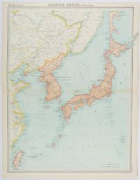
1922rif. 215880Edinburgh.: John Bartholomew & Son Ltd. 1922. Large double page map 54.2 x 43 cms map original fold some edge toning and to the fold but in very good condition. Large map prepared as plate 65 for “The Times Survey Atlas of the World” in 1922 and was prepared at the Edinburgh Geographical Institute under the direction of J G Bartholomew. The map shows Japan's territory inclusive of Korea southern Sakhalin and Taiwan. . John Bartholomew & Son Ltd. unknown
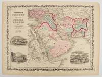
1860rif. 177019New York.: Johnson & Browning. circa1860. Engraved map 30.2 x 40.5 cm 34.5 x 45.5 cm sheet original hand-colour elaborate strapwork border three fine vignettes of Muscat Trebisond small marginal edge tears top corner chipped the map in very good condition. Most attractive decorative map of Arabia the Ottoman Empire Persia Afghanistan Beloochistan and surrounds by one of the most popular and successful 19th Century American atlas publishers. . Johnson & Browning. unknown
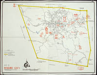
1960rif. 206510circa1960. Printed pictorial map 44.8 x 58 cm 46.7 x 60.3 cms sheet original folds a little wear but in very good condition. Attractive 1960s tourist map of Baguio city when it was the "Summer Capital" of the Philippines. Tourist attractions are shown pictorially in red blue triangles denote wood carving shops the city boundaries outlined in yellow sealed and unsealed roads are also shown. . unknown
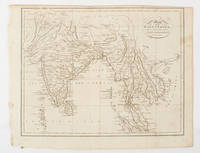
1805rif. 175148London & Glasgow.: W. and D. Brownlie. 1805. Engraved map 18.7 x 23.9 cm original folds age toned and spotted inner margin a trifle ragged paper thinning in a few spots in good condition. Attractive map engraved for "A System of Geography; or A Descriptive Historical and Philosophical View of the Several Quarters of the World" published in 1805. . (W. and D. Brownlie) unknown
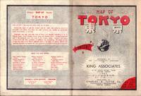
1954rif. 194113Tokyo.: Charles E. Tuttle Company. 1954. Printed four colour map 92 x 71cm; 102.5 x 74.5cm sheet folding into pictorial wrappers 25.6 x 19 cm inset map of the Marounouchi District and on the verso an extensive grid reference in English and Japanese and over four panels a map of the streetcar railway and subway system scant spotting to cover two small fold splits without loss and toning most evident at the folds in very good condition. Comprehensive 1950s map of Tokyo by US publisher Charles E. Tuttle "Here at last is the map that makes order out of chaos.extending as far as Haneda Airport Grant Hights Harbor Area and Nakano Ward" blurb. . Charles E. Tuttle Company. unknown
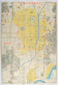
1922rif. 171899京都. Kyoto.: 山中書房. Yamanaka Shobō. 大正 11 1922. Attractive colour folding map of Kyoto with a quite detailed illustrated tourist guide printed in blue and white on the reverse some light browning holes at some folds good copy. 78.5 x 54cm This 1922 colour folding tourist map of Kyoto offers sightseeing information each panel showing a photographic monochrome image of the site discussed. The two inset maps on the Kyoto map show Otsu city on the shore of Lake Biwa and the Arashiyama area north of Kyoto. The main map highlights the major temples and famous sights in red geographic features such as rivers and hills are shown and an inset chart shows distances of sights from the nearby stations. The information on the reverse gives more detail on the famous sights a calendar of events seasonal highlights and details of the Imperial graves around Kyoto. . 山中書房. [Yamanaka Shobō]. unknown
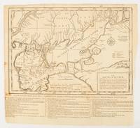
1739rif. 174921London.: The Gentleman's Magazine. circa1739. Engraved map 22.2 x 31.4 31.1 x 33 cm sheet size elaborate explanatory key in three columns at the foot original folds sealed 2 cm tear to the lower part of the inner margin one other small fold tear no loss inner margin of the key trimmed with some loss an original fault paper browned and spotted on the verso but an historic map in good condition. . [The Gentleman's Magazine]. unknown
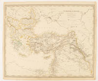
1840rif. 174957London.: Charles Knight & Co. circa1840s. Lithographed map with original outline hand-colour 31.9 x 39.1 cm small marginal tears neatly repaired with archival material but no loss small surface abrasion affecting the border at the foot edgewear and browning inked pagination in an early hand but in very good condition. A handsome map with fine topographical engraving also showing the borders with Hungary Russia and Persia. . Charles Knight & Co. unknown
rif. 3031203070.Gpaperback. Good. Access codes and supplements are not guaranteed with used items. May be an ex-library book. paperback