4 359 résultats
1998réf. DBS-9780854047383RSC 1998. 1st. Hardcover. New. RSC hardcover
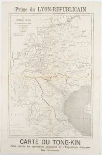
1883réf. 180621Lyon.: Lyon-Républicain. circa1883. Engraved map 40.5 x 27.5; 48.9 x 31.8 cm sheet original folds some browning to the fold and margins two small holes at the central fold without significant loss in good condition. Map issued as a supplement to "Le Lyon-Republicain" one of the great radical daily newspapers in Lyon. The map is after documents by French explorer and trader Jean Dupuis 1829-1912 who had explored regions along the Red River in the hopes of establishing trade routes within Vietnam and China and variously published. This supplement was issued on the eve of the Tonkin War in 1883 so that readers could follow the military movements of the French Expeditionary Force. It shows northern Vietnam and into south-western China with provinces marked and river systems in detail. . Lyon-Républicain. unknown
réf. 35055like new. unknown
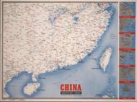
1945réf. 194660New York.: Army Information Branch. Volume III No. 51F. 9 April1945. Folding colour map and six inset maps in a vertical panel 88 x 119 cms sheet and on the recto circular map of Europe smaller inset map of Asia and of the Ryukyu Islands descriptive text original folds in very good bright condition. Scarce Newsmap of "China Southeast Coast" from Shanghai to French Indochina with the islands of Formosa and Hainan. At the right edge are inset maps of the vicinities of Shanghai Wenchow Foochow Swatow Canton and Hong Kong. On the verso is a large map of the European theatre of operations centred on Berlin a map of the Pacific area noting the American occupation of Okinawa with a detailed map of this island. In unusually fine bright condition. . Army Information Branch. unknown
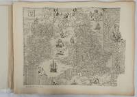
1932réf. 176499London.: Royal Geographical Society. 1932. Twenty one loose maps with tissue guards printed on sheets 49.5 x 63.5 cm in the original folio title-wrappers the maps with some edge wear and toning but on the whole in very good condition the wrappers browned and stained torn with minor loss at the foot of the title wrapper small closed edge tears now re-enforced with archival material and sound. Lacking the introductory notes by Edward Heawood. The complete suite of maps: an impressive production. The first map is a general map of England and Ireland by an unknown author 1594; nineteen county maps; and a final sheet of miniature county maps printed as a deck of playing-cards. The county maps proper vary in date from Saxton's “Southamtonia” of 1575 to John Speed's version of Norden's map of Sussex dated 1610. A contemporary reviewer dubbed it " a rich cartographical feast" allowing easy access to rare and valuable maps and comparison of maps by different cartographers for the same county. The county maps reproduced include five by Christopher Saxton three by John Norden Philip Symonson's map of Eastern Kent published in 1596 a series of seven maps dating from the early years of the seventeenth century two maps prepared for Camden and two published by John Speed. . Royal Geographical Society unknown
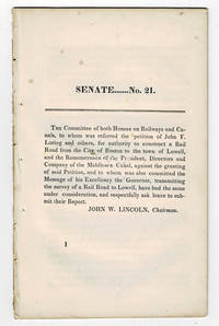
1830réf. 99804Boston MA: Printed by Dutton and Wentworth 1830. 1830. Very good. - Octavo 8-1/2 inches high by 5-1/4 inches wide. Softcover bound in printed self-wrappers. Once bound in with other similar pamphlets these three related items are unbound and removed with stab marks along the left edges. The pagination is a follows: pages 1-11 1 & 13-21 1-8; and 1-12. There is some scattered foxing throughout all three items. The cover page of the Senate No. 10 report dated December 15 1829 is darkened & stained with minor chipping to the bottom corners of that page and of the last page. Very good. First edition Massachusetts Senate No. 21. The report is signed on page 11 by John W. Lincoln Chairman. The report is followed by the text of a bill entitled "An act to establish the Boston and Lowell Rail Road Corporation." The Boston and Lowell Railroad was the first major railroad in the state of Massachusetts. The Boston and Lowell Railroad was preceded by the Middlesex Canal. Converting the canal to a railroad would eliminate the issue of transportation being unavailable during the winter when the canal froze. Patrick Tracy Jackson led the task of convincing the state legislature to fund the project. This proved difficult as the investors of the Middlesex Canal were against building a new form of transportation designed to replace their canal. The report at hand details the protest of the directors of the Middlesex Canal against granting the petition of John F. Loring and others to construct a railroad in its place. Loring and the other investors received their charter on June 5 1830 and the railroad began operations on June 24 1835. The pamphlet is accompanied by an earlier February 12 1830 pamphlet titled:"To the Honorable the Senate and House of Representatives in General Court assembled. : The president directors and company of the Middlesex Canal having seen the publication of the petition of John F. Loring and others for a rail road from Boston to Lowell and the order of notice thereon beg leave to present the following remonstrance to granting the prayer thereof." 12 pages. Signed page 12: Wm. Sullivan Josh. Coolidge Geo. Hallet committee of directors of Middlesex Canal to this purpose duly authorized. House No. 40 printed by Dutton and Wentworth 1830. In addition an earlier pamphlet from 1829 is included: "Boston December 15 1829. To His Excellency Levi Lincoln Governor of the Commonwealth of Massachusetts : Sir On the behalf of the Commissioners of Internal Improvements I have the honor to transmit herewith a report of a survey made in conformity to a resolve of the legislature passed on the 12th day of June 1829 directing the Board to survey a route for a rail road from the town of Taunton to some point in the route previously surveyed between Boston and Providence : with great consideration and respect I am your humble and most obe't. serv't. Josiah J. Fiske chairman." 8 pages. Signed on page 8: Josiah J. Fiske Willard Phillips James Hayward Commissioners of the Board of Internal Improvements. Senate No. 10. Printed by Dutton and Wentworth. [Boston, MA: Printed by Dutton and Wentworth], [1830]. paperback
1929réf. 64507Springfield MO: Kucker Studio 1606 W. Elm Lilley’s Tourist Camp ca. 1929. One large oblong panoramic photograph sized 32 x 10.25 in. generous white margins photographer’s imprint & caption w/in negative at lower fore-edge minor scuffing closed tears & minor creasing to either end still nice bright image w/ excellent contrast. This original photograph captures the quintessential Motoring Tourist Camp run by the Lilley’s at the end of the Roaring 20’s along historic US Route 66 through Springfield MO. The structures all were designed in the stucco Spanish-Revival style with clay roofs Sinclair Visible Gas Pumps and a restaurant that served chicken & steak dinners packed lunches and BBQ sandwiches. This image remains largely the only record of the short-lived efforts of James Lilley 1893-1967 to run and operate a Sinclair gas station car repair grocery store and restaurant before the Great Depression when later he went to work for the railroad and the entrepreneurial life was left behind. May 1886-1950 was longtime photographer for Springfield Missouri’s Kucker Studio noted for his images of the Southwest Missouri State Teacher’s College Drury University and even historical portraits such as President Harry S. Truman. He was also known for documenting many of the sites along Route 66 where it intersected through Springfield. No similar records of this image could be found. Kucker Studio, [1606 W. Elm], Lilley’s Tourist Camp, unknown
2016réf. STM-9781839362002United States: APLS 2016. Hardbound. Brand New. Book Condition:- Brand New. Secured Packaging. Fast DeliveryBookseller Inventory # 9781839362002 APLS hardcover
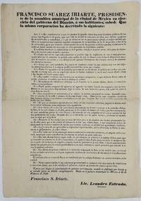
1848réf. 68814Mexico 1848. Broadside 46 x 32 cm. Old fold lines some shallow chipping around edges. Printing 18 articles decreed by Francisco Suarez Iriarte President of the Municipal Assembly of Mexico City regulating sanitation and garbage dumps water carriers licenses for coaches and carriages etc. Signed in type by Iriarte and by Lic. Leandro Estrada Secretario. OCLC lists one copy: Brown Univ. unknown
1848réf. 68814Mexico 1848. Broadside 46 x 32 cm. Old fold lines some shallow chipping around edges. Printing 18 articles decreed by Francisco Suarez Iriarte President of the Municipal Assembly of Mexico City regulating sanitation and garbage dumps water carriers licenses for coaches and carriages etc. Signed in type by Iriarte and by Lic. Leandro Estrada Secretario. OCLC lists one copy: Brown Univ. unknown books
2025réf. x-1032558792Routledge 2025. Hardcover. New. 154 pages. 9.18x6.12x9.45 inches. Routledge hardcover
2026réf. x-0367675374Taylor & Francis Ltd 2026. Hardcover. New. 184 pages. 9.18x6.12x9.45 inches. Taylor & Francis Ltd hardcover
réf. 67360Ediciones del Murciélago 1929 México. 1ª edición. 24x19. 78 pgs. Dedicatoria autógrafa del autor. Y0614 Ediciones del Murciélago, 1929, México. 1ª edición. unknown
2023réf. x-1032473819Routledge 2023. Hardcover. New. 248 pages. 9.19x6.13x0.70 inches. Routledge hardcover
2017réf. x-1138081574Routledge 2017. Hardcover. New. 224 pages. 9.25x6.25x0.75 inches. Routledge hardcover
2009réf. x-0415995957Routledge 2009. Hardcover. New. 1st edition. 224 pages. 9.50x6.50x0.75 inches. Routledge hardcover
2018réf. x-1138572047Routledge 2018. Hardcover. New. 192 pages. 9.00x6.25x0.75 inches. Routledge hardcover
2019réf. x-0367318180Taylor & Francis 2019. Hardcover. New. 291 pages. 9.01x5.98x0.87 inches. Taylor & Francis hardcover
réf. 2540692-nnew. unknown
2015réf. x-1785602837Emerald Group Pub Ltd 2015. Hardcover. New. 301 pages. 9.25x6.50x1.25 inches. Emerald Group Pub Ltd hardcover
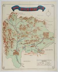
1930réf. 206841Kofu.: Onkodo Printing Co. circa1930s. Colour pictorial map 70.2 x 56 cms; 75.5 x 59.5 cms sheet light wear along the inner margin some soft creases from folding short split at center fold; in very good clean condition. An appealing and decorative map of Yamanashi Prefecture which while a process print has the attractive soft look of a lithograph adorned with vignettes of key attractions landmarks such as Mt. Fuji and industry such as silk and wine. The legend lists Railways 'Footing' Roads Hot Springs Hotels and National Parks. A scarce and attractive English language map for the tourist market. . Onkodo Printing Co., unknown
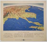
1944réf. 200808Remington Rand. 1944. Five printed colour maps each: 31.4 x 47 cms; 46.3 x 53.3 cms sheet central fold marginal edge wear chips and a few small edge tears tidemark affecting the ocean at the outer edge of Map VII but all the maps in very good condition. From a series of World War II battlefront maps "for the delight of arm-chair strategists" published by the Library Bureau of Remington Rand seven were published. Taken from a bird's eye view of the globe and with relief artistically rendered by artist Kenneth Thompson 1907-1996 and descriptive text by George Fielding Eliot 1894-1971. Eliot spent his youth in Australia attending Melbourne University serving with distinction in the Australian Infantry in WWI. Moving to the United States after a short stint in Canada serving with the RCMP her served as a reserve officer in the U.S. Army reserve in military intelligence from 1922 to 1933 and during WWII Eliot famously broadcast the first extended television coverage following the attack on Pearl Harbor. He continued to write books and articles about military strategy and world politics into the 1960s. In keeping with the "aviation-age" cartography of Richard Edes Harrison the unusual perspective of the maps--from above and often with a direction other than north at the top of the map--challenges the viewer to reconsider the geopolitical situation with the text of Eliot as a further prompt his captions below: Map III Italy & South France "Hannibal Caesar and Napoleon made their reputations here" Map IV The Western Front "Will the cockpit of 1918 see the decisive battles of 1944" Map V Southeastern Asia "The road to Mandalay -- and to China --along which bombs for Tokyo must travel" Map VI The Southwest Pacific "Island-hopping toward Japan -- in short and long hops" Map V11 The North Pacific "Here the enemy trusts in the protection of vast ocean distances" . Remington Rand. unknown
1926Roy. 8vo., First Edition, with a coloured frontispiece (original tissue guard present), and 167 illustrations by the author in the text; handsomely bound in dark red full morocco, back gilt with raised bands, gilt from original upper board and backstrip preserved and mounted on new and separate leaves, a most attractive copy ideal as a gift or for presentation. A lovely copy
2004réf. DADAX0826469736Continuum 2004-06-15. hardcover. New. 6.14x0.69x9.21. Buy with confidence. Excellent Customer Service & Return policy. Continuum hardcover
1987réf. 2080302106809575Nagasaki City Civil Engineering Department Road Maintenance Section 1987. Soft Cover. Fine. Number of pages: 136 pages Size: A4 version Nagasaki City Civil Engineering Department Road Maintenance Section paperback