4.415 Ergebnisse
1924Best.-Nr. 015720Paris Au Sans Pareil 1924 In-12 Broché, couverture illustrée Edition originale
1996Best.-Nr. __0471960128John Wiley & Sons Inc 1996. Hardcover. New. 1st edition. 375 pages. 9.50x6.25x1.00 inches. John Wiley & Sons Inc hardcover

1986Best.-Nr. x-9061935431Dr W Junk Pub Co 1986. Hardcover. New. 406 pages. 11.34x8.58x1.10 inches. Dr W Junk Pub Co hardcover
1996Best.-Nr. DADAX0471960128Wiley 1996-04-19. 1. hardcover. New. 6.26x1.13x9.09. Buy with confidence. Excellent Customer Service & Return policy. Wiley hardcover
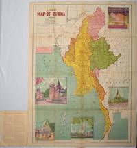
1951Best.-Nr. 214601Delhi.: S.B. Makhija & Brothers. circa1951. Printed colour map 98.6 x 69 cm folding into pictorial wrappers 25.3 x 19.5 cm five pictorial colour inserts of pagodas and the Shwethalyaung reclining Buddha wrappers a little chipped marginal wear and three small fold splits in the map but overall in very good condition. Attractive large map of Burma with the provinces coloured steamship routes shown in red and printed in the booklet a range of information printed based on the 1951 census including climate agriculture and form of government "Burma became an independent nation completely outside the British Empire on January 4 1948 and is now a sovereign independent republic known as the Union of Burma". . S.B. Makhija & Brothers. unknown
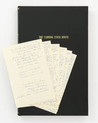
Best.-Nr. 147183First Edition. Hardcover. Fine. Small folio; morocco-grain cloth lettered in gilt; in fine condition. The volume contains: a manuscript personal diary of the trip octavo 6 leaves removed from a small journal and loosely inserted; a typed transcript of the diary quarto 4 leaves printed rectos only; typed transcripts of journals kept by two other members of the same expedition both quarto printed rectos only the first 10 leaves plus signed cover letter the second i ii 34 leaves plus a map complimentary copy number 7 inscribed and signed by the author; and 74 colour photographs each 88 × 130 mm mounted next to printed captions they show desert scenery waterholes Aboriginal rock art explorers' inscriptions and more. Also bound in are photocopies of four publications or extracts relating to the Canning Stock Route. hardcover
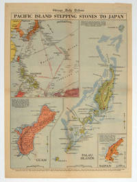
1944Best.-Nr. 208880Chicago.: Chicago Daily Tribune. 28 September1944. Colour pictorial map on a single newspaper leaf archivally laid down on linen 50 x 39.2 cms; 59.3 x 43.3 cms sheet including captions faint toning to fold lines very good condition. Vivid colour maps of the Palau Islands Guam and Saipan in the Marianas and an inset location map published in the "Chicago Daily Tribune" in September 1944 months after the landing of US and Allied Forces in the offensive against the Japanese during the Pacific War. . Chicago Daily Tribune. unknown
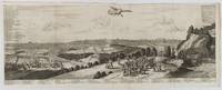
1720Best.-Nr. 180201A Leide. Leiden.: Chez Pierre van der Aa. circa1720. Engraved panorama on watermarked laid paper 28.5 x 77.5 including captions; 31 x 79.5 cm sheet title cartouche engraved key in French and Dutch the upper margin trimmed to the platemark original folds edgewear and toning neat sealed tear to the outer edge barely visible 5mm intrusion to the image a very good dark impression. Finely composed and engraved panorama of Tokyo prepared for the monumental work "Galerie Agreable du Monde" by the master Dutch publisher Pieter Van de Aa 1659-1733. The detailed key in Dutch and French notes myriad buildings and temples on the horizon and in the foreground two processions converge: of nobles and their attendants dancers a trio of dogs and a priest or religious attending a suppliant. Pieter van der Aa 1659-1733 was born in Leiden Holland and started his own book publishing business when he was only twenty-three. His prolific output of highly decorated maps and atlases culminated in his magnum opus “Galerie Agreable du Monde” which illustrated the world known to Europeans in the early eighteenth century. Comprising 66 volumes it was the of plates published at that time it has been estimated that only 100 copies were published. . Chez Pierre van der Aa unknown
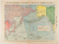
1942Best.-Nr. 180751Chicago.: Chicago Daily Tribune. Friday June 51942. Printed colour map on a single newspaper leaf 37.5 x 53.2 cm; 44.7 x 59.8 cm sheet inset legend marginal browning and at the folds some undulation of paper and tide mark along lower section but in remarkably bright very good condition. Strategic map published in the Chicago Daily Tribune "The World's Greatest Newspaper" on June 5th 1942 two days after the Japanese attack on Dutch Harbor the site of the US army and navy bases in the Aleutians and as it transpired at the outset of the Battle of MIdway. The owner and proprietor of the Tribune Robert McCormick was staunchly against the United States entering the war and had firm views once it had occurred that American resources should not be used defending the British Empire. Famously the Tribune published the "Victory Program" Roosevelt’s military plan to prepare the United States for possible entry into World War II and was subject to prosecution for an alleged violation of the Espionage Act relating to the newspaper’s front-page account of the Battle of Midway 4-7 June 1942. It became an important test case for the limits of free speech and censorship during war-time. The Legend shows territorial Control of Ocean Areas marking Japanese Naval and Air bases as of 1941 and "according to latest reports" those established in the first six months of 1942. Also shown are pre-war sovereignties as at the bombing of Pearl Harbour on December 7th 1941. The Anson Archipelago is shown but a question mark "indicates islands etc. whose existence or give position is doubtful…". . Chicago Daily Tribune. unknown
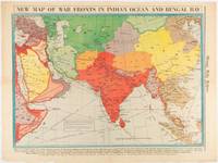
1942Best.-Nr. 180782Chicago.: Chicago Daily Tribune. April 211942. Printed colour map on a single newspaper leaf 37.5 x 53.2 cm; 60 x 45 x 59.6 cm sheet marginal browning and at the folds but remarkably bright in very good condition. World War II map of Asia save for Japan showing British allies colonies and lines of supply and marking Japanese territorial occupation published in the Chicago Daily Tribune "The World's Greatest Newspaper" in April 1942. "The Indian Ocean and the Bay of Bengal are the strategic waters in this campaign in which the occupied parts of Burma and the Andaman Islands serve as bases" caption ". the historic Chicago Tribune was an innovator in color inks and printing but also a pioneer in bringing colorful art in the form of illustrations photographs cartoons and advertisements to the average person in an everyday medium." see The Janet A. Ginsburg Chicago Tribune Collection Michigan State University Libraries. . Chicago Daily Tribune. unknown
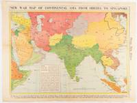
1942Best.-Nr. 180760Chicago.: Chicago Daily Tribune. January 91942. Printed colour map on a single newspaper leaf 37.2 x 53.4 cm; 45 x 59.9 cm sheet inset legend marginal browning and at the folds lower margin with small edges tears not affecting the caption but remarkably bright in very good condition. Rare map of Asia "Between Suez on the west and Shanghai on the east" showing territorial interests and theatres of war published in the Chicago Daily Tribune in January 1942 barely two months after the Uniited States had joined the war effort after the bombing of Pearl Harbour. Thailand and Vietnam "French Indo-China" are marked "Occupied by the Japanese" and north-eastern China similarly marked Iran "Anglo-Russian Occupation" and the Gulf states "British Ally". The caption notes that "The map inludes waters thru which runs the British life line from the Suez canal to remote Australia and New Zealand. Nearly half the people in the world live in the lands shown on this map--more than 450 million for example in China and more than 375 million in India". ". the historic Chicago Tribune was an innovator in color inks and printing but also a pioneer in bringing colorful art in the form of illustrations photographs cartoons and advertisements to the average person in an everyday medium." see The Janet A. Ginsburg Chicago Tribune Collection Michigan State University Libraries. . Chicago Daily Tribune. unknown
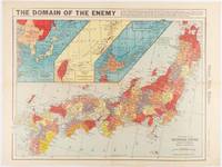
1941Best.-Nr. 180789Chicago.: Chicago Daily Tribune. December 121941. Printed colour map on a single newspaper leaf 41.5 x 53 cm; 45.1 x 59.9 cm sheet three inset maps of the Japanese Empire; Taiwan and Ryukyu Islands; and Hokkaido and Chisima marginal browning and at the central fold but remarkably bright in very good condition. Map of the Japanese Empire ominously titled published in the Chicago Daily Tribune one week after the bombing of Pearl Harbour. Prefectures are attractively coloured. Based on a Rand McNally map the Tribune briskly got to work issuing maps for readers showing the beginnings of the war with Japan. Later maps were also published for sale separately but remarkably few have survived. ". the historic Chicago Tribune was an innovator in color inks and printing but also a pioneer in bringing colorful art in the form of illustrations photographs cartoons and advertisements to the average person in an everyday medium." see The Janet A. Ginsburg Chicago Tribune Collection Michigan State University Libraries. . Chicago Daily Tribune. unknown
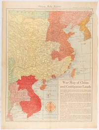
1519Best.-Nr. 180794Chicago.: Chicago Daily Tribune. January 151942. Printed colour map on a single newspaper leaf 53 x 40.7 cm; 59.8 x 45 cm sheet inset text box marginal browning and at the folds but remarkably bright in very good condition. WWII map of China showing most of China Indo-China Thailand and Korea with territory captured and controlled by Japan shaded in orange and red published by the Chicago Daily Tribune barely six weeks after the bombing of Pearl Harbour. The text on the map reads "Since 1937 China has been at war with Japan. Lacking many essentials of war the Chinese nevertheless have managed to maintain a front against the aggressors. China's principal life line is the Burma road shown on the map which starts at Lashio Burma and extends to Kunming Yunnan province where it links with connections to Chunking the present Chinese capital". Based on a Rand McNally map the Tribune briskly got to work issuing maps for readers showing the beginnings of the war with Japan. Later maps were also published for sale separately but remarkably few have survived. "… the historic Chicago Tribune was an innovator in color inks and printing but also a pioneer in bringing colorful art in the form of illustrations photographs cartoons and advertisements to the average person in an everyday medium." see The Janet A. Ginsburg Chicago Tribune Collection Michigan State University Libraries. . Chicago Daily Tribune. unknown
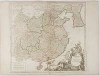
1751Best.-Nr. 177606Paris. 1751. Engraved map 48 x 52.2 cm; 51 x 67.6 cm sheet provinces highlighted with outline hand-colour elaborate title cartouche central fold small tear at the foot affecting the border old paper repair on the verso affecting the margin only pin-holes to the four marginal corners margins a little browned and dusty a handsome map in good condition. Fine large format map showing China Korea Taiwan and parts of Central Asia prepared for De Vaugondy's "Atlas Universel". The beautifully foliated cartouche features a duo of joyful Chinese musicians one dancing and a diminutive figure holding a parasol. From the Estate of the late collector and scholar Arthur Hacker. . unknown
1981Best.-Nr. mon0000977443Ross Erikson 1981T. paperback. Very Good. 0.7008 in x 8.9016 in x 5.7008 in. Rubbing on front cover. Water marks on spine and small part of back cover. Ross Erikson paperback
1999Best.-Nr. 2080302106809654Toei Kawagoe Road Residential Ruins Survey 1999. Soft Cover. Fine. Number of books: 6 Toei Kawagoe Road Residential Ruins Survey paperback
2007Trade paperback Very good. No dust jacket as issued. Light Wear on cover. Pages a ll intact, clean, no tear and no writings. Stock Photo different from actual book cover. Trade paperback (US). Glued binding. 533 p. Audience: General/trade.
Best.-Nr. BN704894Les amis du père François. Softcover. SOS chatons en détresse SOS chatons en détresse Isabella Camino et Delphine Lacharron Les amis du père François paperback
1946Best.-Nr. 51162BB2 Bände. Buenos Aires, Editorial Losada, 1946. 8°. 265 S., 216 S. Originalbroschur mit Schutzumschlägen.
1970Best.-Nr. 2091202133106272Ministry of Construction Road Bureau Kinki Regional Construction Bureau 1970. Soft Cover. Fine. Number of books: 2 Ministry of Construction Road Bureau Kinki Regional Construction Bureau paperback
Best.-Nr. 3006Milwaukee: The Company; Daily News Book and Job Steam Printing Office 1857. . 8vo yellow wrappers front printed This is not a later printing of Library of Congress Modelski No. 440. There is no inset and the copyright is 1856 Milwaukee: [The Company]; Daily News Book and Job Steam Printing Office, 1857. unknown
Best.-Nr. 3006Milwaukee: The Company; Daily News Book and Job Steam Printing Office 1857. . 8vo yellow wrappers front printed This is not a later printing of Library of Congress Modelski No. 440. There is no inset and the copyright is 1856 Milwaukee: [The Company]; Daily News Book and Job Steam Printing Office, 1857. unknown books
1902Outside dimensions 14.5" x 10.5". Circa 1902. Railroads, Elevated Railroads, Broadway Cable Road, and Horse Cars indicated. Centerfold. Light wear. Please see our photo for details. Book
2003170 pp. Bibliography of books [in English] about Bethune. Eighty-five black and white reproductions of documents. Opens with an informative fifteen page footnoted introduction by David Lethbridge. Dr. Norman Bethune [1890-1939] is revered to this day in China for his front-line medical service to the Communist Army in the late 1930s. "But from the moment he joined the Communist Party of Canada, the RCMP secret intelligence division kept extensive and detailed files on his every move. Only recently declassified, and fully reproduced for the first time in this volume, are the actual secret police files on Bethune. Never before have Bethune's own words spoken so clearly about the political convictions and personal courage that have led him to be remembered as a revolutionary militant of 'absolute selflessness.'" - back cover. Former library copy with usual markings and above-average external wear. Binding intact. A worthy reference copy. Book
1909Pages 293-332 plus xxiv pages of great vintage ads. Many great black and white photos. Features: Notable American Homes - "Darlington," the estate of george Crocker, Esq., Ramsey, NJ; Designs Direct from Nature; "Annesden," the Summer Home of Miss Annie E. Quimby, Bridgehampton, Long Island; Playhouses for Children; A Group of Small Houses - costing from $3,000 to $10,000; Grape Culture in France; A House with a Guaranteed Cost - A House That Can Be Built for Seven Thousand Dollars; The "Wayside Inn", otherwise known as the "Red Horse Tavern" of Sudbury, MA; The Rochester, NY Chamber of Commerce Cheap Cottage Competition, won by Miss Esther M. Byers - The First and Second Prize Designs; House of James E. Wheeler, Edgehill Road, New Haven, CT; One-page illustrated ad for the "Invincible" Electric Renovator (vaccum) from the Electric Renovator Mfg. Co.; Back cover two-color ad for Waterman's Ideal Fountain Pen; and more. Printed on glossy stock. Complete and unmarked with average wear. Covers and some pages loose but all present. A worthy copy of this great vintage issue. Magazine