[AKIYAMA EINEN (OR NAGATOSHI)] 秋山永年.Biblio.com
4 426 résultats
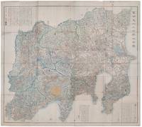
1418réf. 159850Shūseidō 衆星堂. Reprint. Tenpō 14 1843. Large folding handcoloured map of the thirteen provinces from which Mt. Fuji can be viewed. 159 x 178cm. Folds into paper covered card covers measuring 40 x 24cm. Title label upper cover. A little browning along folds occasional spotting and soiling. A little worming causing approximately 1cm of loss in places. Two chops in lower section. A very striking and attractive map. This very large handsome map is a detailed map of the thirteen provinces from which one can see Mt. Fuji. Provinces shown are the eight provinces of the Kantō region Sagami 相模 Musashi 武蔵 Kazusa 上総 Shimofusa 下総 Awa 安房 Kōzuke 上野 Shimotsuke 下野 and Hitachi 常陸 and five other provinces Izu 伊豆 Suruga 駿河 Tōtōmi 遠江 Kai 甲斐 and Shinano 信濃. The map offers a large amount of detailed information such as province and county borders rivers high ways post towns checkpoints villages and scenic spots. The cartographer Akiyama Einen or Nagatoshi 秋山永年 came from Edo and the editor Funakoshi Seizō 船越清蔵 studio name: Shugu 守愚 1805-62 a Confucian scholar from Nagato Province now the western half of present-day Yamaguchi Prefecture. A dedication by Funahashi Akira 舟橋徴 is dated 1843. . Shūseidō 衆星堂 unknown
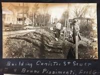
1913réf. 53568Hornell NY & Low Moor VA: Homer A. Sitterley Asst. City Engineer for Hornell NY; Chief Mining Engineer Low Moor Iron Co. 1913-1917. Oblong 8vo. 10 x 7 in. 142 pp unpaginated. thick black paper stock w/ 298 original photographs sized from 2 x 3 in. up to 3.25 x 5.5 inches 280 this size 2 of them cyanotype and the majority with neat white ink manuscript descriptions linen-backed frontisp. map of Hornell NY dated 1915. Contemporary limp black-cloth post-binder sewn at gutter margin w/ black silk braid minor soiling tidemark to outer fore-edges of front cover first couple leaves minor fraying & wear to corners still a VG- exemplar w/ most images with strong contrast. This remarkable album documents the tremendous range of road building projects sewer improvements bridge building and dam construction in and around Hornell NY in Steuben County in the years before World War I. Steuben County was the next to the last County in New York State to join the Good Roads Board sponsored by the American Automobile Association in 1907 primarily because during the opening decades of the 20th century that area of New York had some of the worst roads. These images show the construction and building of sewer lines on Crosby Street Canister Street paving projects on East Ave. Jane Street West Street -- with fantastic images of early Foote Concrete Machinery Co. road paver in operation pouring concrete West Genesee Street Church Street and others. Sitterley b. 1889 makes a study of the filtering systems and sewer plant for New York City at the time includes photo of the newly opened Hornell trolley “Subway” as well as numerous photos of poor condition sidewalks which were slated for modernization as an adjunct of the Good Roads agenda hand-in-hand with laying of new sewer lines. In addition he has included photo of himself with surveyor’s transom and the Hornell City Engineer together with the City Park Superintendent. A significant portion of the album is devoted to the building of the Seneca Street Bridge including the building of the coffer dams to hold back the water to pour the piers the construction of the abutments and finally the finished bridge. That bridge would later be rebuilt by a WPA project in 1936 and now is up for replacement again. Sitterley’s last major projects were overseeing the building of the new Hornell city dams and city reservoirs together with road improvements gate houses and spillways. In March 1916 he leaves Hornell NY to become Chief Mining Engineer for the Low Moor Iron Co. which was a producer of pig iron in Alleghany County of Western Virginia which operated from 1872-1930. The company was often plagued with labor unrest as they maintained very poor “Company” towns and were constantly struggling with the Chesapeake & Ohio Railroad to ship their ore. In 1916 they were on the upswing as a company as the growing steel demands of World War I began to lift all ore producers at the time. See: Corning Convention of Good Roads Associations Good Roads Magazine April 1907 pp. 134-135; Homer Aldrich Sitterley Bi-Monthly Bulletin of the American Institute of Mining Engineers No. 126 June 1917 p. xxxv; Russell Story of the Great Flood and Cyclone Disasters in New York State 1913 New York Roots 1999; Papers of the Low Moor Iron Company 1873-1927 Special Collections Univ. of Virginia Library 2010. Homer A. Sitterley, Asst. City Engineer for Hornell, NY; Chief Mining Engineer, Low Moor Iron Co., hardcover
1740réf. 19595(Augsburg), Matthäus Seutter, um 1740. Ca. 50 cm x 58 cm (Platte).
2016réf. 120005Promopress. New. Hardcover. FREE UPGRADE to Courier/Priority Shipping Upon Request - IN STOCK AND IMMEDIATELY AVAILABLE FOR SHIPMENT - Flawless copy brand new pristine never opened. Text in English French Spanish and Italian. -- with a bonus offer-- . 2016. 8416504083 . Promopress hardcover
2011réf. 88890Verlag Fur Moderne Kunst. New. Hardcover. FREE UPGRADE to Courier/Priority Shipping Upon Request - IN STOCK AND IMMEDIATELY AVAILABLE FOR SHIPMENT - Flawless copy brand new pristine never opened -- Text in German and English. 96 pp; 41 color illustrations. -- with a bonus offer--; Comparing the shared textures of woven and painted works of art and craft this volume juxtaposes a burial cloth from Peru a poncho from Guatemala silk ikat from Southeast Asia and woven fabrics from Persia with works by artists such as Eduardo Chillida Adolfo Estrada Helmut Federle Johannes Itten and Sean Scully. . 2011. 3869841362 . Verlag Fur Moderne Kunst hardcover
réf. Z1-N-007-00593sold by OECD Publications Center. Used - Good. Ships from UK in 48 hours or less usually same day. Your purchase helps support Sri Lankan Children's Charity 'The Rainbow Centre'. Ex-library so some stamps and wear but in good overall condition. 100% money back guarantee. We are a world class secondhand bookstore based in Hertfordshire United Kingdom and specialize in high quality textbooks across an enormous variety of subjects. We aim to provide a vast range of textbooks rare and collectible books at a great price. Our donations to The Rainbow Centre have helped provide an education and a safe haven to hundreds of children who live in appalling conditions. We provide a 100% money back guarantee and are dedicated to providing our customers with the highest standards of service in the bookselling industry. [sold by] OECD Publications Center unknown
1953réf. 013812New York Ace Books, Inc. - Collection « Ace double books » D-15 1953 In-12 broché, couverture illutrée Signé par l'auteur
1886réf. 47038Lincoln: Journal Company State Printers 1886. 1886. NEBRASKA RAILROAD. First edition. 8vo. Original orange printed wrappers 16 pp. folding map: Map of Nebraska 1886. 59 x 99 cm. 23 1/4" x 41" 12 miles to one inch. The map was the project of the Burlington Route for selling land. Very detailed and routes outlined in bright red. Broken Bow was to be the new center of life in Nebraska. The map is in fine condition some splitting at the bottom two inches of the spine due to the folded size of the map and a tiny closed tear and a few minor nicks to the rear cover fore-edge overall a near fine copy. Journal Company, State Printers, 1886. unknown
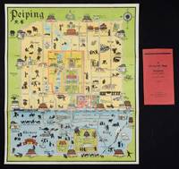
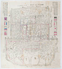
1934réf. 158433Peiping.: Peiyang Press. circa1934. Coloured folding plan of Peking with original envelope. 60 x 50cm. A few neat repairs at folds two panels evenly browned on reverse. A very good copy of a scarce pictorial plan with its envelope. This delightful and scarce pictorial map of Peking with landmarks and streets in romanised Chinese with occasional Chinese characters is surprisingly scarce. Although apparently issued in several editions in the 1920s and 30s it appears relatively infrequently on the market. The divisions of the Legation District are indicated by their flags - this edition shows the German Legation by use of the black white and red bands of the German flag. This flag which was no longer used after 1935 helps date this edition. Other landmarks and attractions shown included theatres foreign shopping area adjacent to the legations quarter Liu Li Chang Curio District the racecourse the many city gates etc. . Peiyang Press. unknown
réf. GOR010663244Paperback. Very Good. paperback
1882réf. 2111902160200908Ikaho bussan 1882. Soft Cover. Fine. Volume: 1 Ikaho bussan paperback
1788réf. 024356London: Printed for J. Walker 1788. Book. Very Good. Hardcover. First Edition. 12mo. A very good four volume set in contemporary full tree calf binding with double lettering pieces in red and green. Complete pp. iii-vii 1 222; 2 206; 2 238 & 2 198. No half-titles which may or may not be wanting but the pagination for the prelims to vol. I might suggest that one is required Very good bindings with a little rubbing a couple of volumes slightly chipped to the head/tail of the spines corners lightly bruised. Contents clean and tight manuscript Greek initials to title pages dated 1788 otherwise unmarked no foxing paper crisp. A very good set. A Rare Eighteenth Century Novel. We have managed to located just one other copy at auction in the last thirty years and that at Sotheby's sale of July 21 1993 where it made £1000 on the hammer though seemingly not such a nice copy. Referenced by: ESTC T068744. Printed for J. Walker Hardcover
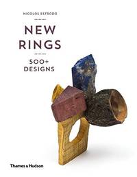
réf. Z1-M-015-02686Thames & Hudson. Used - Good. Ships from UK in 48 hours or less usually same day. Your purchase helps support Sri Lankan Children's Charity 'The Rainbow Centre'. Ex-library so some stamps and wear but in good overall condition. 100% money back guarantee. We are a world class secondhand bookstore based in Hertfordshire United Kingdom and specialize in high quality textbooks across an enormous variety of subjects. We aim to provide a vast range of textbooks rare and collectible books at a great price. Our donations to The Rainbow Centre have helped provide an education and a safe haven to hundreds of children who live in appalling conditions. We provide a 100% money back guarantee and are dedicated to providing our customers with the highest standards of service in the bookselling industry. Thames & Hudson unknown
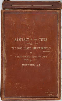
1885réf. 25162Riverhead New York 1885. Hardcover. Very good condition. The original manuscript title to a very large tract of land near Brookhaven Long Island acquired by John A. Bowman from the individual proprietors and conveyed here by Bowman in its entirety to the Long Island Improvement Company Ltd. The Long Island Improvement Company was formed by Austin Corbin then president of the L. I. Rail Road and others in 1881. Corbin sought the land in order to develop expensive summer residences on Long Island; Bowman was acting as Corbin's agent in the acquisition of this valuable property. Austin Corbin 1827 – 1896 was an American railroad executive plantation owner resort operator banker and robber baron. In Iowa as a bank president he engaged in mortgage scams. Later through theft and corruption he consolidated the individual rail lines into the profitable Long Island Rail Road. He was widely despised in his day: Puck Sept 1882 printed a caricature in which Corbin appears at a Louis XIV styled party where he carouses with Jay Gould and other robber barons. The Abstract a bound sml. folio volume records that Bowman paid $5 per acre for most of the parcels in 1882 then conveyed January of 1883 the incalculably valuable entire tract to the LI Improvement Co for $1. The Abstract volume concludes with the Suffolk County embossed seal and is signed by the Clerk at Riverhead 1st June 1885. It includes the ownership history of each parcel as well as a history of the town of Brookhaven from its founding. The Abstract volume is accompanied by the original hand colored manuscript map on architectural vellum of the entire tract with silk ribbon binding showing the 25 property owner names and parcel sizes. Surveys were conducted by Justus Roe. The map is titled "Map of Property of the Long Island Improvement Company Limited at Medford LI". The scale is 300 feet to the inch. The northern boundary of the tract shows the Brewster Terry Property and Horse Block Road; the western edge defined by Tunnel and Progues Road and the Austin Roe and Daniel Gerard property; the southern boundary with Georgianna Rider property and Canaan and Medford Roads; the eastern boundary with the Robinson property and Lime Road. The Long Island RR can be seen running from east to west at approximately one third of the way through the tract at the north side. The map signed in ink at the lower right corner E. H. H. Forder. The Abstract bound in full gilt tan leather 9 x 14 3/4" attorney's name stamped in gilt at lower corner James Armstrong Attny 115 B'Way N. Y. Boards slightly rubbed; front board detached but present. Pages very bright and clean. The map 67 x 44" a few short splits at folds but very bright and clean in very good condition. A remarkable record of Long Island land speculation in the late 1880s. hardcover
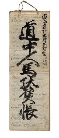
réf. 11489Written on all four sides of each sheet. 22 sheets each folded length-wise 460 x 153 mm. in half stitched at head allowing it to be hung on the wall. Japan: on label on upper cover in trans.: dated "1804-29." The 53 relay stations on the TÅkaidÅ road between Edo and Kyoto were required to keep careful ledgers recording the fees and assignments for packhorses and porters. The prices were regulated by the shogunate and were charged station-to-station and by weight and season. This fascinating document submitted to the bakufu stating so on final leaf details these prices at many of the stations along the road during the time of the first great travel boom in Japan ca. 1800-30. For each job details are given regarding number of horses and porters and prices with a seal and date of the innkeeper or horse wrangler. The seals give the names of the stations. Minor worming but a nice copy preserved in a chitsu. ⧠Constantine N. Vaporis "Caveat Viator. Advice to Travelers in the Edo Period" in Monumenta Nipponica Vol. 44 No. 4 Winter 1989 pp. 461-83. unknown
réf. 11489Written on all four sides of each sheet. 22 sheets each folded length-wise 460 x 153 mm. in half stitched at head allowing it to be hung on the wall. Japan: on label on upper cover in trans.: dated "1804-29." The 53 relay stations on the TÅkaidÅ road between Edo and Kyoto were required to keep careful ledgers recording the fees and assignments for packhorses and porters. The prices were regulated by the shogunate and were charged station-to-station and by weight and season. This fascinating document submitted to the bakufu stating so on final leaf details these prices at many of the stations along the road during the time of the first great travel boom in Japan ca. 1800-30. For each job details are given regarding number of horses and porters and prices with a seal and date of the innkeeper or horse wrangler. The seals give the names of the stations. Minor worming but a nice copy preserved in a chitsu. ⧠Constantine N. Vaporis "Caveat Viator. Advice to Travelers in the Edo Period" in Monumenta Nipponica Vol. 44 No. 4 Winter 1989 pp. 461-83. unknown books
1857réf. 2234Genève, Impr. de Gme Fick, 1857. In-folio broché de IX-69 pages, 29 planches. Coupes légèrement déchirées sur les plats, deux petits manques au bas et haut du dos, quelques rousseurs.
réf. 5234Barcelona: Viladot Facsimils. Viladot Facsimils unknown
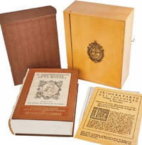
1995réf. 24401995 Lucerne, Editions Facsimilé, 1995. 30,5x44 cm. Fac-similé reproduisant à l'identique la première partie du manuscrit enluminé conservé sous la cote ms. fr. 2810 à la Bibliothèque Nationale de France à Paris. Format des feuillets légèrement variable comme sur l'original médiéval. Texte en français médiéval. Superbe reliure en plein veau marron. Plats ornés des armoiries royales françaises. Dos à 8 nerfs, orné de caissons dorés portant le monogramme L (Louis, roi de France). Pièce de titre en maroquin rouge. Roulettes dorées à l'intérieur des plats. Coffret recouvert de soie bleu-roi et orné des armoiries royales sur le plat supérieur. Minimes et très discrètes traces de frottement sur la reliure, sinon ouvrage en excellent état et d'une qualité exceptionnelle.
1799réf. 2111902160200187Washimi Tamotsu 1799. Soft Cover. Fine. Number of books: 1 book Washimi Tamotsu paperback
1900réf. 169765Circa1900. Large illustrated map of Beijing showing the city in the period following the invasion of the military forces of the Eight National Alliance old folds scale not given. Some scattered light foxing particularly at edges short closed tear at fold lower edge neat non acidic tape repair short section upper edge wear along folds and a couple of small unobtrusive holes with minor image loss. Blocks of text in traditional Chinese right and left upper sections stating each nation's occupied zone Japanese text title accompanies the English title along the upper section of the map. 63.7 x 56.9cm. Very good overall. A rare and significant large Japanese woodblock map of Peking Beijing issued just after the suppression of the Boxer Rebellion. Centred on the Forbidden City the map depicts Peking following the multinational suppression of the Boxer Rebellion or Yihetuan Movement of 1900. The map was issued to illustrate the areas of occupation associated with each of the powers in the Eight Nation Alliance. The map gives measurements of the city walls detailed names of streets and buildings and the boundaries of the inner and outer city including the forbidden city are shown with demarcation lines in pink yellow and blue. The hand coloured eight national flags of the occupation powers are featured at the right and left. This map is essentially a later edition of 京城内外首善全圖 a map of Beijing issued by the Qing for administrative purposes in the mid-19th century. The Japanese seized the wood blocks during the suppression of the Rebellion and subsequently pulled new impressions overprinting them additional details including flags and demarcations of areas of the city held by members of the Alliance. Versions are known in French German Japanese and as with the present example English. An attractive map of great historical interest. . unknown
1838réf. 021038London: T. McLean D.& P. Colnaghi and John F. Lewis 1838. 1838. Book. Illus. by John F. Lewis. Near Fine. Hardcover. First Edition. Folio approx. 55 x 36.5cm. Complete with all Lithographic plates as called for; tinted frontispiece tinted title-vignette further 27 tinted views on 25 leaves all by Lewis after Coke Smyth. A very clean bright copy. Finely bound in modern brown morocco to style with gilt lettering to the spine and gilt bands to the top and bottom of the spine. Contents clean and tight new light brown endpapers in keeping with the new binding two blank leaves to the front and rear all pages have been professionally cleaned and restored by a paper conservator minimal and unobtrusive water staining remains to some pages and plates mostly confined to the margins and blank areas most plates unaffected new archival paper guards to all plates no inscriptions. A fine complete copy beautifully rebound. References -. Abbey Travel II 394; Atabey 722; Blackmer 1015; Contominas 413; RIBA 1886. T. McLean, D.& P. Colnaghi and John F. Lewis [1838]. Hardcover
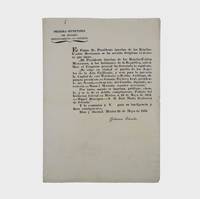
1835réf. 377678Mexico 1835. 1. plus integral blank. Signed in print by Estrada. Folio. Unbound. 1. plus integral blank. Signed in print by Estrada. Folio. A broadside decree issued by Migual Barragan giving city status to Pueblo de Nuestra Se ora la Reina de Los Angeles and naming it the provisional capital rather than Monterey. The Mexican congress declares: "The town of Los Angeles of Alta California is elevated to the rank of city and it will be from now on the capital of this territory." However representatives from Monterey would block moving the capital. "This decree was largely due to the efforts of Carlos Antonio Carrillo the deputy from California to the Mexican Congress and the author of the Exposicion of 1831" Streeter. Streeter's copy sold for $200 to Dawson's in 1968. Eberstadt 133-187; Streeter sale 2476; Rocq 4223 unknown
1835réf. 377678Mexico 1835. 1. plus integral blank. Signed in print by Estrada. Folio. Unbound. 1. plus integral blank. Signed in print by Estrada. Folio. A broadside decree issued by Migual Barragan giving city status to Pueblo de Nuestra Se ora la Reina de Los Angeles and naming it the provisional capital rather than Monterey. The Mexican congress declares: "The town of Los Angeles of Alta California is elevated to the rank of city and it will be from now on the capital of this territory." However representatives from Monterey would block moving the capital. "This decree was largely due to the efforts of Carlos Antonio Carrillo the deputy from California to the Mexican Congress and the author of the Exposicion of 1831" Streeter. Streeter's copy sold for $200 to Dawson's in 1968. Eberstadt 133-187; Streeter sale 2476; Rocq 4223 unknown books
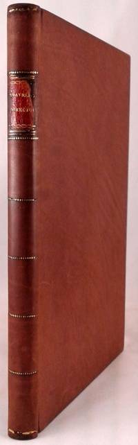
1804réf. 151171804. MOORE JOSHUA J. and THOMAS W. JONES. The Traveller's Directory: or a Pocket Companion Shewing the Course of the Main Road from Philadelphia to New York; and from Philadelphia to Washington: With Descriptions of the Places through which it Passes and the Intersections of the Cross Roads . By S. S. sic Moore and T. W. Jones. Philadelphia: Mathew Carey 1804. 8vo. 4 37 1 19 i.e. 17 p. 38 engraved strip maps on 22 plates. Modern full calf correctly done in perfect period style with original spine label slightly chipped at edges remounted and original endsheets relaid. Front free endsheet chipped at fore-edge name clipped from top blank margin of title page intermittant light browning of text and foxing of maps as is usual with this book. A very good copy of a book never found in fine condition. Second edition of the second American book of road maps following Christopher Colles' exceedingly rare Survey of the Roads of the United States 1789 and the first road map book to provide detailed maps of the road from Philadelphia north through New Jersey to New York and from Philadelphia south through Delaware Maryland and Virginia to Washington. Joshua John Moore and Thomas W. Jones were young surveyors in the employ of the Philadelphia publisher Mathew Carey. From several letters they wrote to Carey during the course of the survey Lea & Febiger papers PHi a clear picture emerges of the extremely difficult task they had undertaken. On June 29 1801 they wrote from New York: "We should have written to you before this had not fatigue of our daily Journies rendered repose indispensable after the finishing of our Notes and Traverses. After twelve days driving our way through an immense multitude of Questioners Observers laughters & Critics who generally thronged around us at every place to our great discomposure at first . we are at length arrived here. If astonishment would ensure success to a work we may entertain strong hopes indeed of ours; but it has nearly exhausted our health as every violent effort naturally must." Upon completion of the surveys the maps were drawn by the surveyors. They locate crossroads streams taverns churches and other public buildings and occasionally private houses. The text describes the various towns through which the roads pass. In this second edition published two years after the first edition of 1802 the descriptive text has been extensively corrected and expanded. The maps are identical to those in the earlier edition and are printed from the same plates. unknown books