5 449 résultats
réf. DADAX140945004XNew unknown
réf. DADAX0754671984New unknown
réf. SONG159998962XUsed: Good unknown
réf. DADAX0754670686New unknown
1873réf. 697671873. Hardcover. Good. Circa 175 pages of holograph text; remainder of book blank. Scuffed leather minute book. 34cm. Ruled pages. This railroad seems to been relatively short running from the Connecticut border south of Longmeadow Massachusetts to East Hartford. At the final 1887 meetings of the stockholders and directors recorded in this minute book the Company appeared to be facing a foreclosure suit by the Connecticut State Treasurer. The railroad appears to have ceased in 1887. hardcover
1873réf. 697671873. Hardcover. Good. Circa 175 pages of holograph text; remainder of book blank. Scuffed leather minute book. 34cm. Ruled pages. This railroad seems to been relatively short running from the Connecticut border south of Longmeadow Massachusetts to East Hartford. At the final 1887 meetings of the stockholders and directors recorded in this minute book the Company appeared to be facing a foreclosure suit by the Connecticut State Treasurer. The railroad appears to have ceased in 1887. hardcover books
2007réf. 1-0763738808Jones & Bartlett Pub 2007. Paperback. New. 1st edition. 298 pages. 9.00x6.00x0.75 inches. Jones & Bartlett Pub paperback
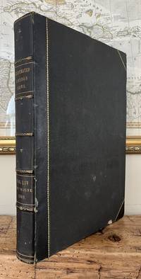
1869réf. 85507hLondon: Illustrated London News 1869. Book. Near Fine. Hardcover. Folio - over 12 - 15" tall. Half-year run bound in early half-leather over pebbled cloth boards. Some edge-wear and bumping to covers; small paper label painted over to upper spine. Edges toned and old library bookplate and marks to front and rear endpapers. Front hinge nearly exposed internally at endpaper but still firm. Otherwise clean tight and unmarked. Very neat -- a sound and handsome volume and internally unusually bright and clean. Superb illustrations. Illustrated London News Hardcover
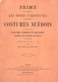
réf. 59049Paris. Uten år. Stor 4to. Originalt kombinert foromslag og tittelblad. Uten tekst. Med 20 kolorerte plansjer. Aux Bureaux des Journeaux Fransk. Colas 511. “Couvert servant de titre 20 planches gravées sur acier et coloriées chiffr 1 à 20.”Lipperheide 1052. Bortsett fra noe slitasje i ryggstripen et pent eksemplar. unknown
réf. DADAX1901205029New unknown
réf. DADAX0415149363New unknown
réf. DADAX0367314444New unknown
réf. DADAX0367316773New unknown
réf. DADAX0415483204New unknown
réf. 2108100387xbvkPhotographer's stamp on the cardboard-base's verso: ''S. ICHIDA / Motomachi - Nichome / KOBE, JAPAN''. Photograph size ca. 20,5 x 26,5 cm, mounted on white cardboard, size ca. 34 x 40 cm.
1959réf. 2407100222xbvkKyoto/Japan, Jimbunkagaku Kenkyusho Kyoto University, 1957-1959. Overall ~2.100 pages. - 4 Publisher's gilt titled orange-colour cloth-bindings in 3 publ. slipcases (Vol. 3 and Index-Vol. in 1 slipcase); 4to.(ca. 26 x 19 x 17 cm; ca. 5 kg.).
1965réf. 2407100219xbvkKyoto, Jimbunkagaku Kenkyusho Kyoto University, 1964/1965. 20, 1.825 (2) pages. - Publisher's gilt titled orange-colour cloth-bindings in the publ. slipcases; 4to.(ca. 26 x 19 x 10 cm; ca. 3,5 kg.).
réf. DADAX0367098628New unknown
réf. DADAX0415786991New unknown
réf. DADAX0415722454New unknown
réf. 46821368-nnew. unknown
réf. Bloomsbury-9781538126912Rowman & Littlefield. Hardback. New. 292 pages Rowman & Littlefield hardcover
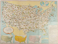
1955réf. 172003Washington D.C.: 国務省. Kokumishō. No date. circa1955. Large folding Japanese coloured map of the United States with 3 inset maps at foot of map showing main railways air and highway routes and hemispheres at the top right. Some browning mainly visible on reverse still a good copy. 66 x 81cm. An intricate and detailed pictorial map of the United States published in Japanese by the US State Department. The same type of map had been published since 1945 in English and subsequently in other languages. The Japanese language map is hard to find. The map is undated but was probably produced in the 1950's. The images include depictions of women board riders in two piece swimsuits of the sort popular in the 1950s but the inset text lists Alaska and Hawaii as external territories of the US indicating that the map was produced before they attained statehood in 1959. An inset panel provides information on the area and population of the US the population of major American cities mineral and other resources climate and topography. A note at the bottom right hand corner of the map states that copies of the map can be obtained free of charge from your nearest US Information Office. Every region of the country is decorated with an illustration of the natural resources industries or cultural or historical resources associated with that particular place. These include images of early colonial settlers the birthplaces of Mark Twain and Woodrow Wilson Booker T. Washington's house and Abraham Lincoln's grave; images of major dams oil fields coal mines cotton plantations etc. various animals and crops and images of ships cars and public buildings including the Statue of Liberty located rather oddly far out at sea. . 国務省. [Kokumishō]. unknown
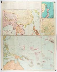
1943réf. 206908Chicago.: Geographical Publishing Company. 1943. 10 printed colour maps on a large single sheet 91 x 71 cm small inset map of the European theatre chronology of events original folds a few short fold splits archivally sealed; in very good condition. A suite of numbered U.S. war maps with Allied action overstamped in red by the publisher that for Germany and France with pictorial stamps for strategic targets including "Chemical Factories" and "Airplane Factories". The maps numbered 1 to 10: English Channel; Italy; Southern Greece; Western Mediterranean Sea; Germany and France; Baltic Sea and Scandinavia; China Burma India; Japan; Tokyo; and Greater Pacific Battle Zone: a large half sheet map noting the placement of US and Japanese bases. The "Chronology of Important War Events" lists action from the bombing of Pearl Harbour: "Japan's day of Infamy: Japanese air attack cripples American Fleet at Pearl Harbour" to March 21 1944 "Germans take over key political posts in Bulgaria and Romania". Issued by the Geographical Publishing Company of Chicago this educational sheet includes an advertisement for WLS Chicago "The prairie farmer station" with a list of their war broadcasts and a world clock. . Geographical Publishing Company. unknown