Open Road Travel GuidesBiblio.com

rif. 1883323746.Gpaperback. Good. Access codes and supplements are not guaranteed with used items. May be an ex-library book. paperback
rif. 019959175X.Ghardcover. Good. Access codes and supplements are not guaranteed with used items. May be an ex-library book. hardcover
2016rif. 2-0198783809Oxford Univ Pr 2016. Paperback. New. reprint edition. 465 pages. 9.50x7.25x1.00 inches. Oxford Univ Pr paperback
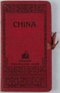
1920rif. 161936no date. circa1920. Linen backed colour folding map of China insets of Peking and Environs and Hongkong and Canton in lower left corner. 54 x 63.8cm. Table of place names at upper left gives the cities that "By a recent ordinance of the Republic all 'Fu' 'Chow'' and 'Ting' cities have been nominally reduced to the rank of 'Hsien'. The following parallel list gives the 'Fu' cities the names of which have been officially changed together with the new form adapted." Map folds into a red cloth covered case with ribbon ties 19 x 10.3cm. Title and decoration printed in black on upper cover. Trifle foxed on linen backing a little insect damage case in a few small places otherwise a very good clean map. . hardcover
rif. I-696-380Les amis du père François. Paperback. Very Good. Ammareal gives back up to 15% of this item's net price to charity organizations. Les amis du père François paperback
rif. 8416327505.Gpaperback. Good. Access codes and supplements are not guaranteed with used items. May be an ex-library book. paperback
rif. 2-69968Paris 1913 cartella rossa con lacci e 34 "rapporti" di pp. 12/120 cad. con num. tavole. progetti ed ill. Interessante. unknown
rif. 0373252889.Gmass_market. Good. Access codes and supplements are not guaranteed with used items. May be an ex-library book. unknown
rif. 46067416-nnew. unknown
rif. 46067416like new. unknown
rif. A9786206010777Paperback / softback. New. paperback
rif. A9781538126912Hardback. New. A quick-hitting professional resource of 48 core legal and financial principles for anyone sitting on a nonprofit board. The 24 legal questions and 24 financial questions provide nonprofit leaders with a framework for understanding the key issues that are likely to affect their current or future roles in the nonprofit sector. hardcover
rif. 1952626072.Gpaperback. Good. Access codes and supplements are not guaranteed with used items. May be an ex-library book. paperback
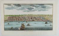
1750rif. 177186circa1750. Hand-coloured engraving 19.5 x 35.6 cm 25.5 x 41.6 cm sheet original folds two old paper repairs not affecting the image a trifle toned but in very good condition Attractive bird's-eye view town plan of Makassar in Sulawesi prepared for Abbé Prevost's monumental 'Histoire Générale des Voyages.' . unknown
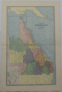
1886rif. 175917Sydney & Melbourne.: The Picturesque Atlas Publishing Company Limited Sydney & Melbourne. 1886-1888. Large printed colour map 60.9 x 37 cm 69.9 x 45.3 cm sheet central fold slight browning at the fold and to the generous margins in very good condition. Detailed map prepared for Andrew Garran's monumental "Picturesque Atlas of Australasia" 1886-1888 with the counties attractively coloured. New Guinea is shown to the North and borders with Northern Territory South Australia and New South Wales. The extent of the Great Barrier Reef is delineated along with the ocean "Border of Colony". Proposed and current railways are shown with an extensive place index printed on the verso of the map. . The Picturesque Atlas Publishing Company, Limited, Sydney & Melbourne. unknown
rif. 1517475139.Gpaperback. Good. Access codes and supplements are not guaranteed with used items. May be an ex-library book. paperback
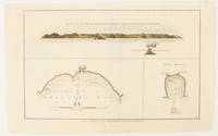
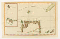
1784rif. 174896London.: Alexander Hogg at the King's Arms. circa1784. Engraved map in triptych on laid paper 20.1 x 32.7 cm three insets: cross section of the north side of Queen Charlotte's Islands Solomon Islands with detail of a volcano "6 leagues North"; Swallow's Bay Harbour; and Byron's Harbour early hand colour trimmed to the plate mark at the top edge neat sealed tear affecting the publisher's caption slight edge wear and paper toning but a most attractive map in very good condition. Attractive engraving of the Queen Charlotte's Islands Solomon Islands. The Islands were named for the consort of King George III by Philip Carteret the British naval officer and explorer who participated in two of the Royal Navy's circumnavigation expeditions in 1764–66 and 1766–69. His ship the Swallow gave her name to the Bay and Carteret's commanding officer on the first of his voyages John Byron to the Harbour depicted in this most attractive early chart. . Alexander Hogg at the King's Arms. unknown
1784rif. 174895London.: Alexander Hogg at the King's Arms. circa1784. Engraved map on laid paper 21.4 x 33.7 cm inset of Gower's Simson's and Carteret's Island early outline hand colour trimmed to the plate mark at the top edge three small edge tears affecting the upper margin only slight paper toning but a most attractive map in very good condition. Fine impression of the Queen Charlotte's Islands Solomon Islands. It features the Swallow's track the ship's route taken by Captain Philip Carteret in 1767 the British naval officer and explorer who participated in two of the Royal Navy's circumnavigation expeditions in 1764–66 and 1766–69. . Alexander Hogg at the King's Arms. unknown
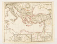
rif. 174950Gotha.: Justus Perthes. Map with original colour and outline hand-colour 32.2 x 40 cm text in German five inset maps central fold slight marginal toning and spotting on the verso but in very good condition. A most handsome and highly detailed map detailing the Eastern provinces of the Byzantine/Roman Empire in the time of the Roman Emperor Justinian 527-565. The inset maps depict Carthage Rome Constantinople Naples and a Western continuation of the main map originally issued for the "Hand-Atlas für die Geschichte des Mittelatters und die Neueren Zeit" . Justus Perthes. unknown
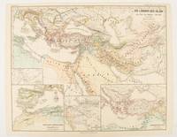
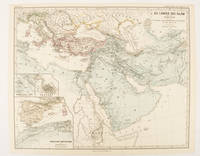
1877rif. 174917Gotha: Justus Perthes. 1877. Map with original colour and outline hand-colour 32.7 x 40.7 cm four inset maps text in German central fold slight marginal edge wear and spotting to the verso but in very good condition. A handsome map detailing the lands of Islam at the time of the Bujids 945-1055. The inset maps depict a western extension to the main map southern Arabia the lands of the Ghaznavid sultanate in Central Asia and lands of the Eastern Roman/Byzantine Empire issued for the "Hand-Atlas für die Geschichte des Mittelatters und die Neueren Zeit". . Justus Perthes unknown
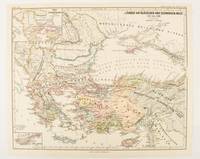
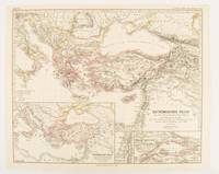
1877rif. 174915Gotha: Justus Perthes. 1877. Map with original colour and outline hand-colour 32.2 x 40 cm two inset maps text in German central fold in very good condition. A most handsome map detailing countries on the Aegean and Black Seas 1311 to 1390. The inset maps depict the kingdom of Stephan Duschan Serbia and the land of the Crimean Goths issued for the "Hand-Atlas für die Geschichte des Mittelatters und die Neueren Zeit". . Justus Perthes unknown
1877rif. 174913Gotha: Justus Perthes. 1877. Map with original colour and outline hand-colour 32.2 x 40 cm three inset maps text in German central fold slight marginal toning in very good condition. A most handsome map detailing the lands of Islam under the Abbasids up to the capture of Baghdâd by the Bûjids from 750 to 945 AD. The inset maps depict Northern Iraq Baghdad and a western continuation of the main map issued for the "Hand-Atlas für die Geschichte des Mittelatters und die Neueren Zeit". . Justus Perthes unknown
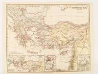
1874rif. 174914Gotha: Justus Perthes. 1874. Map with original colour and outline hand-colour 32.2 x 40 cm three inset maps text in German central fold slight marginal toning in very good condition. A most handsome map detailing the Eastern Roman Empire from the immigration of Hungarians in Ponnonia around 895 to the subjugation of the Bulgarian Empire by Emperor Basilius in 1019. The inset maps depict Divisions of the Empire Palestine and the Themata around Propontis present day Sea of Marmara issued for the "Hand-Atlas für die Geschichte des Mittelatters und die Neueren Zeit". . Justus Perthes unknown
1876rif. 174911Gotha: Justus Perthes. 1876. Map with original colour and outline hand-colour 32.2 x 40 cm text in German four inset maps central fold slight marginal toning and spotting on the verso but in very good condition. A most handsome and highly detailed map detailing the Eastern provinces of the Byzantine/Roman Empire before the Fourth Crusade. The inset maps depict Constantinople Divisions of the Empire and Antioch issued for the "Hand-Atlas für die Geschichte des Mittelatters und die Neueren Zeit" . Justus Perthes unknown
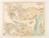
1876rif. 174910Gotha: Justus Perthes. 1876. Map with original colour and outline hand-colour 32.2 x 40 cm seven inset maps text in German central fold slight marginal toning in very good condition. A most handsome and highly detailed map detailing provinces of the Latin Empire in the wake of the Crusades. The inset maps depict Achaia in Greece Divisions of the Empire and a city plan of Constantinople issued for the "Hand-Atlas für die Geschichte des Mittelatters und die Neueren Zeit" . Justus Perthes unknown