MORDEN, ROBERTBiblio.com
4388 risultati
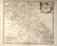
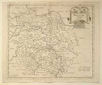
rif. 64216London.: Gibson. Early 18th Century. Black and white map from Camden's Britannia showing towns roads rivers and landforms 38 x 46.5 cm. . [Gibson.] unknown
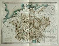
1800rif. 57070c1800. Copper engraving with handcolouring map shows Germany and parts of France Italie Hongrie Pologne and Prusse sic. Minor hole upper border few closed tears and some browning edges otherwise a clean and bright image. Map measures approximately 34 x 46cm. . unknown
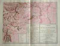
1805rif. 570721805. Copper engraving with handcolouring map shows the border of the Austrian Empire and Hungary Vienne sic and the Danube can be seen at the top of the map Two keys and scale inset. Few closed tears and some browning edges otherwise a clean and bright image. Map measures approximately 34 x 44cm. Map of Germany indicating the present division of this empire as well as the new possessions of the princes who make up the Germanic body and including Batavia and Helvetia Switzerland with their divisions. by E. Mentelle a member of the institute and P. G. Chanlaire one of the authors of the National Atlas. An xiii 1805. Paris. There is a key to the explanation of the signs and an explanation of the colours used for the district of the various states contained in this map. . unknown
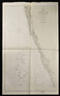
1937rif. 65133Washington. D.C.: U.S. Navy Hydrographic Office. 10th edition. 1937. Two charts black and white folded as issued. #1589: sheet measures approx. 89 x 118cm #1590: 127 x 76cm little creased at upper edge. Very good. A great length of the coast is here charted with much detail marked along the coast including rivers towns and the topography. The charts mark soundings in fathoms or feet and various natural and man-made features of the coastal area. Both are stamped "Corrected Through Notice to Mariners Feb. 17 1951". . U.S. Navy Hydrographic Office. unknown
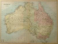
1884rif. 56997Edinburgh.: A & C Black. 1884. Printed colour map of Australia some light foxing few minor tears browned edges still a clear and bright image. Map measures approximately 42 x 55cm. . A & C Black unknown
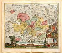
1717rif. 61880Nuremberg.: Johann Baptist Homann. 1717. A beautifully engraved hand coloured map of North East Germany showing the area around Erfurt in detail. In the centre of the map is a small plan of Erfurt which is also shown as a panoramic view at the foot of the map and titled 'St. Petersburg'. An elaborate decorative title cartouche in the lower right corner depicts allegorical figures surrounded by the produce of the land including sheaves of wheat; a beehive; and a cornucopia of fruits. Cherubs holding a coat of arms float up from the scene on the right while on the lower left a centaur sits meditatively beneath a pine tree amongst slaughtered cattle. Physical features of the area are illustrated and farming areas shown by fields which criss-cross across the map. A clear dark impression the work of an outstanding German cartographer who in 1715 was appointed as imperial geographer by Emperor Charles VI. This map also includes "Schwan See" Swan Lake under a town of the same name which has since disappeared. Hand coloured two very minor splits at upper and lower edges on centre fold and not affecting engraved area a handsome map 54 x 61.5 cm. . [Johann Baptist Homann.] unknown
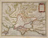
rif. 54794Amsterdam.: Jodocus Hondius. Circa Early 17th Century. Map depicting the southeastern part of present day Ukraine and the Crimean peninsula including the northern most part of the Black Sea and reaching north to Smolensk. Published by Hondius in the French edition of the Mercator-Hondius Atlas. Hand outline colour topographical detail shown pictorially some wear along centrefold occasional pale foxing mostly in margins decorative title cartouche upper right corner French text on verso showing through clear plate mark even age toning 48.5 x 58 cm. . [Jodocus Hondius]. unknown
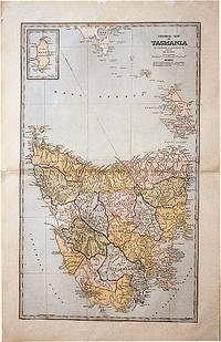
1888rif. 61874Sydney.: The Picturesque Atlas Publishing Company. 1888. A large and detailed map of Tasmania from The Picturesque Atlas Publishing Company showing railroads existing as well as under construction and coloured regions dividing the island into districts. Hachures depict landforms detailed index to place names on verso small inset upper left corner showing Kind Island printed colour 70 x 45.5 cm. . The Picturesque Atlas Publishing Company. unknown
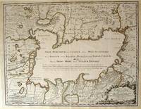
1723rif. 54819Rainer Ottens. 1723. A most attractive map with early outline hand colour vertical fold barely visible diagonal crease upper half of map few very pale small brown spots otherwise a clean and bright image. Numbering in red pencil few annotations in pencil and light number stamp on reverse however not at all visible from front of map or affecting image. Sheet measures 46.6 x 60.2cm. . Rainer Ottens. unknown
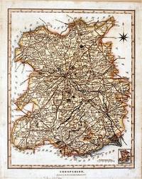
1827rif. 61872London.: J. Wilkes. 1827. Attractive hand coloured map of Shropshire 27.5 x 21.5 cm. very occasional light foxing on reverse but not visible on the image itself. A most attractive map. . [J. Wilkes.] unknown
1584rif. 64215Antwerp.: Abraham Ortelius. circa1584. Two engraved maps on laid paper each 30.3 x 19.5 cm printed on the one sheet 48 x 60 cm original fold attractive hand colour with related French text on verso slight toning and spotting to the margins but the maps in very good condition preserved in a modern window mount. Attractive maps of the German coast published in Ortelius' great atlas "Theatrum Orbis.". The left-hand map showing the mouths of the Elbe complete with sea monster and Eider Rivers and the coast of Schleswig-Holstein; the right-hand map of the Baltic coast with the Pomeranian islands of Rugen and Usedom. . (Abraham Ortelius). unknown
rif. 64139London.: Gibson. Early 18th Century. Engraved map on watermarked paper central fold 38 x 46.5 cm decorative title cartouche towns roads rivers and landforms shown; from Gibson's edition of Camden's Britannia upper edge trimmed by the original binder causing minor loss to the border at the inner edge but in very good condition. . [Gibson.] unknown
rif. 1287361501.Gpaperback. Good. Access codes and supplements are not guaranteed with used items. May be an ex-library book. paperback
rif. 0548829373.Gpaperback. Good. Access codes and supplements are not guaranteed with used items. May be an ex-library book. paperback
rif. 0548478686.Gpaperback. Good. Access codes and supplements are not guaranteed with used items. May be an ex-library book. paperback
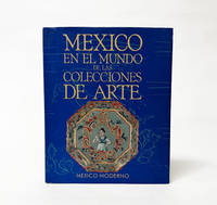
1994rif. 029030Secretaria de Relaciones Exteriores UNAM CONACULTA 1994. Book. Near Fine. Cloth. 1st Edition. 381 pages. Hardcover. Texts in Spanish. Minimal shelfwear to the edges of the boards with equally light wear and rubbing to the dustjacket with two remaining pieces of adhesive tape on the inside flaps of the jacket following the removal of a protective plastic cover. Else the binding is tight the interior clean and free of markings. Bound in black cloth covered boards and wrapped in a bright illustrated paper dustjacket. . Secretaria de Relaciones Exteriores, UNAM, CONACULTA Hardcover
1958rif. LpFL1022125Museo Victor Emilio Estrada 1958-01-01. Paperback. Acceptable. Museo 1958 paperback small exterior damp stain at spine head of rubbed wrapper 6 small puncture holesstaples through entire text block smooth spine tight binding fine fold-out chart clean unmarked text Prompt reliable service shipped next business day. Int'l mailed via first class or priority. Museo Victor Emilio Estrada paperback
1995rif. 5965014John Wiley and Sons 1995. This is an ex-library book and may have the usual library/used-book markings inside.This book has hardback covers. In good all round condition. Please note the Image in this listing is a stock photo and may not match the covers of the actual item800grams ISBN:9780471960126 John Wiley and Sons hardcover
2017rif. Manohar-9781138124769Routledge 2017. Hardcover. New. Routledge hardcover
2017rif. Manohar-9781138124769Routledge 2017. Hardcover. New. Routledge hardcover
2013rif. 250714004MNR EDICIONES 2013-01-01. hardcover. Good. 10x8x0. Ships Out Tomorrow! MNR EDICIONES hardcover
1999rif. 020230Museo Soumaya Mexico 1999. Book. Fine Condition. Cloth. 264 pages. Hardcover catalogue bound in maroon cloth covered boards and wrapped in an illustrated paper dustjacket. Faint shelfwear to the edges of the dustjacket which is essentially bright and intact. Binding is tight and solid with sharp edges and corners of the boards. Interior is clean and unmarked. Texts in Spanish. Lavishly illustrated. Museo Soumaya, Mexico Hardcover
rif. 14471Memorandum: 17 June 1910. Receipt by Campbell: on letterhead of The Acacias Brooks Road Gunnersbury W. London. 8 July 1910. Letter by Langford: on letterhead of The Lisle Press Ltd. 24 Whitcomb Street Pall Mall. 17 June 1910. The collection consists of four items. All four in good condition on lightly-aged paper with slight creasing. ONE: Typed Memorandum. 3pp. foolscap 8vo. Signed over a stamp by Campbell and witnessed by Florence Campbell of Newcastle-on-Tyne. Campbell agrees to teach Langsford 'how to prepare the photographic paper called "Gelatino-chloride glossy printing-out paper" by the same formula and process as he uses and put him in the way to start and carry on a business for himself'. Further to this end he describes five actions he will take beginning with drawing up 'a plainly written copy of the formula along with instructions for the mixing and preparation . stating the ingredients used and the exact quantities required also plain directions how to coat and finish off the paper guaranteeing under a penalty of One Hundred Pounds that such formula and directions shall be in every respect precisely the same as used by him'. He will also give Langsford lessons at his home in Gunnersbury: 'How to mix the formula for preparing the P.O.P. then how to coat and finish off the paper and how to pack it for sending to customers; how to cut up and send away small samples with circulars by post to photographer and others and to be generally and fully instructed in everything necessary to enable him to commence and carry on a business for himself as a preparer of the photographic paper known as P.O.P.' TWO: Typed Receipt signed by 'Leonard Langsford' 17 June 1910. 'Herewith agreement duly signed as promised which I think meets the case. Kindly initial alterations. I enclose also cheque for £6. for plant.' Campbell acknowledges receipt by signing over a stamp at the foot of the page. THREE: Autograph Receipt signed by Arthur Campbell 8 July 1910. Acknowledging receipt of £25 from Langsford 'as set forth in agreement dated June 17th 1910'. FOUR: Autograph Letter Signed to Langsford from '<Kate> Reilly'. 1p. 12mo. Without date or place. Acknowledging receipt of a 'cheque £3/-/- on account'. It is not clear whether Arthur Campbell of Gunnersbury was the son of Alfred S. Campbell 1840-1912 the noted English-born photographer and inventor based in New York and proprietor of Campbell Studios there and in London. Memorandum: 17 June 1910. Receipt by Campbell: on letterhead of The Acacias, Brooks Road, Gunnersbury, W. [London]. 8 July 1910. unknown
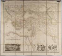
1853rif. 176118Paris.: Ministère d'Etampes et de Géographies. 1853. Engraved map with outline hand colour 67.2 x 75.1 cm sectioned and linen-backed two large vignettes: a view of Constantinople; and costumed Turks and European soldiers facing off across a stream the linen browned with some loss but not affecting the map with the fine nineteenth century label of Charles Delarue & Hivert on the verso. Fine map with beautiful vignettes by Adrien Toussaint Lallemand 1793 - c.1856 geographer and engraver at the Depôt de la Guerre. Lallemand was appointed at a precociously young age and later set up in business on his own the quality of his work assuring him of the continued business of the Depôt. Highly attractive map of the Ottoman Empire published at the outset time of the Crimean War 1853-1856. This item is held off-site. Please note there may be a few days delay while it is brought into our shop for viewing or mailing to you. Thank you for your understanding. . Ministère d'Etampes et de Géographies unknown
rif. 1024947734.Ghardcover. Good. Access codes and supplements are not guaranteed with used items. May be an ex-library book. hardcover