5.449 Ergebnisse
Best.-Nr. 9707226439.Gpaperback. Good. Access codes and supplements are not guaranteed with used items. May be an ex-library book. paperback
Best.-Nr. 6208737435.Gpaperback. Good. Access codes and supplements are not guaranteed with used items. May be an ex-library book. paperback
Best.-Nr. 620873746X.Gpaperback. Good. Access codes and supplements are not guaranteed with used items. May be an ex-library book. paperback
Best.-Nr. 6208737443.Gpaperback. Good. Access codes and supplements are not guaranteed with used items. May be an ex-library book. paperback
1976Best.-Nr. 0087940Laughlintown: Southwest Pennsylvania Genealogical Services 1976. First printing. Paperback. Very Good. First edition 1976. Softcover 91 one-sided pages clean unmarked text Very Good copy light creasing to the tips of some pages some soiling or discoloration to the page-edges and covers rubbing and light wear to the book's covers. Southwest Pennsylvania Genealogical Services paperback
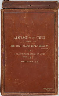
1885Best.-Nr. 25162Riverhead New York 1885. Hardcover. Very good condition. The original manuscript title to a very large tract of land near Brookhaven Long Island acquired by John A. Bowman from the individual proprietors and conveyed here by Bowman in its entirety to the Long Island Improvement Company Ltd. The Long Island Improvement Company was formed by Austin Corbin then president of the L. I. Rail Road and others in 1881. Corbin sought the land in order to develop expensive summer residences on Long Island; Bowman was acting as Corbin's agent in the acquisition of this valuable property. Austin Corbin 1827 – 1896 was an American railroad executive plantation owner resort operator banker and robber baron. In Iowa as a bank president he engaged in mortgage scams. Later through theft and corruption he consolidated the individual rail lines into the profitable Long Island Rail Road. He was widely despised in his day: Puck Sept 1882 printed a caricature in which Corbin appears at a Louis XIV styled party where he carouses with Jay Gould and other robber barons. The Abstract a bound sml. folio volume records that Bowman paid $5 per acre for most of the parcels in 1882 then conveyed January of 1883 the incalculably valuable entire tract to the LI Improvement Co for $1. The Abstract volume concludes with the Suffolk County embossed seal and is signed by the Clerk at Riverhead 1st June 1885. It includes the ownership history of each parcel as well as a history of the town of Brookhaven from its founding. The Abstract volume is accompanied by the original hand colored manuscript map on architectural vellum of the entire tract with silk ribbon binding showing the 25 property owner names and parcel sizes. Surveys were conducted by Justus Roe. The map is titled "Map of Property of the Long Island Improvement Company Limited at Medford LI". The scale is 300 feet to the inch. The northern boundary of the tract shows the Brewster Terry Property and Horse Block Road; the western edge defined by Tunnel and Progues Road and the Austin Roe and Daniel Gerard property; the southern boundary with Georgianna Rider property and Canaan and Medford Roads; the eastern boundary with the Robinson property and Lime Road. The Long Island RR can be seen running from east to west at approximately one third of the way through the tract at the north side. The map signed in ink at the lower right corner E. H. H. Forder. The Abstract bound in full gilt tan leather 9 x 14 3/4" attorney's name stamped in gilt at lower corner James Armstrong Attny 115 B'Way N. Y. Boards slightly rubbed; front board detached but present. Pages very bright and clean. The map 67 x 44" a few short splits at folds but very bright and clean in very good condition. A remarkable record of Long Island land speculation in the late 1880s. hardcover
Best.-Nr. 17648Windsor Terrace City Road. 13 November 1861. Four pages 4to creased but good condition. Thanks for a letter. He differs with his correspondent on the "postponing the projected Memoir of Dr Clarke published 1843-9. I think it should have appeared 2 or 3 years ago and taken precedence of Daniel Isaacs. With Dawson's life you are prompt published 1842 and the publishers will find the advantage in an extensive sale. Every one who has seen him in the Pulpit or heard him from the Platform are desirous to refresh their memory with an outline of his extraordinary character" but postponement of publication would mean loss of public interest. "Not so in Dr Clarke he must live from generation to generation but a 'conversational life' should be for his cotemporaries who are now rapidly passing away. I think Thomas Jackson has murdered his own Work by cutting it into slips for the Magazine and reduced it into shilling parts. Surely a connexion like ours would have taken off the whole 1500 copies of Charles Wesley's Life .promoting a review in the Magazine". He then quotes a "MS. Letter Dated Wakefield 27 Sep. 1791" written by William Thompson at length about his life of Whitehead and the effects of publishing it in the Magazine. He goes on to discuss the unsatisfactory "state of our Funds" and mentions the resignation of a "Mr Farmer" Treasurer. He cuts short his letter because of a visit found among his "books and papers" but adds a closely written full page of notes on Everett's work on Dr Clarke. Note: Marriott bequeathed £10000 to the Wesleyan Missionary Society obit. in Wesleyan Methodist Magazine vol.75 p.103 1852. Windsor Terrace [City Road]. 13 November 1861. unknown
Best.-Nr. 9688604380.Gpaperback. Good. Access codes and supplements are not guaranteed with used items. May be an ex-library book. paperback
Best.-Nr. 6136474956.Gpaperback. Good. Access codes and supplements are not guaranteed with used items. May be an ex-library book. paperback
Best.-Nr. 6138956702.Gpaperback. Good. Access codes and supplements are not guaranteed with used items. May be an ex-library book. paperback
Best.-Nr. 1409259420.Ghardcover. Good. Access codes and supplements are not guaranteed with used items. May be an ex-library book. hardcover
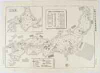
1955Best.-Nr. 172396No publication details. Circa1955. Chinese black and white military map of Japan based on a map issued by 赤旗報 Shimbun Akahata on 24 June 1953. No scale given inset map of Hokkaido upper left corner legend lower section showing air and navy bases military exercise bases ammunition dump shooting ranges for the air force and navy headquarters of the coast guard etc. Text upper section provides details of the different types of US military bases and infrastructure. Text in traditional Chinese. 25.8 x 35.8cm. . No publication details. unknown
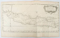
1750Best.-Nr. 136782circa1750. Black and white copperplate engraving map of Java a little light even browning neat colour pencil highlighting of rivers and two settlements. Folded as issued. Good copy. 26 x 44cm. Issued in Prevost's Histoire Générale des Voyages ou nouvelle collection de toutes les relations de voyages par mer et par terre. . unknown
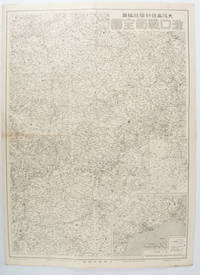
1572Best.-Nr. 172829大阪. Osaka.: 大阪毎日新聞社. Osaka Mainichi Shinbunsha. 昭和 13 1938. Black and white map folded showing Hankow one of the three cities which merged to become Wuhan 54.5 x 49cm scale 1:2000000. Some light browning tiny closed tear upper margin neatly repaired with conservation standard tape. Good copy. This Hankow/Hankou War Situation Map is a supplement map of Osaka Mainichi Newspaper on 25 August 1938. The two inset maps show the region around Nanjing and Hong Kong. It gives detailed place names of Hankow area. . 大阪毎日新聞社. [Osaka Mainichi Shinbunsha]. unknown
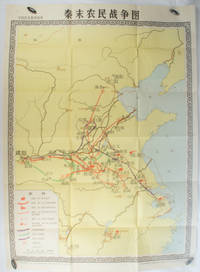
1981Best.-Nr. 173280Beijing.: 地图出版社. Di tu chu ban she. 1st Edition 2nd Printing. 1981. Large Chinese coloured educational map folded scale 1:2000000. Legend lower left corner shows the routes of military advance led by peasant rebellion leaders' 陈胜Chen Sheng and 吴广Wu Guang in red and other military activities led by 项羽Xiang Yu and 刘邦Liu Bang in various colours. In original worn paper wrapper map in very good condition. Text in Chinese. Map measures 105.5 x 76.6cm. . 地图出版社. [Di tu chu ban she]. unknown
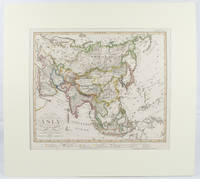
1855Best.-Nr. 173439Gotha.: Perthes Justus. Circa1855. Engraved map 44.1 x 36.3 cm sheet size 35.8 x 29.7cm map size plate mark map with original hand colouring and hand coloured key noting Islamic "Mohammedanische" Buddhist "Buddhaistische" and European territories by country. Unusual map in an early issue. It was included as map 39 in Stieler's "Hand-Atlas uber alle Theile der Erde und uber das Weltgebaude by Frederic von Stulpnagel" revised by Hermann Berghaus in 1855. The issue is noted to the top right: Ausg. in 63BI. no XIV. Fine outline hand colouring denotes territories by religion and Chinese ports open to European trade and Japanese ports open to American trade. . Perthes, Justus. unknown
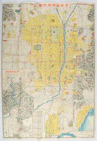
1922Best.-Nr. 171899京都. Kyoto.: 山中書房. Yamanaka Shobō. 大正 11 1922. Attractive colour folding map of Kyoto with a quite detailed illustrated tourist guide printed in blue and white on the reverse some light browning holes at some folds good copy. 78.5 x 54cm This 1922 colour folding tourist map of Kyoto offers sightseeing information each panel showing a photographic monochrome image of the site discussed. The two inset maps on the Kyoto map show Otsu city on the shore of Lake Biwa and the Arashiyama area north of Kyoto. The main map highlights the major temples and famous sights in red geographic features such as rivers and hills are shown and an inset chart shows distances of sights from the nearby stations. The information on the reverse gives more detail on the famous sights a calendar of events seasonal highlights and details of the Imperial graves around Kyoto. . 山中書房. [Yamanaka Shobō]. unknown
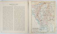
1903Best.-Nr. 173709Gotha: Justus Perthes. 1903. Map printed in colour 24.7 x19.4cm and leaf of descriptive text in German 26.5 x 22.5cm slight toning and edges of the map worn with two small tears no loss. Geopolitical map of Burma with railways and railways under construction highlighted. The accompanying text is by the German Tibetologist linguist and orientalist Dr Emil Schlagintweit. . Justus Perthes unknown
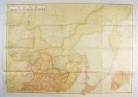
1419Best.-Nr. 171112東京. Tokyo.: 伊林書店. Ibayashi Shoten. 昭和14 1939. Colour printed folding map 78 X 109cm minor damage original envelope 27.5 x 20cm. Very good copy. This map offers comprehensive information on northern China Manchuria the Soviet Union and Hokkaido including Kuril Islands under the Japanese control. It also includes the Jewish Autonomous State which existed in the late 1930s. The inset map provides detailed information on the border area of Japan Manchuria and the Soviet Union. Legends include national borders railways major cities iron mines and oil wells. Published in 1939 this map is an expression of the tension Japan felt in its relationship with the Soviet Union. At the time the Soviet Union was seen as the mighty threat to the lying just north of Manchuria and Japan . . 伊林書店. [Ibayashi Shoten]. unknown
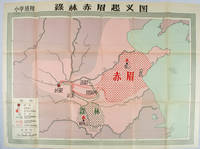
1958Best.-Nr. 171563Beijing.: 地图出版社. Di tu chu ban she. 1st Edition 2nd Printing. 1958. Large Chinese coloured educational map folded. Scale 1:2000000 legend lower left corner showing the military advance of two peasant insurgent groups Lulin and Chimei's march towards the capital city Chang'an now Xi'an in 17 AD. In original worn paper wrapper map in very good condition. Text in traditional Chinese. Map measures 77 x 105.2cm. 王匡 Wang Kuang and 王凤 Wang Feng founded the Lulin Army in the region of modern Hubei Province. 樊崇 Fan Chong lead the Chimei also known as Red Eyebrows Army in the northern parts of modern Shandong Province. . 地图出版社. [Di tu chu ban she]. unknown
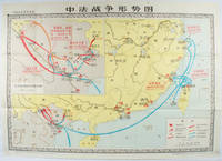
1978Best.-Nr. 171343北京. Beijing.: 地图出版社.Di tu chu ban she. 1978. Large Chinese map in colour showing southern part of China and northern Vietnam folded in original envelope scale 1: 150000 inset map upper left corner scale 1:800000. Both maps show the battles between Qing court and French army between 23 Aug 1884 and 25 Mar 1885. Original paper envelope repaired with acidic free tape map in very good condition. Text in Chinese. Sheet measures 76.8 x 107.1cm. . 地图出版社.[Di tu chu ban she]. unknown
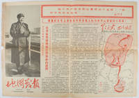
1967Best.-Nr. 169746Beijing.: 地图戰報.Di tu zhan bao. September1967. Maps printed in red and black single sheet printed on both sides folded scale not given photographic image of Mao Zedong. Some light browning at edges with tears and losses on left edge still good. Text in Chinese. Sheet measures 26.5 x 38.4cm. Includes a map of Autumn Harvest Uprising and also shows the routes of the military advancing towards Jinggangshan between September and October 1927. On reverse left section a map shows the route along which Chairman Mao led the Fourth Army of the Chinese Red Army marching towards south of Anhui and Jiangxi Provinces in 1929. On reverse right section a map titled "The Long March of The Chinese Workers' and Peasants' Red Army October 1934-October 1935". Quotations of Chairman Mao about the Long March insert on corners of the map. Issue no. 6 of a series of maps with text issued by the Red Guards organisations in the form of Cultural Revolution tabloid-sized newspaper. This issue is designed to celebrate the 40th anniversary of the Autumn Harvest Uprising which was one of the earliest armed uprisings organised by the Chinese Communist Party. . 地图戰報.[Di tu zhan bao]. unknown
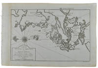
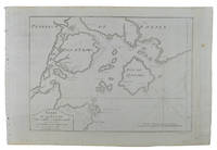
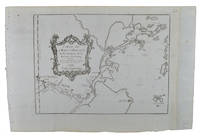
1749Best.-Nr. 136826Paris. circa1749. Black and white engraved map on watermarked laid paper 20.9 x 32.7cm showing coastal area of Zhejiang Province Province de Che-kiang including Zhoushan Archipelago Isle de Chusan Zhoushan Bay Bay de Chusan and Xiangshan County Siang-chan-luen a walled city outside of upper border Ningbo Ning-po prefecture under Qing administration title cartouche lower left original folds. This map is No. 3 Vol. 6 from the impressive 15-volume "Histoire Generale des Voyages" compiled by Antoine François Prévost. Even browning mainly to the sheet edges in very good condition. . unknown
1749Best.-Nr. 136795Paris. circa1749. Black and white engraved map of Quanzhou and Zhangzhou 21.1 x 30 cm here spelled Chin-chew and Chang-chew and both final words with added superscript "ou" on watermarked laid paper 25.6 x 38 cm original folds a few marginal spots simplified compass rose and a decorative fleur de lis bottom right in very good condition. Attractive map including the estuary of Quanzhou River Xiamen Emowi and Kinmen or Quemoy Quemowi island. The map was designed by the eminent French cartographer Jacques-Nicolas Bellin and here published as plate No. 22 in the impressive 15 volume compilation of voyages "Histoire Generale des Voyages" by Antoine François Prévost. . unknown
1749Best.-Nr. 136827Paris. Circa1749. Engraved map on watermarked laid paper 20 x 27.3 cm of Fuzhou and coastline of Fujian Province original folds designed by the great French cartographer Jacques-Nicolas Bellin. This map is from the impressive 15-volume "Histoire Génèrale des Voyages" compiled by Antoine François Prévost map no. 2 Vol. 6. This map shows the estuary of Yangtze River Rivière de Chang. Very light browning on sheet edges but in very good condition. . unknown