[INAGAKI, RIKICHI]. 稲垣利吉.Biblio.com
5 228 résultats
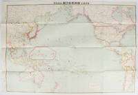
réf. 169329東京. Tokyo.: 九段書房.Kudan shobo. 大正十四 1925. Coloured folding Japanese map showing the military strength of Japan the United States and the United Kingdom in the Pacific original pictorial envelope scale not given. Some small holes at folds occasional light foxing a prior owner's signature on reverse minor wear envelope. Very good copy in like envelope. Map measures 54.4 x 78.8cm. The explanatory text in Japanese printed on the reverse in blue summarises the colonial possessions of the US and the UK as well as providing a comparison between the land size naval presence natural resources immigration issues and maritime transport capacities of Japan the United States and the United Kingdom. Legend indicates national regional provincial territorial boundaries canals undersea cables airline routes metropolitans capital cities mining fields hot springs ancient battle fields major trade ports Japanese embassies and consular offices. A large area marked 日本委任统治 "South Pacific Mandate" highlighted in a box is adjacent to Australian occupied Papua New Guinea. . 九段書房.[Kudan shobo]. unknown
réf. 13277Paris, Office Indochinois du Tourisme, sans date (1930?). 1 plaquette in-8 carrée, reliée par un cordon de soie, couvertures souples illustrées, 12 pp., illustrée de nombreuses photos en noir et blanc in texte et d'une double carte en couleurs du tracé de la Route Mandarine ou Route Coloniale No1. Bon état général.
1795réf. 210851795 1 feuillet avec en-tête préimprimé : MARINE LIBERTE, EGALITE, FRATERNITE et orné d'une vignette en noir, manuscrit à l'encre brune sur papier vergé ligné filigrané, format 20 centimètres de large par 30,8 centimètres de haut, Lettre écrite à bord de la Frégate "LA NEREÏDE", le 13 Floréal An 3, signature manuscrite de Jean-Pierre PILLET
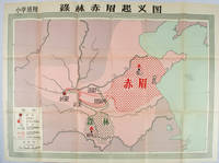
1958réf. 171563Beijing.: 地图出版社. Di tu chu ban she. 1st Edition 2nd Printing. 1958. Large Chinese coloured educational map folded. Scale 1:2000000 legend lower left corner showing the military advance of two peasant insurgent groups Lulin and Chimei's march towards the capital city Chang'an now Xi'an in 17 AD. In original worn paper wrapper map in very good condition. Text in traditional Chinese. Map measures 77 x 105.2cm. 王匡 Wang Kuang and 王凤 Wang Feng founded the Lulin Army in the region of modern Hubei Province. 樊崇 Fan Chong lead the Chimei also known as Red Eyebrows Army in the northern parts of modern Shandong Province. . 地图出版社. [Di tu chu ban she]. unknown
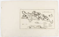
1703réf. 176390Amsterdam. circa1703. Engraved map on watermarked laid paper 16.5 x 26.5 cm plate-mark 26 x 42 cm sheet key in German inset detail of grave sites on the island of "Rhenee" Rineia and Apollonian relics lower corner creased and with a sealed tear to the verso no loss in very good condition. Fine engraving with large margins of the Greek island of Delos of great significance to classical antiquity and the mythological birthplace of the Greek deities Artemis and Apollo. . unknown
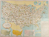
1955réf. 172003Washington D.C.: 国務省. Kokumishō. No date. circa1955. Large folding Japanese coloured map of the United States with 3 inset maps at foot of map showing main railways air and highway routes and hemispheres at the top right. Some browning mainly visible on reverse still a good copy. 66 x 81cm. An intricate and detailed pictorial map of the United States published in Japanese by the US State Department. The same type of map had been published since 1945 in English and subsequently in other languages. The Japanese language map is hard to find. The map is undated but was probably produced in the 1950's. The images include depictions of women board riders in two piece swimsuits of the sort popular in the 1950s but the inset text lists Alaska and Hawaii as external territories of the US indicating that the map was produced before they attained statehood in 1959. An inset panel provides information on the area and population of the US the population of major American cities mineral and other resources climate and topography. A note at the bottom right hand corner of the map states that copies of the map can be obtained free of charge from your nearest US Information Office. Every region of the country is decorated with an illustration of the natural resources industries or cultural or historical resources associated with that particular place. These include images of early colonial settlers the birthplaces of Mark Twain and Woodrow Wilson Booker T. Washington's house and Abraham Lincoln's grave; images of major dams oil fields coal mines cotton plantations etc. various animals and crops and images of ships cars and public buildings including the Statue of Liberty located rather oddly far out at sea. . 国務省. [Kokumishō]. unknown
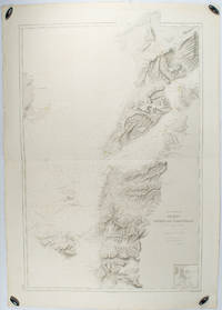
1883réf. 178272Paris.: Service hydrographique et océanographique de la marine. 1883 but1894. Engraved hydrographical chart on watermarked double sheet 99 x 63 cm soundings in metres lighthouses picked out in yellow and red inset map of the port and town of Tenedos central fold a few very slight edge tears to the generous margins light spotting and surface soiling but in very good condition. Fine and impressive large naval chart of this strategically important strait then still under the control of the Ottoman Empire. From a private collection; "Lord John Fitzroy Royal Yacht Squadron" in manuscript on the verso. . Service hydrographique et océanographique de la marine unknown
réf. 13915London. May and June 1888. 4pp. foolscap 8vo. Bifolium. In fair condition on aged paper. First page headed: 'The Edgware Road Fire The proprietor of "The Daily Telegraph" have as hitherto on similar occasions opened a Subscription list for the Sufferers and it is estimated that £3000 will be required to meeet the urgent claims for relief which are already too well known I shall be glad to receive any donations you may be pleased to give on their behalf JNER.'. Arranged in eight columns two to a page with running totals and a grand total of £16 1s 0d. The first donation is for 10s 6d from 'Mr. Kynock' and the last for 1s from Mr Catliffe'. Accompanying the list are two newspaper cuttings laid down on one side of a piece of 12mo paper with manuscript heading The Edgware Rd. Fire Fund'. The first cutting records the donation of £20 by 'Fredk. Gorring Buckingham Palace-road' and of £16 1s 0d by 'Employés of Fredk. Gorringe'; the second cutting reproduces a letter from Gorringe reading: 'TO THE EDITOR OF "THE DAILY TELEGRAPH." SIR - I have pleasure in sending a cheque for £20 towards the fund being raised for the assistants who are sufferers by the Edgware-road fire; also one for £16 1s from my employés. - Yours faithfully FREDK. GORRINGE. Buckingham Palace-road June 5.' The fire had occurred on 30 May 1888 with The Times devoting the following day's editorial to it beginning: 'London has been visited by many greater and more destructive fires but by few more tragic and pathetic in their circumstances than that which occurred in the Edgware-road shortly after six o'clock yesterday morning. The large drapery establishment of Messrs. GARROULD occupying the angle formed by the Edgware-road and Queen-street was suddenly attacked by fire and five of the young assistants who slept in the upper floors were burnt to death or suffocated while five more were seriously scorched or injured by jumping from the windows.' The Times drew parallels with another fire eight months before at the Exeter Theatre and concluded that it had 'once more taught Londoners the lesson that they cannot have efficient protection from fire without paying for it'. [London. May and June 1888.] unknown
1770réf. 51365Paris: Chez Le Rouge 1770. First edition . Oblong 4to. Engraved title leaf and seven engraved maps one folding the other six with a number of strip maps separated by thin rules detailing the route from Strasburg to Versailles. Delineates topographical features cities and villages churches forests etc. Not recorded on OCLC. Later patterned wrappers worn long tear in rear wrapper; interior soiled some old tidelines mostly marginal but affecting the image in the last two maps; several manuscript additions but a very good example of a scarce 18th-century French route map. Chez Le Rouge unknown books
1770réf. 51365Paris: Chez Le Rouge 1770. First edition . Oblong 4to. Engraved title leaf and seven engraved maps one folding the other six with a number of strip maps separated by thin rules detailing the route from Strasburg to Versailles. Delineates topographical features cities and villages churches forests etc. Not recorded on OCLC. Later patterned wrappers worn long tear in rear wrapper; interior soiled some old tidelines mostly marginal but affecting the image in the last two maps; several manuscript additions but a very good example of a scarce 18th-century French route map. Chez Le Rouge unknown
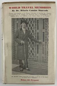
1932réf. 12800Washington DC: Claude T. Clements Press 1932. 14362pp. Profusely illustrated. Publisher's tan cloth with titles stamped in brown on spine and front board. In original unclipped pictorial dust jacket. Minor edge wear light insect damage to boards. Dust jacket either trimmed a bit short or originally produced a half-inch shorter than boards. Minor dust-soiling to jacket with minor insect damage to rear flap. Internally clean. Overall very good. The rare autobiographical travel narrative by one of the most important Filipino-American political leaders in history especially notable for retaining the original pictorial dust jacket. Hilario Camino Moncado established the Filipino Federation of America in 1925 in Los Angeles California. It was also known at various times as the Filipino World Federation and the Filipino Crusaders World Army. As one of the fraternal organizations appealing to the small but growing Filipino immigrant community the FFA distinguished itself from competitors by accentuating "clean living" and rules of moral conduct. Moncado earned a law degree and also edited and published Filipino Nation. Through his work Moncado sought to portray the immigrant community as responsible and healthy in contrast to the then-prevalent depictions of them as uneducated gamblers. Much less publicly the FFA developed a set of religious teachings that held Moncado to be the reincarnation of Jesus Christ by way of José Rizal the Filipino patriot executed in the waning days of Spanish rule. Moncado's birthday was changed to make him appear to have been born after Rizal's death so that his identity as Rizal's reincarnation would be more plausible. In the present travel memoir Moncado focuses on political and social issues encountered on a trip around the world conveying an impression of worldliness which burnished his reputation within the Filipino-American community. He visits England Holland Germany France Italy Egypt India China Japan and "Home Sweet Home Philippines." A sampling of chapters focus on London his visit to Oxford University the refusal of Germany to pay reparations from the First World War mentioning the German people's and particularly Hitler's stance against paying them any further his visit to the League of Nations "Mussolini - Benevolent Despot or Tyrant" Gandhi and "India's Revolution" China "The Awakening Giant" "Americanized Japan" and the betrayal of the Filipino independence movement by the American Congress. OCLC records just eight institutional copies including one in the Philippines one in Singapore and six in the United States at NYPL UC-Davis the University of Hawaii Michigan Washington and Wisconsin. Claude T. Clements Press unknown books
1932réf. 12800Washington DC: Claude T. Clements Press 1932. 14362pp. Profusely illustrated. Publisher's tan cloth with titles stamped in brown on spine and front board. In original unclipped pictorial dust jacket. Minor edge wear light insect damage to boards. Dust jacket either trimmed a bit short or originally produced a half-inch shorter than boards. Minor dust-soiling to jacket with minor insect damage to rear flap. Internally clean. Overall very good. The rare autobiographical travel narrative by one of the most important Filipino-American political leaders in history especially notable for retaining the original pictorial dust jacket. Hilario Camino Moncado established the Filipino Federation of America in 1925 in Los Angeles California. It was also known at various times as the Filipino World Federation and the Filipino Crusaders World Army. As one of the fraternal organizations appealing to the small but growing Filipino immigrant community the FFA distinguished itself from competitors by accentuating "clean living" and rules of moral conduct. Moncado earned a law degree and also edited and published Filipino Nation. Through his work Moncado sought to portray the immigrant community as responsible and healthy in contrast to the then-prevalent depictions of them as uneducated gamblers. Much less publicly the FFA developed a set of religious teachings that held Moncado to be the reincarnation of Jesus Christ by way of José Rizal the Filipino patriot executed in the waning days of Spanish rule. Moncado's birthday was changed to make him appear to have been born after Rizal's death so that his identity as Rizal's reincarnation would be more plausible. In the present travel memoir Moncado focuses on political and social issues encountered on a trip around the world conveying an impression of worldliness which burnished his reputation within the Filipino-American community. He visits England Holland Germany France Italy Egypt India China Japan and "Home Sweet Home Philippines." A sampling of chapters focus on London his visit to Oxford University the refusal of Germany to pay reparations from the First World War mentioning the German people's and particularly Hitler's stance against paying them any further his visit to the League of Nations "Mussolini - Benevolent Despot or Tyrant" Gandhi and "India's Revolution" China "The Awakening Giant" "Americanized Japan" and the betrayal of the Filipino independence movement by the American Congress. OCLC records just eight institutional copies including one in the Philippines one in Singapore and six in the United States at NYPL UC-Davis the University of Hawaii Michigan Washington and Wisconsin. Claude T. Clements Press unknown
1957réf. 19761957 Jogjakarta (Yogyakarta), [Yogyakarta municipality], 1957. 16 - 28 - 246 pp., 6 colored samples of road tax disc labels for non-motorised vehicles (carts - andong, handcarts - kletek, horse or buffle carts - cikar, becak, bicycles) pasted-down, softcover.
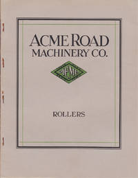
1927réf. 014098NY: Acme Road Machinery Company 1927. Quarto. 48 pp; illustrated throughout in b/w. Stapled wraps. Very good with some rusting to staples and a small split to top of spine. Internally clean and bright. Early examples of heavy road working equipment. Soft Cover. Near Fine. Acme Road Machinery Company Paperback
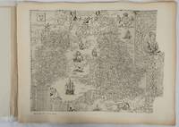
1932réf. 176499London.: Royal Geographical Society. 1932. Twenty one loose maps with tissue guards printed on sheets 49.5 x 63.5 cm in the original folio title-wrappers the maps with some edge wear and toning but on the whole in very good condition the wrappers browned and stained torn with minor loss at the foot of the title wrapper small closed edge tears now re-enforced with archival material and sound. Lacking the introductory notes by Edward Heawood. The complete suite of maps: an impressive production. The first map is a general map of England and Ireland by an unknown author 1594; nineteen county maps; and a final sheet of miniature county maps printed as a deck of playing-cards. The county maps proper vary in date from Saxton's “Southamtonia” of 1575 to John Speed's version of Norden's map of Sussex dated 1610. A contemporary reviewer dubbed it " a rich cartographical feast" allowing easy access to rare and valuable maps and comparison of maps by different cartographers for the same county. The county maps reproduced include five by Christopher Saxton three by John Norden Philip Symonson's map of Eastern Kent published in 1596 a series of seven maps dating from the early years of the seventeenth century two maps prepared for Camden and two published by John Speed. . Royal Geographical Society unknown
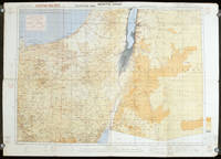
1942réf. 207841London.: Royal Engineers. July1942. Printed colour topographical map mounted on linen 56.7 x 79.2 cms; 64.6 x 89. 5 cms sheet original folds edgewear small marginal chips a little dusty but in good condition. Detailed World War II operational map of Egypt and the Middle East issued by 512 Army Field Survey Company of the Royal Engineers. The map is marked "Not to be Published" in the upper right margin. Railways roads camel tracks telegraph lines boundaries altitudes towns and villages are marked. . Royal Engineers. unknown
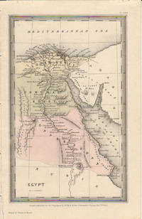
1833réf. 174939London.: Published for the Proprietors by Mr. Bull. 1833. Engraved map 14.1 x 8.8 cm original hand colour in very good condition. Fine miniature map with appealing hand colour denoting Lower Central and Upper Egypt. . Published for the Proprietors by Mr. Bull. unknown
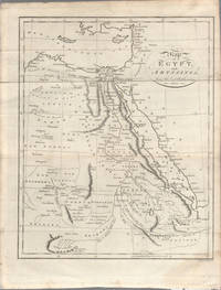
1803réf. 174955London. circa1803. Engraved map 23 x 18.5 cm original folds small split to one fold affecting the margin only paper age- toned lower corner darkened and on the verso inked circles to the lower half in an early hand but in good condition. Finely engraved early 19th Century map also showing to the north Syria Palestine and Cyprus and Darfur and Mountains of the Moon Sources of the Nile to the South. . unknown
1880réf. 174937London Edinburgh & Glasgow.: William Mackenzie. 1880. Map printed in colour with original outline hand colour 29.8 x 22.7 cm central fold edge toning but in very good condition. Published for inclusion in "The National Encyclopaedia: A Dictionary of Useful Knowledge". . William Mackenzie. unknown
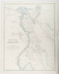
1861réf. 177021Edinburgh & London.: William Blackwood & Sons. 1861. Engraved map with original outline hand-colour 57 x 43.8 cm 61.1 x 49 cm sheet central fold very slight edge toning but the map in very good bright condition. First edition. Fine large folding map: the Nile delta and river with attractive original outline colour railways and canals marked and name references to biblical and classical geography. Published for inclusion as map 39 in "Keith Johnston's royal atlas of modern geography" . William Blackwood & Sons. unknown
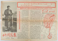
1967réf. 169746Beijing.: 地图戰報.Di tu zhan bao. September1967. Maps printed in red and black single sheet printed on both sides folded scale not given photographic image of Mao Zedong. Some light browning at edges with tears and losses on left edge still good. Text in Chinese. Sheet measures 26.5 x 38.4cm. Includes a map of Autumn Harvest Uprising and also shows the routes of the military advancing towards Jinggangshan between September and October 1927. On reverse left section a map shows the route along which Chairman Mao led the Fourth Army of the Chinese Red Army marching towards south of Anhui and Jiangxi Provinces in 1929. On reverse right section a map titled "The Long March of The Chinese Workers' and Peasants' Red Army October 1934-October 1935". Quotations of Chairman Mao about the Long March insert on corners of the map. Issue no. 6 of a series of maps with text issued by the Red Guards organisations in the form of Cultural Revolution tabloid-sized newspaper. This issue is designed to celebrate the 40th anniversary of the Autumn Harvest Uprising which was one of the earliest armed uprisings organised by the Chinese Communist Party. . 地图戰報.[Di tu zhan bao]. unknown
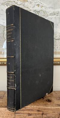
1869réf. 85507hLondon: Illustrated London News 1869. Book. Near Fine. Hardcover. Folio - over 12 - 15" tall. Half-year run bound in early half-leather over pebbled cloth boards. Some edge-wear and bumping to covers; small paper label painted over to upper spine. Edges toned and old library bookplate and marks to front and rear endpapers. Front hinge nearly exposed internally at endpaper but still firm. Otherwise clean tight and unmarked. Very neat -- a sound and handsome volume and internally unusually bright and clean. Superb illustrations. Illustrated London News Hardcover
1839réf. 10927Le Mans, Imprimerie Monnoyer, 1839 ; in-8, broché ; 48 pp., couverture beige décorée d'ornements typographiques de style romantique.
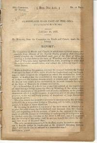
1837réf. 28840Washington 1837. 24th Cong. 2d Sess. H. Rep. 135. 38pp disbound folding sketch of wire suspension bridge across the Ohio River at Wheeling. Some leaves browned else Very Good. unknown books
1837réf. 28840Washington 1837. 24th Cong. 2d Sess. H. Rep. 135. 38pp disbound folding sketch of wire suspension bridge across the Ohio River at Wheeling. Some leaves browned else Very Good. unknown