4 566 résultats
1994"Road to Avonlea" is a CBC/Sullivan Films TV series based on stories and characters created by L.M. Montgomery. When Sara and Felicity's gossip column accidentally appears on page one of the Avonlea Chronicle, the editor, Aunt Olivia, must figure out how to make amends. Book
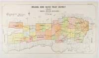
1912réf. 177249Sydney.: W.A. Gullick Govt. Printer. 1912. Large lithographed folding county map 78.8 x 45.4 cm the parishes highlighted in colour two small fold splits slight toning in very good bright condition. Attractive map from the Report on the first Interstate Conference on Artesian Water Sydney 1912 showing boundaries of water trust districts proposed boundaries with position and length of drains for the counties of Denham and Jamison in northern New South Wales boundaried by the Namoi River to the South. . [W.A. Gullick, Govt. Printer] unknown
2023réf. BN174916Kath Estrada 2023. 2023. Softcover. Dropshipping Dropshipping Kath Estrada Kath Estrada paperback
2006réf. 6rrzjDue South Craft Route Project 2006. 2nd edition . Softcover. Very Good. 0x0x0. 2nd edition 2006. Heavy book may require extra postage unless posted within South Africa. The wraps are in very good condition. Internally the pages are neat clean and complete. The binding is secure. GK. Our orders are shipped using tracked courier delivery services. Due South Craft Route Project paperback
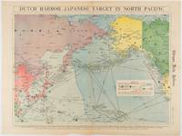
1942réf. 180751Chicago.: Chicago Daily Tribune. Friday June 51942. Printed colour map on a single newspaper leaf 37.5 x 53.2 cm; 44.7 x 59.8 cm sheet inset legend marginal browning and at the folds some undulation of paper and tide mark along lower section but in remarkably bright very good condition. Strategic map published in the Chicago Daily Tribune "The World's Greatest Newspaper" on June 5th 1942 two days after the Japanese attack on Dutch Harbor the site of the US army and navy bases in the Aleutians and as it transpired at the outset of the Battle of MIdway. The owner and proprietor of the Tribune Robert McCormick was staunchly against the United States entering the war and had firm views once it had occurred that American resources should not be used defending the British Empire. Famously the Tribune published the "Victory Program" Roosevelt’s military plan to prepare the United States for possible entry into World War II and was subject to prosecution for an alleged violation of the Espionage Act relating to the newspaper’s front-page account of the Battle of Midway 4-7 June 1942. It became an important test case for the limits of free speech and censorship during war-time. The Legend shows territorial Control of Ocean Areas marking Japanese Naval and Air bases as of 1941 and "according to latest reports" those established in the first six months of 1942. Also shown are pre-war sovereignties as at the bombing of Pearl Harbour on December 7th 1941. The Anson Archipelago is shown but a question mark "indicates islands etc. whose existence or give position is doubtful…". . Chicago Daily Tribune. unknown
LE MANS, imp. E. Lebrault - 1882 - In-8 - Broché - 340 pages - Exemplaire non coupé - Propre - envoi rapide et soigné
réf. 28125LE MANS, imp. E. Lebrault - 1882 - In-8 - Broché - 340 pages - Exemplaire non coupé - Propre - envoi rapide et soigné
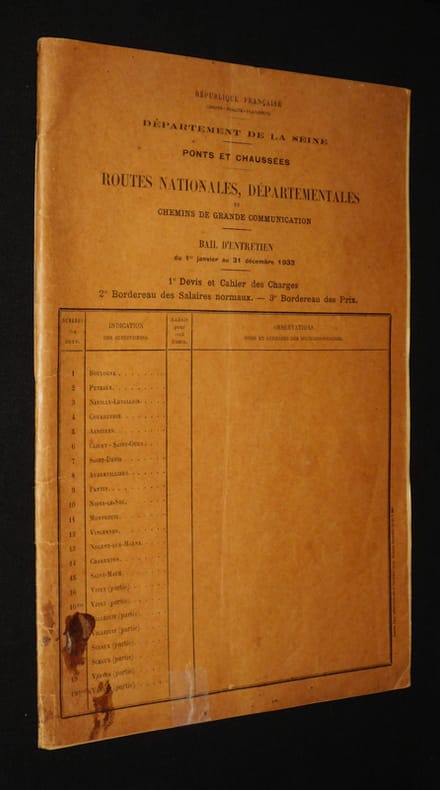
1933réf. xf210Paris, Imprimerie administrative centrale (anc. Maison Jousset) Brochure 1933 PEU COMMUN. In-4 (21 x 31 cm), brochure, 40 pages, contient : 1° Devis et cahier des charges - 2° Bordereau des salaires normaux - 3° Bordereau des prix ; volume plié au centre, taches et petite réparation au ruban adhésif au premier plat, salissures et résidus de papier collé au quatrième plat, surligneur aux pages 26-27, en l'état. Livraison a domicile (La Poste) ou en Mondial Relay sur simple demande.
réf. GF35673Montpellier - Seran - Gras - Coucourdan - 1799 - 1 volume in4 de 31 pages - broché, dérelié - Bon état -
réf. 1399894382.Ghardcover. Good. Access codes and supplements are not guaranteed with used items. May be an ex-library book. hardcover
réf. aly2805Washington: Smithsonian Institution 1965. folio. pp. xix 234. 196 b/w plates. cloth slightly shaken previous ownerís signature on front free endpaper Washington: Smithsonian Institution, 1965 hardcover
1965réf. 359284City of Washington: Smithsonian Institution Press 1965. Hardcover. Near Fine. First edition. Quarto. 234pp. Blue cloth with gilt stamping on front board and spine. Spine ends and corners bumped owner's name penned on front pastedown else near fine. Smithsonian Contributions to Anthropology: Volume 1 Whole Number. Smithsonian Institution Press hardcover
1965réf. 359284City of Washington: Smithsonian Institution Press 1965. Hardcover. Near Fine. First edition. Quarto. 234pp. Blue cloth with gilt stamping on front board and spine. Spine ends and corners bumped owner's name penned on front pastedown else near fine. Smithsonian Contributions to Anthropology: Volume 1 Whole Number. Smithsonian Institution Press hardcover books
1970Book shows light wear only. Binding is solid and square, covers have sharp corners, exterior shows no blemishes, text/interior is clean and free of marking of any kind. 182 pages, chapters include Pettygrove period, Gold hits the townsites, Rival at Milwaukie, The first steamships, The great plank road, etc.
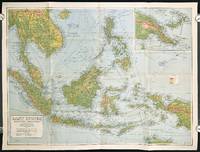
1940réf. 211106Sydney.: H.E.C. Robinson Pty. Ltd. circa1940. Full colour folding map 71 x 97 cms; 76.2 x 10² cms sheet blank on verso save for a neat inked stamp "East Indies" inset map of New Guinea and Papua heights shown by colour very good clean condition. Large scale World War II era map by Sydney publisher H. E. C. Robinson. Extremely detailed map it is coloured according to height above sea level and showing naval bases railways shipping routes air routes. Includes smaller inset map of "New Guinea & Papua" showing the eastern part of the island. . H.E.C. Robinson Pty. Ltd. unknown
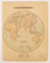
1875réf. 175128Harper & Brothers. 1875. Spherical map printed in colour 21.3 x 21.2 cm with shaded key to elevation and ocean currents unrelated text on the verso paper toned and margins soiled bottom edge ragged small sealed to to the inner margin but in sound condition. Map showing the five continents of Asia Africa Antarctica Europe and Australia. Published by Harper & Brothers for inclusion in their "School Geography". Plateau of Tibet very prominently marked. Gobi Desert and Plateau of Mongolia also marked India described as Hindostan Indo-China includes Thailand. . Harper & Brothers. unknown
réf. 0656645520.Ghardcover. Good. Access codes and supplements are not guaranteed with used items. May be an ex-library book. hardcover
réf. 1359653538.Ghardcover. Good. Access codes and supplements are not guaranteed with used items. May be an ex-library book. hardcover
in-12, broché 335 pages. Couverture illustrée. Bel exemplaire. [PMvf]
réf. 3848467593.Gpaperback. Good. Access codes and supplements are not guaranteed with used items. May be an ex-library book. paperback
1940réf. RO60091434SEIX BARRAL. 1940. In-12. Cartonné. Etat d'usage, Couv. légèrement passée, Dos satisfaisant, Intérieur frais. 200 pages. Premier plat illustré en couleurs. Nombreuses planches illustrées en noir et blanc. Texte en espagnol. Ouvrage de bibliothèque avec étiquette au dos et bandeau sur la page de titre.. . . . Classification Dewey : 860-Littératures espagnole et portugaise
réf. 6209311156.Gpaperback. Good. Access codes and supplements are not guaranteed with used items. May be an ex-library book. paperback
réf. 6209458513.Gpaperback. Good. Access codes and supplements are not guaranteed with used items. May be an ex-library book. paperback
réf. 6209466192.Gpaperback. Good. Access codes and supplements are not guaranteed with used items. May be an ex-library book. paperback
1996réf. 1003948NEW ~ A collection of texts and photographs documenting Mexican composer and director Eduardo Mata's life and musical career. Incudes a Chronology and Discography. 156pp. B&W illustrations mostly photographs. En espanol / Spanish. Edition of 1500. In stock. Imported by Alla. Light shelf wear to cover. Usually ships within three days. CONACULTA / INBA / UNAM paperback