JOHNSON, JoyceLivre Rare Book
4 389 résultats
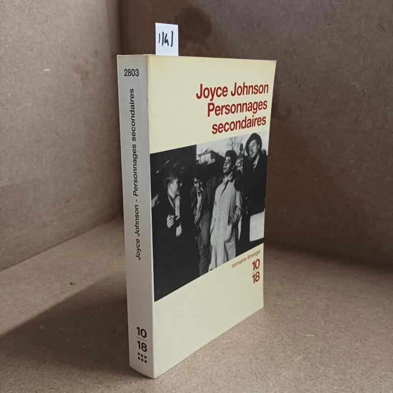
1997réf. 11411997 - broché - Editions 10/18, N° 2803 - Collection Domaine étranger dirigée par J-C Zylberstein - 1997 - In-12 (format poche) broché - 316 pages - Traduction de l'américain par Brice Matthieussent
réf. 55-3072Mexico: Producciones Internacionales Cinematográficas Asociadas PICASA 1974. 94 cm. x 69 cm. Actual display poster for the movie. Folded with signs of use mainly on the edges. Se trata de un cartel de mostrar real de la película. Se doble con signos de uso principalmente en los bordes. Mexico: Producciones Internacionales Cinematográficas Asociadas (PICASA), 1974. unknown
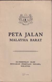
1970réf. 223469Kuala Lumpur.: Pengarah Pemetaan Negara. 1970. Large colour folding map in original paper wrappers. Text in Malay and English. 83.5 x 53.5cm folded 21 x 15cm. Closed tear along spine of trifle soiled upper wrapper otherwise a very good copy. . Pengarah Pemetaan Negara. unknown
réf. SLIVCN-9782384863051GRENOUILLE
réf. 34630Les editions sociales francaises, 1954. Format 13x21 cm, broche, 63 pages. Tres bon etat.
réf. 58305Hamburg Deutsche Verlags-Gesellschaft D.V.G. 1912. . Außentitel "Pharus Atlas deutscher Städte". - Aachen Berlin Bremen Breslau Coblenz Cöln a. Rh. Darmstadt Dresden Duisburg Düsseldorf Frankfurt a.M. Hamburg Hannover Kiel Leipzig Lübeck Magdeburg München Stettin Stuttgart sowie Brüssel London Paris Wien. Mit illustrierten Bäder- und Kurort-Anzeigen und Führer von Heidelberg Hildesheim Osnabrück und Rendsburg von diesen Städten keine Pläne vorgesehen sowie internationalem Hotel-Register und einem Mitgliederverzeichnis des Internationalen Möbel-Transport-Verbandes. Mit einem Sonderanhang "Schweiz". Besonders interessant durch die zahlreichen schön gestalteten Anzeigen der Zeit viele davon ganzseitig. - Berieben wenig bestoßen innen nur vereinzelt etwas fleckig wenige Blätter eingerissen 1 Blatt m. großem Einriß. Hamburg, Deutsche Verlags-Gesellschaft D.V.G. 1912]. unknown
2010réf. 2111902158502785Parco Entertainment Division 2010. Soft Cover. Fine. Number of pages: 1 volume without pages Size: 30cm Parco Entertainment Division paperback
1994réf. 2090202118108949Chugoku Shimbun 1994. Soft Cover. Fine. The book is in fine condition. Chugoku Shimbun paperback
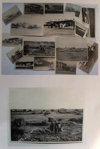
1930réf. 0559431930. Photographic Image. Very Good. No Binding. A collection of 15 black and white photographic prints 1 Drigh Road RAF camp 1921 8x6 ins; 2 ms note on the back " Imperial Airways machine crashed at Jack Persia Sept 1929 3 killed" 8x5 ins; 3 plane with personnel and buildings ms note "Long distance flight French Drigh Road 14/12/29"; 4 crashed plane ms note "First Wapiti crash Drigh Road 8x5 ins; 5 Farey-Napier monoplane; 6 Iris biplane on water 8x5 ins; 7 West Camp shops RAF Cranwell; 8 plane "Pride of Detroit" in hanger ms note Drigh Road air base Sept 4th 1927" 5x3 ins; 9 plane with ground crew and hangers ms note Drigh Road Sept 15th 1927"; 10 biplane GB-EKBU with onlookers ms note "first Moth to fly to India Leake & Stark 10.1.27 5x3 ins; 11 Blackburn Dart at Cranwell with 4 other photographs of Drigh and unidentified locations. All in very good condition. T.E. Shaw was at Drigh Base from 7.1.27 until 26.5.28. A nice collection. unknown
1925réf. 14910en noir et blanc (17,5 x 23 cm), datant des années 1925-1930 (lieutenant Fleury Seive photographe) ; vue prise à moyenne altitude en venant du sud ; on y voit les bancs de sable qui encombrent la rivière d'Ain, le pont, le château, la route de Pont d'Ain au premier plan.
1925réf. 14916en noir et blanc (17,5 x 23 cm), datant des années 1925-1930 (Lt Fleury Seive photographe) ; vue entière de la ville prise à moyenne altitude dans le sens nord-sud avec le cimetière et la route de Dorton au premier plan. Deuxième cliché à plus haute altitude.
1925réf. 14915en noir et blanc (17,5 x 23 cm), datant des années 1925-1930 (lieutenant Fleury Seive photographe) ; vue prise à haute altitude, dans l'axe sud-sud-ouest / nord-nord-est avec le village de Sénissiat au premier plan légèrement à gauche, le Mont July juste derrière et la route du Berthiand.
1930réf. 14906(17 x 23 cm), du terrain d'aviation, datée du 22 juillet 1930 (pilote adjudant-chef Duboeuf ; observateurphotographe, adjudant Ploux), prise à 200 m d'altitude dans le sens est-ouest ; on y voit très nettement le grand hangar en construction (la moitié du toit n'est pas couverte), ainsi que la voie ferrée d'Ambérieu à Bourg.
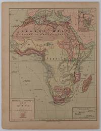
1877réf. 176015New York.: Harper & Brothers. circa1877. Chromolithographed map with outlne handcolour 27.1 x 21 cm major towns marked with a red cross relief by hachures ocean currents marked two inset maps of the Suez canal and Mascarene Island two very small marginal edge tears not affecting the map slight toning unrelated text on the verso prepared for "Harper's School Geography" in very good condition Interesting map of Africa before the escalation of the European race for colonial possessions from 1880. The map shows: the European possessions of the Cape Colony Transvaal Republic Orange River Republic and Natal; regions of the continent as fertile belts and desert belts; and indicates agricultural and other production such as palm oil ivory skins and cattle. Major cities are shown with important trade centers highlighted with a red cross. Prepared for US students in "Harper's School Geography" longitude is shown from the Greenwich prime meridian at the head of the map and from the Washington prime meridian at the foot. A small outline map of Ohio is included for relative scale. . Harper & Brothers. unknown
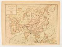
1875réf. 174830New York.: Harper & Brothers. 1875. Map printed in colour polar projection 21 x 27.1 cm marginal spotting and toning small edge tears to the inner margin but in god condition. Prepared for "Harper's School Geography" first published by Harper & Brothers in 1875. The map shows physical features mountains steppes plains rivers and deserts etc. together with sources of primary production: whale fisheries furs coffe tea minerals etc.The verso of the map with references and attractive line engravings part of the entry for Netherlands and Belgium. . Harper & Brothers. unknown
1987réf. 6807New York etc., Gordon & Breach, 1987. XIV, 390 S. (24 cm) Pappband / gebundene Ausgabe
1982réf. 51253New York etc., Gordon & Breach, 1982. XIV, 390 S. (24 cm) illustrierter Pappband / gebundene Ausgabe
2005réf. 1-1570916209Charlesbridge Pub Inc 2005. Hardcover. New. library binding edition. 32 pages. 10.25x8.25x0.50 inches. Charlesbridge Pub Inc hardcover
2012réf. 33769Selbstverlag, 2012.
1988No marks or inscriptions. Creasing to lower corners of covers, none to spine. A very clean very tight copy with bright unmarked boards, minor traces of storage and no bumping to corners. 100pp. With twenty years of research and investigation behind it, this study traces the development of the steam traction engine and ever more powerful road haulage vehicles up to todays container lorries. Very well illustrated.
2009réf. Q-1570916551Charlesbridge 2009-02-01. Hardcover. New. In shrink wrap. Looks like an interesting title! Charlesbridge hardcover
2011réf. Q-1570917930Charlesbridge 2011-02-01. Paperback. New. In shrink wrap. Looks like an interesting title! Charlesbridge paperback
réf. 65193Paris, éd. Sequana, 8 juillet 1941, in-8, br., 82 pp., 15 photos et 1 carte hors texte en noir, préface du Genéral Noguès, Table des matières, cachets et étiquette de bibliothèque, non rogné, L'histoire de la "piste impériale n° 1"; reliant Casablanca à Dakar durant la première moitié du XXe siècle. Bon état du papier; couverture fortement défraîchie
1990pp. 99-144. Illustrated. 4to. Original color pictorial wraps. PA PAMPH 20_1 BX3
1749réf. 136794Paris. circa1749. Black and white engraved plan map of Peking on laid paper folded designed by the prominent French cartographer Jacques-Nicolas Bellin. This map is No. 18 Vol. 5 from the impressive 15-volume "Histoire Generale des Voyages" compiled by French novelist Antoine François Prévost. This city map shows two areas of walled cities: Ville Tartare Imperial city and the Forbidden City and Ville Chinoise ethnic Han residential area. Notes A and B represents buildings within the Forbidden City. A: Lieu de Plaisance ou l'on voit une Montagne faite a la main B: Grandes Cours du Palais de l'Empereur. Two missionary buildings French and Portuguese as well as the Tower of Mathematics illustrated within Ville Tartare. Two temples illustrated side by side near the south gate of the Ville Chinoise. Overall in good condition very light browning on edges and darker toning along the borders of the map. Text in French. Map measures 21 x 16.4cm. . unknown