4.359 Ergebnisse
1973Best.-Nr. 2090502113717862Not Available 1973. Soft Cover. Fine. The book is in fine condition. Not Available paperback
2007Best.-Nr. 2091502135307432Yuzankaku 2007. Soft Cover. Fine. Volume: 1 Yuzankaku paperback
2007Best.-Nr. 2080502106409616Yuzankaku 2007. Soft Cover. Fine. Number of pages: 278p Yuzankaku paperback
Best.-Nr. 6207028449.Gpaperback. Good. Access codes and supplements are not guaranteed with used items. May be an ex-library book. paperback

2024Best.-Nr. x-3031504690Springer Nature 2024. Hardcover. New. 109 pages. 10.98x8.27x0.47 inches. Springer Nature hardcover
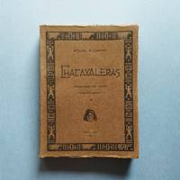
1921Best.-Nr. 25.0468Buenos Aires : Talleres Gráficos de Alfredo de Martino 1921. 2ª ed. Rústica. 13.5x18. Talleres Gráficos de Alfredo de Martino paperback
Best.-Nr. 55-1817Mexico 1974. Mexican movie poster. 94 cm. x 69 cm. Folded with signs of use mainly on the edges. Se trata de un cartel de mostrar real de la película. Se doble con signos de uso principalmente en los bordes. Mexico, 1974. unknown
1926Best.-Nr. 16703Buenos Aires Sociedad De Publicaciones El Inca 1926 In-12 carré 120 pp, Envoi de l'auteur à Jean Ott, couvertures conservées
Best.-Nr. SLIVCN-9782384863075GRENOUILLE
Best.-Nr. 31580Lyon Horvath In-8 carré 96 pp illustrées - Sont ajoutés les ouvrages suivants : Chartres, un patrimoine à vivre (Editeur : Le Cherche Midi - 2004 - ISBN 2749103282 - 47 pp illustrées- Cathédrale, couvent des Cordeliers, pont Bouju, Musée des Beaux-Arts, ancien palais épiscopal) ; Chartres, le chemin de mémoire (Le Cherche midi - 2006 - 2749109280 - 49 pp illustrées - Mémoires de personnages ou de faits qui ont façonné la ville - de Marceau à la guerre de 1870, du 1er conflit mondial à la libération ou à la guerre d'Indochine : guide indispensable à la découverte de Chartres) ; Chartres, guide de la cathédrale (éditions Houvet - 96 pp illustrées)
Best.-Nr. WOC-1276I. Environs de Paris: Fontainebleau. II. Nivernais, Morvan, Bourgogne et Bresse. III. Jura et Franche-Comté. IV. Haute-Savoie et Savoie. V. Dauphiné et Briançonnais. VI. Bourbonnais, Auvergne et Velay. VII. Vallée du Rhône et Vivarais. VIII. Côte D'Azur. IX. Ile de Corse (Autocars P.LM.). X. Algérie (Chemins de fer et Autocars P.L.M.). Ouvrage illustré de cartes et de photos hors-texte. Paris, Imprimerie Maréchal, sans date. In-4 (31,5x25cm) cartonnage éditeur, dos toile bleue un peu passé. 226pp. Quelques traces de scotch sur les pages de gardes.
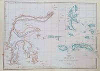
1860Best.-Nr. 184035London.: Weekly Dispatch Atlas. circa1860. Map with outline handcolour 31.3 x 43.3; 33.3 x 48.7 cms sheet 12 x 17 inches small marginal bloom not affecting the map in very good condition. Detailed mapping of these two island groups by Edward Weller 1819–1884 from the ‘Weekly Dispatch Atlas’ an atlas published in monthly instalments from 1855 for subscribers to the long running newspaper. Weller was a pioneer in lithography and was sought after for his skill in producing detailed and accurate maps. . Weekly Dispatch Atlas. unknown
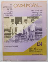
1982Best.-Nr. 347449Mexico City: Instituto Nacional de Antropologia e Historia Departamenteo de Antropologia Fisica 1982. Paperback. 69 3 pages 2 folding maps illustrations bibliography paperback. Torn creases to top portion of front cover near spine otherwise Very Good. Coleccion cientifica 124. Study of a Totonac community in Puebla Mexico with an emphasis on description of physical anatomy eye shape nose mouth ears fingers etc. Instituto Nacional de Antropologia e Historia, Departamenteo de Antropologia Fisica paperback books
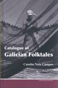
2021Best.-Nr. Alibris.0047196The Kalevala Society. 2021. Hard cover. Fine. 318 p. Includes: index bibliography. . The Galician Catalogue typologically records Galician tales within the European oral tradition. It orders them under the internationally recognized ATU Aarne Thompson Uther index system uses regional catalogues classification and includes new cataloguing proposals for uncatalogued ethno-texts. Galicia's rich narrative tradition of the past has now practically disappeared which has led the editor to also index tales of which there is only one version. The Galician Catalogue is enriched by its subject index which includes the names of the most frequent themes and motifs the characters and their actions. The work should be regarded as a model reference on the folktale heritage of Galicia and the areas sharing the Galician language in Asturias Leon Zamora and Caceres Valle de las Ellas. For researchers in International folktales it will also be an invaluable source of information. Camiño Noia Campos Santiago de Compostela 1945 is Professor emerita at the University of Vigo Pontevedra. Occupying the Chair of Galician Literature she has devoted a large part of her research to collecting and transcribing oral folktales. In 2002 Professor Noia published the collection Contos galegos de tradición oral the basis for the Catálogo tipolóxico do conto galego published in 2010. The latter includes a complete example tale of each type using the approach of Julio Camarena and Maxime Chevalier in the Spanish Catalogue Catálogo tipológico del cuento folklórico español. Noia has also published articles in Galician Spanish and French on various aspects of Galician oral tales. The Kalevala Society hardcover
1912Best.-Nr. 13113Monmouth Illinois:: Western Road Tool Company 1912. loose sheets as issued. Fine. Approx. 10-1/2 x 14 inches. Illustrated from photographs heightened in red and line drawings. Offering the "Perfection Gang" Road Drag horse gang drags scrapers plows grader blades and other road machines with order form. Western Road Tool Company, unknown
2002Best.-Nr. ZB1209427Ministerio de Defensa 2002. 434 pp. very well illustrated paperback text clean and binding tight very good. - If you are reading this this item is actually physically in our stock and ready for shipment once ordered. We are not bookjackers. Buyer is responsible for any additional duties taxes or fees required by recipient's country. Photos available upon request. Ministerio de Defensa paperback
Best.-Nr. C10bisIn-4, 74p., nombr. ill. (dont une locomotive-tramway), cartonnage.
1975Best.-Nr. RO80158506CHEZ L'AUTEUR. 1975. In-4. Broché. Bon état, Couv. convenable, Dos satisfaisant, Intérieur frais. Fascicule de 16 pages, illustré en couleurs.. . . . Classification Dewey : 910.4-Voyages
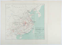
1898Best.-Nr. 214719Paris.: Erhard Frères. 1898. Lithographed folding colour map 44.5 x 49.5 cms; 54.6 x 76.3 cms sheet towns and cities items of production and trade routes highlighted in red original folds in very good clean condition. Detailed map prepared for the Lyon Chamber of Commerce Mission to China under the direction of a young Henri Brenier 1867-1962 with the purpose of advancing French colonial expansion and shoring up the interests of the dominant Lyon silk trade. The map shows the principal centres of population production waterways roads telegraph lines and railroads togther with the centres of production and distribution for coal iron tin gold and silver opium tea rice sugar peanuts cinnamon wool medicinal plants and leather. The trade mission was organized following the Treaty of Shimonoseki and the end of the Sino-Japanese War: the Chamber of Commerce of Lyon understood that end of this war would signal a profound economic development and change. . Erhard Frères hardcover
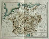
1800Best.-Nr. 57070c1800. Copper engraving with handcolouring map shows Germany and parts of France Italie Hongrie Pologne and Prusse sic. Minor hole upper border few closed tears and some browning edges otherwise a clean and bright image. Map measures approximately 34 x 46cm. . unknown
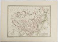
1837Best.-Nr. 177519Paris. circa1837. Engraved map with original outline hand-colour 22 x 30 cm; 28.8 x 38.6 cm sheet marginal repair to the lower corner not affecting the map sheet lightly age-toned in very good condition preserved in a window mount. Fine map of China Japan and Central Asia noting Manchuria "Mandchourie" bordering Northern India and Turkestan in the West and Russia "Russie d'Asie" in the North. From the estate of the late collector and scholar Arthur Hacker with his pencilled catalogue mark on the verso. . unknown
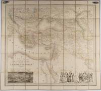
1853Best.-Nr. 176118Paris.: Ministère d'Etampes et de Géographies. 1853. Engraved map with outline hand colour 67.2 x 75.1 cm sectioned and linen-backed two large vignettes: a view of Constantinople; and costumed Turks and European soldiers facing off across a stream the linen browned with some loss but not affecting the map with the fine nineteenth century label of Charles Delarue & Hivert on the verso. Fine map with beautiful vignettes by Adrien Toussaint Lallemand 1793 - c.1856 geographer and engraver at the Depôt de la Guerre. Lallemand was appointed at a precociously young age and later set up in business on his own the quality of his work assuring him of the continued business of the Depôt. Highly attractive map of the Ottoman Empire published at the outset time of the Crimean War 1853-1856. This item is held off-site. Please note there may be a few days delay while it is brought into our shop for viewing or mailing to you. Thank you for your understanding. . Ministère d'Etampes et de Géographies unknown
1830Best.-Nr. 009582Paris - 21 Quai Voltaire: Rosselin 1830. Map. Fine. Map. A fine map hand-coloured in outline folding into original marbled paper boards with title label to the front board. Boards rubbed conrners worn. The map measures 74 x 55cm and is in very good condition with the paper bright. A very good to fine copy of this rare map. Rosselin hardcover
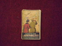
1914Best.-Nr. 106329Folding road map 22" x 34" folding into a 7" x 4 1/2" pocket type road map color illustrated title front cover with add panels on the reverse. Some tears at folds one panel split at fold some aging browning and soiling; otherwise a bright impression in pretty good condition. An attractive and somewhat scarce European roadmap. The map is French and shows roads available for motoring between France Italy and Switzerland. The OCLC locates only a couple of copies. OCLC. Kummerly & Frey, books