SPEED, JohnBiblio.com
1 013 résultats
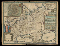
1676réf. 21930London: Sold by Tho: Basset in Fleet Street and Richard Chiswell in St. Pauls Church yard 1676. 405 by 515mm. 16 by 20.25 inches. Speed's map of Russia Double-page engraved map with hand-colour. A map of Russia one of the nine new maps added to the 1676 edition of Speed's 'Prospect' the first atlas compiled and published by an Englishman. Unusually this map is not in the carte-à-figure style that characterizes the 'Prospect'. Instead set in the top left-hand corner of the map is a detailed plan of Moscow with points of particular interest such as 'The Emperours Palace' and 'The Horse market' labelled. On the right-hand side is an elaborate cartouche containing views including 'Archangel' Arkhangelsk and 'A Hott House'. Accompanying text in English 'The Description of Russia' is printed on the reverse. John Speed 1552-1629 was the outstanding cartographer of his age. By trade a merchant tailor but by proclivity a historian it was the patronage of Sir Fulke Greville poet and statesman that allowed him to pursue this interest in earnest. His 'Theatre of Great Britain' first published in 1611 or 1612 was the first large-scale printed atlas of the British Isles. The 'Prospect of the Most Famous Parts of the World' from which the present work is drawn appeared in 1627 bound with the 'Theatre' and is the first world atlas compiled by an Englishman to be published in England. Engraved in Amsterdam many of the maps are anglicized versions of works by Dutch makers in distinctive carte-à-figure style featuring borders with figures in local costume and city views. This map is from the 1676 edition of the 'Prospect' published by Thomas Bassett and Richard Chiswell. While not as rare as the earlier publications this edition is perhaps the most important given that it is the first to include the nine new maps: among them Virginia and Maryland Barbados and the present example Russia. It is also the last time that the 'Prospect' was printed as an atlas. Shirley Atlases T.SPE-2f. Sold by Tho: Basset in Fleet Street and Richard Chiswell in St. Pauls Church yard,
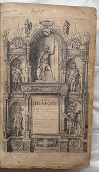
1632réf. 30290London: John Dawson for George Humble 1632. Folio pp. 22 1237 i.e. 1281 - page numbers 1043-1086 assigned to recto only 85; includes the preliminary blank leaf; engraved frontispiece portrait of Speed by S. Savery numerous woodcut illustrations and genealogical tables throughout; numerous woodcut initials and ornaments; contemporary full calf perfunctorily rebacked in brown calf maroon morocco label on spine; several clean tears entering text no loss leaf 5a with small piece missing from fore-edge causing minor loss to a few words and numbers light occasional dampstains; a good sound complete copy. A continuation of his Theatre of Great Britaine whose contents are described in this volume as "The Chorographicall Part" accounting for the first 4 books. This volume "The Historicall Part" therefore begins with "the fifth booke" but is complete in itself. STC 23049; Graesse V 462-63; Lowndes 2471-72. John Dawson, for George Humble unknown
1632réf. 30290London: John Dawson for George Humble 1632. Folio pp. 22 1237 i.e. 1281 - page numbers 1043-1086 assigned to recto only 85; includes the preliminary blank leaf; engraved frontispiece portrait of Speed by S. Savery numerous woodcut illustrations and genealogical tables throughout; numerous woodcut initials and ornaments; contemporary full calf perfunctorily rebacked in brown calf maroon morocco label on spine; several clean tears entering text no loss leaf 5a with small piece missing from fore-edge causing minor loss to a few words and numbers light occasional dampstains; a good sound complete copy. A continuation of his Theatre of Great Britaine whose contents are described in this volume as "The Chorographicall Part" accounting for the first 4 books. This volume "The Historicall Part" therefore begins with "the fifth booke" but is complete in itself. STC 23049; Graesse V 462-63; Lowndes 2471-72. John Dawson, for George Humble unknown books
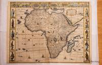
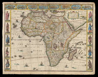
1626réf. 320851626. John Speed was a notable cartographer and historian of Britain. This decorative map is sought after by collectors because it is the first map of Africa prepared by a notable English cartographer. His Theatre of the Empire of Great Britaine was widely influential later editions of which included this map of Africa. The map first was published in A prospect of the most famous parts of the world which was a supplement to Speed's Theatre. Somewhat paradoxically this first English map of Africa was engraved by the famous Abraham Goos from Amsterdam - he was a relative of the Hondius family and therefore knew well the Dutch maps from which this map is derived. The map has a long publication history see Betz: published first by William Humble then his son George first state with date of 1626; then Roger Rea most of whose atlases were destroyed in the Great Fire of London 2nd state. Basset & Chiswell acquired Speed's plates after 1668 and published this 3rd state of the map together with maps of the other continents and the world map. Some time before 1690 Christopher Browne acquired the plates but a map of Africa from him is not known. The map is based maps of Jodocus Hondius whose Latin annotations are translated into English and Willem Blaeu his geography. The geography is typically early seventeenth century with its legendary Ptolemaic mountains rivers and lakes; typically the Nile arises from two lakes. The Europeans knew little about the interior of Africa and therefore there are numerous illustrations of terrestrial animals 'elephants for want of towns' according to Jonathan Swift; the oceans have ships and sea serpents. The English text on verso provides a fascinating view of the European concept concerning the wildlife customs and manners of the African people. There is a description of Anthropophagi cannibals who kill their own babies to avoid the trouble of raising them; but in order to preserve their race steal children from their neighbors. The side borders of this carte-a-figure map comprise sets of 5 decorative costumes of African peoples and the top border displays prospects of eight African Cities. Some of the border illustrations are copied from Willem Blaeu. At top is a panel of panoramas and plans illustrating Tanger Ceuta Alger Tunis Alexandria Cairo Alca Mozambique and the Canary Islands. This example of the map is in attractive colour and in very good condition. a few minor chips along the edges and an old repair on the bottom joint. Acid free mounting tape on the back. unknown
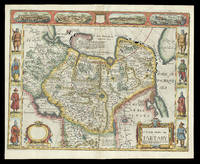
1676réf. 21929London: and are to be sold by Tho: Bassett in Fleet Street & Richard Chiswell in St. Pauls Churchyard 1676. 395 by 510mm. 15.5 by 20 inches. Speed's map of 'Tartary' Double-page engraved map with hand-colour. A map of Tartary encompassing parts of modern-day Siberia and Central Asia from the 1676 edition of the first atlas compiled and published by an Englishman Speed's 'Prospect'. The decorative border that runs along the top of the map depicts views of major cities as well as the house built on 'Nova Zemla' Novaya Zemlya by the explorer Willem Barentsz and his crew stranded there in 1596 here presented fending off a polar bear. Along each side are illustrated figures in regional costume. Accompanying text in English 'The Description of the Kingdom of Tartary' is printed on the reverse. John Speed 1552-1629 was the outstanding cartographer of his age. By trade a merchant tailor but by proclivity a historian it was the patronage of Sir Fulke Greville poet and statesman that allowed him to pursue this interest in earnest. His 'Theatre of Great Britain' first published in 1611 or 1612 was the first large-scale printed atlas of the British Isles. The 'Prospect of the Most Famous Parts of the World' from which the present work is drawn appeared in 1627 bound with the 'Theatre' and is the first world atlas compiled by an Englishman to be published in England. Engraved in Amsterdam many of the maps are anglicized versions of works by Dutch makers in distinctive carte-à-figure style featuring borders with figures in local costume and city views. This map is from the 1676 edition of the 'Prospect' published by Thomas Bassett and Richard Chiswell. While not as rare as the earlier publications this edition is perhaps the most important given that it is the first to include the nine new maps: among them Virginia and Maryland Barbados and Russia. It is also the last time that the 'Prospect' was printed as an atlas. Shirley Atlases T.SPE-2f. and are to be sold by Tho: Bassett in Fleet Street & Richard Chiswell in St. Pauls Churchyard,
1627réf. 64885London. 1627. A handsome early Sudbury and Humble edition of John Speed's map of Oxfordshire in colour. Towns and cities are highlighted in red decorative college arms and the supposed years of their foundation are found on either side of the map. A detailed inset map of the city of Oxford is in the upper right corner with a separate key with 28 listed city landmarks. The arms of the earl of Oxford to the right. Two academic university figures are seen standing with a pair of compass dividers either side of a striking globe representing the scale of miles. A strapwork border design and the royal coat of arms complete this map wonderfully well. Size: 395 x 535 mm. Copperplate engraving with later hand colouring. Fair condition. Some old repairs to lower central fold. Slight discolouration to the central fold. unknown
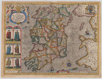
1610réf. 38006London: John Sudbury and George Humble 1610-27. In very good to excellent condition. 38.5 x 51 cm 15.25 x 20 inches. Original antique copper engraving hand colored in outline and wash very likely old colored. Engraved by Jodocus Hondius. Published 1627 English text edition. Very decorative map of the County of the kingdom of Ireland. At the top left is the title cartouche on which two putti are sitting holding a harp. Below are six engraved costume prints depicting three couples: Gentleman / Gentlewoman of Ireland Civil Irish woman / Civil Irish Man Wild Irish man / Wild Irish woman. In the top right corner we the coat of arms with the inscription 'God and my right' in French language. In the Irish Sea next to the compass rose and mileage scale a sailing ship and a sea monsters are engraved. Below the imprint with the publisher John Sudbury and George Humble and the privileg dated 1610. An early edition of this rare map of Ireland with strong engraved waves in the sea. John Speed 1551 oder 1552 28. Juli 1629 war ein englischer Kartograf Chronologe und Historiker mit Wurzeln in Cheshire. Als Sohn eines Bürgers und Schneiders in London verließ er den Beruf seiner Familie um die Aufgabe anzunehmen die Geschichte Topografie und Karten der Königreiche Großbritanniens zusammenzustellen und zu überarbeiten um die Vereinigung ihrer Monarchien in der Person von König James I. und VI. darzustellen. Er erreichte dies mit bemerkenswertem Erfolg mit der Unterstützung und Hilfe der führenden Altertumsforscher seiner Generation. Er stützte sich auf die Shire-Karten von Christopher Saxton John Norden und anderen und verbesserte sie indem er als Erster die Hundertgrenzen in sie einfügte und er war der Landvermesser und Urheber vieler der darin enthaltenen Stadtpläne. Seine Arbeit trug dazu bei frühneuzeitliche Konzepte der britischen Nationalidentität zu definieren. Seine biblischen Genealogien wurden auch offiziell mit der Erstausgabe der King-James-Bibel in Verbindung gebracht. Er gehört zu den berühmtesten englischen Kartografen. Wikipedia.A minor marginal light staining in very good to excellent condition. 2nd English edition 1616 P. 255 John Sudbury and George Humble unknown
réf. 11763London: Performed by Iohn Speed and ar to besolde in Popes head alley by George Humble. 1627. No binding. Very Good. 380 x 510 mm. later outline and wash colour in good condition. This fascinating map recording the military history of England Wales and Ireland was first published in John Speed's 'Theatre of the Empire of Great Britaine' in 1627. For this edition a separate world atlas entitled 'A Prospect of the most Famous Parts of the World' was first published. Bound between the two works was this map with four pages of accompanying text. The map is derived from one separately published by John Speed similarly entitled published c.1601 which survives in just five known examples. This map is engraved by Cornelis Danckerts for George Humble. The battles recorded include the Norman invasion of 1066 and all subsequent conflicts through 1588 and the Spanish Armada. A trail of ships up through the North Sea marks the Armada's defeat. Small illustrations of opposing troops mark the site of battles. This is an example of the first state with the imprint of George Humble. This state was issued through the 1650s with alteration to the text setting on the verso only. Provenance: Clive A. Burden Ltd.; private English collection. Shirley 1991 nos. 239 & 431; Skelton 1970 18. Performed by Iohn Speed, and ar to besolde in Popes head alley by George Humble. 1627 unknown
1664réf. 3551London: Rowland Reynolds. Very Good. 1664. First Edition. Rebacked with new endpapers; early twentieth century blind & gilt embossed spine over contemporary full ruled sheep. Fore edge corners renewed. Four full page engravings: incl. frontis of James Howell standing in a wood; his coat of arms to the left which seems to be borrowed form his 'Dendrologie' Paris1641; Charles II of Britain Louis XIV of France & Philip IV of Spain with chapters corresponding to each monarch.; Folio; Additional images and further information provided upon request. ; All shipments through USPS insured Priority Mail. . Rowland Reynolds
1632réf. 129648At London : Printed By Iohn Dauuson For George Humble And Are To Be Sold In Popes-Head Pallace At The Signe Of The White Horse 1632. Third Edition. Hardback. Finely and period sympathetically bound in modern aniline calf over marble boards. Raised bands with a dark morocco gilt-blocked label. An uncommonly good example - scans and additional bibliographic detail on request. ; 1237 pages; With sundry descents of the Saxons kings their marriages and armes. Signatures: par. 6 -par. 1 A8 B-2H6 2I4 2K-4S6 4T4 4V-4Z6 5A8 5B-5Y6 5Z4. Physical desc. : 20 1237 i. E. 1281 85 p. : ill. geneal. Tables. This third edition has been reissued enlarged and newly corrected. Subject: Great Britain - History - To 1485. Referenced by: STC 2nd ed. 23049. At London : Printed By Iohn Dauuson, For George Humble, And Are To Be Sold In Popes-Head Pallace, At The Signe Of The White Hors hardcover
1626réf. 21913London: published at the charges of G. Humble 1626 but 1627-1632. 390 by 500mm. 15.25 by 19.75 inches. The first English map of Africa Double-page engraved map with hand-colour. The first English map of Africa from the first atlas compiled and published by an Englishman Speed's 'Prospect'. The map was engraved by Abraham Goos for Speed's 'Prospect of the Most Famous Parts of the World'. Along the top border are eight inset views of cities mainly in North Africa for example Alexandria Tangier and Tunis; along the side margins are inset engravings of people from different regions. The map is dense with place names rivers mountains and lakes many fictitious. While ships and sea-monsters populate the sea inland are depicted animals including zebras elephants lions and monkeys. The source of the Nile is given to the Lakes Zaire and Zaflan as according to Ptolemy. Accompanying text in English 'The Description of Africa' is printed on the reverse. John Speed 1552-1629 was the outstanding cartographer of his age. By trade a merchant tailor but by proclivity a historian it was the patronage of Sir Fulke Greville poet and statesman that allowed him to pursue this interest in earnest. His 'Theatre of Great Britain' first published in 1611 or 1612 was the first large-scale printed atlas of the British Isles. The 'Prospect of the Most Famous Parts of the World' from which the present work is drawn appeared in 1627 bound with the 'Theatre' and is the first world atlas compiled by an Englishman to be published in England. Engraved in Amsterdam many of the maps are anglicized versions of works by Dutch makers in distinctive carte-à-figure style featuring borders with figures in local costume and city views. Norwich 30; Shirley Atlases T.SPE-2a. published at the charges of G. Humble,
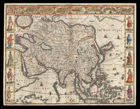
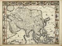
1626réf. 21912London: Are to be sold in pops-head alley against the Exchange by G. Humble 1626 but 1627-1632. 400 by 510mm. 15.75 by 20 inches. The first English printed map of Asia Double-page engraved map with hand-colour. The first English printed map of the continent of Asia from the first atlas compiled and published by an Englishman Speed's 'Prospect'. The map is heavily influenced by Hondius' 1623 map and inherits the gaps in his geographical understanding of Asia: Korea is presented as a peninsula and an anonymous stretch of water separates Asia from America identified only as a blending of 'The Tartarian Sea' and 'The West Ocean'. In India one finds the mythical 'Lake Ciamay' a common feature of European maps of Asia from the 16th to the 18th c. the imagined source of the major rivers of south-east Asia. The map is not without topographical accuracy however. In China the Great Wall of China is depicted described as 'a bulwarke against the suddaine infall of ye Tartars on this side'. Vignettes in the border at the top of the map depict bird's-eye views of important towns among them 'Goa' and 'Aden'. Illustrated in the borders along the sides of the map are costumed figures. Accompanying text in English 'The Description of Asia' is printed on the reverse. John Speed 1552-1629 was the outstanding cartographer of his age. By trade a merchant tailor but by proclivity a historian it was the patronage of Sir Fulke Greville poet and statesman that allowed him to pursue this interest in earnest. His 'Theatre of Great Britain' first published in 1611 or 1612 was the first large-scale printed atlas of the British Isles. The 'Prospect of the Most Famous Parts of the World' from which the present work is drawn appeared in 1627 bound with the 'Theatre' and is the first world atlas compiled by an Englishman to be published in England. Engraved in Amsterdam many of the maps are anglicized versions of works by Dutch makers in distinctive carte-à-figure style featuring borders with figures in local costume and city views. Chubb XXV; 'Mapping the Continent of Asia' 30; Shirley Atlases T.SPE-2a; Suárez 200. Are to be sold in pops-head alley against the Exchange by G. Humble,
1623réf. 1701800Published by George Humble 1623. Hardback. Very Good. Very good condition with no wrapper. Their Originals Manners Habits Warres Coines and Seales: with the Successions lives acts etc. of the English Monarchs. Second Edition. Revised and enlarged. Contents lists 10 books; this binding contains the following: Contents plus 8 page proeme; Books 5 - 10 plus Summary of the whole and 78 page index table. Very large format. Leather binding with raised bands to spine and black title labels and gilt titles. Contains woodcuts. Leather binding is a modern binding which is faded to spine. NO frontis. Book reads complete with in itself - but starts at book 5. A rare survivor of this historical book! Published by George Humble hardcover
réf. 4272London: George Humble. 1627-31. No binding. Good. 390 x 510 mm. in fine later colour with one minor margin tear short of the image repaired. A very attractive carte-a-figures of Asia engraved by Abraham Goos by John Speed 1552-1629. Speed is the most famous of all the English map-makers. His two most famous publications are ""The Theatre of the Empire of Great Britain"" first published in 161112 and the ""Prospect of the most famous parts of the world"" first published in 1627. Speed was a tailor by profession with a great interest for history and maps. He wanted to produce an English atlas of the same high standards and quality as those published on the continent. First he prepared a series of county maps of England and Wales and personally travelled all over the British Isles to acquire the information for all the town plans to be included as separate insets. The ""Prospect of the most famous parts of the world"" first published in 1627 was often bound with the ""Theatre"" and added an additional 20 engraved maps of the various parts of the world. The map is attractive because of the border illustrations and insets with figures in national costume city views town plans and other interesting features. According to a pencilled note on the verso this example is from the second edition of 1631. NMM 438; Phillips Atlases 488; Shirley BL T.Spe 1f; Skelton 18; Wing S4886; Yeo J. 30. George Humble. 1627-[31] unknown
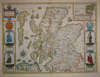
1676réf. 7572London: Basset & Chiswell 1676. Copper engraving 38.5 x 51.5 cms recent hand-colour light crease in the lower right hand corner but generally a very good example; English text on verso. Cartographically Speed follows Mercator but his is one of the most distinctive and decorative early maps of Scotland. The portraits in the borders originally represented James VI and I and his family including a young Prince Charles. The royal family was burnished from the copper plate during the Interregnum and replaced with the commoners seen here: a Scotch man and woman and a Highland man and woman notable as early depictions of tartan. John Speed 1552-1629 is unquestionably the most significant British map-maker of the seventeenth-century. A brief note from Granger's Bibliographical History of England 1779 contains most of the information we have about Speed's life: "John Speed who was bred a Tailor was by the generosity of Sir Fulk Grevil his patron set free from a manual employment and enabled to pursue his studies to which he was strongly inclined by the bent of his genius. The fruits of them were his Theatre of Great Britain containing an entire set of maps of the counties drawn by himself his History of Great Britain richly adorned with seals coins & medals from the Cotton collection; and his Genealogies of Scripture first bound up with the Bible in 1611 which was the first edition of the present English translation. His maps were very justly esteemed & his History of Great Britain was in its kind incomparably more complete than all the histories of his predecessors put together ." The first edition of Speed's "Theatre" was published in 1612. It was the first atlas of the British Isles and the first attempt made by an Englishman to match the achievements of the great continental publishing houses - although much of the engraving of the copper plates was performed in Amsterdam by Jodocus Hondius. Speed was an antiquary and intended that his atlas should be read in conjunction with his history of Britain. He managed to include a great deal of historical detail on his 'modern' county maps and the inset town plans some surveyed by himself together comprise the first collection of town plans of the British Isles all in all making the Theatre a highly decorative as well as a useful volume. It was a great success and there were editions printed throughout the seventeenth-century. Map Basset & Chiswell unknown
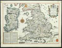
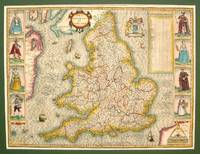
1614réf. M7656London: Sudbury & Humble c.1614. Very Good some skillful reinforcement of the folds. Notes: StolenRare first state of the map. This handsome map from Speed's "Theatre of the Empire of Great Britaine" after Jodocus Hondius 1610 engraving was described by Christopher Saxton and augmented by John Speed in 1612. This striking map of England has along its side decorative costume figures and a detailed table of all the Shires and other important location of England. Size : 385x515 mm 15.16x20.28 Inches Coloring: Hand Colored Category: Maps Europe United Kingdom; Sudbury & Humble unknown
1884réf. 15810Louisville KY: John P. Morton and Company 1884. First Edition. Cloth. Near fine. From the library of General William T. Sherman the first edition of Reminiscences of Abraham Lincoln and Notes of a Visit to California by his close friend Joshua F. Speed. Octavo 2 67pp 3. Brown cloth title in gilt on spine and front cover. Dark green endpapers. Internally clean solid text block. Archival tissue reinforcement to hinge of title page. Bookplate of "W.T. Sherman General" and his son Philemon T. Sherman on the front endpaper. Howes S-826 Kentucky Coleman 2953 Monaghan 1005 This work by Speed is one of three known copies to enter the public market. Provenance: The Sherman-Fitch Collection Lot 51424-110 Fleischer's Auction 2024. This book was acquired by Philemon after his father's death in 1891 at which point the "W.T. Sherman General" bookplate was added. The second bookplate was added by Sherman's grandson Tecumseh Sherman Fitch 1908-1969 who inherited the collection in 1942. At the outbreak of the Civil War in 1861 Joshua F. Speed a close friend of Lincoln since his days in the Illinois Legislature coordinated Union military activities in Kentucky. This responsibility introduced him to Brig. General William T. Sherman who commanded the Department of the Cumberland in Louisville. Sherman made numerous requests to Washington for supplies for his troops but it took an intervention by Speed and his direct connection to Lincoln to make it happen. Sherman was amazed and said to Speed: "How is it that more attention is paid to the request of you a citizen than to me a general in the army You had better take command here." Speed replied: "The only mistake you made General was in not asking for more." The two men continued to exchange letters as Sherman's military career moved forward. Their correspondence is likely why Sherman desired a copy of this short memoir by Speed. John P. Morton and Company unknown
1884réf. 15810Louisville KY: John P. Morton and Company 1884. First Edition. Cloth. Near fine. From the library of General William T. Sherman the first edition of Reminiscences of Abraham Lincoln and Notes of a Visit to California by his close friend Joshua F. Speed. Octavo 2 67pp 3. Brown cloth title in gilt on spine and front cover. Dark green endpapers. Internally clean solid text block. Archival tissue reinforcement to hinge of title page. Bookplate of "W.T. Sherman General" and his son Philemon T. Sherman on the front endpaper. Howes S-826 Kentucky Coleman 2953 Monaghan 1005 This work by Speed is one of three known copies to enter the public market. Provenance: The Sherman-Fitch Collection Lot 51424-110 Fleischer's Auction 2024. This book was acquired by Philemon after his father's death in 1891 at which point the "W.T. Sherman General" bookplate was added. The second bookplate was added by Sherman's grandson Tecumseh Sherman Fitch 1908-1969 who inherited the collection in 1942. At the outbreak of the Civil War in 1861 Joshua F. Speed a close friend of Lincoln since his days in the Illinois Legislature coordinated Union military activities in Kentucky. This responsibility introduced him to Brig. General William T. Sherman who commanded the Department of the Cumberland in Louisville. Sherman made numerous requests to Washington for supplies for his troops but it took an intervention by Speed and his direct connection to Lincoln to make it happen. Sherman was amazed and said to Speed: "How is it that more attention is paid to the request of you a citizen than to me a general in the army You had better take command here." Speed replied: "The only mistake you made General was in not asking for more." The two men continued to exchange letters as Sherman's military career moved forward. Their correspondence is likely why Sherman desired a copy of this short memoir by Speed. John P. Morton and Company unknown books
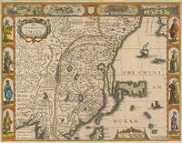
réf. 64286London: Are to be sold in pops-head Ally by G. humble 1627-32. Original copper engraved map sheet 40.5 x 52 cm; plate: 39.5 x 51 cm with later hand-colouring of China also showing Korea and Japan. Vignette views of Macao and Quinzay and scenes showing the Chinese manner of 'Travelling by Land' and 'Execution' in the upper border. Eight illustrations showing different types of oriental costume four in the left border and four in the right. English text 'Description of the Kingdome of China' to verso. Watermark to western side. Excellent condition. [London: Are to be sold in pops-head Ally by G. humble 1627-32]. unknown
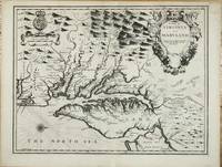
réf. 10915London: Sold by Tho:Bassett in Fleetstreet and Richard Chiswell in St. Pauls Church Yard. 1676. No binding. Good. 380 x 500 mm. with a small upper right corner margin repair otherwise in good condition. One of the maps 'relating to North America introduced into the 1676 edition of John Speed's 'Theatre of the Empire of Great Britaine' is this one of Virginia and Maryland. Augustine Herrman's landmark map of the region had been published three years earlier and bore a royal Privilege. However that did not protect its superior cartography from being poached. Here the mapmaker is more circumspect following John Smith's general outline from 1612. He draws upon the Herrman mainly for toponomy. As such it is the first printed map to utilise its improved geography although the Robert Morden and William Berry 'Map of New England .' was advertised just four days later. We should also bear in mind the possibility of Speed's 'Epitome' being issued earlier still. As such it is particularly important in representing the transition between two fundamental maps of the region. Other areas where the Herrman was used is in the depiction of the Delaware Bay and River which was omitted altogether from the Smith map and an improved delineation of the north-eastern shore of Chesapeake Bay. An independent source for the Atlantic coast of the peninsula is used. The June 1668 border settlement between Maryland and Virginia on the eastern shore is shown with the Herrman-like usage of a double line of trees. One item that did not appear on either of the progenitor maps is a brief inclusion of northern Carolina. The text on the reverse of the map is a condensed version of that found in John Ogilby's America 1671' Burden. John Speed 1552-1629 is the most famous of all the English map-makers. His two most celebrated publications are 'The Theatre of the Empire of Great Britain' covering the British Isles first published in 161112 and the 'Prospect of the Most Famous Parts of the World' first published in 1627. Speed was a tailor by profession with a great interest in history and maps. He wanted to produce an English atlas of the same high standards and quality as those published on the continent. The 'Prospect of the Most Famous Parts of the World' was published in 1627 two years before the death of Speed. Ownership of the atlas passed through various hands until sometime after 1668 when Roger Rea sold the rights to Thomas Bassett and Richard Chiswell. Bassett was a specialist in legal books and Chiswell was the publisher for the Royal Society. The final 1676 edition of the 'Prospect' includes eight further maps on seven sheets appearing for the first and only time. Baer 1949 no. 86; Burden 1996 no. 164; Morison Papenfuse Bramucci & Janson-La Palme 1983 pp. 17-19; Papenfuse & Coale 1982 pp. 16-18; Phillips 'Atlases' 488; Shirley 2004 T.Spe 1j; Skelton 1970 92; Verner 1968 pp. 170. Sold by Tho:Bassett in Fleetstreet and Richard Chiswell in St. Pauls Church Yard. 1676 unknown
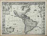
réf. 11106London: George Humble. 1627-31. No binding. Fair. FIRST ATLAS MAP TO DEPICT CALIFORNIA AS AN ISLAND. 390 x 510 mm. with a wormhole near the bottom of the centrefold repaired otherwise in good condition. ""This desirable map is the first published in an atlas to depict California as an island and an accurate east coast of North America particularly between Chesapeake Bay and Cape Cod."" Burden. It was first published in the 1627 edition of John Speed's 'Theatre of the Empire of Great Britain' the first English world atlas. For this edition the work was expanded with 'A Prospect of the Most Famous Parts of the World' which included a further twenty maps The map is engraved by the Dutchman Abraham Goos c.1590-1643 who drew on his engraving of North America from 1624 and the Henry Briggs map of 1625 to depict California as an island once more. ""He was the only Dutch cartographer to do so for some considerable time. There are five fewer placenames in California than the Briggs. However like his earlier one he includes a similar faint north-west coastline and Strait of Anian. 'Brasil' and 'Frisland' remnants from the sixteenth century make a stubborn appearance in the North Atlantic. The fledgling colonies of 'Plymouth' in New England and 'Iames Citti' in Virginia are both recognised. Decorating the whole are three attractive borders. The two sides illustrate the natives of the continent the left bears those of the north and the right those of the south. Despite the map's obvious attention to the English presence in North America none of the eight towns represented in the third are from that part. This is owing to the relative lack of any contemporary views to draw upon."" Burden. South America includes 'Bones Aeyres' founded in 1580. It is also one of the earliest maps to record Tierra del Fuego following Jacob Le Maire and Cornelis Schouten's voyage rounding Cape Horn 1615-17. John Speed 1552-1629 was a historian but his most remembered for his maps. He was like his father a tailor by trade. The 1627 edition was published by George Humble who reissued it in 1631. Provenance: Juan and Peggy Rada Collection. Burden 1996 217; Leighly 1972 pl. 4; McLaughlin & Mayo 1995 no. 3; Skelton 1970 no. 16; Tooley 1964 p. 113; Tooley 1973 pp. 302-3; Tooley 1977 pp. 4-9; Wheat 1957 pp. 36-7 & no. 39. George Humble. 1627-[31] unknown
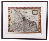
1626réf. ACH8NIO8K9DULondon: George Humble 1626. Framed. 41 x 53 cm. Engraved map with hand coloured borders probably by Pieter van den Keere 1571-after 1646. Incorporating a fine compass-rose with 32 rhumb lines and names of the wind-directions a coat of arms of France a title-cartouche a legend "A catalogue of the cities et ! villages in everie Province" and an indication of scale ca. 1:1.120.000. The map is topped by 8 hand coloured miniature profiles of major cities and bordered by hand coloured figures in local costume at the left 5 male figures and right 5 female figures. Very fine and attractive map in its first edition as published in John Speed's A Prospect of the most famous Parts of the World London 1627. The very successful map was republished in 1654 in two different states and 1674. Its decorative border incorporates profiles of Amsterdam Antwerp Ghent Middelburg Groningen Zutphen Utrecht and Atrecht and figures depicting "a Gentle woman" "a Brabanders wiffe!" "a Hollanders wiffe !" "a Fishers wiffe!" "a Contreywoman!" and their male counterparts.Slightly creased with restored tears along the head and foot of the central fold. Otherwise a very good copy.l Van der Heijden 88 first state of 4. George Humble, unknown
1611réf. 008199London in Popes-head alley at ye signe of ye white Horse: John Sudbury & George Humble. 1611. 1st Edition . Hardcover. Very Good. Elephant Folio - over 15 - 23" tall. SCHWEITZER Christoph wood engraver. An important source for understanding how the history of Britain was interpreted in the early Stuart period 14 years in the making! First edition 1611. In contemporary calf with gilt arabesque to center of boards neatly rebacked with portions of original spine compartments relaid corners refurbished lacks ties. Internally engraved title with 18th-century manuscript note to verso of title regarding the volume numerous woodcut illustrations of seals & coins etc. many woodcut head & tail-pieces & initial letters errata leaf at rear margins to initial leaves lightly frayed some toning and scattered spotting endpapers renewed 18th-century monogram bookplate to fpd ms ink name to tp Lizerghe 2 tp 151-786 pp 787-801 ie 802 ff 803-894 pp 2 conclusion 23 tables 1 errata a few leaves bound in the wrong order. Folio 473x287 mm. STC 23045. Thomson - Illustrations of the History of GB XCIII The pagination is continued from The Theatre of the Empire of Great Britaine STC23041. John Sudbury & George Humble. hardcover
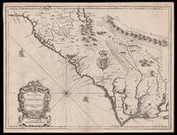
1676réf. 15098London: Thomas Bassett and Richard Chiswell 1676. 380 by 505mm. 15 by 20 inches. Sheet size 408 by 530mm 19 x 21 inches. Engraved map with text on verso. A fine and attractive map of the Carolina colony. Publishers Thomas Bassett and Richard Chiswell republished English cartographer John Speed's 1552-1629 popular 1611 atlas "The Theatre of the Empire of Great Britain" in 1676. As a supplement they included new section "A Prospect of the most Famous parts of the World" which contained maps engraved by Francis Lamb of the English colonies of New England and New York Virginia and Maryland Carolina and Florida and Jamaica and Barbados. This map depicts the Carolina colony in 1676 drawing from the Lord Proprietor's Map by royal geographer John Ogilby and the explorations of John Lederer fl. 1670-1675. The map orients the West to the top and depicts the coastline from Cape Charles at the mouth of the Chesapeake Bay to the north and St Augustine Florida to the south. Looking inland the Appalachian Mountains marked as "Apalathean Mountains" cut across the top right section of the map. The present map features a cartouche where the Ogilby publication had an inset map of the Ashley and Cooper Rivers. This map is one of the first to name Charleston "Charles Town" on the banks of the Ashley River. The map correctly identifies the town on the south bank of the Ashley River whereas Speed's smaller format map of Carolina incorrectly places the town on the north banks of the river. King Charles II granted eight Lord Proprietors land in North America that extended between 31 and 36 degrees latitude later extended to 29 degrees. Lederer was a German explorer who travelled West from the East coast of Virginia in hopes of finding the Pacific and the "Sea of China" with its associated riches. He never did reach the Pacific - unsurprisingly - but his personal records of his travels influenced contemporary maps. His description of the "Arenosa Desert" reflects Lederer's memory of crossing the Carolina pine barrens in the blistering summer heat. The "Great Lake" is likely the Catawba flooded which he mistook as permanent. In total Lederer traipsed across Virginia and the Eastern coast three times making it as far as the Blue Ridge mountains. Lederer's discoveries are recorded in Sir William Talbot's translation of the explorer's account from Latin to English and published in London in 1672 as "The Discoveries of John Lederer in three several Marches from Virginia To the West of Carolina." On the verso the text describes Lederer's journeys and discoveries. Burden 457 Cumming 77 Thomas Bassett and Richard Chiswell, unknown
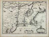
réf. 10914London: Sold by Tho:Bassett in Fleetstreet and Richard Chiswell in St. Pauls Church Yard. 1676. No binding. Very Good. 380 x 505 mm. in good condition. This fine map of New England was published at a important period of its history. It is from the most prestigious English world atlas of the seventeenth century by John Speed 1552-1629. Speed is the most famous of all the English map-makers. His two most celebrated publications are 'The Theatre of the Empire of Great Britain' covering the British Isles first published in 161112 and the 'Prospect of the Most Famous Parts of the World' first published in 1627. Speed was a tailor by profession with a great interest in history and maps. He wanted to produce an English atlas of the same high standards and quality as those published on the continent. The 'Prospect of the Most Famous Parts of the World' was published in 1627 two years before the death of Speed. Ownership of the atlas passed through various hands until sometime after 1668 when Roger Rea sold the rights to Thomas Bassett and Richard Chiswell. Bassett was a specialist in legal books and Chiswell was the publisher for the Royal Society. The final 1676 edition of the 'Prospect' includes eight further maps on seven sheets appearing for the first and only time four of these are of the 'Kings dominions abroad' the American colonies: New England Virginia and Maryland Carolina Jamaica and Barbados. The cartography of New England is drawn from the Joannes Janssonius 'BELGII NOVI .' 1651. In this example though the cartographer eliminates the south-westerly regions of the map as the intention was to provide a more detailed map of the Virginia and Maryland area. In fact it is most closely derived from the Nicolaas Jansz. Visscher version published c.1651. 'This is particularly noticeable when studying the decorative fauna depicted and the additional placenames that Visscher introduced such as Zuyder Zee south of Cape Cod here translated to South Sea. The only major cartographic alteration is the narrowing of the Delaware peninsula utilising the Augustine Herrman map 167374. Most of the differences reflect the anglicising of the map; one of the more notable additions is Boston. This is one of the first maps to depict the English pre-eminence in the region. The text on the reverse of the map describes the region although examples are known without it.' Burden. Burden 2007 455; McCorkle 2001 676.6; Phillips 'Atlases' 488; Shirley 2004 T.Spe 1j; Skelton 1970 92; Stokes 1915-28 I p. 148 & II p. 96 n.36. Sold by Tho:Bassett in Fleetstreet and Richard Chiswell in St. Pauls Church Yard. 1676 unknown