HUGUENIN-LASSAUGUETTE, (Fritz-Edouard) (1842-1926):Livre Rare Book

3832 risultati
rif. 115093aafÉdité par A. Chateau (1890-1896), Lithographe à la Chaux-de-Fonds (Suisse) 1889 - 1894 (1896), in-4° oblong, (à l'italienne), 8 ff. (titre - préface (L. Favre) / notices historiques ( par C.W.J.) de texte + 1 feuille manuscr. liste de 98 lithogr. + 98 planches (dont la planche n° 1: Panorama de Neuchâtel 1889, sur double feuille), petit tampon rouge sur titre de l’ancien propriétaire ‘Emile Quartier fils Brenets 5 avr 1909’, Reliure demi-chagrin à coins, titre doré sur le premier plat. Qqs pts tâches sur le premier plat, un coin légèrement rapé, sinon bel exemplaire.
rif. 868.1aafchez Birmann & Fils Basel ca 1830, 28x20.5 cm, Aquatinta, unter Passapartout und Glass im Goldramen 45x38.5 cm.
rif. 9931aafJansonius Waesbergen, s.d., (nach 1695, 39 x 51 cm l'image, Gravure sur cuivre originale. / Originale Kupferstich in kräftigem, klarem Abdruck. Selten. Sehr selten. Erstmals 1657 in Janssonius' Städtebuch erschienen, hier aus de Wits "Theatrum praecipuarum totius Europae urbium": hs. Num. in Tinte "21" oben rechts u. ohne Rückentext. "In 1694 the plates came into the hands of Frederick de Wit who issued them as part of (his) Theatrum" (N. H. S. 158). - Guter u. kräftiger Abdruck; Encadrement baguette ornée avec filet nacre laqué, passepartout avec filet noir. 66 x 76 cm (avec le cadre).
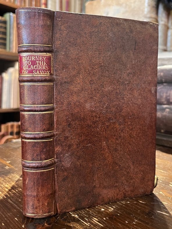
1776rif. 20735London, Printed for G. Robinson, 1776. In-8 de [27]-XXI-[1]-266 pages,plein veau marron, dos à nerfs ornés de filets dorés, pièces de titre rouge, tranches rouges.
1553rif. 73321553 Lyon (Jean de Tournes) pour Jaques de Strada et Thomas Guérin, 1553.In-4° de [24]-394-[30] pages, dans une superbe reliure d'époque , plein veau, plats avec double encadrements dorés , dos à 5 nerfs Première édition française, publiée simultanément avec l’édition latine. Traduction française de Jean Louveau et imprimée par Jean de Tournes (bien que son nom n’y figure pas) ; elle est ornée d’un grand bois sur le titre avec, au verso, les armoiries de Fugger à qui l’ouvrage est dédié et d’environ 400 PORTRAITS EN MEDAILLON sur fond noir.L’œuvre de Strada est doublement intéressante au point de vue de la numismatique et de la gravure ; elle a été gravée sur bois sous la direction de Bernard Salomon par les meilleurs tailleurs d’histoire. (Baudrier X, 366). Plusieurs feuillets piqués et cernes clairs en marge, ex. un peu dérelié, gardes manquantes. Condition moyenne. Ex-libris manuscrit sur le titre. (USTC 18010).
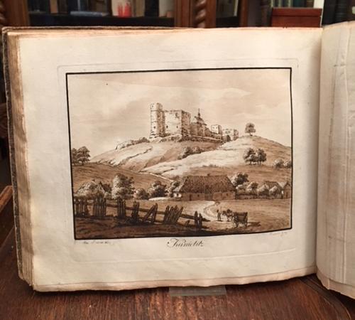
1798rif. 46894ABPrag, [Johann Gottfried] Calve, 1798. 4°quer (23x28), [1] Bl. S. [1-3], IX S., [3] Bl., S.4-267, mit Titelkupfer und SchlußVignette, sowie 14 (1 farb Plan, 13 lavierte), Kupfertafeln, flex Pbd d.Zt., stärker berieben und bestossen, Papier teils fleckig, randig und mit kleineren Randläsuren, 1. Schutzpergamin fehlt, Tafeln sauber und gut, ordentliches festes Exemplar,
1762rif. 1105901762. In der Platte signiert "Piranesi F." und mit dem Titel "Sepolcro di Cecilia Metetla". 45 x 64, 5 cm (Plattengröße).
rif. 8380Vista panoramica di Venezia.Gouache sur trait gravé,avec rehauts de gomme.L’auteur serait P. MAJOOCHI,et la gravure de Francesco CITTERIO. Chez Vallardi éditeur à Milan,vers 1850.1075x425mm y compris son cadre doré, d’époque.880x230mm hors marges. Très bon état.Le cadre n’a jamais été démonté,ce qui explique ces quelques traces de poussière sur le verre. Coloris frais. La vue de Venise est centrée sur la piazza San Marco, la tour du Campanile bissectrice de la composition avec le port sur la droite. Antonio VALLARDI est une maison d’édition italienne basée à Milan. Fondée en 1750 par Francesco Cesar VALLARDI
rif. 141246aafCarlsruhe, bey dem Verfasser, (Karlsruhe), (1818 - 1819), quer in-4to, Textbde: mit 8 lithogr. Titeln m. Vign. u. Atlasband: 4 gefalt. lithogr. Frontispices. 91 Lithogr. Tafeln (num. 1 - 88), in verschiedenen Grössen, v.a. von F. Bollinger (gedruckt bei Sidler in München), aber auch W. Rehlen, Th. Bauer, H. von Winter, Sebastian Wolf, K. Müller, Anton Falger, Auer, Peter Wagner, Ch. Häuser, Kraus. exlibris Textbdn: Dr. Gerhart Güttler / exlibris Peter E. Obertgfell, Halbleder, beschabt und an den Kanten etwas aufgeplatzt, festes Exemplar.
1909rif. 2111902160200943Oyagi toku kichi 1909. Soft Cover. Fine. Volume: 1 Oyagi toku kichi paperback
1954rif. 004698Paris Grasset 1954 In-8 Broché Ed. originale
1793rif. 3843"One of the more important images of postcolonial Boston" The building now known as "the Old State House" at the head of State Street in downtown Boston stands on the site of the first Town House that was built in the 1650s and burned in 1711. Its successor building the State House housed both town and provincial officers and activities until 1742 at which time town personnel moved to a location in the newly constructed Faneuil Hall. Of this view Deák notes: "The view from Washington Street shows the rear of the structure flanked by eminent merchant houses. Fashionable residents tradesmen mounted pedestrians and a variety of horse-drawn vehicles animate the streets. We can look past the State House down State Street far off into the distance of the harbor. There numerous masts of ships can be detected towering above the town's buildings which are constructed close together and are of substantial proportions.What we have in this engraving is one of the more important images of postcolonial Boston showing it as a thriving independent seaport" p. 128. References: Lewis Guide to Engravings in American Magazines 1741-1810: pp. 11 49. Stokes & Haskell American Historical Prints: Early Views of American Cities etc.: B-109. Deák Picturing America: 194. Condition: Old fold lines some of which have been strengthened on the reverse; minor edge tears. Scattered spots of very light foxing. Overall a well-preserved and visually pleasing example. ICN 7755. From the July, 1793 issue of Massachusetts Magazine
1789rif. 3750Contemporary Image of the First Capitol of the United States In September 1788 Congress selected New York City as the temporary site of the new government. "The citizens of New York desirous of testifying their attachment to the new national government and of making their city the place of permanent residence of the Federal Legislature have enlarged and repaired their city Hall and made it a convenient and elegant structure worthy of the respectable body for whose use it is designed." Columbian Magazine p. 473. The conversion of City Hall to the "Federal Edifice" or Federal Hall was directed by L'Enfant at a cost of $65000. The Executive offices the Senate and House chambers and the Supreme Court were all housed in this building. It was the nation's first Capitol under the Constitution. Although New York City's tenure as the new nation's capital was brief lasting only until 1790 Federal Hall was the site of several highly significant historic events. Washington's inauguration was held on the balcony of Federal Hall and he gave his inaugural address in the Senate chambers. Also the Hall was the meeting place of the first Congress; it was here that Congress adopted the Bill of Rights. There is no engraver noted on the image but several other engravings in TheColumbian Magazine from this time period have been ascribed to James Trenchard the Magazine's publisher. The image appeared a year before Amos Doolittle's famous and virtually unobtainable engraving which portrays Washington's inauguration on the balcony of Federal Hall. References: Cresswell The American Revolution in Drawings and Prints: 554 illustrated p. 203. Lewis Guide to Engravings in American Magazines 1741-1810: p. 6. For the Doolittle engraving see Deak Picturing America 1497-1899: 181. Condition: A strong clean image with original fold lines present. Lower half of left margin replaced with a portion of the inner and outer neat lines and a tiny portion of the image manually recreated. Otherwise very good. ICN 3112. From the August, 1789 issue of The Columbian Magazine.
1788rif. 3741Harvard College -- "the earliest engraving of the College which one may reasonably hope to obtain" This engraving entitled "View of the ancient Buildings belonging to Harvard College Cambridge New-England" appeared in the December 1788 issue of The Columbian Magazine. Bail notes that the view is based on the Burgis-Price print of 1743 which in turn was a slight modification of the Burgis view of 1726. The view taken from a point in front of the present Johnston Gate shows three College buildings in 1726 from left to right: the second Harvard College the first Stoughton Hall and the still-standing Massachusetts Hall. Although unsigned the engraving is undoubtedly the work of James Trenchard a co-owner of The Columbian Magazine and the engraver of nearly all the plates which appeared in it. Of the Columbian Magazine view Bail states: "In spite of the fact that the print is solely an adaptation it is important because of its early appearance and relative scarcity. This is the earliest engraving of the College which one may reasonably hope to obtain." The engraving is accompanied by a disbound example of the December 1788 Columbian Magazine in which it appeared. It includes a 5-page "An Account of the ancient Colleges of Cambridge in New-England." Most of this is a republication of material from "a very scarce and valuable pamphlet" printed in London in 1642. In addition to a description of the College "The edifice is very fair and comely within and without." the rules and curriculum of the College are provided. A very desirable engraving of Harvard with an example of the magazine in which it originally appeared. References: For the engraving: Bail Views of Harvard: 13; Plate XVII illustrated. Fielding American Engravers upon Copper and Steel: 1819. Condition: Image is age-toned with some generally light foxing. Darkening to margins outside of platemark where previously matted; remnant of strip of masking tape at upper margin on verso. The Magazine is complete and quite bright and clean although several pages are detached from the balance of the text. ICN 3431. Printed for the Proprietors by W. Spotswood.
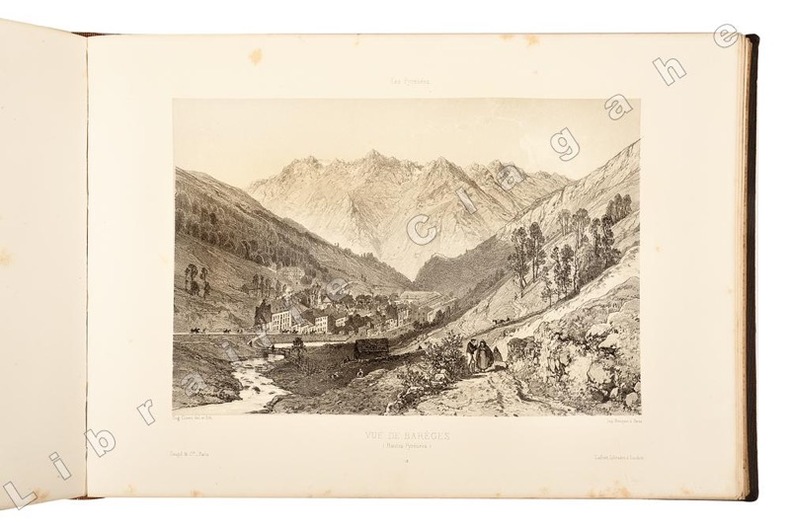
rif. 21335soit 2 tomes, reliés en un volume in folio oblong, cartonnage de percaline marron à fers dorés spéciaux et à froid sous le titre “Souvenir des Pyrénées” par Eug. Ciceri. Lafont-libraire-Editeur 40 allées d’Etigny-Luchon, dos chagrin marron foncé, nerfs, caissons de filets dorés, titre doré, tranches dorées ; s.d. [1870 ou 1873, BNF] ; a) [1] f. de Titre, 8 pp. sur 2 colonnes, 1 plan et une carte dépliante lithographiés par Salette à Toulouse, 28 lithographies dont 8 dépliantes (2 ou 4 panneaux), tirées par Becquet à Paris pour l’éditeur Goupil. b) [1] f. de titre, 12 pp. de texte sur 2 colonnes, 32 lithographies dont 9 dépliantes (2 panneaux), idem. Soit en tout 60 lithographies dessinées et mises sur pierre par Eugène Ciceri, dont 17 dépliantes, non compris le plan et la carte également lithographiés.
rif. 9522aafLith. Weibel-Comtesse à Neuchâtel. XIXe siècle, 40 x 29 cm l'image, 62.5 x 55 cm (cadre), lithographie colorieé à la main d'époque, encadrement baguette mérisier méplat, passepartout.
1890rif. AMO-4520[Japon, Yokohama ?, vers 1890] Très beau spécimen en grand format (36 x 27 cm environ pour l'album et 26,5 x 20,5 cm pour les tirages). Complet. Très bel album très bien conservé malgré quelques chocs sur quelques bords et le dos de l'album manquant (bande de cuir), parfaitement solide et très décoratif. Très belle esthétique d'ensemble, superbe décor sur le premier plat (rare aussi beau et fin). Intérieur d'une grande fraîcheur. Beau coloris au pinceau à la main.
rif. 82885aafA Sallanche chez l’Auteur, s.d., vers 1789, 39 x 61 (46x65) cm, eau-forte rehaussée à la main (aquarellée et gouachée à l’époque), sur papier vergé avec filigrane ‘ C.& I Honig’, 1 feuille, passepartout.
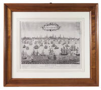
1660rif. ABC_49405Amsterdam 1660. In a passe partout framed in a modern wooden frame. Engraving: ca. 38.5 x 50 cm; frame: 66.5 x 76 cm. Rare large engraved view of Amsterdam as seen from the inlet known as the IJ. The work is captioned in French and includes a numbered legend for the buildings in the background. According to d'Ailly it must have been engraved between 1660 and 1668 as it shows the Oost-Indisch Zeemagazijn a large warehouse built by the Dutch East India Company between 1660-1663 but not the Lutheran Church which was built in 1668. The present engraving is not signed but is very similar to a slightly later view of Amsterdam by French engraver Pierre-Alexandre Aveline 1656-1722. It bears the same caption and legend and has a nearly identical background but differs in the typography cartouche and the amount of ships in the foreground. The present state is exceptionally rare as we have not been able to trace any other copies of it in sales records and only three in literature.The engraving is slightly creased the upper right corner has been professionally repaired. Otherwise in very good condition.l D'Ailly E. A. Repertorium van de profielen der stad Amsterdam en van de plattegronden der schutterswijken 98 3 copies; cf. d'Ailly 101 and 102 Aveline view. unknown
rif. 138584aafVevey, G. Blanchoud Êdit, s.d. (ca. 1860), in-8° oblong, (17x24 cm.), titre illustré imprimé en bistre et noir + 45 magnifiques planches lithographiées rehaussées à la gouache, dont 5 panoramas sur double page, exemplaire sans rousseurs, cartonnage d'éditeur rouge, dos en toile, titre doré au centre du premier plat.
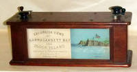
1878rif. 47603Providence RI 1878. During the 1870s excursion tours around Narragansett Bay were such a popular attraction that the Excursion View Company commissi . Providence RI 1878. During the 1870s excursion tours around Narragansett Bay were such a popular attraction that the Excursion View Company commissioned an artist to sketch the complete trip just as a passenger would see it. The drawings were transferred to lithographic stones and printed in color on a continuous roll which could be viewed in a wooden box by turning the knobs and moving the roll. This charming device uses two of these panoramic strips to take the viewer on a trip from Providence to Block Island and back again. The first scroll starts at Fox Point in Providence and travels south passing Squantum Point Silver Spring Pomham Rocks Light Riverside Sabin Point Light Annawanscut Nayatt Point Light Warren Hog Island and Bristol. It then proceeds around Bristol Point and heads northward into Mount Hope Bay passing Churchs Cove to Fall River Mass. and then southward again passing Globe Village and Bristol Ferry to Newport. The end of the first scroll shows Benton Reef at the southern tip of Newport Island and the Atlantic. The second scroll starts at Southeast Light on Block Island and travels northward along the coast to New Shorham Old Harbor. The viewer then passes Clay Head and Black Rock Fort Dumpling and Jamestown on the eastern shore on Conanicut Island Rose and Goulds Islands then around to the western shore of Conanicut Island into the West Passage heading south. Next past Dutch Island and Beaver Tail lighthouses Point Judith Lighthouse and north again to Narragansett Pier Bonnet Point South Ferry Wickford Quonsett Point East Greenwich Buttonwood Warwick Lighthouse Rocky Point Conimicut Point Lighthouse and Pawtuxet. This second scroll ends at the old Sassafras Point Lighthouse in Providence. Both strips show and identify many of the leading shoreline hotels of the day private homes rivers industries rocks forts and sailing vessels of all kinds. Many important paddle steamers are shown including the Bay State Florence City of Newport Rhode Island Canonicus Bristol Bay Queen Empire State and Providence. The lithographed illustration strips are in excellent original condition as is the box and its wooden scroll turners. Back in 1970 a company named Industrial National Bank unearthed a working specimen of this rarity. They were so impressed with it that they incorporated the views into a calendar for that year. Each month displays different illustrations along the way. With these vision views as they were called a passenger could relive his trip around Narragansett Bay long after he had returned home. At the time the Panorama was an exciting and elaborate souvenir but now the few existing rolls give us a fascinating look at the coastline as it appeared nearly a century ago. The calendar measures 16 x 12 ¾ inches. It is included with the Excursion View Box. Both items . Two chromolithographed strips each 30 feet in length and 3 3/4 inches wide. Contained in a double sided glazed walnut box measuring 5 x 6 x 13 1/2 inches. . unknown
1878rif. 47603Providence RI 1878. During the 1870s excursion tours around Narragansett Bay were such a popular attraction that the Excursion View Company commissi . Providence RI 1878. During the 1870s excursion tours around Narragansett Bay were such a popular attraction that the Excursion View Company commissioned an artist to sketch the complete trip just as a passenger would see it. The drawings were transferred to lithographic stones and printed in color on a continuous roll which could be viewed in a wooden box by turning the knobs and moving the roll. This charming device uses two of these panoramic strips to take the viewer on a trip from Providence to Block Island and back again. The first scroll starts at Fox Point in Providence and travels south passing Squantum Point Silver Spring Pomham Rocks Light Riverside Sabin Point Light Annawanscut Nayatt Point Light Warren Hog Island and Bristol. It then proceeds around Bristol Point and heads northward into Mount Hope Bay passing Churchs Cove to Fall River Mass. and then southward again passing Globe Village and Bristol Ferry to Newport. The end of the first scroll shows Benton Reef at the southern tip of Newport Island and the Atlantic. The second scroll starts at Southeast Light on Block Island and travels northward along the coast to New Shorham Old Harbor. The viewer then passes Clay Head and Black Rock Fort Dumpling and Jamestown on the eastern shore on Conanicut Island Rose and Goulds Islands then around to the western shore of Conanicut Island into the West Passage heading south. Next past Dutch Island and Beaver Tail lighthouses Point Judith Lighthouse and north again to Narragansett Pier Bonnet Point South Ferry Wickford Quonsett Point East Greenwich Buttonwood Warwick Lighthouse Rocky Point Conimicut Point Lighthouse and Pawtuxet. This second scroll ends at the old Sassafras Point Lighthouse in Providence. Both strips show and identify many of the leading shoreline hotels of the day private homes rivers industries rocks forts and sailing vessels of all kinds. Many important paddle steamers are shown including the Bay State Florence City of Newport Rhode Island Canonicus Bristol Bay Queen Empire State and Providence. The lithographed illustration strips are in excellent original condition as is the box and its wooden scroll turners. Back in 1970 a company named Industrial National Bank unearthed a working specimen of this rarity. They were so impressed with it that they incorporated the views into a calendar for that year. Each month displays different illustrations along the way. With these vision views as they were called a passenger could relive his trip around Narragansett Bay long after he had returned home. At the time the Panorama was an exciting and elaborate souvenir but now the few existing rolls give us a fascinating look at the coastline as it appeared nearly a century ago. The calendar measures 16 x 12 ¾ inches. It is included with the Excursion View Box. Both items . Two chromolithographed strips each 30 feet in length and 3 3/4 inches wide. Contained in a double sided glazed walnut box measuring 5 x 6 x 13 1/2 inches. . unknown books
rif. 9933aafAugsburg, l'auteur, (Verlag Jeremias Wolff) s.d., ca. 1730-31, 100 x 35 cm, 125 x 55 avec cadre, Prächtige Kupferstich Vedute von ‘Freiburg im Üchtland’, nach Friedrich Bernhard Werner durch Wolffs Erben verlegt. ƒ Gerahmt.. - Encadrement baguette en bois ornée avec filet nacre, passepartout.
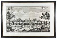
1728rif. 91I90T01U79OAmsterdam 1728. Leonardus Schenk Framed 82.5 x 121 cm. Large engraved wall print on 2 sheets together 57.5 x 97 cm showing the Leiden city wall between the Koepoort and Zijlpoort with various windmills and prominent buildings in the background identified by name. The title appears in a banderole at the head with putti on either side holding the arms of Leiden and Holland. Leonardus Schenk's name appears as engraver and publisher at the right end of the banderole. Large view of the city of Leiden by the Amsterdam engraver and publisher Leonardus Schenk. The viewer observes the city from the south from between the city's Koe and Zijl gates. In the background several windmills and a few characteristic buildings are identified by name in the engraving including the university the library the Pieterskerk the Town Hall the Mare kerk the "Burcht" the fort and the Hooglandse kerk. On the quay outside the wall groups of people walk sporadically passed by small boats on the nearby city moat. In the foreground we see a typical Dutch landscape with grazing cattle farm workers a loaded hay cart and haystacks in the field. We know of several other wall prints by Schenk depicting local situations with almost photographic detail. Thanks to this detail important socio-historical aspects have been passed on to later generations giving these prints an important cultural meaning today. A few spots formerly folded otherwise in very good condition.l Overvoorde Catalogus van de prentverzameling der Gemeente Leiden 1906 no. 640; Waller Biogr. woordenb. Noord Ned. graveurs p. 287. unknown
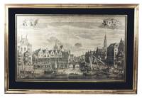
1728rif. A2RGD4WT38YEAmsterdam: Leonardus Schenk 1728. In black passepartout and gilt frame 82 x 121 cm. Large engraved wall print on 2 sheets together 58 x 97 cm the sheets overlapping each other slightly showing the traditional business centre of the city of Leiden. The title both in Dutch and French is printed in a banderole at the head with putti on each side supporting the arms of Leiden and Holland. Leonardus Schenk's name appears as engraver and publisher at the right tip of the banderole. A large engraved wall print in two sheets showing the trading and commercial centre of the city of Leiden at the convergence of the Oude Rijn and Nieuwe Rijn canals. Unlike most other Dutch towns Leiden had no central market square so that the waterways formed the major access routes for merchandise. On the banks of the canals there is a lively market that converges on the bridge central in the print. Market traders and customers come and go. Women from the coastal fishing villages of Katwijk and Noortwijk display fresh fish for sale. Right in the print we see the monumental "Waag" the weigh-house built in 1658 following a plan by the Dutch architect and engraver Pieter Post. The splendid relief designed by Rombout Verhulst that crowns the entrance is reproduced with a sharp eye for detail. In front of the building commercial goods are hoisted up from carts and a number of ships for transport to the weigh-house. Several other ships had moored and now continue to their destination. A boat flying the Dutch flag brings in a prominent party while a herald standing precariously at the bow trumpets for right of way. We know of several other wall prints by Schenk depicting local situations with almost photographic detail. Thanks to this detail important socio-historical aspects have been passed on to later generations giving these prints an important cultural meaning today. With some faint foxing otherwise in very good condition.l Overvoorde Catalogus van de prentverzameling der Gemeente Leiden 1906 no. 964; Waller Biogr. woordenb. Noord Ned. graveurs p. 287. Leonardus Schenk, unknown