Applin, Jo/ Fer, BrionyBiblio.com

12 060 résultats
2018réf. 2-1848222653Lund Humphries Pub Ltd 2018. Hardcover. New. 183 pages. 11.25x9.75x1.00 inches. Lund Humphries Pub Ltd hardcover
2013réf. 5461De Gruyter 2013. Hardcover. Very Good. Hardcover xv 236 pages NOT ex-library. Book is clean and bright throughout with unmarked text free of inscriptions and stamps firmly bound. Boards show short creases and small indentations to corners and spine ends. Issued without a dust jacket. -- The structural and semantic properties of adverbials represent a still poorly understood area of sentential syntax and semantics in Germanic languages. In particular it is an open question which different adverbial usages need to be distinguished which usages are tied to which syntactic positions and how these different usage can be formally analyzed. Focussing on adverbial adjectives in German this study provides detailed answers to these questions. By distinguishing between verb-related adverbials and event-related adverbials the author provides a new analysis of the large class of adverbials traditionally labelled as manner adverbials. It is shown that the two different classes are linked to different syntactic positions and formal analyses and derivations for the two different usages are developed. The book is therefore of interest not only to anyone working on the linguistics of German but also to all linguists working on the syntax-semantics interface and the formal analysis of adverbials. -- Contents: 1 Introduction: -- Scope & aim; On adverbials & adjectives Defining adverbials Adverbial: vs. subject & vs. object & vs. predicative & vs. particle; Adverbial adjectives; Basic distinctions Class properties of adverbial adjectives; Set-theoretic classifications; Sentence & non-sentence adverbials; Other important semantic properties Opacity; Veridicality; Structure of the book; 2 Readings of sentence adverbials: -- Subject-oriented adverbials; Speaker-oriented adverbials Speech-act & Epistemic & Evaluative adverbials; Domain adverbials; Semantic constraints on possible sentence adverbials; 3 Readings of Verb-Related Adverbials: -- Manner adverbials; Degree adverbials Contexts & constraints for degree modification; Degree-manner ambiguities; Method-oriented adverbials; Verb-related adverbials & secondary predication Resultatives; Ambiguities & blends; Depictives; Adverbial adjectives & verb-adverbial combinatorics Statives that allow manner modification; Mannerless statives; Verb-related adverbials & negation; 4 Event-Related Adverbials: -- Mental-attitude adverbials; Event-external adverbials Inchoative readings of schnell and langsam; Holistic usages; Wobei-paraphrase; 5 Syntactic position of manner adverbials: -- Establishing syntactic positions; Adverbial modification and information structure; Eckardt's account: Scrambled indefinite direct objects Restricted combinations: Implicit resultatives & verbs of creation; Readings of indefinites and topicality; In-group readings; Problems for Eckardt's account; Frey and Pittner: Object integration; An alternative account: It's the adverbial's reading that is decisive Adverbials out of the blue Thetic sentences; Re-interpreting the controversial examples; Theme-rheme condition; More evidence and some subtleties Clear minimal pairs; Lexical semantics & verb-adverbial combinatorics; Scrambling; 6 Adverbials in formal semantics: The classical analysis: -- Operator approach Thomason & Stalnaker; Operator approach & scope; Operator approach as a general analysis of modification structures; Criticism of the operator approach; Argument approach: McConnell-Ginet; Predicate approach: Event-based semantics Event-based semantics & intuitive plausibility; Scope of the event-based approach; Neo-Davidsonian approaches; Possible combinations: Events & predicate-modifier approach; 7 Semantic analysis of verb-related adverbials: -- Manners in the ontology; Manners in the representation; Benefits of the analysis; 8 Summary and outlook; Notes; References; Index De Gruyter hardcover
réf. 24714374like new. unknown
réf. 33874188like new. unknown
réf. 1935263773.Ghardcover. Good. Access codes and supplements are not guaranteed with used items. May be an ex-library book. hardcover
réf. 1955026726.Ghardcover. Good. Access codes and supplements are not guaranteed with used items. May be an ex-library book. hardcover
1913réf. 00005054Edge Moor Delaware: Edge Moor Iron Co. 1913 95 pages many neat photographs of boilers the book is quite tight and pretty gold lettering against red cloth boards. Edge Moor Iron Co. hardcover
réf. G9500105055I3N00Estrada. Paperback. Good. Pages can have notes/highlighting. Spine may show signs of wear. ~ ThriftBooks: Read More Spend Less.Dust jacket quality is not guaranteed. Estrada paperback
réf. 16365William E. Cary Red Bank Spring and Axle Works and Iron and Steel Warehouses Red Bank and Adeline St. Manchester. Letter and receipt dated 1904 other two items of the same date. All four items in fair condition on aged and worn paper. LETTER: 1p. 4to. 13 June 1904. On the firm's printed letterhead with 6 x 8.5 cm engraving at head of the firm's premises 'cover an area of 1 1/2 acres' surrounded by text at head and along length of left-hand margin. The typed letter concerns the opening of an account: 'It is usual to open a/cs on monthly terms for new a/cs but I will make an exception in your case . but you must not take more than 2 or 3 months credit at the outside.' RECEIPT: Signed receipt for 4s 6d. On small stub with the firm's printed details. Dated 12 April 1904. ENVELOPE: Printed with address: 'Mr. WILLIAM E. CARY Red Bank Spring and Axle Works and Iron and Steel Warehouses RED BANK and ADELINE ST. MANCHESTER.' FLIER: 2pp. 4to. Printed in black ink on both sides of a piece of light-green paper. With details prices and engravings of a total of 45 products. One side carrying 21 engravings 17 'Rein Rails' one 'Rein Hook' and three 'Rein Holders'. The other side carrying 24 engravings of 'Rein Rails'. A history of the firm titled 'A Century of Springs' was published in 1948. William E. Cary, Red Bank Spring and Axle Works, and Iron and Steel Warehouses, Red Bank and Adeline St., Manchester. Letter and unknown
1984réf. 1435Atlanta GA: Ringsider Magazine Georgia Championship Wrestling Inc. 1984. First Edition First Printing. Original wraps. Very Good . 8 1/4 X 10 3/4 Inches. 6 PP. Original circa 1984 Georgia wrestling program featuring the National Heavyweight Champion "Super Destroyer" AKA The Spoiler and The Iron Shiek among others. Rare program with Johnny "Wildfire" Rich on the cover. Original price of $1.00 on front. Slight wear to egdes and corners but a clean copy overall. Ringsider Magazine (Georgia Championship Wrestling, Inc.) unknown
réf. 68047Centro Ramon Pineiro para a Investigacion en Humanidades - Xunta de Galicia In-8 24 cm 332pp. illustr. planches photos en couleurs Nb-0146 unknown
réf. 68137Edizioni d'Arte Ghelfi In-4 29 cm 88pp. illustr. 60 illustr. et portrait photo reliure cart. de l'editeur avec jaquette tres bon etat Nb-0129 unknown
réf. 65960Editions l'Entree des artistes In-8-carre 25 cm 48pp. illustr. couverture blanche bon etat Ats28 unknown
réf. 51830Eds Flammarion In-4-carre 27 cm 192pp. illustr. photographies reliure cart. de l'editeur avec jaquette Nb-0159 unknown
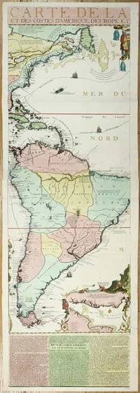
réf. 11134Paris: 1713. No binding. Very Good. 1175 x 380 mm. full early wash colour with accompanying title page included a key map bookplate of the Duke of York on the verso in very good condition. Three sheets of an exceedingly rare fifteen-sheet wall map by Nicolas de Fer accompanied by the title with key map all in fabulous original colour. When published in 1713 it was the most extravagant map of America yet produced. It encompasses not just the American continent but the whole of the Pacific Ocean also. The map is made up of ten sheets in two rows of five and accompanied by 5 further smaller sheets of descriptive text which are not always present along the bottom. Here we offer the two sheets encompassing the east coast of North America and much of South America. The end of the War of Spanish Succession 1701-14 was near by 1711 and with a weakened Spain France began to eye North America. This renewed interest led to 'Louisiana' and the founding of New Orleans in 1718. Nicholas de Fer 1646-1720 was born the youngest of eight children to the map seller Antoine de Fer fl.1644-d.1673 and grew to be one of the most well-known mapmakers in France in the seventeenth century. He was apprenticed in 1659 to the engraver Louis Spirinx at the age of twelve. Following the death of his father in 1673 Nicholas worked with his mother to continue the family business. On her retirement in 1687 she passed the business to Nicolas in exchange for a crown a week unlimited bread and a pint of wine per day Pastoureau. His earliest known work is a map of the Canal of Languedoc in 1669. Arguably his most famous production is his wall map of America published in 1698. It is renowned for the beaver scene. In 1690 he became cartographer to the Dauphin of France and eventually to Louis XIV himself. From 1690 he began publishing his own books such as 'Les Forces de l'Europe' and the 'Petit et Nouveau Atlas' in 1697. His first wall map in 1694 was naturally of the world and this was followed by a set of four continents. The British possessions are hemmed into the coast of North America and include Acadia. In South America the mythical Lake Parime is excluded but the Orinoco and Amazon Rivers are still connected. Sea routes to and from the tip of South America are displayed and a fabulous inset of the Rio de la Plata is found lower right. The scene accompanying this is the mountain of Potosi the source of fabulous silver reserves with an image of panning for gold in the water nearby. The whole is wonderfully engraved by P. Starckman and dedicated to Monseigneur le Comte de Toulouse. The text beneath describes the voyage of Jacques le Hermite 1582-1624 in 1623-5 to present day Argentina and Tierra del Fuego. Le Hermite himself died on the voyage in Callao on the Peruvian coast. The map was a model for the later reduction by Henri Abraham Chatelain published in 1719 and Hermann Moll. An extremely rare map no examples are traced in the Library of Congress or the British Library. This example is from the magnificent collection of the Duke of York 1763-1827 unfortunately distributed at Sotheby's in May 1827. The second son of King George III he early on entered the military. His unfortune experiences can often be laid at the poor state of the military forces. It however led to the mocking rhyme 'The Grand Old Duke of York'. He is now credited with reshaping the armed forces to be more professional and merit based. He became Commander-in-Chief during the Napoleonic Wars. His collection when auctioned was described as being '88 folio double book cases' which contained 5500 maps each of which bore his distinctive bookplate with manuscript volume and map number below. Provenance: With bookplate of Frederick Augustus Duke of York 1763-1827; Sotheby's May 1827; collection of Hein Wenzel Berlin with stamp; Richard B. Arkway Inc. 2000; Juan and Peggy Rada Collection. Harley & Walters 1978; Howgego 2003 1713 unknown
réf. __193410907XLean Enterprise Institute Inc. Paperback. New. 224 pages. 8.20x10.90x0.75 inches. Lean Enterprise Institute, Inc. paperback
réf. A9780313301070Hardback. New. Common core library reference sources are annotated to aid the user in finding the most useful resource and a keyword index helps students connect homework and term paper subjects with the reference works most likely to supply the needed information. hardcover
réf. 0464120985.Ghardcover. Good. Access codes and supplements are not guaranteed with used items. May be an ex-library book. hardcover
réf. A9780415211802Paperback / softback. New. Antonino Ferro sets out his new conceptual system for analysis considering not only the inner world of the patient but the continued interaction of that world with the inner world of the analyst. paperback
réf. 1846099870.Gpaperback. Good. Access codes and supplements are not guaranteed with used items. May be an ex-library book. paperback
réf. 1558062491.Gpaperback. Good. Access codes and supplements are not guaranteed with used items. May be an ex-library book. paperback
réf. 0947912460.Ghardcover. Good. Access codes and supplements are not guaranteed with used items. May be an ex-library book. hardcover
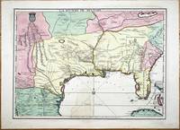
réf. 9768Paris: A Paris dans l'!sle sur Ie Quay de l'Orloge a la Sphere Royale avec Prive. Du Roy 1715. 1715. No binding. Good. EXTREMELY RARE FIRST STATE OF NICOLAS DE FER'S LANDMARK MAP IN FULL CONTEMPORARY WASH COLOUR. 465 x 640 mm. in full early wash colour faint water stain lower centrefold otherwise in excellent condition. EXTREMELY RARE FIRST STATE OF NICOLAS DE FER'S LANDMARK MAP IN FULL CONTEMPORARY WASH COLOUR. This printed map is derived from the manuscript of Guillaume de L'Isle in 1701 a significant map in the history of the depiction of the Mississippi Valley. Considerable advances were made in the understanding of this region particularly along the Gulf of Mexico in the first two decades of the 1700s. Much of this new information came at the hands of French explorers. In Paris the key mapmakers processing this information were Claude de L'Isle 1644-1720 his son Guillaume de L'Isle 1675-1726 and Nicolas de Fer 1646-1720. The three significant printed maps of the time are De L'Isle's Carte du Mexique et de la Floride 1703 La Riviere de Missisipi et ses Environs 1718 and this de Fer 1715. The de Fer is an important link in the understanding of the region. The most prominent unknown at the beginning of this period was the location of the mouth of the Mississippi River. Whilst René-Robert Cavalier de La Salle 1643-87 had proved that the Mississippi River flowed into the Gulf of Mexico the position of its mouth was ill conceived and displayed too far west on contemporary maps. 'During the 1690s attempts had been made to encourage an expedition to follow on La Salle's claims to the Mississippi valley. All of them foundered until a government-sponsored one by Louis Phélypeux Comte de Pontchartrain Minister of the Navy. He ordered Pierre le Moyne d'Iberville to command the voyage. He was the third of fourteen children of Charles Le Moyne 1626-83 who had arrived in Canada in 1641. Pierre 1661-1706 was born at Ville-Marie Canada and by the age of fourteen had sailed to France returning in 1678. In 1686 he was present with some of his brothers fighting the English in Hudson Bay under Pierre de Troyes. On another voyage to the same region he was trapped in the ice along with the English and there spent the winter of 1689-90 until freed in the spring. Most of his experience was in Canada although he did take part in an attack on Schenectady in New York 1690. Pontchartrain's instructions to d'Iberville were to establish a colony at the mouth of the Mississippi River and therefore enable control of the huge waterway. He sailed from Brest on 24 October 1698 with three vessels and 200 colonists arriving at Ship Island off present day Biloxi Mississippi 25 January 1699. Having put ashore the colonists he embarked in four small boats up the Mississippi delta until he reached the Iberville River which he entered. Crossing Lakes Maurepas and Pontchartrain he returned to the coast. He then began construction of Fort Maurepas on Biloxi Bay before leaving for France on 4 May 1699' Burden. 'D'Iberville returned to Biloxi promptly arriving 7 December 1699. In the New Year he constructed Fort Iberville eighteen leagues upriver from the mouth of the Mississippi … The most detailed record cartographically of d'Iberville's voyages can be found in Nicolas de Fer's Les Costes aux Environs de la Riviere de Misisipi 1701' Burden. The results of these explorations were recorded on Guillaume De L'Isle's 1701 manuscript. It was one of the first to display the Mississippi delta and to illustrate the extent of the Missouri River. Cumming described it as 'notable for its early representation of the Carolina Trading Path' from Charleston Carolina to the Mississippi river. De L'Isle never published a printed version of the manuscript. The second state of Claude and Guillaume De L'Isle's L'Amerique Septentrionale in 1700 records a delta but is not directly derived from the manuscript. The only printed version was this map issued by De Fer in 1715 with additional information. Jackson notes 'the s A Paris dans l'!sle sur Ie Quay de l'Orloge a la Sphere Royale avec Prive. Du Roy 1715. 1715 unknown
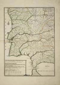
réf. 4614Paris: 1705. No binding. Good. 575 x 425 mm. early outline colour light browning to the left of the centrefold otherwise in good condition. This fine map of Portugal by Nicholas de Fer is engraved by P. Starckman. It was issued in the first edition of the ""Atlas ou Recueil de Cartes Geographiques"" 1709. Pastoureau 1984 De Fer II C no. 72. 1705 unknown
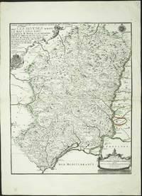
réf. 4160Paris: 1705. No binding. Good. 590 x 470 mm. early outline colour. Some light foxing to the lower margin otherwise in fine condition. The map displays the region to the west of the lower Rhone river valley. It shows Beziers in the west and Arles at the mouth of the river. It extends north up the river to Tournon. It was published in De Fer's folio atlas entitled 'Atlas ou Recueil de Cartes Geographiques'. The atlas followed a quarto one and was first issued in 1709. With two attractive cartouches the map extends from Lyon in the south to Chatillon in the north. Pastoureau 1984 Fer II C no. 30. 1705 unknown