12 027 résultats
1856réf. 218181856 Paris, Hachette (Bibliothèque des Chemins de Fer), 1856, in 12 broché, 427 pages ; couverture illustrée.
1856réf. 734741856 Paris, Hachette (Bibliothèque des Chemins de Fer), 1856, in 12 relié demi-basane vert bouteille, dos lisse orné, 427 pages ; cachets ; frottis d'usage ; intérieur frais.
réf. 239457Map. Engraving with original hand coloring. Image measures 8.75" x 12". This charming map of Dunkirk shows the city as it sits on the coast of the southernmost part of the North Sea here labeled as the Sea of Flanders. Working circa 1705 De Fer has represented the city with a schematized drawing of its exterior walls. Canals connecting the city to nearby towns and churches are also depicted and labeled. Sand bars are drawn and mountains are represented pictorically and a decorative compass rose at the upper left points due north. The map is in very good condition with no chips or tears and minor staining. Nicolas de Fer 1646-1720 was a French cartographer engraver and publisher. He became official geographer to the French Dauphin 1691 and to the Spanish King 1702 and was renowned particularly for his maps of the French coast of which this is a fine example. unknown
réf. 239457Map. Engraving with original hand coloring. Image measures 8.75" x 12". This charming map of Dunkirk shows the city as it sits on the coast of the southernmost part of the North Sea here labeled as the Sea of Flanders. Working circa 1705 De Fer has represented the city with a schematized drawing of its exterior walls. Canals connecting the city to nearby towns and churches are also depicted and labeled. Sand bars are drawn and mountains are represented pictorically and a decorative compass rose at the upper left points due north. The map is in very good condition with no chips or tears and minor staining. Nicolas de Fer 1646-1720 was a French cartographer engraver and publisher. He became official geographer to the French Dauphin 1691 and to the Spanish King 1702 and was renowned particularly for his maps of the French coast of which this is a fine example. unknown books
2011Firenze, 2011; ril., pp. 46, tavv. col., cm 22,5x30,5. italiano ril.
2002Menaggio, 2002; cartonato, pp. 112, ill. b/n e col., cm 23,5x34.
réf. ARR00536Ministère des Travaux Publics, 1883. Carte entoilée 100x80 cm, échelle 1/ 1. 250 000e, environs de Paris repris au 1/500 000e.
1849réf. ARR0059cP., Andriveau-Goujon, 1849. 90x80cm, entoilée. Bien couservée.
réf. CF123Carnet 14x36cm., 1 carte sur double page, notice, 72 pp. de croquis, cartonnage.
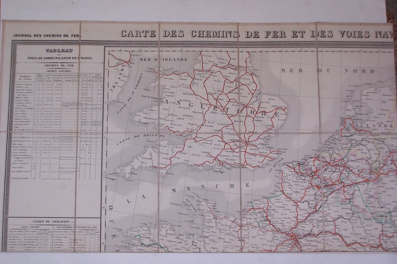
réf. CF313P., Journal des Chemins de Fer, 1853. 115x75 cm, entoilée.
réf. CF444Album 22x32 cm, planches sur double-page avec plan et profil du N° 3 au N° 58. Il manque la dem-carte gauche et les planches 1 et 2.
réf. CF459bisPlaquette in-8 carrée, 14 pages, photos Roger Schall, couverture cartonnée.
1867réf. 115331867. Paris E. Andriveau-Goujon géographe-éditeur 1867 - Carte au 1/1.340.000 toilée couv. cartonnée 83 5 cm x 96 5 cm - Un lé se détache sans manque sinon bon état
réf. CF515Paris, Imp. E. Dufrenoy, 1891. 63x70cm., entoilée.
réf. CP12Collection d'environ 700 cartes.
réf. 32440Berne, Service Tpographique Fédéral 1907,
réf. 24215Strasbourg, Simon fils et Schmidt & Grucker, s.d. léporello coudé sous couverture cartonnée imprimée avec attaches, de format 176 x 20.5 cm. Exemplaire frais malgré un tampon humide sur la couverture
réf. 51703Mars 1893.Très grande carte toilée rempliée avec étiquette.Bel état.
réf. 51704Décembre 1921.Immense carte toilée rempliée.Bel état.
1940réf. 43561940 carte noire entoilée, dépliée grand in-folio, repliée in-octavo, 28 compartiments, début 20ème Paris Hachette et Cie,
réf. 14555Carte générale de l’Italie indiquant les routes et les Chemins de fer par BERTHE L. géographe. Garnier Frères libraires éditeurs sans date. Couverture imprimée avec vignette 120x200mm, carte dépliée 620x290mm.
1920réf. 98885Paris Hachette 1920 1 vol. broché in-12 cartonnage éditeur renfermant une grande carte dépliante en couleurs au format (75 x 70 cm). En bonne condition.
réf. 13841Paris : Napoléon Chaix (Guide-Chaix - Carte des chemins de fer français), 1854 - carte lithographiée en couleurs (jaune, bleu, rose, vert et noir), dépliante entoilée sous étui gaufré pleine percaline, doré de l'éditeur (63,5 x 90,5 cm, toile comprise) - carte d'une grande fraîcheur en très bon état -
réf. 44261 Paris, Union industrielle et Commerciale & le Moniteur du Commerce et de l'Industrie,sd, carte (118 x 128 cm) entoilée et pliée au format in-4°.