12 011 résultats
1867réf. R150184670BERNAL. 1867. In-16. Cartonné. Etat d'usage, Couv. légèrement passée, Dos frotté, Pliures. Carte en couleurs dépliante de 90.5 cm / 62;5 cm. Quelques photos en noir et blanc encadrant la carte. Petites déchirures dans certaines pliures.. . . . Classification Dewey : 625-Chemins de fer, routes, autoroutes
1886réf. 7472BBParis, 1886. 95,5 x 83 cm Stahlstichkarte. Orig.-Leinen mit Deckeltitelvergoldung., karte Einbandrücken etwas berieben.
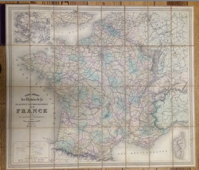
1859réf. 24423Paris Paul DUPONT 1859 une carte dépliante en couleurs entoilée in-octavo ( Format plié : 21 x 12,4 cm), format déplié : 82,5 x 98 cm, 1876 Paris Paul DUPONT Editeur (tampon bleu de la Librairie BRASSEUR, Paris au dos),
réf. 51704Décembre 1921.Immense carte toilée rempliée.Bel état.
1867réf. 115331867. Paris E. Andriveau-Goujon géographe-éditeur 1867 - Carte au 1/1.340.000 toilée couv. cartonnée 83 5 cm x 96 5 cm - Un lé se détache sans manque sinon bon état
réf. RO20146730FEDERATION DES SYNDICATS D'INITIAVTIVE DU SUD-CENTRE. Non daté. In-12. Broché. Bon état, Couv. convenable, Dos satisfaisant, Intérieur frais. Carte en couleurs d'environ 30 x 45 cm. 12 pages au verso, illustrées en noir et blanc, dans le texte et hors texte.. . . . Classification Dewey : 625-Chemins de fer, routes, autoroutes
réf. 13094cartes de l’atlas LEVASSEUR édition de 1845. Publié par A. COMBETTE. Départements divisés par arrondissements, cantons, communes avec les tracés de toutes les routes, chemins de fer et canaux. Format avec marges, en moyenne 570x390mm. Petites déchirures réparées, en marge extérieure à certaines cartes. Réparations anciennes 1 Aisne- 2 Ain-3 Allier- 4 Basses Alpes- 5 Hautes Alpes- 6 Ardèche- 7 Ariège- 8 Aude- 9 Aveyron - 10 Charente- 12 Cantal- 13 Charente inférieure- 14 Cher- 15 Corrèze- 16 Côte du Nord- 17 Creuse - 18 Doubs- 19 Drôme -20 Eure- 21Eure et Loir- 22 Gard- 23 Garonne- 24 Gers- 25 Hérault- 26 Ille et Vilaine- 27 Indre- 28 Indre et Loire- 29 Isère- 30 Loir et Cher- 31 Loiret- 32 Haute Loire- 33 Loire inférieure- 34 Loiret- 35 Lot- 36 Lot et Garonne- 37 Lozère- 38 Maine et Loire- 39 Morbihan- 40 Nièvre- 41Orne- 42 Pas de Calais- 43 Puy de Dôme- 44 Pyrénées Orientales- 45 Pyrénées- 46 Hautes Pyrénées- 47 Rhône- 48 Haute Saône- 49 Saône et Loire- 50 Sarthe- 51 Bouches du Rhône- 52 Seine- 53 Seine inférieure-54 Deux Sèvres-55 Somme-56 Tarn- 57 Tarn et Garonne- 58 Var- 59 Vaucluse- 60 Vendée- 61 Vienne- 62 Haute Vienne- 63Yonne . Gravure par SMITH et BURTY- A. PIAT- LA GUILLERMIE et RAINAUD. Chaque carte:
réf. 13093LEVASSEUR cartes de l’atlas LEVASSEUR édition de 1854. Publié par A. COMBETTE. Départements divisés par arrondissements, cantons, communes avec les tracés de toutes les routes, chemins de fer et canaux. Format avec marges, en moyenne 350x520mm. Rousseurs en bordures des marges .Légère pliure angle supérieur droit. Disponibles :1 Ariège-2 Aude-3 Aube- -4 Calvados—5 Cantal-6 Charente- 7 Charente inférieure-8 Cher-9 Corrèze-10 Côte du Nord- 11 Creuse-12 Doubs-13 Dordogne-14 Drôme-Eure-15 Eure et Loir –16 Finistère- 17 Gard-18 Garonne- 19 Gers- 20 Gironde- 21 Hérault-21 bis Ille et Vilaine- 22 Indre-23 Indre et Loire-24 Isère- 25 Landes-26 Loir et Cher- 27 Loire-28 haute Loire-29 Loire inférieure-30 Loiret-31 Lot- 32 Lot et Garonne-33 Lozère-34 Maine et Loire-35 Morbihan-36 Nièvre- 37 Nord-38 Oise- 39 Orne- 40 Pas de Calais- 41 Puy de Dôme- 42 Pyrénées- 43 Hautes Pyrénées-44 Pyrénées orientales-45 Rhône-46 Haute Saône-47 Saône et Loire- 48 Sarthe- 49 Seine- 49 Seine inférieure- 50 Seine et Oise- 51 Deux Sèvres- 52 Somme- 53 Tarn- 54 Tarn et Garonne- 55 Vaucluse- 56 Vendée- 57 Vienne- 58 Haute Vienne- 59 Yonne- 60 Europe- 61 Afrique- 62 Asie. Chaque carte
réf. CP12Collection d'environ 700 cartes.
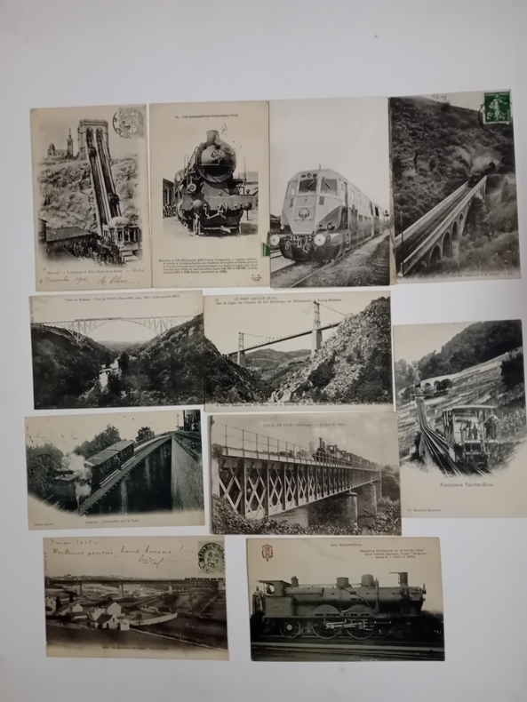
réf. 25783Important choix de cartes postales de la collection Fleury. Locomotives des Compagnies de Chemins de Fer de l'Est, du Nord, de l'Ouest, de l'Ouest/Nord, de l'Ouest/Etat d'Orléans, du PLM, de la Ceintujre, de l'Alsace-Lorraine, de la Suisse, de l'Allemagne et de l'Italie.@Faites-nous part de vos desiderata. Chaque carte :
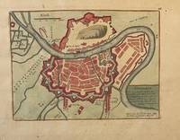
réf. PR121919-036Original map of Grenoble France. Later colored with the river Iser les Recolets Tour de Natot Porte de Beaune.Engraving with later hand coloring on laid paper in good condition. Total size 270 x 390 mm. Numbered with 46 in the right top.NL Decoratieve historische kaart van Grenoble in Frankrijk. unknown
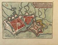
réf. PR121919-035Original map of Le Havre in North of France. Later colored with citadelle la Corderie Fontaine Bassin des Capucins and compass.Engraving with later hand coloring on laid paper in good condition. Total size 280 x 380 mm. Numbered with 26 in the right top.NL Decoratieve historische kaart van Havre de Grâce de vroegere naam van het huidige Le Havre gelegen aan de monding van de Seine in Normandië Frankrijk. Komt waarschijnlijk uit de atlas Les Forces de L'Europe van Nicolas de Fer een bekende Franse cartograaf. Le Havre werd in 1517 gesticht door Frans I als strategische haven. De kaart toont een versterkt Le Havre zoals het eruitzag tijdens de 17e18e eeuw toen de stad een belangrijk militair en handelscentrum was. De citadel werd aangelegd om de monding van de Seine te verdedigen tegen Engelse invallen. unknown
1701réf. 23030Paris: Nicolas De Fer 1701. First Edition. Very Good. Ginville Vincent de. Ginville Vincent de. First Edition. Paper size 42.5 cm x 28.5 cm. Plate mark 34 x 22.5 cm. Marginal paper clip stain inked '109' upper right corner some marginal chipping to the paper and old penciled price lower right. A few unobtrusive spots inside the plate marks. Copperplate engraving by Vincent de Ginville with later awfully bright hand color. This map would frame up nicely. There appears to be several versions of this map. The David Rumsey Collection has an example dated on the cartouch 1705 which he notes as being from Nicolas De Fer's Atlas Curieux published later. The Library of Congress has an example of the map offered here with the 1701 date and a separate page with explanations of the map. We don't know where this 1701 example came from separately issued or another atlas. The map highlights locations of Indian villages found by La Salle during his explorations of the coastal areas of the United States. We see the Gulf of Mexico Cap de la Floride and many inland village names. A nice map showing some early history of the southern United States. It includes parts of modern-day Louisiana Mississippi Alabama and Florida as well as the Bahamas and Cuba. Nicolas De Fer unknown
1701réf. 23030Paris: Nicolas De Fer 1701. First Edition. Very Good. Ginville Vincent de. Ginville Vincent de. First Edition. Paper size 42.5 cm x 28.5 cm. Plate mark 34 x 22.5 cm. Marginal paper clip stain inked '109' upper right corner some marginal chipping to the paper and old penciled price lower right. A few unobtrusive spots inside the plate marks. Copperplate engraving by Vincent de Ginville with later awfully bright hand color. This map would frame up nicely. There appears to be several versions of this map. The David Rumsey Collection has an example dated on the cartouch 1705 which he notes as being from Nicolas De Fer's Atlas Curieux published later. The Library of Congress has an example of the map offered here with the 1701 date and a separate page with explanations of the map. We don't know where this 1701 example came from separately issued or another atlas. The map highlights locations of Indian villages found by La Salle during his explorations of the coastal areas of the United States. We see the Gulf of Mexico Cap de la Floride and many inland village names. A nice map showing some early history of the southern United States. It includes parts of modern-day Louisiana Mississippi Alabama and Florida as well as the Bahamas and Cuba. Nicolas De Fer unknown books
1994Firenze, 4 Ottobre 1994. Firenze, 1994; br., pp. 46, ill. col., cm 19x24. italiano
2005réf. 20643Bibliothèque de l’Image 2005 In-8, cartonnage noir, sous jaquette illustrée, illustrations pleines pages en couleurs, 102 pp. Très bon état.
2010réf. DADAX1169718809Kessinger Publishing 2010-09-10. hardcover. New. 8.50x0.44x11.00. Buy with confidence. Excellent Customer Service & Return policy. Kessinger Publishing hardcover
réf. A9781169718807New. unknown
réf. B9781169718807New. unknown
réf. 1169718809.Ghardcover. Good. Access codes and supplements are not guaranteed with used items. May be an ex-library book. hardcover
1906réf. 71840United States Cast Iron Pipe & Foundry Company 1906. Hardcover. Used - Very Good. Chasmar Winchell Press NY & Pittsburgh. 156 pages. Illustrations of Croton & Wachusett Reservoir Dams Spot Pond Wellesley Charles River Chelsea Creek Mystic River Philadelphia New Orleans installations high pressure fire systems special castings Addyston Ohio Anniston & Bessemer Alabama Buffalo Burlington New Jersey Louisville Scottsdale Pennsylvania works. 10.75 x 8.5" gold stamped black cloth. Cover spotted tips rubbed VG. United States Cast Iron Pipe & Foundry Company hardcover
19941 lingua: inglese Brossura edit. illustrata, cm 28x22, pag. 351, con numerosissime illustraz. a colori e in b.n. - a cura di Elisabeth Schmuttermeier, E. Bryding Adams, Helmut Börsch Supan, Leon Botstein, Georg Himmelheber, Ursula Ilse Neumann, Brigitte Marquardt, Derek E. Ostergard, Albrecht Pyritz, Michael Stratton - Catalogo mostra New York, The Bard Graduate Center for Studies in the Decorative Arts, dal 25 maggio al 7 agosto 1994 - In collaborazione con il MAK Austrian Museum of Applied Arts, Vienna - Panoramica sulle sculture e altri oggetti d'arte in ghisa in Europa centrale dal 1800 al 1850 - Perfetto stato.
19591959 revised castings catalogue price list No. 1 attached on back pastedown. B. Finch & Co presentation label on front pastedown. Lower cover corners badly worn, wear to lower cover edges. Old telephone number in red written on front pastedown and number stamped at top corner of front free endpaper. Covers slightly cocked.
réf. B9783039431427Hardback. New. hardcover
1983Verona, 1983, 8vo stralcio con copertina posticcia muta, pp. 345/358 con una cartina. - !! ATTENZIONE !!: Con il termine estratto (o stralcio) intendiamo riferirci ad un fascicolo contenente un articolo, completo in se, sia che esso sia stato stampato a parte utilizzando la stessa composizione sia che provenga direttamente da una rivista. Le pagine sono indicate come "da/a", ad esempio: 229/231 significa che il testo è composto da tre pagine. Quando la rivista di provenienza non viene indicata é perché ci è sconosciuta. - !! ATTENTION !!: : NOT A BOOK : “extract” or “excerpt” means simply a few pages, original nonetheless, printed in a magazine. Pages are indicated as in "from” “to", for example: 229/231 means the text comprises three pages (229, 230 and 231). If the magazine that contained the pages is not mentioned, it is because it is unknown to us.