11.841 resultados
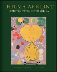
ref. BIB-19007211Cloth-bound / Cloth spine. Publisher: Bokförlaget Stolpe Utg. 2020 Cloth-bound / Cloth spine 262 p. This book is brand new. Original title: Hilma af Klint: Art of Seeing the Invisible Series: Hilma af Klint Language: Svenska --- Information regarding the book: Medverkande: Almqvist Kurt ; Birnbaum Daniel ; Baudin Tessel M. ; Fer Briony ; Hanegraaff Wouter J. ; Kern Stephen ; Lachman Gary ; Pasi Marco ; Sandqvist Gertrud ; Zander Helmut ; sion="1.0" encoding="utf-8"><ONIXMessage release="3.1" xmlns="http://ns.editeur.org/onix/3.1/reference"><Header><Sender><SenderIdentifier><SenderIDType>01</SenderIDType><IDValue>BR101</IDValue></SenderIdentifier><EmailAddress>info@bokinfo.se</EmailAddress></Sender><SentDateTime>20250715T1913</SentDateTime><DefaultCurrencyCode>SEK</DefaultCurrencyCode></Header><Product><RecordReference>9789189069077</RecordReference><NotificationType>02</NotificationType><ProductIdentifier><ProductIDType>15</ProductIDType><IDValue>9789189069077</IDValue></ProductIdentifier><DescriptiveDetail><ProductComposition>00</ProductComposition><ProductForm>BB</ProductForm><ProductFormDetail>B401</ProductFormDetail><Measure><MeasureType>02</MeasureType><Measurement>232</Measurement><MeasureUnitCode>mm</MeasureUnitCode></Measure><Measure><MeasureType>01</MeasureType><Measurement>290</Measurement><MeasureUnitCode>mm</MeasureUnitCode></Measure><Measure><MeasureType>03</MeasureType><Measurement>33</Measurement><Meas We have this book in our store house - please allow for a couple of extra days for delivery. hardcover
ref. BIB-224573201Cloth-bound / Cloth spine. Publisher: Bokförlaget Stolpe Utg. 2020 Cloth-bound / Cloth spine 149 p. This book is brand new. Translator: Eklöf Margareta Language: Svenska We have this book in our store house - please allow for a couple of extra days for delivery. hardcover
1970ref. 304917New York: Doubleday & Company 1970. First Edition; First Printing. Hardcover. Very Good in a Very Good dust jacket. Light edgewear on spine crown. Light toning on front and rear end pages and pastedowns. Doubleday & Company hardcover
2015ref. AME_9780071844888MGH 2015. 1. Hardcover. New/New. _ MGH hardcover
2019ref. x-1108417884Cambridge Univ Pr 2019. Hardcover. New. 1000 pages. 10.00x7.50x1.25 inches. Cambridge Univ Pr hardcover
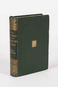
1896ref. 120209AB1896. London Hutchinson & Co 1896. 13.5 cm x 19.5 cm. Frontispiece XV 346 pages. Hardcover publisher's original cloth with gilt lettering and decoration on spine. Small embossment to front board. Deckled top edge. Very good condition with only minor signs of external wear. Minor bumps to board corners. Small cutout of old name on halftitle. Interior lightly tanned throughout but bright and clean. Binding is strong firm and square. Includes for example the following: Shadows from Child Life / Plans and Bushman-Paintings / Sunday Services / Bonaparte Blenkins Makes his Nest / Waldo's Stranger / Gregory Rose Finds his Affinity / A Boer-Wedding / Dreams etc. Olive Schreiner 24 March 1855 11 December 1920 was a South African author anti-war campaigner and intellectual. She is best remembered today for her novel The Story of an African Farm 1883 which has been highly acclaimed as one of the first feminist novels. It tells the story of a girl on an isolated farm on the veld who struggles for her independence in the face of rigid Boer social conventions. in doing so it deals boldly with such contemporary issues as agnosticism existential independence individualism the professional aspirations of women and the elemental nature of life on the colonial frontier. Since the late 20th century scholars have also credited Schreiner as an advocate for the Afrikaners and other South African groups who were excluded from political power for decades such as indigenous Blacks Jews and Indians. Although she showed interest in socialism pacifism vegetarianism and feminism amongst other topics her views escaped restrictive categorisations. Her published works and other surviving writings promote implicit values such as moderation friendship and understanding amongst all peoples and avoid the pitfalls of political radicalism which she consciously eschewed. Called a lifelong freethinker she also continued to adhere to the spirit of the Christian Bible and developed a secular version of the worldview of her missionary parents with mystical elements. Wikipedia hardcover
2003ref. SKU0490593Lean Enterprises Inst Inc 2003-09-01. Spiral-bound. Good. Textbook May Have Highlights Notes and/or Underlining BOOK ONLYNO ACCESS CODE NO CD Ships with Emailed Tracking Lean Enterprises Inst Inc unknown
ref. DADAX0367137097Routledge 2019-06-25. 1. paperback. New. 6.14x0.70x9.21. Buy with confidence. Excellent Customer Service & Return policy. Routledge paperback
ref. DADAX0367150204Routledge 2019-02-07. 1. paperback. New. 6.14x0.36x9.21. Buy with confidence. Excellent Customer Service & Return policy. Routledge paperback
ref. 0300069758.Ghardcover. Good. Access codes and supplements are not guaranteed with used items. May be an ex-library book. hardcover
ref. 1847727921.Gsheet_music. Good. Access codes and supplements are not guaranteed with used items. May be an ex-library book. unknown
ref. 1844493296.Gpaperback. Good. Access codes and supplements are not guaranteed with used items. May be an ex-library book. paperback
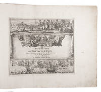
1702ref. 23526Paris 1702. Oblong 1mo 30 x 37 cm. chez l'auteur" = Nicolas de Fer a false imprint Contemporary tanned sheepskin sewn on 5 cords gold-tooled spine with the title in the 2nd of 6 compartments. Ad 1 with 10 letterpress title pages in red and black for the 10 parts; 5 engraved titles for parts 1-5 that for part 5 repeating that for part 2; plus 234 beautifully engraved plates a few folding with 366 maps and views of fortified cities. Ad 2 with an engraved title page 2 letterpress title pages in red and black and 40 engraved plates including 2 folding labelled A-S in part 1 and T-Oo in part 2. 2 works in 12 parts or volumes bound as 1. Splendid atlas of fortifications of the cities of Europe plus Malta and some other Mediterranean sites combined with a maritime atlas of the French coasts published by Pieter Mortier 1661-1711. Both are based on the similar publications of Nicolas de Fer 1646-1720 and falsely indicate that they were published by him.Ad 1: The atlas of fortified cities of Europe. Many of the plans show the work of the greatest 17th-century masters of the art and science of fortification including Samuel Marolois Simon Stevin and Sébastien Le Prestre de Vauban. The last two parts contain primarily smaller maps printed 4 to the page. Ad 2: The maritime atlas of the coasts of France. It also shows the fortifications along the coasts so it complements the fortifications atlas and was clearly designed to match it in format and style. With the caption of one plate cut off and 2 plates and 1 letterpress title-page somewhat browned. Further in good condition. A couple plates are bound in the wrong volume. A splendid fortifications atlas.l Ad 1: Muller Historieplaten 3034a; cf. Pastoureau Atlas français IX A & H pp. 203-209 213: Paris Fer ed. 1690-1695 & Amsterdam Mortier ed. 1702 with different title; Phillips pp. 256-7 other ed.; Ad 2: Muller Historieplaten 3034a; Pastoureau Les atlas français XVIe-XVIIe siècles Fer VIII B p. 203 cf. pp. 201-203; for Mortier see: Koeman III pp. 4-10 and IV p. 423. unknown
1986ref. USD_9780808917557Saunder 1986. 1St. Hardcover. Used - Like New/Used - Like New. _ Saunder hardcover
1992ref. AME_9780824787189marcel dekker 1992. 1st. Hardcover. New/New. _ marcel dekker hardcover
2008ref. AME_9783540852032Springer 2008. 1st. Paperback. New/New. _ Springer paperback
2017ref. x-1495078035Hal Leonard Corp 2017. Paperback. New. 351 pages. 11.75x8.75x1.00 inches. Hal Leonard Corp paperback
2020ref. x-113848959XCRC Pr I Llc 2020. Paperback. New. 1st edition. 232 pages. 9.50x7.00x0.75 inches. CRC Pr I Llc paperback
2012ref. x-1447142969Springer Verlag 2012. Paperback. New. 1st edition. 247 pages. 8.00x5.00x0.50 inches. Springer Verlag paperback
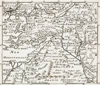
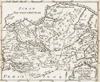
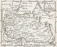
1700ref. 402AG1700. Paris c. 1700. Original copper engraved maps. 15.5 cm wide x 13 cm high. Mounted on paper. Very good condition. From a wonderful collection of Maps from an old english library South Shields - with a tiny library stamp to the mounting paper The stamp is NOT on the Map. Nicolas de Fer 164625 October 1720 was a French cartographer and geographer. De Fer was the youngest of three sons of Antoine de Fer who was also a cartographer. When he was 12 he became the apprentice of Parisian engraver Louis Spirinx and made his first map of the Canal du Midi at the age of 23. After the death of his father in June 1673 his mother Geneviève initially took over the map making company which had begun to decline. She passed it and the atelier called Quai de L'Horloge on to Nicolas in 1687 because of her old age. De Fer was so successful at improving the firm that in 1690 he became the official geographer to Louis Dauphin of France. With support from the Spanish and French Royal Families de Fer also became official geographer for Philip V and Louis XIV the kings of Spain and France respectively. Because of this his maps became Bourbon propaganda endorsing French King Louis XIV. His business flourished producing town plans atlases wall maps and more than 600 sheet maps. He made maps of places in Europe and North America including New Spain places fortified by Vauban the Low Countries and the War of the Spanish Succession. In 1698 de Fer published a map of North America which included a depiction of beavers building dams near Niagara Falls. Seventeen years later Herman Moll published a map which plagiarized elements of de Fer's work particularly the beaver scene. It became known as the "Beaver map". De Fer became the official geographer for His Catholic Majesty in 1720. Two of his sons-in-law Guillaume Danet and Jaques-François Bénard continued the company after de Fer's death on 25 October of that year until around 1760. Wikipedia unknown
1700ref. 398AG1700. Paris c. 1700. Original copper engraved map. 16 cm wide x 13.2 cm high. Mounted on paper. Very good condition. From a wonderful collection of Maps from an old english library South Shields - with a tiny library stamp to the mounting paper The stamp is NOT on the Map. Nicolas de Fer 164625 October 1720 was a French cartographer and geographer. De Fer was the youngest of three sons of Antoine de Fer who was also a cartographer. When he was 12 he became the apprentice of Parisian engraver Louis Spirinx and made his first map of the Canal du Midi at the age of 23. After the death of his father in June 1673 his mother Geneviève initially took over the map making company which had begun to decline. She passed it and the atelier called Quai de L'Horloge on to Nicolas in 1687 because of her old age. De Fer was so successful at improving the firm that in 1690 he became the official geographer to Louis Dauphin of France. With support from the Spanish and French Royal Families de Fer also became official geographer for Philip V and Louis XIV the kings of Spain and France respectively. Because of this his maps became Bourbon propaganda endorsing French King Louis XIV. His business flourished producing town plans atlases wall maps and more than 600 sheet maps. He made maps of places in Europe and North America including New Spain places fortified by Vauban the Low Countries and the War of the Spanish Succession. In 1698 de Fer published a map of North America which included a depiction of beavers building dams near Niagara Falls. Seventeen years later Herman Moll published a map which plagiarized elements of de Fer's work particularly the beaver scene. It became known as the "Beaver map". De Fer became the official geographer for His Catholic Majesty in 1720. Two of his sons-in-law Guillaume Danet and Jaques-François Bénard continued the company after de Fer's death on 25 October of that year until around 1760. Wikipedia unknown
1700ref. 399AG1700. Paris c. 1700. Original copper engraved maps. 16 cm wide x 13.2 cm high. Mounted on paper. Very good condition. From a wonderful collection of Maps from an old english library South Shields - with a tiny library stamp to the mounting paper The stamp is NOT on the Map. Nicolas de Fer 164625 October 1720 was a French cartographer and geographer. De Fer was the youngest of three sons of Antoine de Fer who was also a cartographer. When he was 12 he became the apprentice of Parisian engraver Louis Spirinx and made his first map of the Canal du Midi at the age of 23. After the death of his father in June 1673 his mother Geneviève initially took over the map making company which had begun to decline. She passed it and the atelier called Quai de L'Horloge on to Nicolas in 1687 because of her old age. De Fer was so successful at improving the firm that in 1690 he became the official geographer to Louis Dauphin of France. With support from the Spanish and French Royal Families de Fer also became official geographer for Philip V and Louis XIV the kings of Spain and France respectively. Because of this his maps became Bourbon propaganda endorsing French King Louis XIV. His business flourished producing town plans atlases wall maps and more than 600 sheet maps. He made maps of places in Europe and North America including New Spain places fortified by Vauban the Low Countries and the War of the Spanish Succession. In 1698 de Fer published a map of North America which included a depiction of beavers building dams near Niagara Falls. Seventeen years later Herman Moll published a map which plagiarized elements of de Fer's work particularly the beaver scene. It became known as the "Beaver map". De Fer became the official geographer for His Catholic Majesty in 1720. Two of his sons-in-law Guillaume Danet and Jaques-François Bénard continued the company after de Fer's death on 25 October of that year until around 1760. Wikipedia unknown
1700ref. 403AG1700. Paris c. 1700. Original copper engraved maps. 15.5 cm wide x 13 cm high. Mounted on paper. Very good condition. From a wonderful collection of Maps from an old english library South Shields - with a tiny library stamp to the mounting paper The stamp is NOT on the Map. Nicolas de Fer 164625 October 1720 was a French cartographer and geographer. De Fer was the youngest of three sons of Antoine de Fer who was also a cartographer. When he was 12 he became the apprentice of Parisian engraver Louis Spirinx and made his first map of the Canal du Midi at the age of 23. After the death of his father in June 1673 his mother Geneviève initially took over the map making company which had begun to decline. She passed it and the atelier called Quai de L'Horloge on to Nicolas in 1687 because of her old age. De Fer was so successful at improving the firm that in 1690 he became the official geographer to Louis Dauphin of France. With support from the Spanish and French Royal Families de Fer also became official geographer for Philip V and Louis XIV the kings of Spain and France respectively. Because of this his maps became Bourbon propaganda endorsing French King Louis XIV. His business flourished producing town plans atlases wall maps and more than 600 sheet maps. He made maps of places in Europe and North America including New Spain places fortified by Vauban the Low Countries and the War of the Spanish Succession. In 1698 de Fer published a map of North America which included a depiction of beavers building dams near Niagara Falls. Seventeen years later Herman Moll published a map which plagiarized elements of de Fer's work particularly the beaver scene. It became known as the "Beaver map". De Fer became the official geographer for His Catholic Majesty in 1720. Two of his sons-in-law Guillaume Danet and Jaques-François Bénard continued the company after de Fer's death on 25 October of that year until around 1760. Wikipedia unknown
1750ref. S376681750. paperback. gebraucht gut Bon état. Ein Einriss 3 cm verso fachmännisch geschlossen Papier altersbedingt leicht fleckig und geknickt sonst GUTES EXEMPLAR. 235 x 345 cm. In französischer Sprache. 112. Par N. de Fer Geog. de Sa Majeste' Catolique et de Monseigneur le Dauphin. Für Ihre Zufriedenheit versenden wir mit DHL und ausschließlich mit Trackingcode für eine sichere Sendungsverfolgung! Weitere Angebote unter antiquariat-kastanienhof paperback