N de FerBiblio.com
12.009 resultados
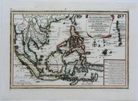
1702ref. M5177Paris 1702. Excellent. Size : 235x340 mm 9.25x13.375 Inches Coloring: Original Outline Coloring Category: ; Maps Asia South East unknown
1706ref. M6655Paris c. 1706. Very Good;. Notes: Cartouche in upper right corner depicts the shield of the Royal coat of arms of the United Kingdom three hunting dogs and a cockfight. The cartouche in the upper left defines the geographical coordinates of London Edinburgh Dublin and Dunkirk. Size : 460x486 mm 18.11x19.13 Inches Coloring: Original Outline Coloring Category: Maps Europe United Kingdom; Maps Europe Ireland; unknown
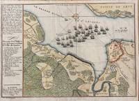
1694ref. M7337Paris: N. de Fer c.1694. Very Good; . Notes: According to Kershaw this map was originally published in "Les Forces De L'Europe" "In August 1690 Sir William Phips left Boston to attack and capture Quebec. Previous military success at Port Royal had given the English an excess of confidence which Phips fully exploited in planning his expedition against Quebec but which quickly evaporated when the under-equipped force discovered the extent of the defenses at Quebec. The operation was disastrous and the English struggled back to Boston losing a number of ships on the way. The battle lines of the English fleet and the details of the French defences were recorded by Villenuve in manuscript form which were subsequently the source of a sequence of printed maps." Kershaw Size : 209x303 mm 8.23x11.93 Inches Coloring: Hand Colored Reference: Kershaw 279 Category: Maps Canada East Quebec Quebec City; Maps City Maps; N. de Fer unknown
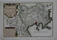
1708ref. M5770Paris 1708. Very Good. Size : 240x345 mm 9.5x13.625 Inches Coloring: Hand Colored Category: ; Maps Europe France unknown
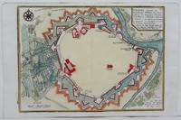
1705ref. M4699Paris 1705. Excellent. Size : 245x340 mm 9.625x13.375 Inches Coloring: Hand Colored Category: Maps City Maps; Maps Europe Austria unknown
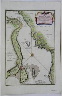
1705ref. M5485Paris 1705. Very Good. Notes: Map of strait between Sweden and Denmark. Size : 335x225 mm 13.125x8.875 Inches Coloring: Hand Colored Category: Maps Europe Scandinavia Countries; unknown
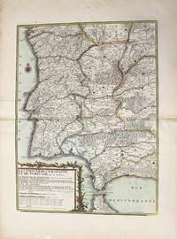
1790ref. M10223Paris: Chez Desnos 1790. Very Good. Notes: Detailed map of Portugal and western Spain showing Gibraltar region. Size : 580x432 mm 22.83x17.01 Inches Coloring: Original Hand Coloring Category: Maps Europe Portugal; Maps Europe Spain; Chez Desnos unknown
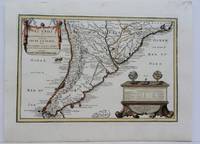
1704ref. M5174Paris 1704. Excellent. Notes: French Map of Chile by renowned French cartographer. Size : 235x340 mm 9.25x13.375 Inches Coloring: Original Outline Coloring Category: Maps South America Countries; unknown
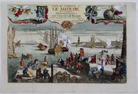
1725ref. M4694Paris 1725. Excellent. Notes: A decorative and beautifully hand coloured title page of the important atlas L'Atlas Curieux ou Le Monde" by Nicholas de Fer. Size : 220x335 mm 8.625x13.125 Inches Coloring: Hand Colored Category: Maps Misc Curiosities Title Pages Games etc. unknown
1705ref. M5133Paris 1705. Excellent. Size : 236x345 mm 9.25x13.625 Inches Coloring: Black & White Category: Maps Europe France unknown
1706ref. M6388Paris 1706. Very Good margins extended. Size : 130x180 mm 5.125x7.125 Inches Coloring: Hand Colored Category: ; Maps Europe Portugal unknown
1883ref. 136482Lovell Coryell & Company 1883. Hardcover. Good. Oxford Edition" Bookplate On Front Paste Down. Hard Cover No Dust Jacket. Closed Tear On Spine. Size: 8Vo - Over 7¾" - 9¾" Tall Lovell, Coryell & Company hardcover
1995ref. Records5-NineSafehouse Records 1995-06-26. Vinyl. Like New. 12x12x0. Cut-out. Still sealed in shrink wrap. Ships fast and guaranteed well protected with domestic tracking. Safehouse Records unknown
1989ref. ZB1033189Universidade de Santiago de Compostela Servicio de Publicacions e Inter 1989. Price HAS BEEN REDUCED by 10% until Monday Oct. 26 weekend SALE item 198 pp. Rebound in cloth with original softcovers retained Hardcover ex library else text clean and binding tight. - If you are reading this this item is actually physically in our stock and ready for shipment once ordered. We are not bookjackers. Buyer is responsible for any additional duties taxes or fees required by recipient's country. Photos available upon request. Universidade de Santiago de Compostela, Servicio de Publicacions e Inter paperback
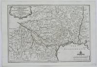
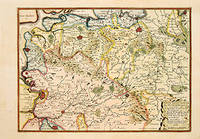
1705ref. 66130Paris. c. 1705. An attractive and quite detailed map of the northern regions of Brabant in Belgium and south western Holland by the French cartographer Nicolas de Fer. A number of larger regional towns are highlighted as are local rivers woodlands hills and marshes. Published in the 'Atlas Curieux ou Le Monde'. Size: 275 x 405 mm. Copperplate engraving with later hand colour. Good condition. Some general age toning. unknown
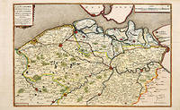
1705ref. 66131Paris. c. 1705. A charming map of Spanish and Dutch Flanders in the early eighteenth century. A number of the larger cities and towns are highlighted together with local physical features in the form of rivers canals woodlands and marshland. Published in de Fer's 'Atlas Curieux ou Le Monde'. Size: 275 x 400 mm. Copperplate engraving with later hand colour. Fine condition. unknown
ref. DADAX1569315353New unknown
ref. DADAX1572931655New unknown
ref. DADAX1589804309New unknown
ref. DADAX1589831071New unknown
ref. DADAX1593720130New unknown
ref. DADAX1602707480New unknown
ref. DADAX1878086952New unknown
ref. DADAX2738435068New unknown
ref. SONG0972514619Used: Good unknown